Cricket St. Thomas / Cruche
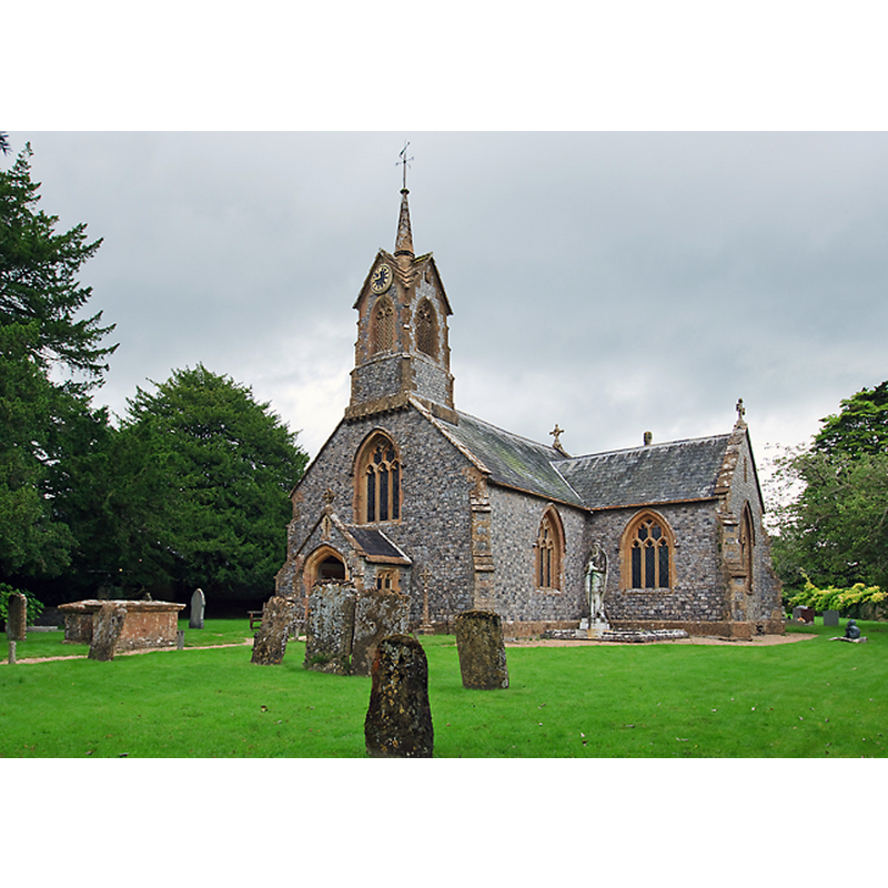
Image copyright © Mike Searle, 2012
CC-BY-SA-2.0
Results: 1 records
view of church exterior - southwest view
Scene Description: Source caption: "St Thomas's church, Cricket St Thomas. The church is in the grounds of a Warner's hotel, and was largely rebuilt in the C19."
Copyright Statement: Image copyright © Mike Searle, 2012
Image Source: digital photograph taken 21 August 2012 by Mike Searle [www.geograph.org.uk/photo/3096854] [accessed 21 February 2018]
Copyright Instructions: CC-BY-SA-2.0
INFORMATION
Font ID: 15338CRI
Object Type: Baptismal Font1?
Font Century and Period/Style: 12th century, Late Norman
Church / Chapel Name: Parish Church of St. Thomas
Church Patron Saint(s): St. Thomas
Church Address: Cricket Park, Cricket St Thomas, Somerset TA204DD, UK
Site Location: Somerset, South West, England, United Kingdom
Directions to Site: Located off the A30, between Chard and Crewkerne
Ecclesiastic Region: Diocese of Bath & Wells
Historical Region: Hundred of South Petherton
Additional Comments: disappeared font? (the one from the 12thC church here)
Font Notes:
Click to view
There is antry for Cicket [St Thomas] [variant spelling] in the Domesday survey [http://opendomesday.org/place/ST3708/cricket-st-thomas/] [accessed 21 February 2018], but it mentions neither cleric nor church in it. The entry for this parish in the Victoria County History (Somerset, vol. 4, 1978) notes: "There was a church at Cricket at least by the 12th century [...] The church contains no visible features earlier than the 19th and 20th centuries and the claim that it was rebuilt by the 2nd Baron Bridport (d. 1868) is probably correct"; there is no mention of a font in the VCH entry. The National Monuments Record, English Heritage [http://www.imagesofengland.org.uk/details/default.aspx?id=262139] [accessed 17 September 2009] records: "the font in timber with openwork timber cover, first used in 1881". [NB: we have no information on the earlier font(s) of the 14th-century; the wooden font is from the 19th-century re-building of this church -- the 1881 font is said to be made of Sicilian chestnut].
COORDINATES
UTM: 30U 507557 5635741
Latitude & Longitude (Decimal): 50.8733, -2.8926
Latitude & Longitude (DMS): 50° 52′ 23.88″ N, 2° 53′ 33.36″ W
LID INFORMATION
Date: 1881
Material: wood
Notes: [cf. FontNotes]
REFERENCES
- Victoria County History [online], University of London, 1993-. URL: https://www.british-history.ac.uk.