Corton Denham / Corfetone
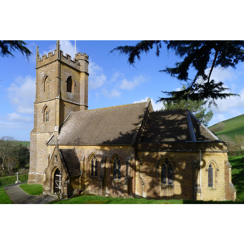
Image copyright © im Heaton, 2014
CC-BY-SA-2.0
Results: 1 records
view of church exterior - southeast view
Scene Description: Source caption: "Church of St Andrew, Corton Denham. A mid 19th century replacement of a Norman church."
Copyright Statement: Image copyright © im Heaton, 2014
Image Source: digital photograph taken 13 March 2014 by Tim Heaton [www.geograph.org.uk/photo/3884862] [accessed 18 April 2018]
Copyright Instructions: CC-BY-SA-2.0
INFORMATION
Font ID: 15337COR
Object Type: Baptismal Font1
Font Century and Period/Style: 12th century, Late Norman
Church / Chapel Name: Parish Church of St. Andrew
Font Location in Church: [destroyed]
Church Patron Saint(s): St. Andrew
Church Address: Corton Denham, Somerset DT9 4LR , UK -- Tel.: 01963 441595
Site Location: Somerset, South West, England, United Kingdom
Directions to Site: Located off (E) the A359, 4 km N of Sherborne (Dorset), 11 km NE of Yeovil
Ecclesiastic Region: Diocese of Bath & Wells
Historical Region: Hundred of Horethorne
Additional Comments: destroyed font (a surviving drawing of the old font is reported by the VCH [cf. FontNotes])
Font Notes:
Click to view
There is an entry for Corton [Denham] [variant spelling] in the Domesday survey [http://opendomesday.org/place/ST6322/corton-denham/] [accessed 18 April 2018], but it mentions neither cleric nor church in it]. Kelly's Directory of 1883 mentions a font "of Bath stone", referring obviously to a modern replacement font. The entry for this parish in the Victoria County History (Somerset, vol. 7, 1999) notes: "There was a church in Corton in the 12th century [...] The medieval building, evidently dating from the 12th century and dedicated to St Andrew by 1543, […] was demolished in 1869 because it was too small and dilapidated […] and its 12thcentury font was destroyed [...] The present church of ST. ANDREW [...] was consecrated in 1870". A foot note [157] in the VCH entry reads: " S.R.S. xiii, p. 5; Taunton, Som. Studies Libr., Pigott colln., drawing of font, 1838." The entry for this church in Historic England [IoE Number: 261789] reports a "small octagonal font with black marble shafts to corners" here, quite likely the one introduced in the 19th-century re-building of the church here.
COORDINATES
UTM: 30U 533716 5650072
Latitude & Longitude (Decimal): 51.00123, -2.5195
Latitude & Longitude (DMS): 51° 0′ 4.43″ N, 2° 31′ 10.2″ W
MEDIUM AND MEASUREMENTS
Material: stone
REFERENCES
- Victoria County History [online], University of London, 1993-. URL: https://www.british-history.ac.uk.
- Kelly, Eric Robert, Kelly's Directory of Somersetshire with the city of Bristol, London: Kelly & Co., 1883, p. 181