Berrow / Barewe / Barowe / Baruwe / Barwe / Bereg / Berewe Gefrey subtus Maluern / Berga / Bergh / Berowe / Berrowe / Borghe / Netherberowe / Netherbury
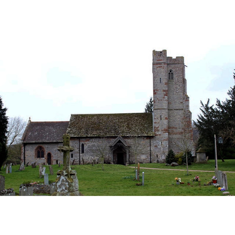
Image copyright © Bob Embleton, 2013
CC-BY-SA-2.0
Results: 7 records
view of church exterior - north view
Copyright Statement: Image copyright © Bob Embleton, 2013
Image Source: digital photograph taken 21 March 2013 by Bob Emblleton [www.geograph.org.uk/photo/3379407] [accessed 23 September 2014]
Copyright Instructions: CC-BY-SA-2.0
view of church exterior - southeast view
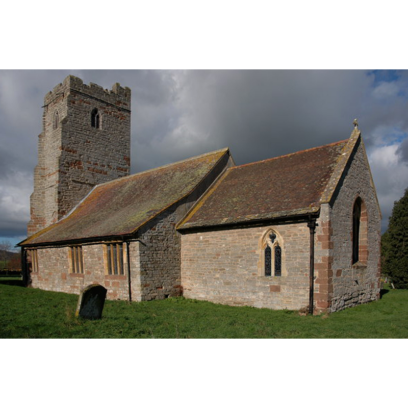
Copyright Statement: Image copyright © Philip Halling, 2007
Image Source: digital photograph taken 21 February 2007 by Philip Halling [www.geograph.org.uk/photo/343997] [accessed 23 September 2014]
Copyright Instructions: CC-BY-SA-2.0
view of church exterior in context - south view
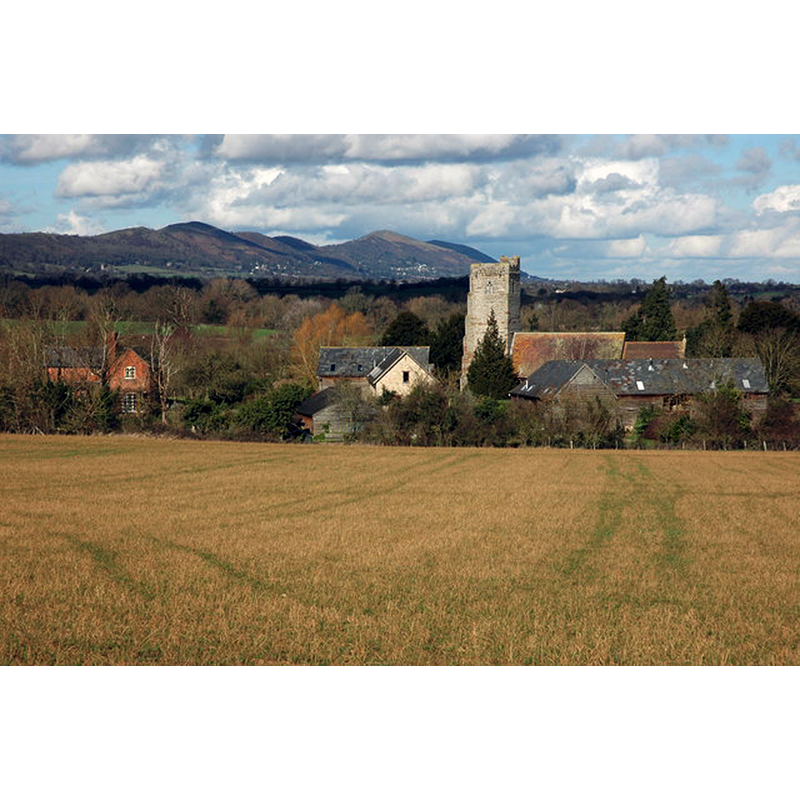
Copyright Statement: Image copyright © Philip Halling, 2007
Image Source: digital photograph taken 21 February 2007 by Philip Halling [www.geograph.org.uk/photo/344016] [accessed 23 September 2014]
Copyright Instructions: CC-BY-SA-2.0
view of church interior - nave - looking east
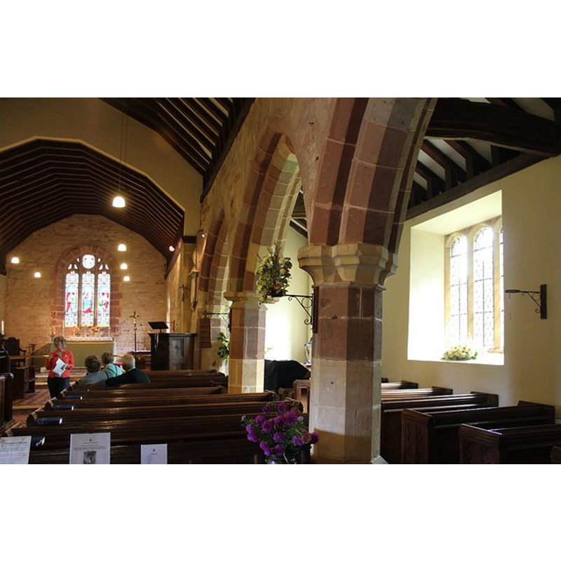
Scene Description: Source caption: "The pillars between the nave and the south aisle are leaning at a dangerous angle. It was suggested that the Victorian re-roofing may have put extra strain on the pillars."
Copyright Statement: Image copyright © Bob Embleton, 2014
Image Source: digital photograph taken 13 September 2014 by Bob Emblleton [www.geograph.org.uk/photo/4164321] [accessed 23 September 2014]
Copyright Instructions: CC-BY-SA-2.0
view of font

Copyright Statement: Image copyright © The Corpus of Romaneque Sculpture in Britain and Ireland, 2014
Image Source: digital image in The Corpus of Romanesque Sculpture in Britain and Ireland [www.crsbi.ac.uk/site/654/] [accessed 23 September 2014]
Copyright Instructions: PERMISSION NOT AVAILABLE -- IMAGE NOT FOR PUBLIC USE
design element - motifs - rope moulding - braided with pearl- or bead-string
Copyright Statement: Image copyright © The Corpus of Romaneque Sculpture in Britain and Ireland, 2014
Image Source: digital image in The Corpus of Romanesque Sculpture in Britain and Ireland [www.crsbi.ac.uk/site/654/] [accessed 23 September 2014]
Copyright Instructions: PERMISSION NOT AVAILABLE -- IMAGE NOT FOR PUBLIC USE
design element - motifs - rope moulding
Copyright Statement: Image copyright © The Corpus of Romaneque Sculpture in Britain and Ireland, 2014
Image Source: digital image in The Corpus of Romanesque Sculpture in Britain and Ireland [www.crsbi.ac.uk/site/654/] [accessed 23 September 2014]
Copyright Instructions: PERMISSION NOT AVAILABLE -- IMAGE NOT FOR PUBLIC USE
INFORMATION
Font ID: 15327BER
Object Type: Baptismal Font1
Font Century and Period/Style: 12th century [basin only], Medieval [composite]
Church / Chapel Name: Parish Church of St. Faith
Font Location in Church: Inside the church
Church Patron Saint(s): St. Faith [aka Faith of Conques, Foy]
Church Address: Church Lane, Berrow, Worcestershire, WR13 6AX
Site Location: Worcestershire, West Midlands, England, United Kingdom
Directions to Site: Located 12 km SE of Ledbury, 13 km SW of Upton
Ecclesiastic Region: Diocese of Worcester
Historical Region: Hundred of Oswaldslow
Additional Comments: altered font: base and plinth are modern replacements
Font Notes:
Click to view
We found no entry for this Berrow in the Domesday survey. A font here is n as Norman font in Noake (1868). Miller (1890) reports a Norman font in this church. The Victoria County History (Worcester, vol. 3, 1913) notes: "At the time of the Domesday Survey BERROW was evidently included in Overbury, of which parish it was a chapelry. [...] The chapel of Berrow was probably built by one of the lords of the manor [...] It was recognized as a chapel of Overbury in 1194 [...] The mid-12th-century church consisted of an aisleless nave and chancel, but of this only the north nave wall remains. The present chancel replaced the earlier one in the 14th century, the chancel arch being removed. The tower dates from the 15th century, [...] The font is circular, with two rows of cable ornament encircling the bowl". English Heritage [Listing NGR: SO7938134278] (1968) reports: "The font is Norman and of cauldron shape with two rows of cable ornament." In Hartwell & Pevsner (2007). Described and illustrated in the CRSBI (2014): "Cauldron shape. The bowl has a band of cable moulding on the lower half of the bowl and a band of beaded cable just below the rim. Base and plinth are modern."
COORDINATES
UTM: 30U 547914 5761989
Latitude & Longitude (Decimal): 52.006477, -2.301953
Latitude & Longitude (DMS): 52° 0′ 23.32″ N, 2° 18′ 7.03″ W
MEDIUM AND MEASUREMENTS
Material: stone
Font Shape: tub-shaped
Basin Interior Shape: round
Basin Exterior Shape: round
Drainage Notes: lead lining
Diameter (inside rim): 52 cm*
Diameter (includes rim): 65 cm [calculated from a circ. of 200 cm*]
Basin Depth: 28 cm*
Basin Total Height: 53 cm*
Notes on Measurements: *CRSBI (2014)
REFERENCES
- Victoria County History [online], University of London, 1993-. URL: https://www.british-history.ac.uk.
- Brooks, Alan, Worcestershire, New Haven; London: Yale University Press, 2007, p. 136
- Corpus of Romanesque Sculpture in Britain and Ireland, The Corpus of Romanesque Sculpture in Britain and Ireland, The Corpus of Romanesque Sculpture in Britain and Ireland. URL: http://www.crsbi.ac.uk.
- Miller, George [Revd.], The Parishes of the Diocese of Worcester, Birmingham: Hall & English, 1890, vol. 2: 89-90
- Noake, John, Noake's Guide to Worcestershire: the complete text, London; Worcester: Longman and Co.; J. Noake, 1868, p. 30