Farlington nr. Portsmouth / Ferlingeton
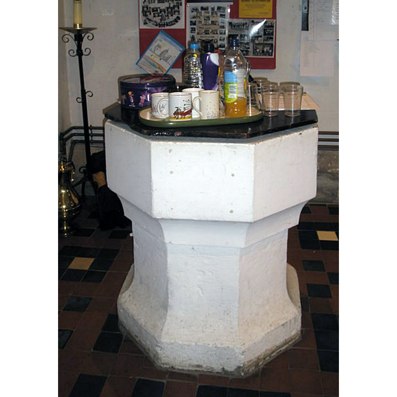
Image copyright © Basher Eyre, 2008
CC-BY-SA-2.0
Results: 2 records
view of font and cover
Copyright Statement: Image copyright © Basher Eyre, 2008
Image Source: digital photograph taken 13 September 2008 by Basher Eyre [www.geograph.org.uk/photo/961722] [accessed 21 June 2018]
Copyright Instructions: CC-BY-SA-2.0
view of church exterior - northeast view
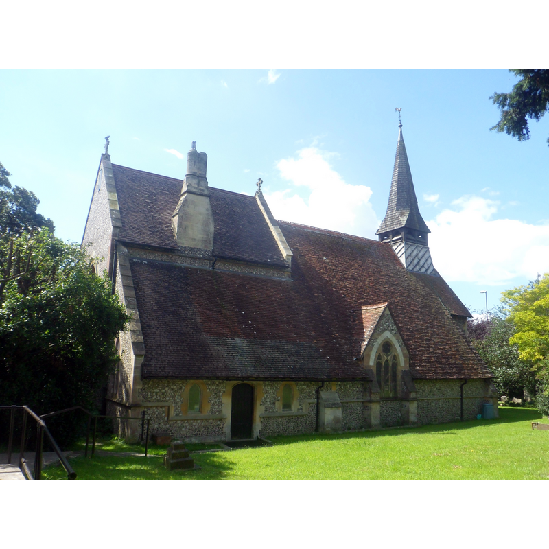
Scene Description: Source caption: "St Andrew's Church, Havant Road, Farlington, City of Portsmouth, England. This small medieval church was rebuilt between 1872 and 1875 by locally prolific architect G.E. Smith."
Copyright Statement: Image copyright © Hassocks5489, 2017
Image Source: digital photograph taken 5 August 2017 by Hassocks5489 [https://commons.wikimedia.org/wiki/File:St_Andrew's_Church,_Havant_Road,_Farlington_(NHLE_Code_1333214)_(August_2017)_(3).JPG] [accessed 21 June 2018]
Copyright Instructions: CC-BY-SA-4.0
INFORMATION
Font ID: 15295HAR
Object Type: Baptismal Font1
Font Century and Period/Style: 14th - 15th century [stem only] [composite font], Medieval [composite]
Church / Chapel Name: Parish Church of St. Andrew
Font Location in Church: Inside the church, at the W end, beneath the tower
Church Patron Saint(s): St. Andrew
Church Address: 2 Brecon Ave, Portsmouth PO6 2AP, UK -- Tel.: +44 23 9264 0836
Site Location: Hampshire, South East, England, United Kingdom
Directions to Site: Located in the NE suburbs of Portsmouth, though not on Portsea Island
Ecclesiastic Region: Diocese of Portsmouth
Historical Region: Hundred of Portsdown
Additional Comments: altered font (the present one [cf. FontNotes]) -- disappeared font? (the one from the ca. 1200 church here)
Font Notes:
Click to view
No entry found for this Farlington in the Domesday survey. The Victoria County History (Hampshire, vol. 3, 1908) notes: "The earliest mention of a church at Farlington seems to be in the year 1200, when there was a suit between Robert de Curci and Roger de Scures concerning the presentation to the church of St. Andrew at Farlington. [...] In 1231 the church was served by a chaplain of Philip de Albini and was in need of repairs. [...] It is almost entirely modern, the chancel having been rebuilt by Street in 1872, and the nave in 1875. [...] The font, at the west of the nave, has an old octagonal base, of the fourteenth or fifteenth century." There is a drawing of this font in the Harvey Pridham Drawings of English Fonts (MS 56). [Folder Number, Item Description]. University of Colorado at Boulder Libraries. Special Collections Dept., done by Harvey Pridham 1 October 1888 accompanied by the following description: "Octagonal, freestone. The bowl, above joint, is modern. Circular bowl inside, no lead, raked sides, flat plan: 3 1/4 margin: Position, under West Bell turret. Modern cover." [NB: a Guide to the catalogue contents is available at http://rmoa.unm.edu/docviewer.php?docId=couspcms56.xml [accessed 12 August 2011]]
COORDINATES
UTM: 30U 638877 5634774
Latitude & Longitude (Decimal): 50.84798, -1.0272
Latitude & Longitude (DMS): 50° 50′ 52.73″ N, 1° 1′ 37.92″ W
MEDIUM AND MEASUREMENTS
Material: stone
Font Shape: octagonal, mounted
Basin Interior Shape: round
Basin Exterior Shape: octagonal
LID INFORMATION
Date: modern
Apparatus: no
Notes: the flat and plain cover appears to be made of marble, or wooden with marbled pattern paint [cf. FontNotes]
REFERENCES
- Victoria County History [online], University of London, 1993-. URL: https://www.british-history.ac.uk.