Ashcott / Aissecote
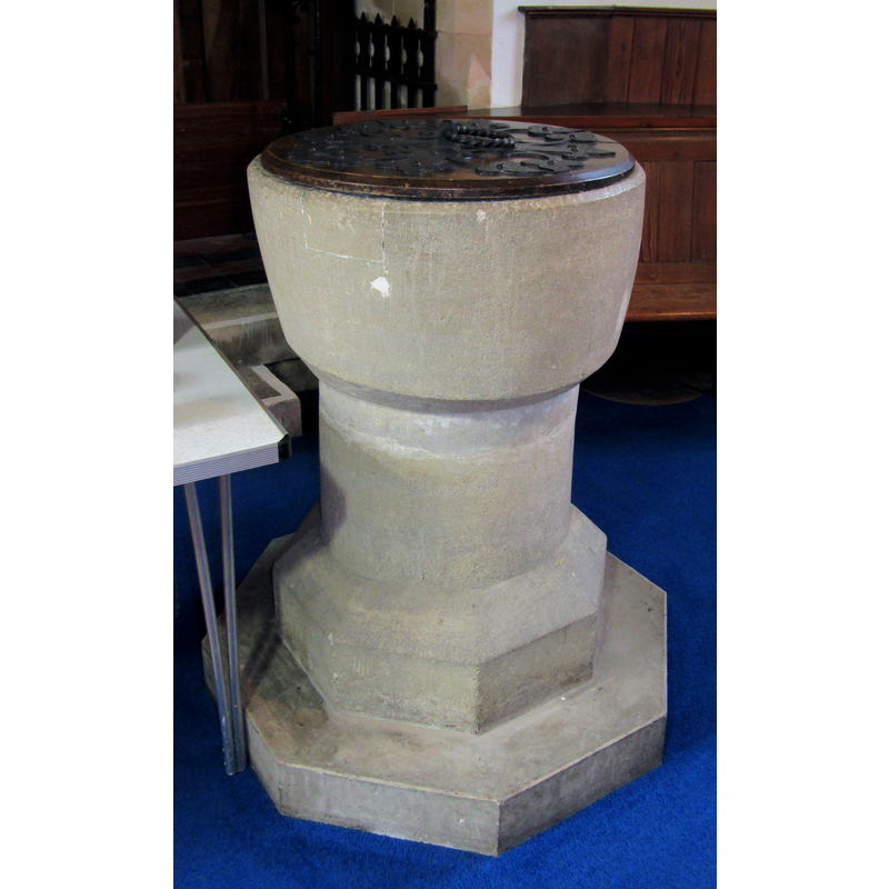
Image copyright © Colin Smith, 2022
Image and permission received from the author (e-mail of 4 September 2022)
Results: 4 records
view of font and cover
Copyright Statement: Image copyright © Colin Smith, 2022
Image Source: digital photograph 30 March 2022 by Colin Smith
Copyright Instructions: Image and permission received from the author (e-mail of 4 September 2022)
view of church exterior - southeast view
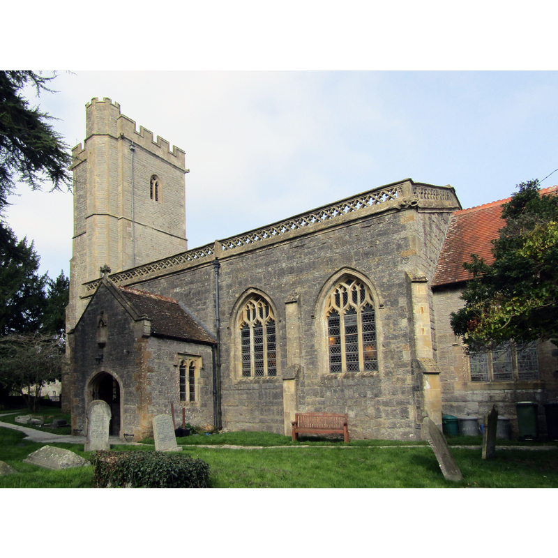
Copyright Statement: Image copyright © Colin Smith, 2022
Image Source: digital photograph 30 March 2022 by Colin Smith
Copyright Instructions: Image and permission received from the author (e-mail of 4 September 2022)
view of church exterior - northeast view
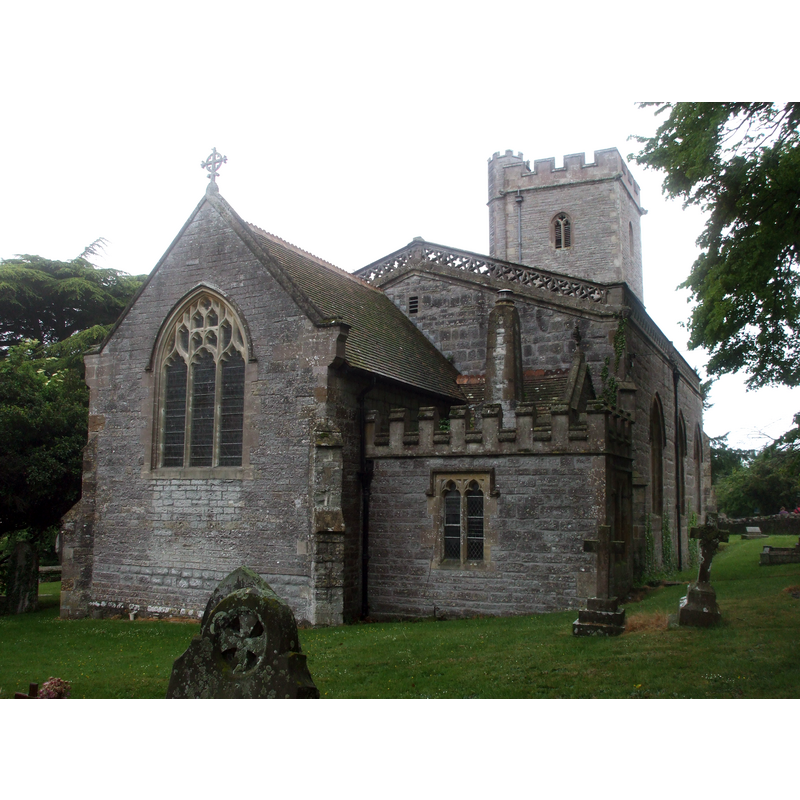
Copyright Statement: Image copyright © John Lord, 2011
Image Source: digital photograph taken 7 May 2011 by John Lord [www.geograph.org.uk/photo/2398334] [accessed 24 April 2018]
Copyright Instructions: CC-BY-SA-3.0
view of church interior - detail
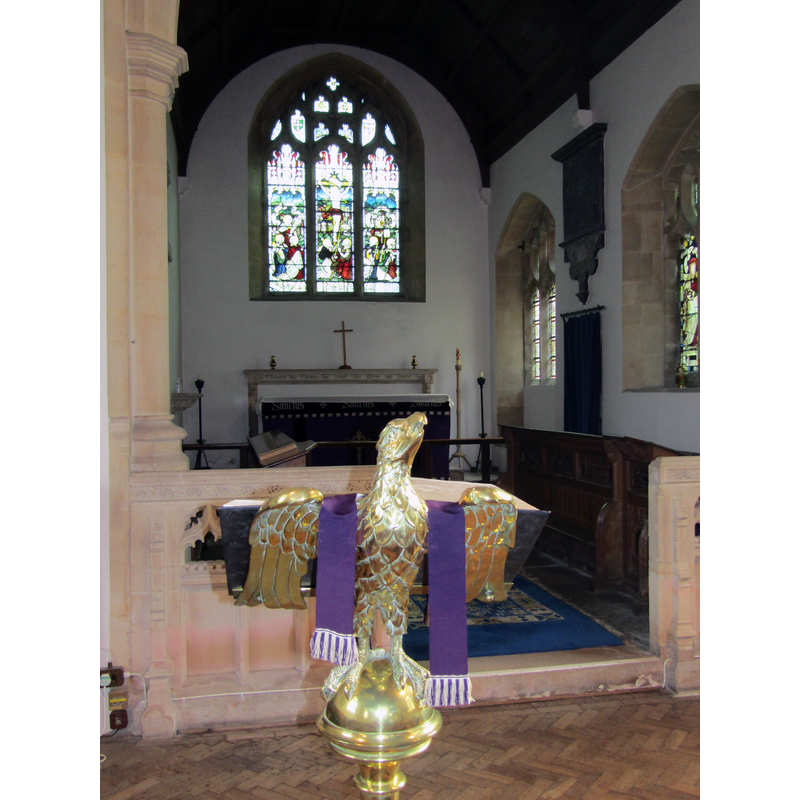
Copyright Statement: Image copyright © Colin Smith, 2022
Image Source: digital photograph 30 March 2022 by Colin Smith
Copyright Instructions: Image and permission received from the author (e-mail of 4 September 2022)
INFORMATION
Font ID: 15284ASH
Object Type: Baptismal Font1
Font Century and Period/Style: 12th century, Late Norman
Church / Chapel Name: Parish Church of All Saints
Font Location in Church: Inside the church, at the W end, S side
Church Patron Saint(s): All Saints
Church Address: High Street, Ashcott TA7 9PZ, United Kingdom
Site Location: Somerset, South West, England, United Kingdom
Directions to Site: Located off the A39 [aka Bath Rd], 6 km WSW of Glastonbury, ENE of Bridgwater
Ecclesiastic Region: Diocese of Bath & Wells
Historical Region: Hundred of Whitley
Additional Comments: altered font? (parts of it are either replacements of heavily re-cut)
Font Notes:
Click to view
There are two entries for Ashcott [variant spelling] in the Domesday survey [http://opendomesday.org/place/ST4337/ashcott/] [accessed 24 April 2018], but there is neither cleric nor church mentioned in them. Drawing of a font in the Harvey Pridham Drawings of English Fonts (MS 56). [Folder Number, Item Description]. University of Colorado at Boulder Libraries. Special Collections Dept., done by Harvey Pridham in July 1888 accompanied by the following description: "All circular, except octagonal foot. Circular bowl, lead lined, same rake in & out, flat bottom, 8 3/4 deep, 2 3/4 margin, chamfered edge inside same as out: position, S. side of Nave Walk, on left entering by S. porch through S. aisle. Modern cover." The entry for this parish in the Victoria County History (Somerset, vol. 8, 2004) notes: "Ashcott was originally a chaperly of Shapwick [...] and was mentioned as such in a list of the churches and chapels of Glastonbury abbey in 1168 [...] The church of All Saints was so dedicated by c. 1244 [...] In 1888 controversial proposals by Edward Dampier of Colchester (Essex), resulted in the removal of the west gallery [...] A low stone screen was installed between chancel and nave, and the font was placed under the tower." The entry for this church in Historic England [Listing NGR: ST4371637149] reports a "Norman tub font" in it church. Not mentioned in Pevsner (1958). The entry for this church in the CRSBI (2018) notes: "At the W end of the nave, towards the N, a greyish, fine-grained stone tub font with a bowl with convex sides and chamfered at top and bottom and inside the upper rim. The bowl is unlined and stands on a cylindrical stem of two blocks, and that on an octagonal base and plinth. The bowl is in very good condition, but with big repairs clearly visible at NW & SE, including evidence of a lock at the SE of the rim. There are some vertical & horizontal tooling marks."
Credit and Acknowledgements: We are grateful to Colin Smith for his photographs of this church and font
COORDINATES
UTM: 30U 513596 5664388
Latitude & Longitude (Decimal): 51.1308, -2.8057
Latitude & Longitude (DMS): 51° 7′ 50.88″ N, 2° 48′ 20.52″ W
MEDIUM AND MEASUREMENTS
Material: stone
Font Shape: bucket-shaped, mounted
Basin Interior Shape: round
Basin Exterior Shape: round
Drainage Notes: lead-lined
Rim Thickness: 6.5 cm [calculated]
Diameter (inside rim): 52 cm**
Diameter (includes rim): 65 cm**
Basin Depth: 22 cm*
Basin Total Height: 34 cm**
Height of Central Column: 33 cm**
Font Height (with Plinth): 104 cm**
Notes on Measurements: * [in inches in Harvey Pridham [cf. FontNotes]] / ** CRSBI (2018)
LID INFORMATION
Date: modern
Notes: [cf. FontNotes]
REFERENCES
- Victoria County History [online], University of London, 1993-. URL: https://www.british-history.ac.uk.
- Corpus of Romanesque Sculpture in Britain and Ireland, The Corpus of Romanesque Sculpture in Britain and Ireland, The Corpus of Romanesque Sculpture in Britain and Ireland. URL: http://www.crsbi.ac.uk.