Clapton in Gordano / Clapton-in-Gordano / Clotune [Domesday]
Results: 3 records
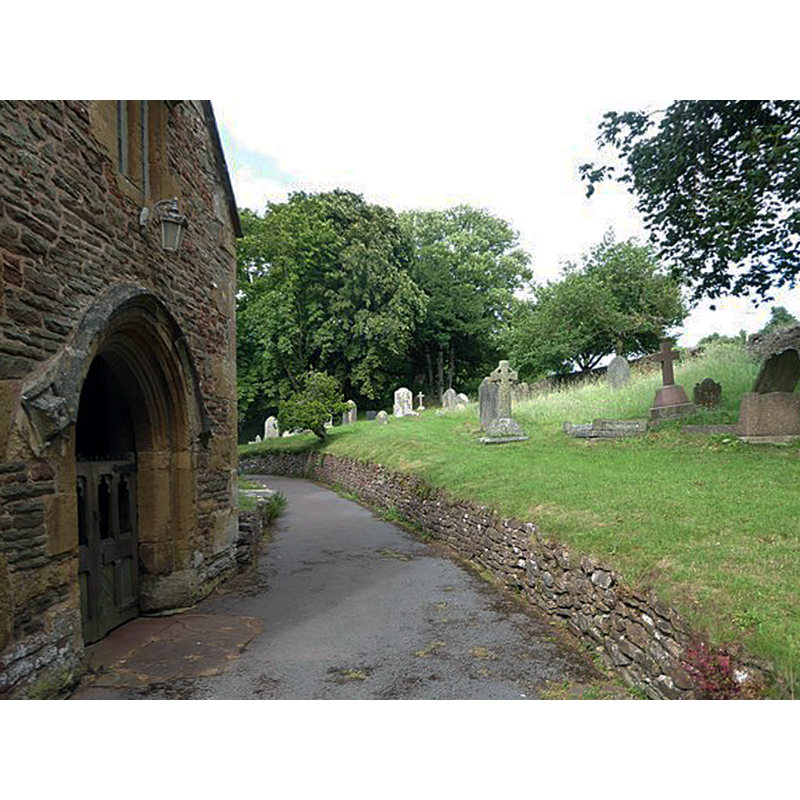
view of church exterior - south porch - detail
Copyright Statement: Image copyright © Basher Eyre, 2017
Image Source: digital photograph taken 24 June 2017 by Basher Eyre [www.geograph.org.uk/photo/5444954] [accessed 13 December 2018]
Copyright Instructions: CC-BY-SA-2.0
view of church exterior - southeast view
Scene Description: EXT SE digital photograph taken 31 Deceember 2017 by Neil Owen [www.geograph.org.uk/photo/5639419] [accessed 13 December 2018]
EXT S PORCH - DETAIL digital photograph taken 24 June 2017 by Basher Eyre [www.geograph.org.uk/photo/5444954] [accessed 13 December 2018]
Copyright Statement: Image copyright © Neil Owen, 2017
Image Source: digital photograph taken 31 Deceember 2017 by Neil Owen [www.geograph.org.uk/photo/5639419] [accessed 13 December 2018]
Copyright Instructions: CC-BY-SA-2.0
INFORMATION
Font ID: 15282CLA
Object Type: Baptismal Font1
Font Century and Period/Style: 13th century [re-carved], Early English [altered]
Church / Chapel Name: Parish Church of St. Michael [redundant since 1995]
Font Location in Church: Inside the church
Church Patron Saint(s): St. Michael
Church Address: Gordano Round, Clapton-in-Gordano, Bristol BS20 7RQ, UK
Site Location: Somerset, South West, England, United Kingdom
Directions to Site: Located off (N) the M5, between Wraxall and Tickenham
Ecclesiastic Region: Diocese of Bath and Wells
Historical Region: Hundred of Portbury
Additional Comments: altered font / re-cut / re-carved
Font Notes:
Click to view
There is an entry for Clapton [-in-Gordano] [variant spelling] in the Domesday survey [http://opendomesday.org/place/ST4774/clapton-in-gordano/] [accessed 13 December 2018] but it mentions neither cleric nor church in it. Rutter (1829) writes: "The font is of early date, and of peculiar character; it is quatrefoil in shape, but has been much disfigured by modern faces." Described in Pevsner (1958): "Quatrefoil bowl with carved faces on the underside; The assumed date is C13, but the faces are later." The National Monuments Record, English Heritage [Listing NGR: ST4677973540] notes: "font in nave has quatrefoil bowl of C13 with later carved faces on undersides".
COORDINATES
UTM: 30U 516167 5700817
Latitude & Longitude (Decimal): 51.4583, -2.7673
Latitude & Longitude (DMS): 51° 27′ 29.88″ N, 2° 46′ 2.28″ W
MEDIUM AND MEASUREMENTS
Material: stone
Font Shape: quatrefoil
Basin Exterior Shape: quatrefoil
REFERENCES
- Rutter, John, Delineations of the North Western Division of the County of Somerset, and of its [...], Shaftesbury; London: Published by the Author; Longman, Rees & Co. [...], 1829, p. 230

![EXT SE digital photograph taken 31 Deceember 2017 by Neil Owen [www.geograph.org.uk/photo/5639419] [accessed 13 December 2018]
EXT S PORCH - DETAIL digital photograph taken 24 June 2017 by Basher Eyre [www.geograph.org.uk/photo/5444954] [accessed 13 December 2018]](/static-50478a99ec6f36a15d6234548c59f63da52304e5/compressed/1181216006_compressed.png)