Wormegay No. 1 / Wermegai / Wermegay / Wirmegey
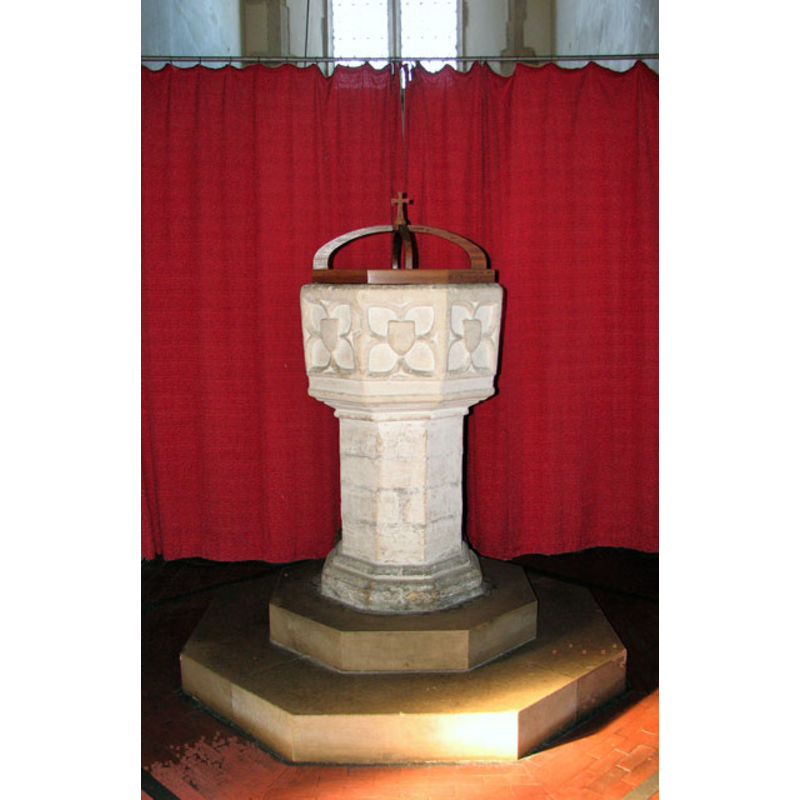
Image copyright © Evelyn Simak, 2010
CC-BY-SA-3.0
Results: 8 records
view of font and cover
Copyright Statement: Image copyright © Evelyn Simak, 2010
Image Source: digital photograph taken 7 March 2010 by Evelyn Simak [www.geograph.org.uk/photo/1742433] [accessed 4 September 2013]
Copyright Instructions: CC-BY-SA-3.0
symbol - shield - blank - in a quatrefoil - cusped quatrefoil - 8
Copyright Statement: Image copyright © Evelyn Simak, 2010
Image Source: digital photograph taken 7 March 2010 by Evelyn Simak [www.geograph.org.uk/photo/1742433] [accessed 4 September 2013]
Copyright Instructions: CC-BY-SA-3.0
design element - motifs - moulding - graded
Copyright Statement: Image copyright © Evelyn Simak, 2010
Image Source: digital photograph taken 7 March 2010 by Evelyn Simak [www.geograph.org.uk/photo/1742433] [accessed 4 September 2013]
Copyright Instructions: CC-BY-SA-3.0
view of church exterior - south view
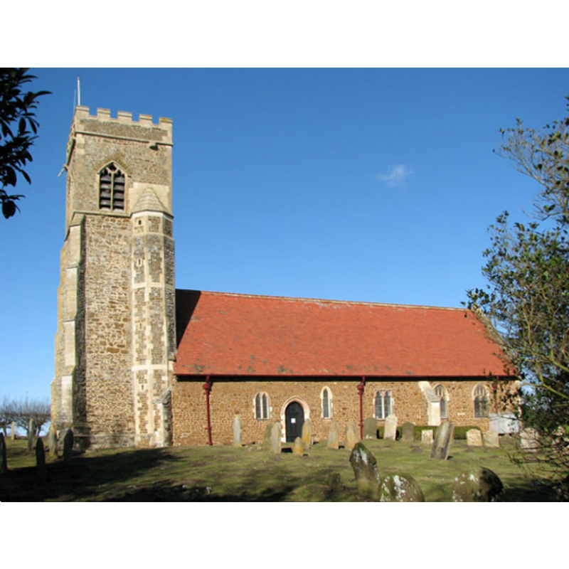
Copyright Statement: Image copyright © Evelyn Simak, 2010
Image Source: digital photograph taken 7 March 2010 by Evelyn Simak [www.geograph.org.uk/photo/1742415] [accessed 4 September 2013]
Copyright Instructions: CC-BY-SA-3.0
view of church exterior - southeast view
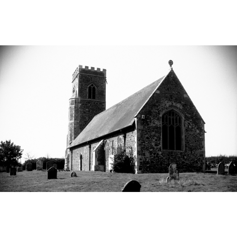
Copyright Statement: Image copyright © George Plunkett, 2013
Image Source: B&W photograph taken 15 September 1996 by George Plunkett [www.georgeplunkett.co.uk/Norfolk/W/Wormegay St Michael's church from SE [7406] 1996-09-15.jpg] [accessed 5 September 2013]
Copyright Instructions: Standing permission by Jonathan Plunkett
view of church interior - nave - looking west
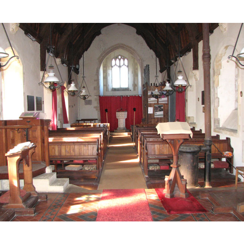
Scene Description: the font and cover at the west end of the nave
Copyright Statement: Image copyright © Evelyn Simak, 2010
Image Source: digital photograph taken 7 March 2010 by Evelyn Simak [www.geograph.org.uk/photo/1742432] [accessed 4 September 2013]
Copyright Instructions: CC-BY-SA-3.0
view of church interior - nave - looking east
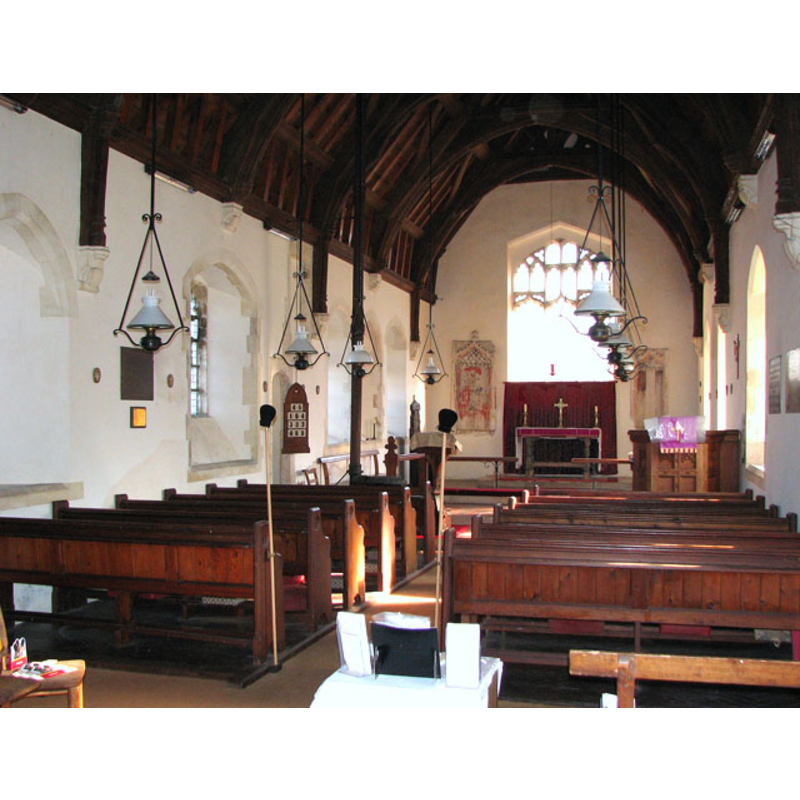
Copyright Statement: Image copyright © Evelyn Simak, 2010
Image Source: digital photograph taken 7 March 2010 by Evelyn Simak [www.geograph.org.uk/photo/1742423] [accessed 4 September 2013]
Copyright Instructions: CC-BY-SA-3.0
design element - motifs - moulding
Copyright Statement: Image copyright © Evelyn Simak, 2010
Image Source: digital photograph taken 7 March 2010 by Evelyn Simak [www.geograph.org.uk/photo/1742433] [accessed 4 September 2013]
Copyright Instructions: CC-BY-SA-3.0
INFORMATION
Font ID: 15269WOR
Object Type: Baptismal Font1
Font Century and Period/Style: 15th century, Perpendicular
Workshop/Group/Artisan: heraldic font
Church / Chapel Name: Parish Church of St. Michael and All Saints and Holy Cross
Font Location in Church: Inside the church, at the W end of the nave
Church Patron Saint(s): St. Michael & All Saints & Holy Cross
Church Address: Church Lane, Wormegay, Norfolk PE33 0SH
Site Location: Norfolk, East Anglia, England, United Kingdom
Directions to Site: Located 10 km SSE of King's Lynn
Ecclesiastic Region: Diocese of Ely [formerly Norwich]
Historical Region: Hundred and half of Clackclose
Additional Comments: altered font? (Blomefield reported the shields defaced [cf. FontNotes]) -- disappeared church? (the one from the pre-Conquest church here)
Font Notes:
Click to view
Blomefield (1805-1810) writes: "Hermerus de Ferrariis, a powerful Norman baron, had the grant of this lordship, on the expulsion of Turchetill, who had large possessions before the conquest [...] In Turchetil's time this lordship consisted of one carucate of land, 8 villains and 2 servi, with 8 acres of meadow, one carucate in demean, and one among the tenants, the 4th part of a mill and 3 fisheries, 3 cows, &c. 4 skeps of bees and a church [...] The Church of Wirmegey is dedicated to St. Michael, [...] It is an ancient single building, of car-stone, flint, &c. covered with reed; at the west end of the nave is an ancient font; on the basons are 8 shields, now defaced; [...] the bason for the holy water is still remaining. The tower, at the west end of the nave, is chiefly of car-stone, in which hangs one bell; the chancel is divided from the nave by a wooden screen, and is covered with Holland gutter-tiles. This church stands near a mile east of the present village, (which is now a very mean one) in the fields by itself." That same font is probably the one described in Pevsner & Wilson (1999): "Octagonal, Perp[endicular], with shields in pointed quatrefoils." [NB: we have no information on the baptismal font of the pre-Conquest church here]
Credit and Acknowledgements: We are grateful to Jonathan Plunkett for the photograph of this church, taken by his father, George Plunkett, in October 1996
COORDINATES
UTM: 31U 329342 5839705
Latitude & Longitude (Decimal): 52.680363, 0.475436
Latitude & Longitude (DMS): 52° 40' 49.31" N, 0° 28' 31.57" E
MEDIUM AND MEASUREMENTS
Material: stone
Font Shape: octagonal, mounted
Basin Interior Shape: round
Basin Exterior Shape: octagonal
LID INFORMATION
Date: modern
Material: wood, oak?
Apparatus: no
Notes: octagonal platform with four ribs meeting at centre with Latin-cross finial; modern
REFERENCES
- Blomefield, Francis, An essay towards a topographical history of Norfolk, 1805-1810, vol. 7: 493-502 / [www.british-history.ac.uk/report.aspx?compid=78384] [accessed 4 September 2013]
- Pevsner, Nikolaus, Norfolk 2: North-West and South (2nd ed.), London: Penguin, 1999, p. 787