Wolterton / Ultertuna / Ultretuna / Vltertuna / Vltretuna / Wulterton
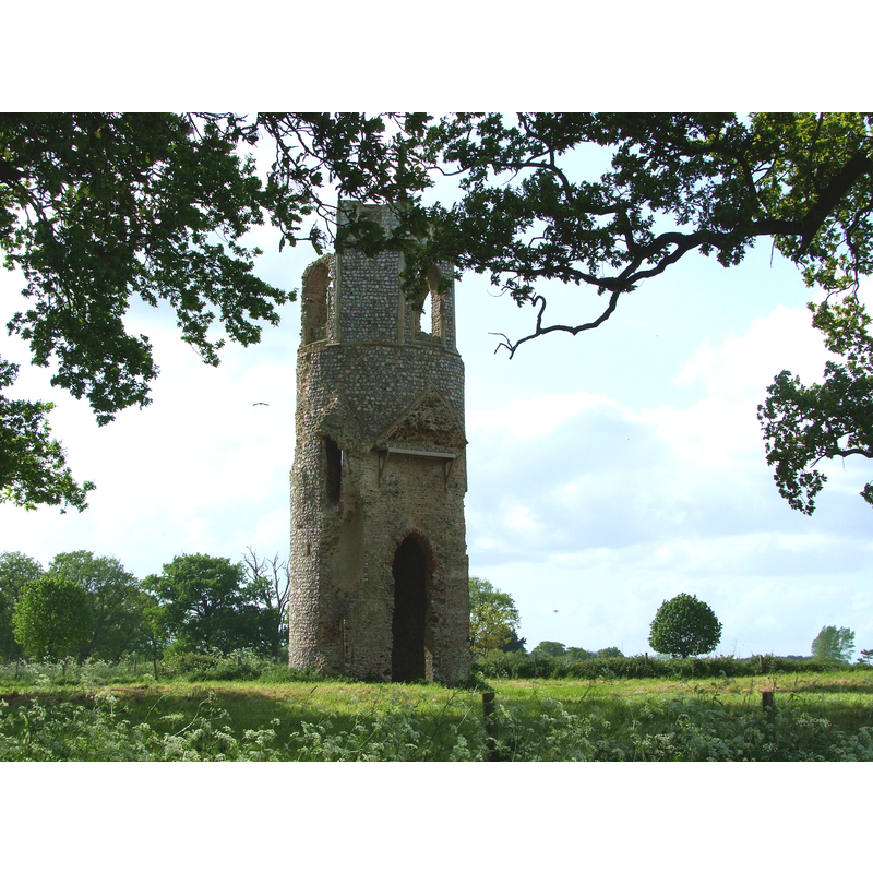
Image copyright © Simon Knott, 2009
Standing permission
Results: 5 records
view of church exterior - tower - southeast view
Scene Description: the contour of the roof of the nave can still be seen on the east side of the tower; the opening would have led to the west end of the nave
Copyright Statement: Image copyright © Simon Knott, 2009
Image Source: digital photograph taken 27 May 2009 by Simon Knott [www.norfolkchurches.co.uk/wolterton/wolterton.htm] [accessed 30 May 2013]
Copyright Instructions: Standing permission
view of church exterior - tower - northeast view
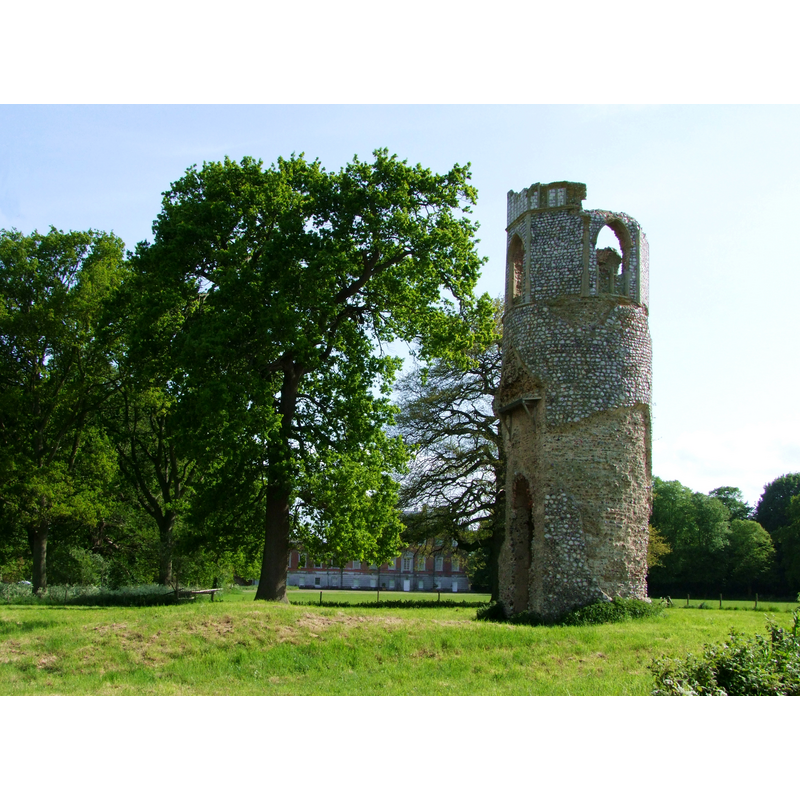
Copyright Statement: Image copyright © Simon Knott, 2009
Image Source: digital photograph taken 27 May 2009 by Simon Knott [www.norfolkchurches.co.uk/wolterton/wolterton.htm] [accessed 30 May 2013]
Copyright Instructions: Standing permission
view of church exterior - tower - west view
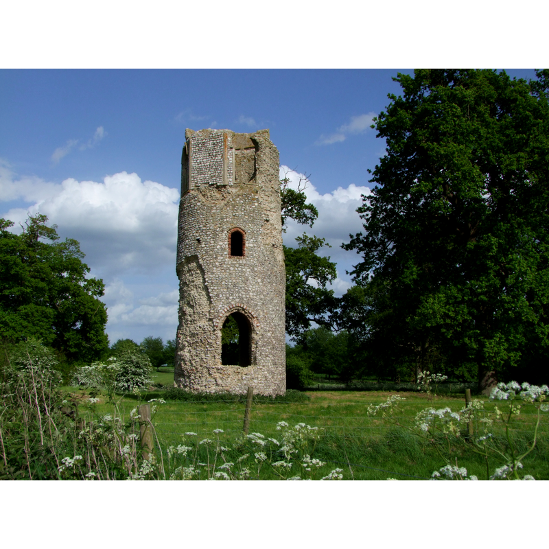
Copyright Statement: Image copyright © Simon Knott, 2009
Image Source: digital photograph taken 27 May 2009 by Simon Knott [www.norfolkchurches.co.uk/wolterton/wolterton.htm] [accessed 30 May 2013]
Copyright Instructions: Standing permission
view of church exterior - tower - northwest view
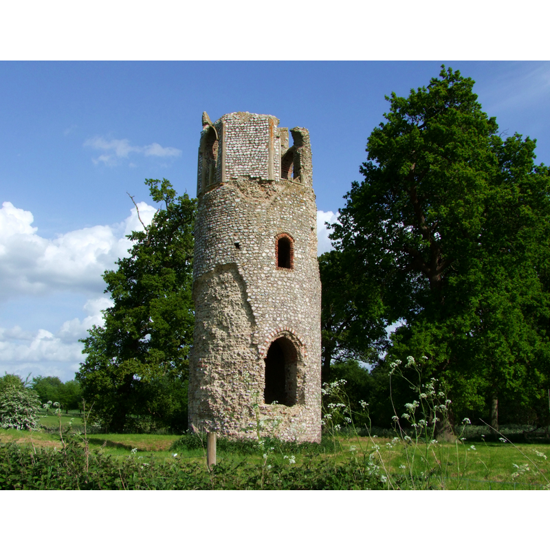
Copyright Statement: Image copyright © Simon Knott, 2009
Image Source: digital photograph taken 27 May 2009 by Simon Knott [www.norfolkchurches.co.uk/wolterton/wolterton.htm] [accessed 30 May 2013]
Copyright Instructions: Standing permission
view of church exterior - tower
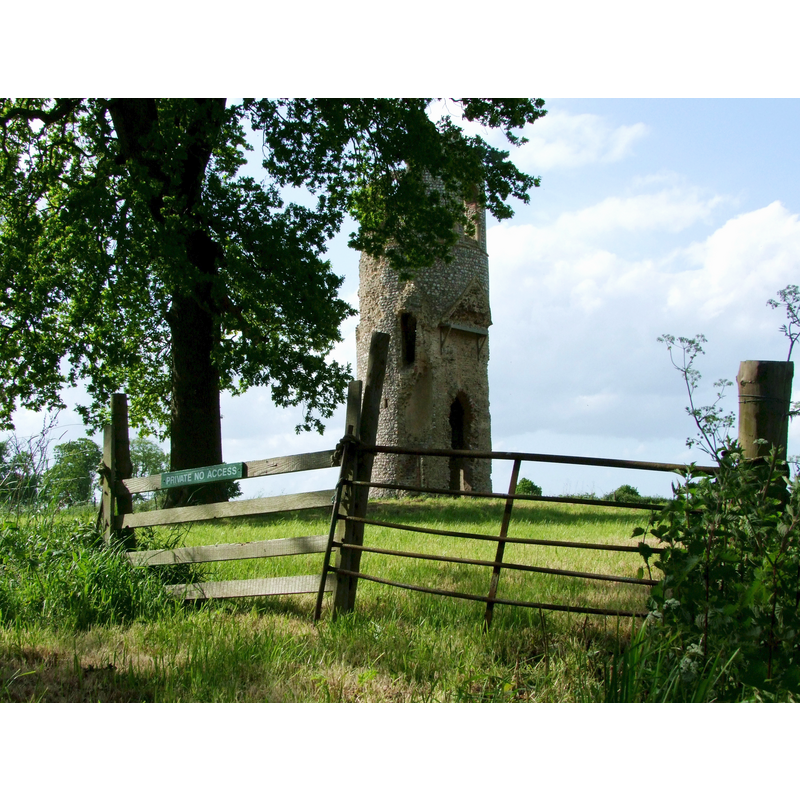
Scene Description: sign on fence: PRIVATE NO ACCESS -- The ruins of St. Margaret's are located in Wolterton estate
Copyright Statement: Image copyright © Simon Knott, 2009
Image Source: digital photograph taken 27 May 2009 by Simon Knott [www.norfolkchurches.co.uk/wolterton/wolterton.htm] [accessed 30 May 2013]
Copyright Instructions: Standing permission
INFORMATION
Font ID: 15267WOL
Object Type: Baptismal Font1?
Font Century and Period/Style: Medieval
Church / Chapel Name: Parish Church of St. Margaret [in ruins]
Font Location in Church: [cf. FontNotes]
Church Wikidata: https://www.wikidata.org/wiki/Q17556343
Church Patron Saint(s): St. Margaret of Antioch [aka Margaret the Virgin, Marina]
Church Notes: round-tower church
Church Address: Wickmere, Norfolk NR11 7LY
Site Location: Norfolk, East Anglia, England, United Kingdom
Directions to Site: Located next to Wickmere, 8 km NNW of Aylsham, 15 SW of Cromer. The ruins of St. Margaret's are located in Wolterton estate
Ecclesiastic Region: [Diocese of Norwich]
Historical Region: Hundred of South Erpingham
Additional Comments: disappeared font?
Font Notes:
Click to view
Blomefield (1805-1810) writes: "The abbey of St. Bennet at the Holm, from the time of its foundation, had half this town and the moiety of the advowson, of the founder's gift at the Conqueror's survey [...] The Church is dedicated to St. Margaret [...] The nave and chancel are both of a height, and are thatched; the south isle and north chancel vestry are down; the steeple is round at bottom and octangular at top, it hath two bells". White's Directory of 1845 writes of the former church: "The venerable ruins of the parish [church] (St. Margaret,) stand on the north side of the hall, embowered in lofty hollies. This building has long been deserted, and scarcely anything but the tower now remains." Knott (2009) writes: "This church had a round tower with an octagonal bell stage, and the windows are picked out in the flint with red brick. This bell stage is falling away, which is probably the most interesting thing about it, because it reveals that the tower was built all in one go - that is to say, the bell stage is not a late medieval addition to a Norman, or even Saxon, round tower, but the whole piece is of a single construction, probably of the 13th century, as many must be." [NB: apparently the demise of this church coincided with the building of Wolterton Hall by Horatio Walpole; the ruined church of St Margaret in the grounds of Wolterton estate] [NB: we have no information on the font of the original church here].
COORDINATES
Latitude & Longitude (Decimal): 52.8425, 1.2110
Latitude & Longitude (DMS): 52° 50' 32.42" N, 1° 12' 41.59" E
REFERENCES
- Blomefield, Francis, An essay towards a topographical history of Norfolk, 1805-1810, vol. 6: 452-456 / [www.british-history.ac.uk/report.aspx?compid=78277] [accessed 30 May 2013]
- White, William, History, gazetteer, and directory of Norfolk and the city and County of the city of Norwich [...], Sheffield: Robert Leader, 1845, [transcribed in http://www.origins.org.uk/genuki/NFK/places/w/wolterton/white1845.shtml] [accessed 8 September 2009]]