Whinburgh / Whinbergh / Winebiga
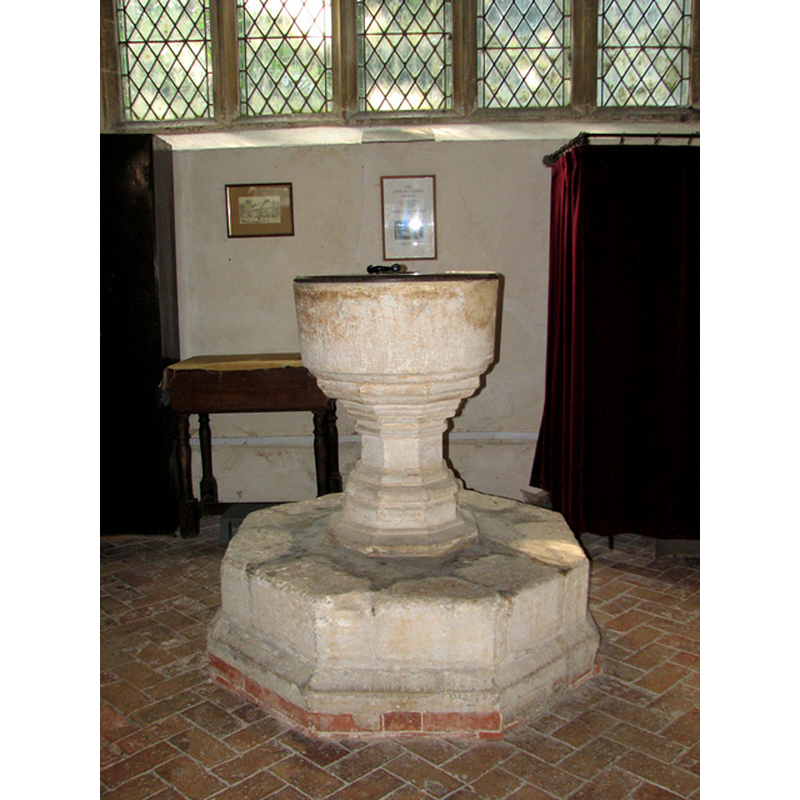
Image copyright © Evelyn Simak, 2010
CC-BY-SA-3.0
Results: 8 records
view of font and cover
Copyright Statement: Image copyright © Evelyn Simak, 2010
Image Source: digital photograph taken 1 September 2010 by Evelyn Simak [www.geograph.org.uk/photo/2050985] [accessed 31 March 2014]
Copyright Instructions: CC-BY-SA-3.0
design element - motifs - moulding
Copyright Statement: Image copyright © Evelyn Simak, 2010
Image Source: digital photograph taken 1 September 2010 by Evelyn Simak [www.geograph.org.uk/photo/2050985] [accessed 31 March 2014]
Copyright Instructions: CC-BY-SA-3.0
view of church exterior - southwest end
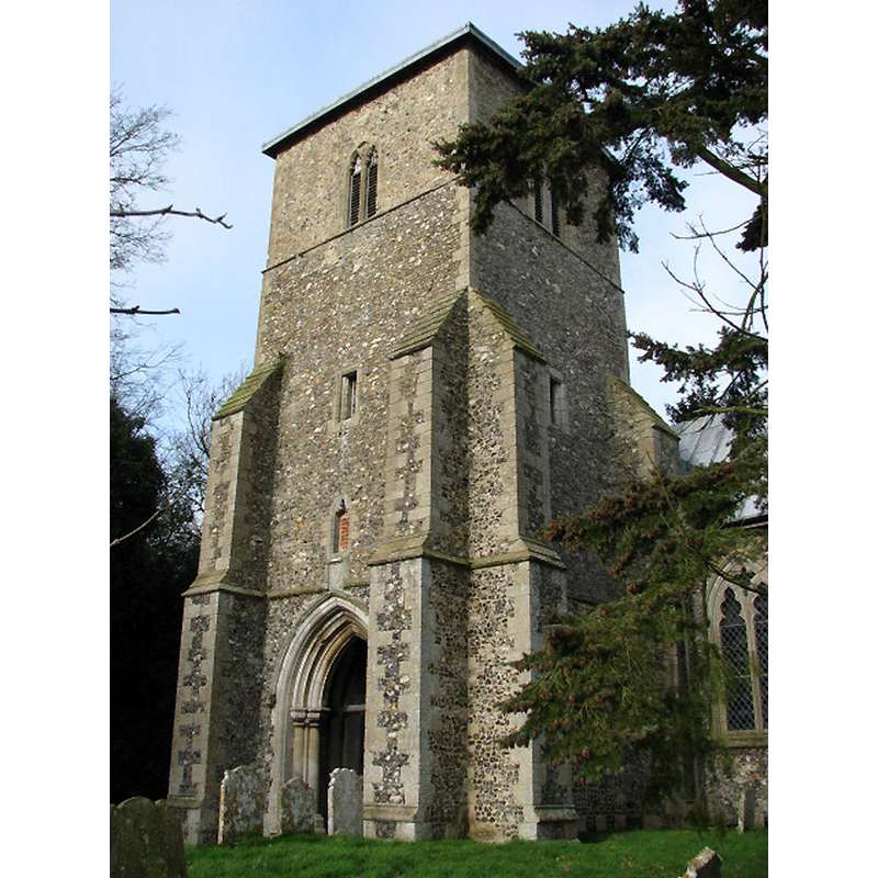
Copyright Statement: Image copyright © Evelyn Simak, 2008
Image Source: digital photograph taken 29 January 2008 by Evelyn Simak [www.geograph.org.uk/photo/671915] [accessed 31 March 2014]
Copyright Instructions: CC-BY-SA-3.0
view of church exterior - east view
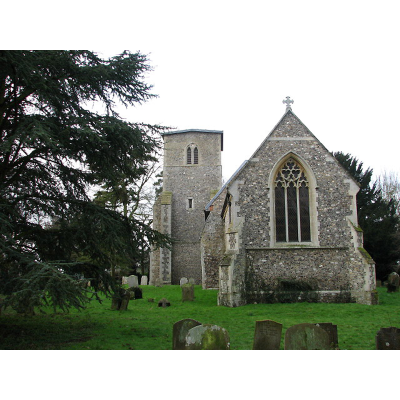
Copyright Statement: Image copyright © Evelyn Simak, 2008
Image Source: digital photograph taken 29 January 2008 by Evelyn Simak [www.geograph.org.uk/photo/671918] [accessed 31 March 2014]
Copyright Instructions: CC-BY-SA-3.0
view of church exterior - southeast view
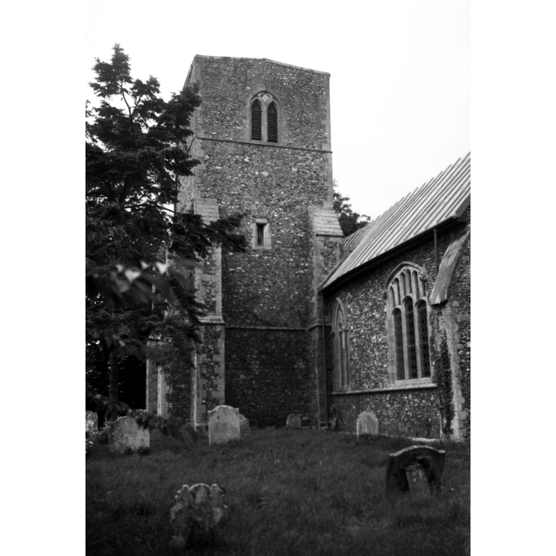
Scene Description: Photo caption: "All of c1300 to the later 14c. The south-west tower includes a porch"
Copyright Statement: Image copyright © George Plunkett, 2014
Image Source: B&W photograph taken 19 June 1994 by George Plunkett [www.georgeplunkett.co.uk/Norfolk/W/Whinburgh St Mary's church from SE [7136] 1994-06-19.jpg] [accessed 31 March 2014]
Copyright Instructions: Standing permission by Jonathan Plunkett
view of church interior - nave - looking west
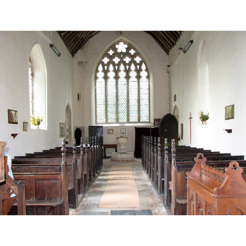
Scene Description: the font at the far end
Copyright Statement: Image copyright © Evelyn Simak, 2010
Image Source: digital photograph taken 1 September 2010 by Evelyn Simak [www.geograph.org.uk/photo/2050984] [accessed 31 March 2014]
Copyright Instructions: CC-BY-SA-3.0
view of church interior - nave - looking east
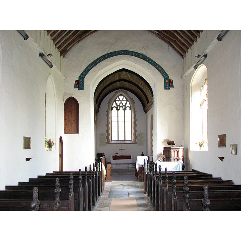
Copyright Statement: Image copyright © Evelyn Simak, 2010
Image Source: digital photograph taken 1 September 2010 by Evelyn Simak [www.geograph.org.uk/photo/2050960] [accessed 31 March 2014]
Copyright Instructions: CC-BY-SA-3.0
design element - motifs - moulding
Copyright Statement: Image copyright © Evelyn Simak, 2010
Image Source: digital photograph taken 1 September 2010 by Evelyn Simak [www.geograph.org.uk/photo/2050985] [accessed 31 March 2014]
Copyright Instructions: CC-BY-SA-3.0
INFORMATION
Font ID: 15255WHI
Object Type: Baptismal Font1
Font Century and Period/Style: 14th century, Decorated
Church / Chapel Name: Parish Church of St. Mary [redundant]
Font Location in Church: Inside the church, at the W end of the nave
Church Patron Saint(s): St. Mary the Virgin
Church Address: Church Lane, Whinburgh, Norfolk, NR19 1QG
Site Location: Norfolk, East Anglia, England, United Kingdom
Directions to Site: Located 6 km SSE of East Dereham
Ecclesiastic Region: Diocese of Norwich
Historical Region: Hundrdd and half of Mitford
Additional Comments: disappeared font? (the one from the Domesday-time church here)
Font Notes:
Click to view
There are two entries for Whinburgh [variant spelling] in the Domesday survey [http://domesdaymap.co.uk/place/TG0008/whinburgh/] [accessed 31 March 2014], one of which reports two churches with church lands in it. There appears to have been a single church here in 1086, as Bloemfield (1805-1810) notes: "a church endowed with 6 acres, valued with Gerveston, [...] and was measured with that town, and joined in payment of the gelt", which would account for two churches reported in the Whinburgh entry. Blomefield (ibid.) adds: "The Church is dedicated to St. Mary [...] In the reign of Edward I. the rector had a manse and 30 acres of land." The present font is described in Pevsner & Wilson (1999): "C14. Plain, with moulded stem and circular bowl." Baptismal font consisting of a round basin with plain tapering sides and a moulded underbowl that becomes octagonal on the second moulding and continues that shape through the stem, lower base and plinth. The wooden cover is round and flat; modern. [NB: we have no information on the font of the Domesday-time church here].
Credit and Acknowledgements: We are grateful to Jonathan Plunkett for the photograph of this church taken by his father, George Plunkett, in June 1994
COORDINATES
UTM: 31U 362200 5834294
Latitude & Longitude (Decimal): 52.641103, 0.963407
Latitude & Longitude (DMS): 52° 38′ 27.97″ N, 0° 57′ 48.26″ E
MEDIUM AND MEASUREMENTS
Material: stone
Font Shape: octagonal, mounted
Basin Interior Shape: round
Basin Exterior Shape: octagonal
LID INFORMATION
Date: modern
Material: wood
Apparatus: no
Notes: [cf. FontNotes]
REFERENCES
- Blomefield, Francis, An essay towards a topographical history of Norfolk, 1805-1810, vol. 10: 271-273 / [www.british-history.ac.uk/report.aspx?compid=78674] [accessed 31 March 2014]
- Pevsner, Nikolaus, Norfolk 2: North-West and South (2nd ed.), London: Penguin, 1999, p. 775