West Tofts / Stoffta
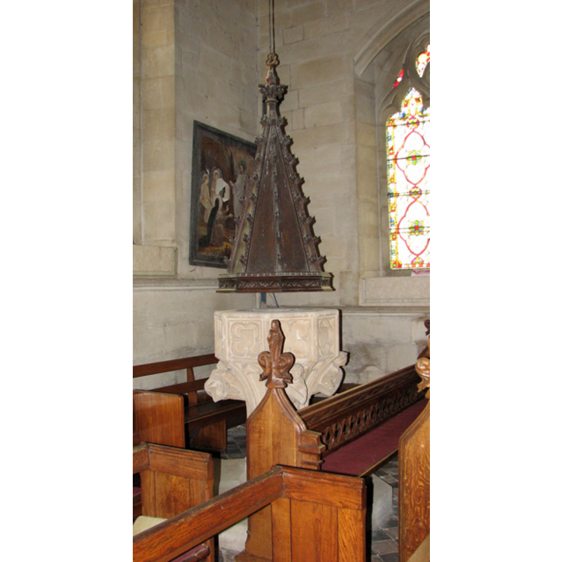
Image copyright © Evelyn Simak, 2010
CC-BY-SA-3.0
Results: 4 records
view of font and cover
Scene Description: the modern font and its cover
Copyright Statement: Image copyright © Evelyn Simak, 2010
Image Source: digital photograph taken 21 July 2010 by Evelyn Simak [www.geograph.org.uk/photo/1975576] [accessed 13 March 2013]
Copyright Instructions: CC-BY-SA-3.0
view of church exterior - south view
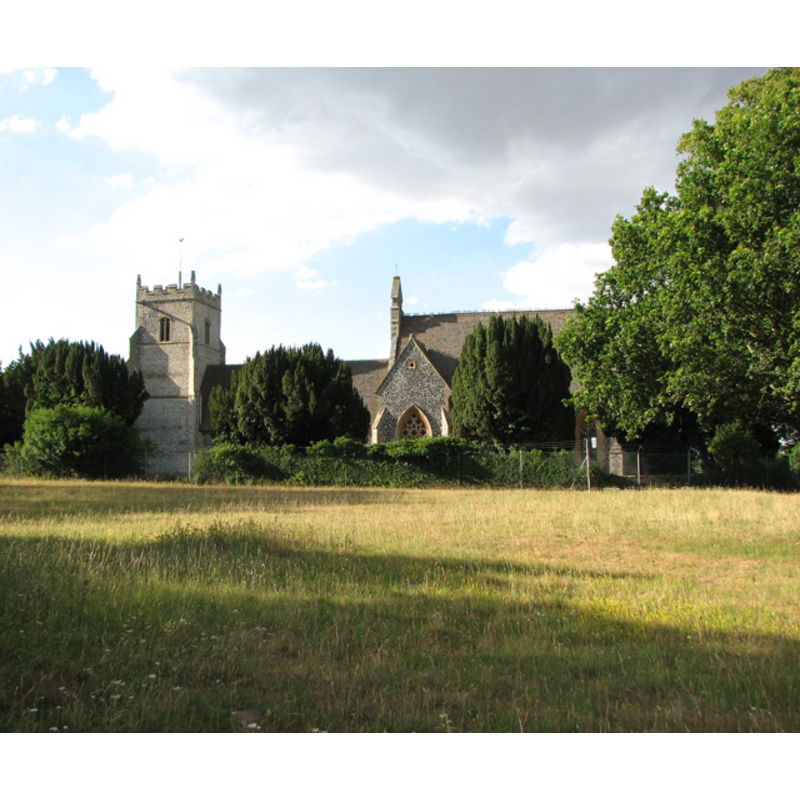
Copyright Statement: Image copyright © Evelyn Simak, 2010
Image Source: digital photograph taken 21 July 2010 by Evelyn Simak [www.geograph.org.uk/photo/1975529] [accessed 13 March 2013]
Copyright Instructions: CC-BY-SA-3.0
view of church interior - nave - looking east
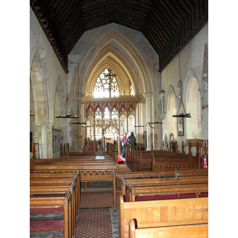
Copyright Statement: Image copyright © Evelyn Simak, 2010
Image Source: digital photograph taken 21 July 2010 by Evelyn Simak [www.geograph.org.uk/photo/1975543] [accessed 13 March 2013]
Copyright Instructions: CC-BY-SA-3.0
view of basin and cover
![the top modern basin visible beneath the cover [cf. Font notes]](/static-50478a99ec6f36a15d6234548c59f63da52304e5/compressed/1090906008_compressed.png)
Scene Description: the top modern basin visible beneath the cover [cf. Font notes]
Copyright Statement: Image copyright © Simon Knott, 2004
Image Source: digital photograph taken 24 May 2004 by Simon Knott [www.flickr.com/photos/97947642@N00/437491447/] [accessed 6 September 2009]
Copyright Instructions: Standing permission
INFORMATION
Font ID: 15247TOF
Object Type: Baptismal Font1
Font Century and Period/Style: 14th century, Decorated
Church / Chapel Name: Parish Church of St. Mary [disused/redundant]
Font Location in Church: [cf.. FontNotes]
Church Patron Saint(s): St. Mary the Virgin
Church Notes: church restored and remodelled by A.W.N. Pugin
Site Location: Norfolk, East Anglia, England, United Kingdom
Directions to Site: Located in the Battle Zone [military training grounds; restricted access], W of Stanford
Additional Comments: no font appears in Knott's page [checked 4 Sept 2009]; not mentioned in Pevsner & Wilson (1999)
Font Notes:
Click to view
Blomefield (1805-1810) writes: "The Church is dedicated to St. Mary, [...] a very ancient building of flint stone, &c.; the nave is [...] covered with reed. [...] In the wall on the south side is a place for the holy water, where formerly was an altar [...] This tower was begun about the end of Henry the Sixth's reign, or in the beginning of Edward the Fourth's" [i.e., ca. 1422-1461]; there is no mention of a font in this source. A font in this church is reported in the English Heritage [Listing NGR: TL8360392898] [www.britishlistedbuildings.co.uk/en-220981-church-of-st-mary-lynford-norfolk] [accessed 13 March 2013]. It is not included in Knott's 2004 entry for this church in his Norfolk Churches, but an illustration that shows the top of the font and the whole wooden cover can be found in his Flickr album [www.flickr.com/photos/97947642@N00/437491447/] [accessed 6 September 2009]: "C14 octagonal font with angel corbels" . The octagonal font in the church is probably a 19th-century model based on Perpendicular designs, octagonal, the sides of the basin decorated with pointed quatrefoils and blank shields in circles on alternate sides. The cover itself could be a 17th-century original, octagonal pyramid with crocketed arrises and floral finial [unless it is a Victorian replica] [NB: we have no information on the original font of this church]
Credit and Acknowledgements: We are grateful to Simon Knott, of www.norfolkchurches.co.uk, for his photograph of this font and cover
COORDINATES
UTM: 31U 344075 5819488
Latitude & Longitude (Decimal): 52.503191, 0.702712
Latitude & Longitude (DMS): 52° 30′ 11.49″ N, 0° 42′ 9.76″ E
LID INFORMATION
Date: 17th-century? / 19th-century?
Material: wood, oak?
Apparatus: no
Notes: [cf. FontNotes]
REFERENCES
- Blomefield, Francis, An essay towards a topographical history of Norfolk, 1805-1810, vol. 2: 256-262 / [www.british-history.ac.uk/report.aspx?compid=78061] [accessed 4 September 2009]