West Rudham / Rudeham
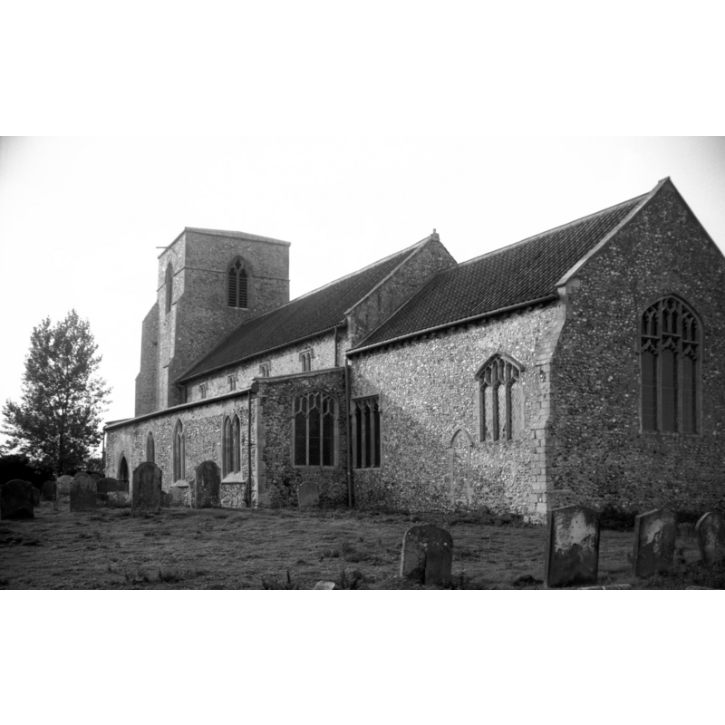
Image copyright © George Plunkett, 2013
Standing permission by Jonathan Plunkett
Results: 1 records
view of church exterior - southeast view
Copyright Statement: Image copyright © George Plunkett, 2013
Image Source: B&W photograph taken by George Plunkett 30 September 1995
Copyright Instructions: Standing permission by Jonathan Plunkett
INFORMATION
Font ID: 15245RUD
Object Type: Baptismal Font1
Font Century and Period/Style: 15th century, Perpendicular
Church / Chapel Name: Parish Church of St. Peter [redundant]
Font Location in Church: Inside the church
Church Patron Saint(s): St. Peter
Church Address: School Lane, West Rudham, Norfolk, PE31 8
Site Location: Norfolk, East Anglia, England, United Kingdom
Directions to Site: Located 3 km from East Rudeham, 13 km W of Fakenham
Ecclesiastic Region: Diocese of Norwich
Historical Region: Hundreds of Gallow and Brothercross
Font Notes:
Click to view
Blomefield (1805-1810) writes: "Rudham, at the survey, included both East and West Rudham, being not at that time distinguished by the name of East and West, both which belonged to the Earl Warren, the capital lord. [...] The Church of West Rudham is dedicated to St. Peter, and was given by Hervey Belet to the priory of Coxford [...] The chapel of All-Saints, in the churchyard of St. Peter of WestRudham, is mentioned in 1493." Blomefield (1805-1810) further reports: "Mr. Godfrey, vicar of West Rudham, and Richard his son, were found to have been killed, in the iter of the King's judges, Ao. 14th Edward I." [i.e., 1286], and lists the next recorded vicar as "William de Rademelde [...] presented by the prior and convent of Cokesford", in 1305. The present font is noted in Pevsner & Wilson (1999): "Perp[endicular], octagonal, simple."
Credit and Acknowledgements: We are grateful to Jonathan Plunkett for the photograph of this church, taken by his father, George Plunkett, in 1995
COORDINATES
UTM: 31U 344895 5854209
Latitude & Longitude (Decimal): 52.815322, 0.698447
Latitude & Longitude (DMS): 52° 48′ 55.16″ N, 0° 41′ 54.41″ E
MEDIUM AND MEASUREMENTS
Material: stone
Font Shape: octagonal, mounted
Basin Exterior Shape: octagonal
REFERENCES
- Blomefield, Francis, An essay towards a topographical history of Norfolk, 1805-1810, vol. 7: 158-162 / [www.british-history.ac.uk/report.aspx?compid=78319] [accessed 30 July 2013]
- Pevsner, Nikolaus, Norfolk 2: North-West and South (2nd ed.), London: Penguin, 1999, p. 769