Westfield nr. East Dereham / Westfelda
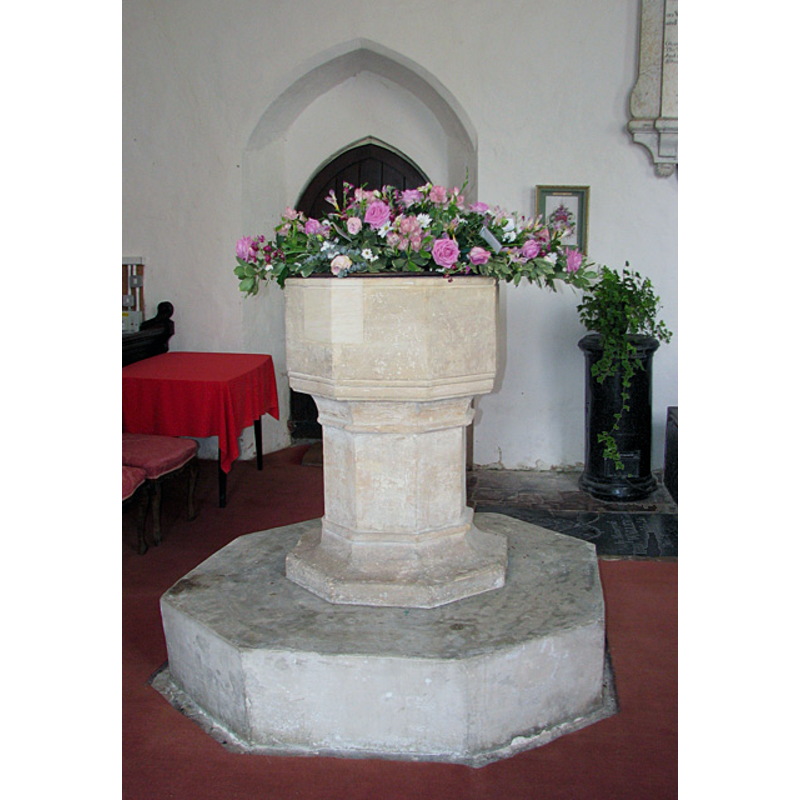
Image copyright © Evelyn Simak, 2010
CC-BY-SA-3.0
Results: 7 records
view of font and cover
Copyright Statement: Image copyright © Evelyn Simak, 2010
Image Source: digital photograph taken 1 September 2010 by Evelyn Simak [www.geograph.org.uk/photo/2047339] [accessed 12 May 2013]
Copyright Instructions: CC-BY-SA-3.0
design element - motifs - moulding
Scene Description: on the basin and base
Copyright Statement: Image copyright © Evelyn Simak, 2010
Image Source: digital photograph taken 1 September 2010 by Evelyn Simak [www.geograph.org.uk/photo/2047339] [accessed 12 May 2013]
Copyright Instructions: CC-BY-SA-3.0
view of church exterior - south porch
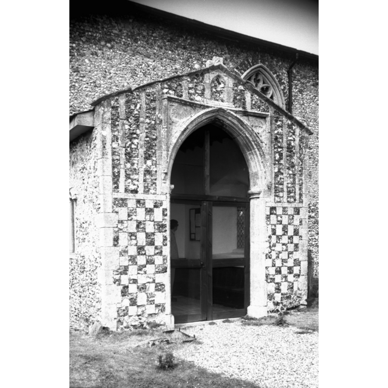
Scene Description: Photo caption: "15c porch has chequer and panelling flushwork"
Copyright Statement: Image copyright © George Plunkett, 2014
Image Source: B&W digital photograph taken 8 July 1995 by George Plunkett [www.georgeplunkett.co.uk/Norfolk/W/Westfield St Andrew's church south porch [7213] 1995-07-08.jpg] [accessed 31 March 2014]
Copyright Instructions: Standing permission by Jonathan Plunkett
view of church exterior - southeast view
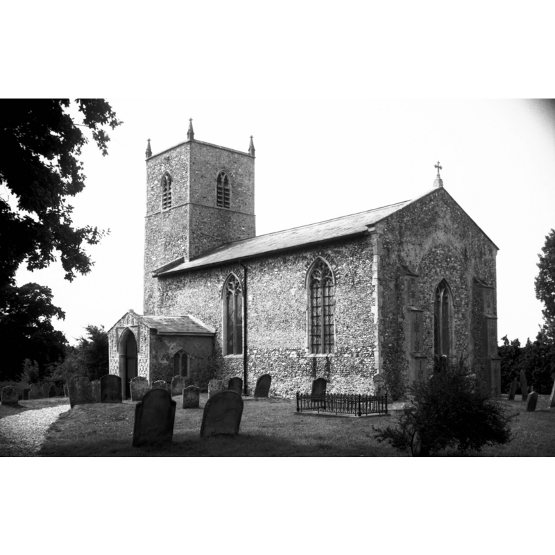
Scene Description: Photo caption: "The chancel was demolished about 1700"
Copyright Statement: Image copyright © George Plunkett, 2014
Image Source: B&W digital photograph taken 8 July 1995 by George Plunkett [www.georgeplunkett.co.uk/Norfolk/W/Westfield St Andrew's church from SE [7212] 1995-07-08.jpg] [accessed 31 March 2014]
Copyright Instructions: Standing permission by Jonathan Plunkett
view of church exterior - southeast view
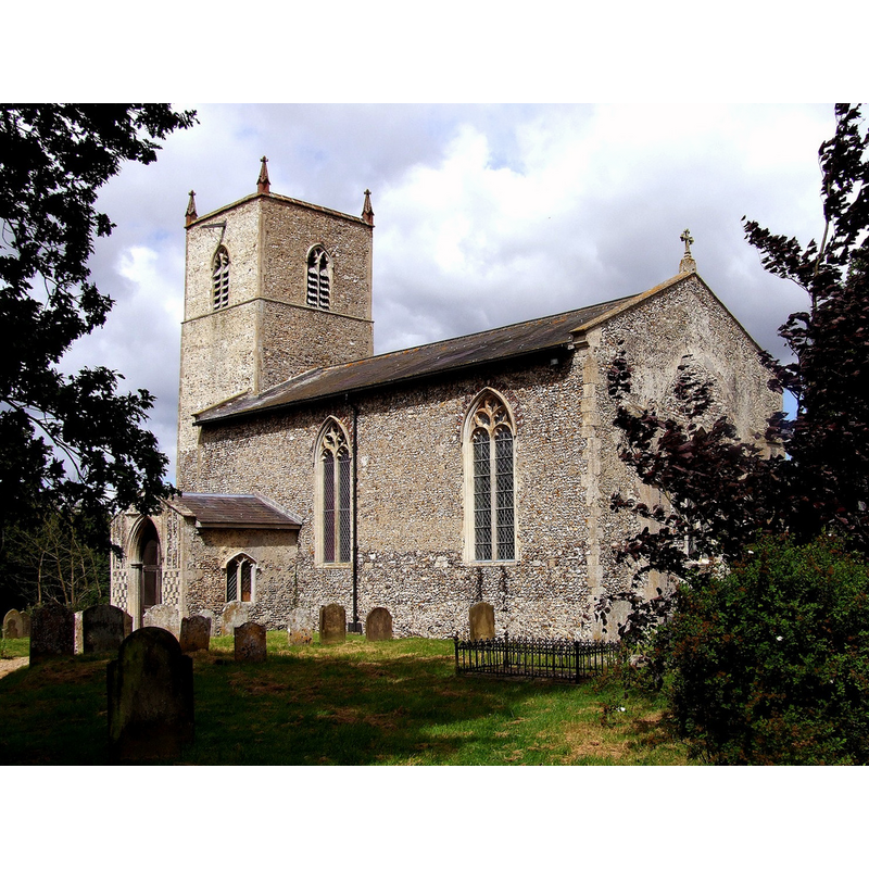
Copyright Statement: Image copyright © Simon Knott, 2008
Image Source: detail of a digital photograph March 2008 taken by Simon Knott [www.norfolkchurches.co.uk/westfield/westfield.htm] [accessed 7 February 2013]
Copyright Instructions: Standing permission
view of church interior - nave - looking west
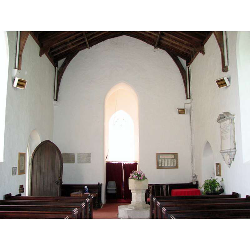
Scene Description: the font and cover visible on the north side of the aisle, opposite the south doorway
Copyright Statement: Image copyright © Evelyn Simak, 2010
Image Source: digital photograph taken 1 September 2010 by Evelyn Simak [www.geograph.org.uk/photo/2047338] [accessed 12 May 2013]
Copyright Instructions: CC-BY-SA-3.0
view of church interior - nave - looking east
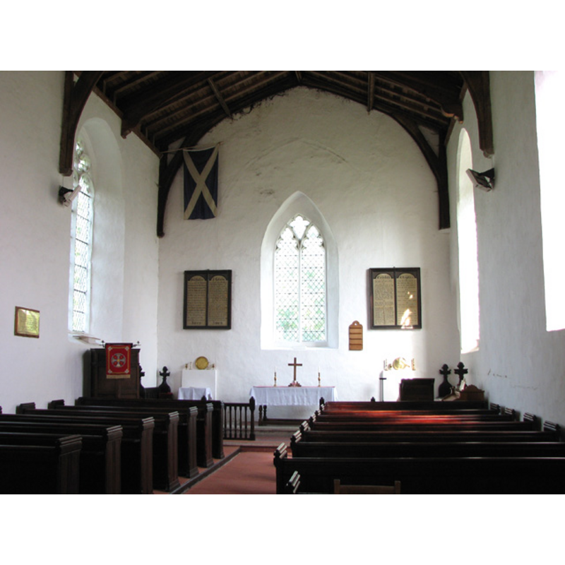
Copyright Statement: Image copyright © Evelyn Simak, 2010
Image Source: digital photograph taken 1 September 2010 by Evelyn Simak [www.geograph.org.uk/photo/2047333] [accessed 12 May 2013]
Copyright Instructions: CC-BY-SA-3.0
INFORMATION
Font ID: 15240WES
Object Type: Baptismal Font1
Font Century and Period/Style: 14th century, Decorated
Church / Chapel Name: Parish Church of St. Andrew
Font Location in Church: Inside the church, at the W end of the nave, slightly to the N side of the aisle
Church Patron Saint(s): St. Andrew
Church Address: Station Lane, Westfield, Dereham, Norfolk, NR19 1QG
Site Location: Norfolk, East Anglia, England, United Kingdom
Directions to Site: Located off (E) the A1075, 3 km S of East Dereham
Ecclesiastic Region: Diocese of Norwich
Historical Region: Hundred and half of Mitford
Additional Comments: damaged font / repaired font [cf. FontNotes]
Font Notes:
Click to view
There is an entry for Westfield [variant spelling] in the Domesday survey [http://domesdaymap.co.uk/place/TF9909/westfield/] [accessed 31 March 2014], but it mentions neither church nor cleric in it. Blomefield (1805-1810) writes: "The Church is a rectory, dedicated to St. Andrew, and a single long pile covered with lead; the chancel is down, and has a square tower with 2 bells. [...] Sir John de Breton was lord and patron in the reign of Edward I. when the rector had a manse, and 15 acres of land." This 'John of Breton' is probably Jean de Bretagne (+1334), nobleman of that dukedom and, later, Earl of Richmond; he was Edward I's nephew. The reference to him in Blomefield (ibid.) must be near-contemporary to the recorded first rector of this church: "In 1300, Henry Basset was instituted; presented by Sir Thomas de Wyteworth, Knt.", all of which indicate that a church here existed before 1300, but perhaps not much earlier than that date. The present font is noted in Pevsner & Wilson (1999): "C14, octagonal. With moulded stem." Illustrated in Knott (2008). The font has mouldings at the upper rim, on the underbowl and at both ends of the octagonal stem; the basin has at least one large repair with new stone insert; raised on an octagonal plinth. The plain and flat wooden cover is modern.
Credit and Acknowledgements: We are grateful to Simon Knott, of Norfolk Churches [www.norfolkchurches.co.uk] for his photograph of this church
COORDINATES
UTM: 31U 360972 5835372
Latitude & Longitude (Decimal): 52.650469, 0.944817
Latitude & Longitude (DMS): 52° 39′ 1.69″ N, 0° 56′ 41.34″ E
MEDIUM AND MEASUREMENTS
Material: stone
Font Shape: octagonal, mounted
Basin Interior Shape: round
Basin Exterior Shape: octagonal
LID INFORMATION
Date: modern
Material: wood
Apparatus: no
Notes: [cf. FontNotes]
REFERENCES
- Blomefield, Francis, An essay towards a topographical history of Norfolk, 1805-1810, vol. 10: 269-271 / [www.british-history.ac.uk/report.aspx?compid=78673] [accessed 31 March 2014]
- Knott, Simon, The Norfolk Churches Site, Simon Knott, 2004. [standing permission to reproduce images received from Simon (February 2005]. URL: www.norfolkchurches.co.uk.
- Pevsner, Nikolaus, Norfolk 2: North-West and South (2nd ed.), London: Penguin, 1999, p. 764