West Barsham / Barseham
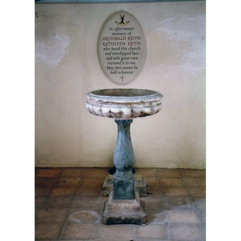
Image copyright © Simon Knott, 2005
Standing permission
Results: 6 records
view of font
Scene Description: the 18th-century font [cf. FontNotes]
Copyright Statement: Image copyright © Simon Knott, 2005
Image Source: digital photograph May 2005 taken by Simon Knott [www.norfolkchurches.co.uk/westbarsham/westbarsham.htm] [accessed 6 June 2013]
Copyright Instructions: Standing permission
view of church exterior - north portal
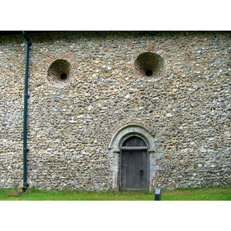
Scene Description: the Norman (?) portal; Saxon (?) windows above
Copyright Statement: Image copyright © Simon Knott, 2005
Image Source: digital photograph May 2005 taken by Simon Knott [www.norfolkchurches.co.uk/westbarsham/westbarsham.htm] [accessed 6 June 2013]
Copyright Instructions: Standing permission
view of church exterior - south portal
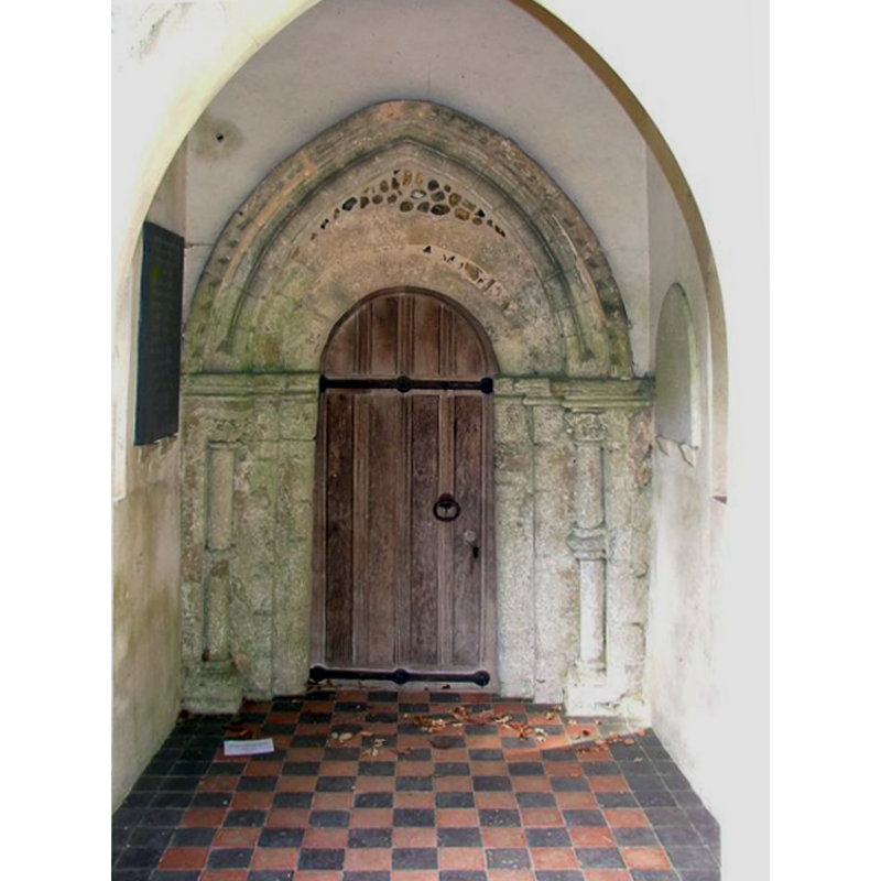
Scene Description: the Norman portal and the added 13th-century surounding arch
Copyright Statement: Image copyright © Simon Knott, 2005
Image Source: digital photograph May 2005 taken by Simon Knott [www.norfolkchurches.co.uk/westbarsham/westbarsham.htm] [accessed 6 June 2013]
Copyright Instructions: Standing permission
view of church exterior - southwest view
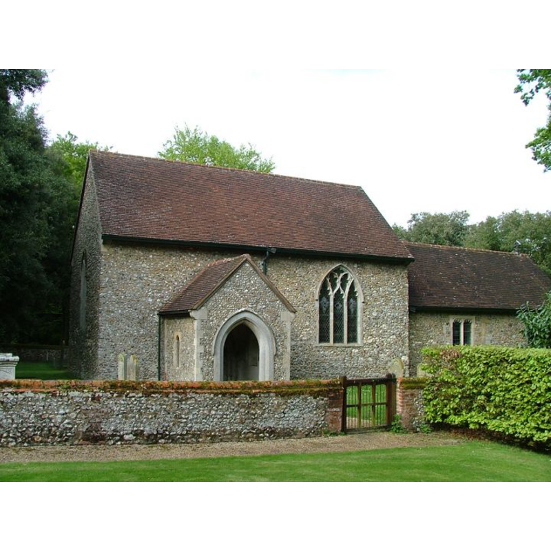
Scene Description: the mid-19th century restoration did away with its 11th-century tower
Copyright Statement: Image copyright © Simon Knott, 2005
Image Source: digital photograph May 2005 taken by Simon Knott [www.norfolkchurches.co.uk/westbarsham/westbarsham.htm] [accessed 6 June 2013]
Copyright Instructions: Standing permission
view of church interior - nave - looking west
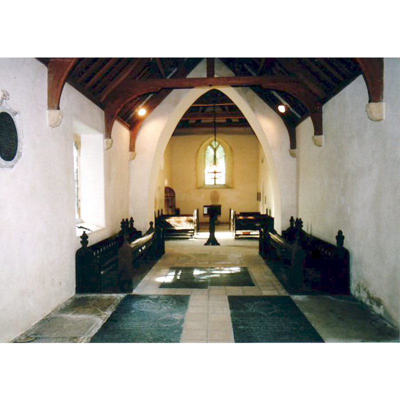
Copyright Statement: Image copyright © Simon Knott, 2005
Image Source: digital photograph May 2005 taken by Simon Knott [www.norfolkchurches.co.uk/westbarsham/westbarsham.htm] [accessed 6 June 2013]
Copyright Instructions: Standing permission
view of church interior - nave - looking east
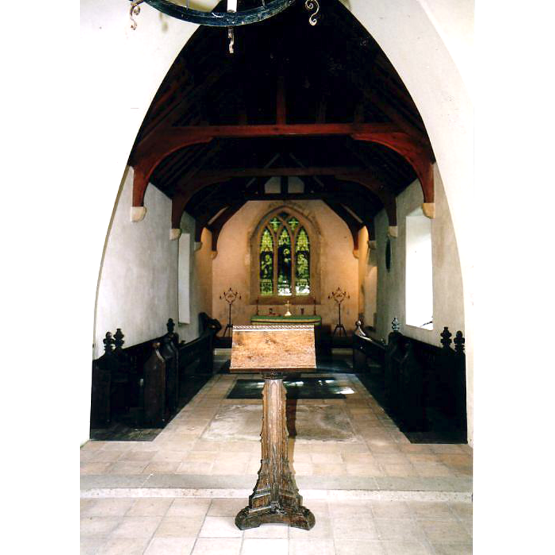
Copyright Statement: Image copyright © Simon Knott, 2005
Image Source: digital photograph May 2005 taken by Simon Knott [www.norfolkchurches.co.uk/westbarsham/westbarsham.htm] [accessed 6 June 2013]
Copyright Instructions: Standing permission
INFORMATION
Font ID: 15237BAR
Object Type: Baptismal Font1?
Font Century and Period/Style: 11th century, Pre-Conquest? / Norman
Church / Chapel Name: Parish Church of the Assumption of the Blessed Virgin Mary
Font Location in Church: [cf. FontNotes]
Church Patron Saint(s): The Assumption of St. Mary
Church Address: Grove Road, Barsham, Norfolk NR21 9NT
Site Location: Norfolk, East Anglia, England, United Kingdom
Directions to Site: Located 6 km NNW of Fakenham
Ecclesiastic Region: Diocese of Norwich
Historical Region: Hundreds of Gallow and Brothercross
Additional Comments: disappeared font? (the one from the original 11thC church here)
Font Notes:
Click to view
Blomefield (1805-19810) writes: "There are three towns of the name of Barsham, that is a ham by a bar, that is, on or by the hills. In Domesday book they are not distinguished by the appellation of East, West, and North, but included under the general name of Barsham. Hugo held then a manor of the Earl Warren; Toke, who was lord of it in the Confessor's time, being deprived of it. It then contained four carucates of land, ten villains, and twenty-six bordarers, with four servi, four carucates in demean, and five amongst the men, &c. three acres of meadow, 4 mills, &c. six socmen had half a carucate, and three bordarers, with two carucates, and a church endowed with 100 acres [...] This I take to be West Barsham [...] from this Hugh, who was lord at the survey, descended Sir Ralph de Wauci, lord; and father of Hugh de Wauci, who by deed, sans date, confirmed to the priory of Castleacre his land of West-Barsham, and all he had therein, with the church of that village, and all the appertenances in pure alms [...] the church of the Assumption of the Blessed Virgin in this town". Blomefield (ibid.) names "William Newton" as first recorded vicar here, in 1220 "presented by the prior and convent of Castleacre." According to English Heritage [Listing NGR: TF8302242092], the present font, round basin on a baluster stem, is 18th-century. [NB: we have no information on the font(s) of the original font of the early church here].
Credit and Acknowledgements: We are grateful to Simon Knott, of Norfolk Churches [www.norfolkchurches.co.uk], for his photographs of church and modern font
COORDINATES
UTM: 31U 353825 5859671
Latitude & Longitude (Decimal): 52.866878, 0.828397
Latitude & Longitude (DMS): 52° 52′ 0.76″ N, 0° 49′ 42.23″ E
REFERENCES
- Blomefield, Francis, An essay towards a topographical history of Norfolk, 1805-1810, vol. 7: 42-47 / [www.british-history.ac.uk/report.aspx?compid=78300] [accessed 5 June 2013]