West Acre / Acra [Domesday] / Acre / Westacre
![Main image for West Acre / Acra [Domesday] / Acre / Westacre](/static-50478a99ec6f36a15d6234548c59f63da52304e5/compressed/1131207015_compressed.png)
Image copyright © Evelyn Simak, 2010
CC-BY-SA-3.0
Results: 7 records
view of font and cover
Copyright Statement: Image copyright © Evelyn Simak, 2010
Image Source: digital photograph taken 17 April 2010 by Evelyn Simak [www.geograph.org.uk/photo/1811176] [accessed 5 December 2013]
Copyright Instructions: CC-BY-SA-3.0
view of font and cover in context
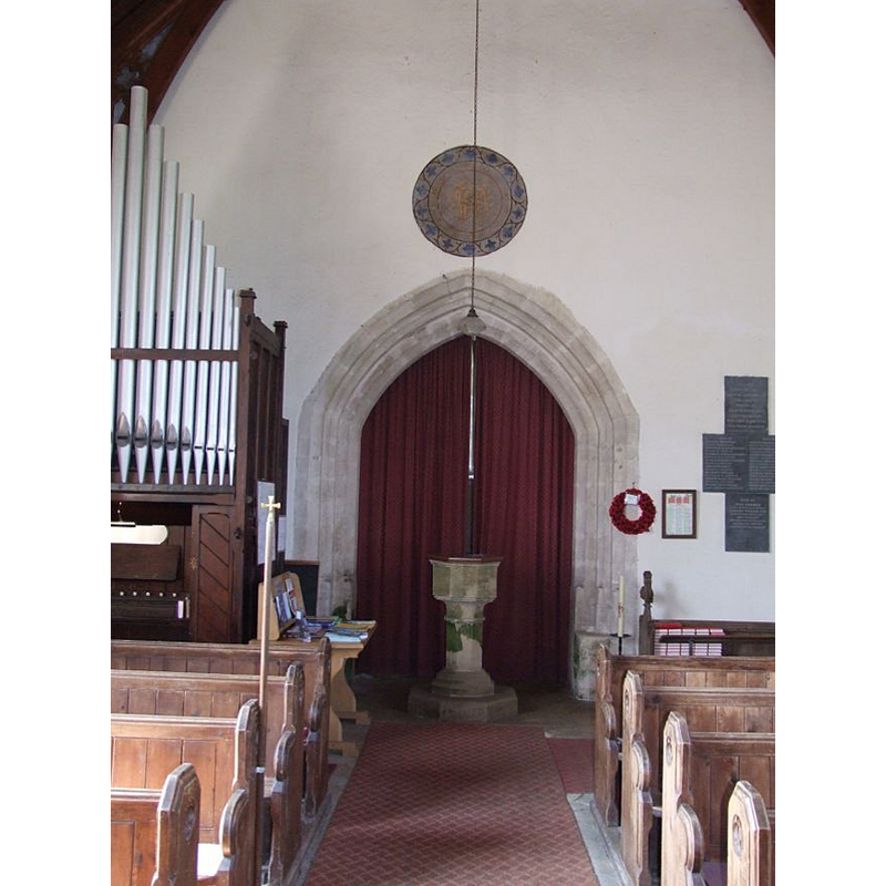
Scene Description: at the west end of the nave, by the tower arch
Copyright Statement: Image copyright © Simon Knott, 2007
Image Source: digital photograph taken 11 August 2007 by Simon Knott [www.norfolkchurches.co.uk/westacre/westacre.htm] [accessed 3 September 2009]
Copyright Instructions: Standing permission
view of church exterior - southeast view
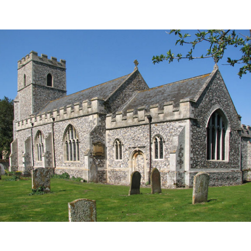
Copyright Statement: Image copyright © Evelyn Simak, 2010
Image Source: digital photograph taken 17 April 2010 by Evelyn Simak [www.geograph.org.uk/photo/1811082] [accessed 5 December 2013]
Copyright Instructions: CC-BY-SA-3.0
view of church exterior - detail
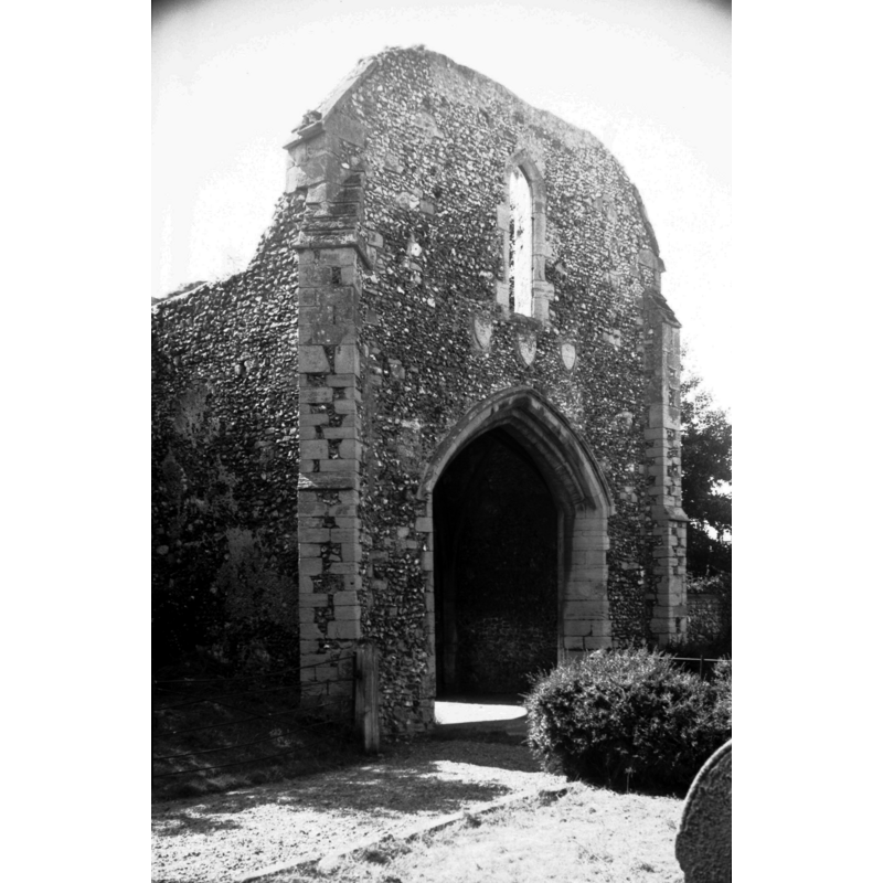
Scene Description: Gatehouse of the old priory -- Photo caption: "Originally founded for the Cluniac order by Ralph de Toney c1087-1100. Gatehouse dates from 14c
Copyright Statement: Image copyright © George Plunkett, 2013
Image Source: B&W photograph taken 19 August 1976 by George Plunkett [www.georgeplunkett.co.uk/Norfolk/W/W Acre Augustinian Priory gatehouse N side [5624] 1976-08-19.jpg] [accessed 5 December 2013]
Copyright Instructions: Standing permission by Jonathan Plunkett
view of church exterior - south view
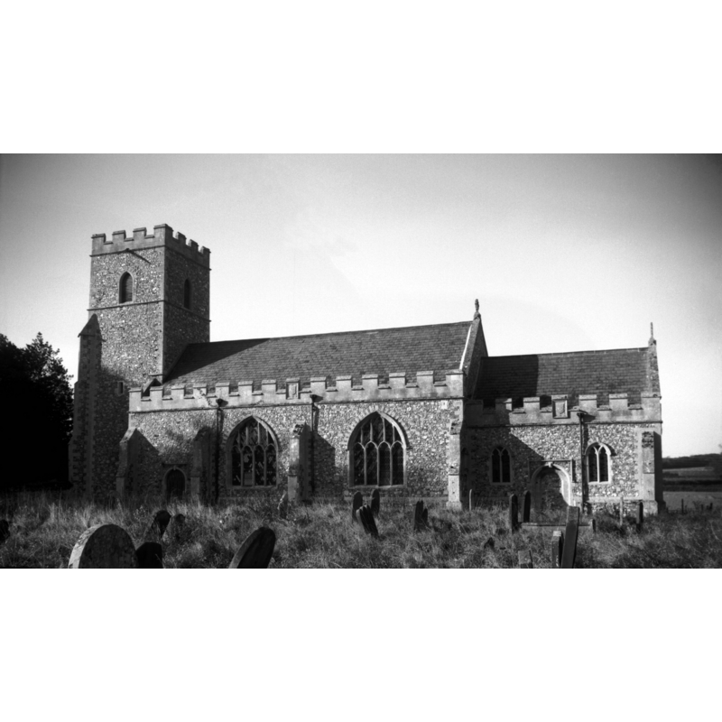
Copyright Statement: Image copyright © George Plunkett, 2013
Image Source: B&W photograph taken 16 October 1993 by George Plunkett [www.georgeplunkett.co.uk/Norfolk/W/W Acre All Saints church south side [7082] 1993-10-16.jpg] [accessed 5 December 2013]
Copyright Instructions: Standing permission by Jonathan Plunkett
view of church interior - nave - looking west
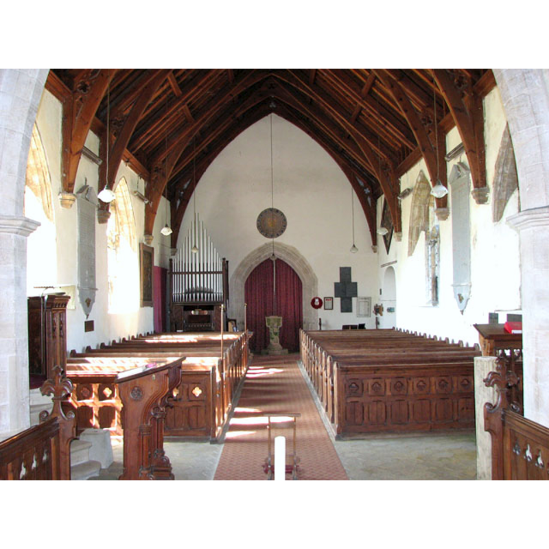
Scene Description: the font visible at the west end, by the tower arch
Copyright Statement: Image copyright © Evelyn Simak, 2010
Image Source: digital photograph taken 17 April 2010 by Evelyn Simak [www.geograph.org.uk/photo/1811173] [accessed 5 December 2013]
Copyright Instructions: CC-BY-SA-3.0
view of church interior - nave - looking east
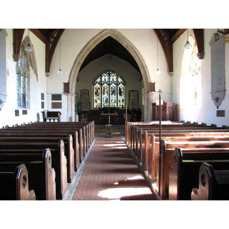
Copyright Statement: Image copyright © Evelyn Simak, 2010
Image Source: digital photograph taken 17 April 2010 by Evelyn Simak [www.geograph.org.uk/photo/1811120] [accessed 5 December 2013]
Copyright Instructions: CC-BY-SA-3.0
INFORMATION
Font ID: 15236ACR
Object Type: Baptismal Font1
Font Century and Period/Style: 16th - 18th century
Church / Chapel Name: Parish Church of All Saints
Font Location in Church: Inside the church, at the W end of the nave
Church Patron Saint(s): All Saints
Church Address: 4 Sandy Lane, West Acre, Norfolk PE32 1TS
Site Location: Norfolk, East Anglia, England, United Kingdom
Ecclesiastic Region: Diocese of Norwich
Historical Region: Hundred of Freebridge
Additional Comments: disappeared font(s)? (the font from the Domesday-time church here; perhaps that was another font in the priory church as well)
Font Notes:
Click to view
"Acre" or "Acra" (Castle and West] appears in three entries in the Domesday survey [http://domesdaymap.co.uk/place/XX0000/castle-and-west-acre/] [accessed 5 December 2013], one of which is reported with a church in it. Blomefield (1805-810) writes; "This town is thus called in respect of its site on a river, as Southacre, Castle, or East-Acre, all which towns occur in the Conqueror's book of Domesday, by the name of Acre, without any adjunct or distinction, being all seated on the same stream, or running water [...] At the survey it was the lordship of Ralph de Tony, descended from Malahulcius, uncle to Rollo, grandfather to William the Conqueror, and son of Roger de Tony, by Alice his wife, daughter of William Fitz-Osbern, one of the Conqueror's lords and generals, and created by him Earl of Hereford. Roger de Tony was standard-bearer of Normandy, and Ralph the son inherited the same office, was a Norman baron, and attended Duke William in the decisive battle of Hastings. [...] This Ralph de Tony was the founder of the priory of Westacre, dedicated it to St. Mary and All-Saints, and with his wife, his sons Roger and Ralph, granted for their own souls and their ancestors, his manor of Westacre with the parish church, (dedicated to All-Saints,) to Oliver the priest, or rector of it, and Walter his son [...] On this grant, Oliver and Walter his sons, entered into the order of the Cluniac monks of this priory, with all their effects". In Blomefield's listed of rectors (ibid.) Oliver appears in first place, sithout a date: "Oliver, who had been rector of the parish church of Westacre, was the first prior"; the second listed rector "William occurs prior in the 10th of Richard I" [i.e., 1199]. Blomefield (ibid.) adds: "The priory church stood a little space eastward of the present farmhouse, and was a large pile, built in a cathedral or conventual manner, as may be traced out from its site and foundation; only part of the tower at the west end of the south isle is now remaining. The cloister joined to this south isle, and there was a door here leading into the west end of the south isle, and another out of it into the church by the great tower that stood between the church and the choir. On the east side of the cloister was a way leading (as I take it) into the chapter-house, the north and south walls of which are partly standing as is part of the dormitory, (as I conceive it,) which was either over part of the west side of the cloister or joined to it. The gate-house leading out of the town into the outward court, or site of the priory, is still standing". Blomefield (ibid.) describes also the parish church: "The Church of Westacre is dedicated to All-Saints, and built mostly of flint stones, and embattled. It was a rectory [...] appropriated to the priory. The tower is foursquare and embattled, has one bell, and both church and chancel are covered with tile". The present font here is illustrated in context in Knott (2007). The small octagonal font has mouldings at the upper rim, on the underbowl chamfer, another at the centre ring position and some more on the lower base; it is raised on a small octagonal plinth; of difficult dating, but probably somewere between the 16th and the 18th century. The wooden cover is octagonal, flat and plain, the sides moulded; appears modern
Credit and Acknowledgements: We are grateful to Simon Knott, of www.norfolkchurches.co.uk, for his photograph of this font; we are also grateful to Jonathan Plunkett for the photographs of this church and priory taken by his father, Jonathan Plunkett, in 1976 and 1993
COORDINATES
UTM: 31U 340176 5842139
Latitude & Longitude (Decimal): 52.70553, 0.634373
Latitude & Longitude (DMS): 52° 42′ 19.91″ N, 0° 38′ 3.74″ E
MEDIUM AND MEASUREMENTS
Material: stone
Font Shape: octagonal, mounted
Basin Interior Shape: round
Basin Exterior Shape: octagonal
LID INFORMATION
Date: modern
Material: wood, oak?
Apparatus: no
Notes: [cf. FontNotes]
REFERENCES
- Blomefield, Francis, An essay towards a topographical history of Norfolk, 1805-1810, vol. 9: 158-163 / [www.british-history.ac.uk/report.aspx?compid=78517] [accessed 5 December 2013]
- Knott, Simon, The Norfolk Churches Site, Simon Knott, 2004. [standing permission to reproduce images received from Simon (February 2005]. URL: www.norfolkchurches.co.uk.