Weasenham All Saints / South Wesenham / Wesenham / Wheenham
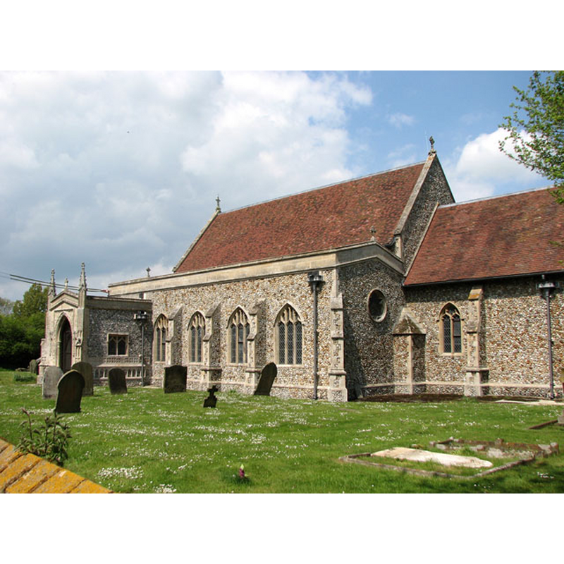
Image copyright © Evelyn Simak, 2010
CC-BY-SA-3.0
Results: 7 records
view of church exterior - southeast view
Copyright Statement: Image copyright © Evelyn Simak, 2010
Image Source: digital photograph taken 18 May 2010 by Evelyn Simak [www.geograph.org.uk/photo/1869679] [accessed 14 February 2014]
Copyright Instructions: CC-BY-SA-3.0
view of church exterior - southwest view
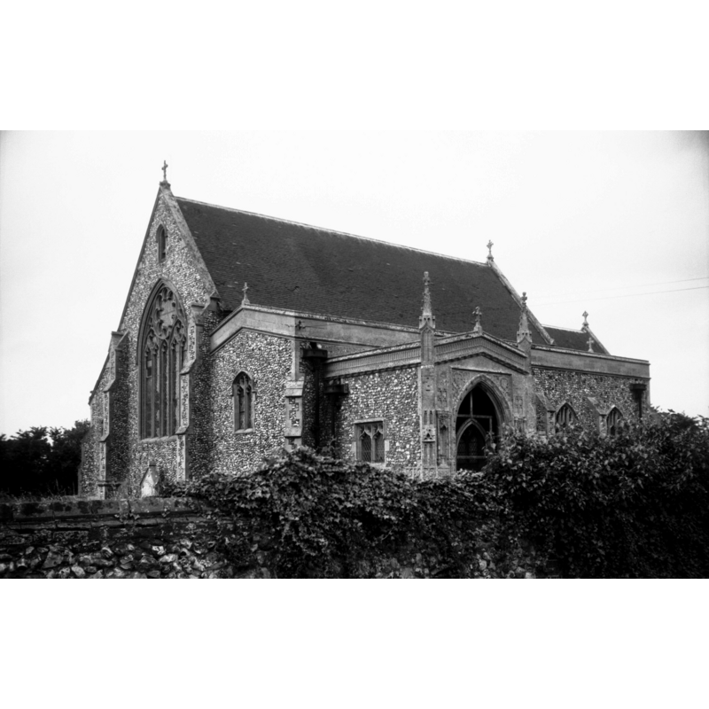
Scene Description: Photo caption: "The west tower collapsed in 1653, the rest almost entirely Victorian"
Copyright Statement: Image copyright © George Plunkett, 2014
Image Source: B&W photograph taken 17 June 1995 by George Plunkett [www.georgeplunkett.co.uk/Norfolk/W/Weasenham All Saints church from SW [7199] 1995-06-17.jpg] [accessed 14 February 2014]
Copyright Instructions: Standing permission by Jonathan Plunkett
view of font in context
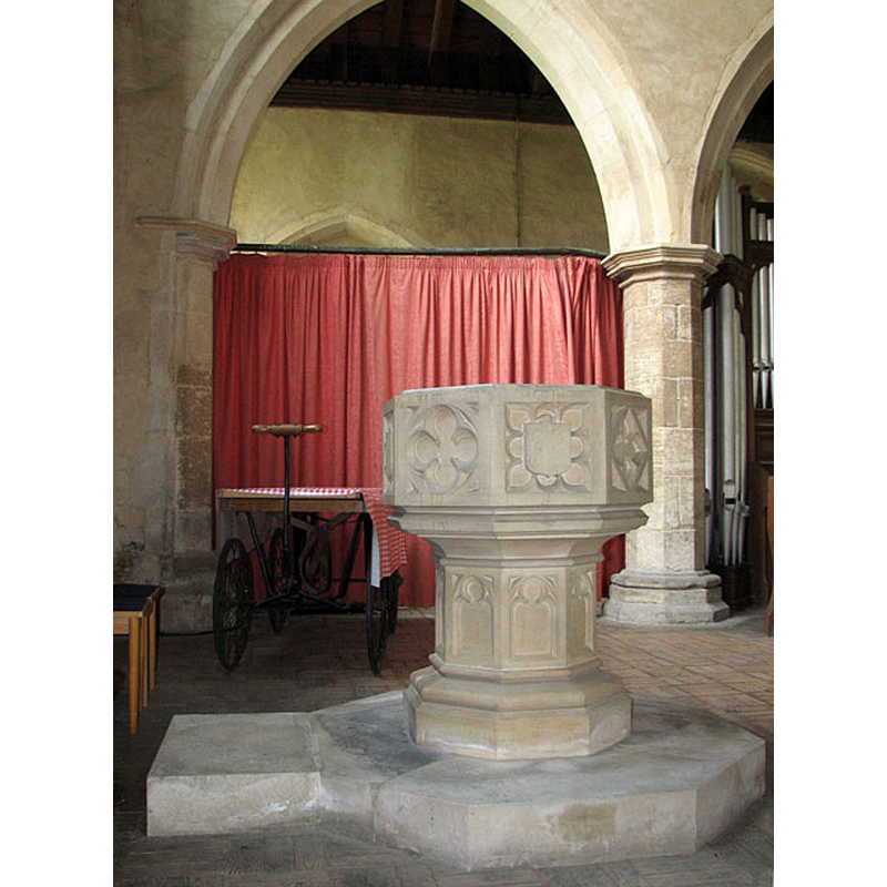
Scene Description: the 19th-century (?) font
Copyright Statement: Image copyright © Evelyn Simak, 2010
Image Source: digital photograph taken 18 May 2010 by Evelyn Simak [www.geograph.org.uk/photo/1869641] [accessed 14 February 2014]
Copyright Instructions: CC-BY-SA-3.0
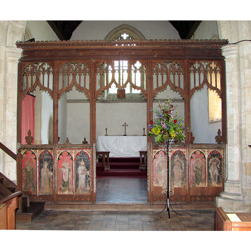
view of church interior - chancel - rood-screen, choir-screen; iconostasis - dado - north side
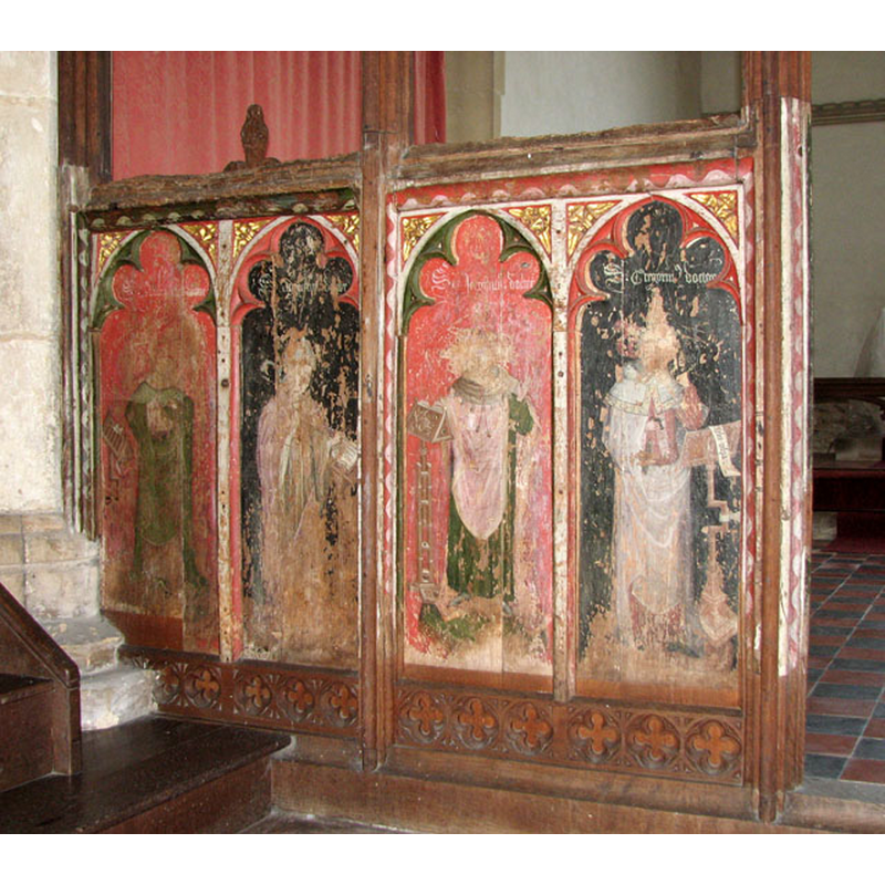
Scene Description: seen from the nave
Copyright Statement: Image copyright © Evelyn Simak, 2010
Image Source: digital photograph taken 18 May 2010 by Evelyn Simak [www.geograph.org.uk/photo/1869722] [accessed 14 February 2014]
Copyright Instructions: CC-BY-SA-3.0
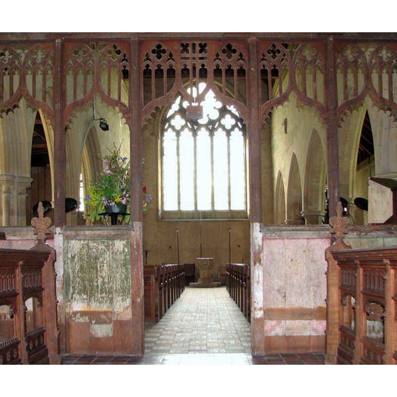
view of church interior - chancel - rood-screen, choir-screen; iconostasis
Scene Description: seen from the nave
Copyright Statement: Image copyright © Evelyn Simak, 2010
Image Source: digital photograph taken 18 May 2010 by Evelyn Simak [www.geograph.org.uk/photo/1869720] [accessed 14 February 2014]
Copyright Instructions: CC-BY-SA-3.0
view of church interior - nave - looking east
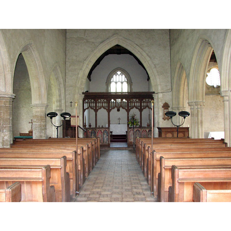
Copyright Statement: Image copyright © Evelyn Simak, 2010
Image Source: digital photograph taken 18 May 2010 by Evelyn Simak [www.geograph.org.uk/photo/1869716] [accessed 14 February 2014]
Copyright Instructions: CC-BY-SA-3.0
view of church interior - nave - looking west
Scene Description: the font is visible at the west end
Copyright Statement: Image copyright © Evelyn Simak, 2010
Image Source: digital photograph taken 18 May 2010 by Evelyn Simak [www.geograph.org.uk/photo/1869736] [accessed 14 February 2014]
Copyright Instructions: CC-BY-SA-3.0
INFORMATION
Font ID: 15235WEA
Object Type: Baptismal Font1?
Font Century and Period/Style: 11th - 12th century, Pre-Conquest? / Norman?
Church / Chapel Name: Parish Church of All Saints
Font Location in Church: [cf. FontNotes]
Church Patron Saint(s): All Saints
Church Address: 101 Church Lane, Weasenham All Saints, Norfolk PE32 2SS
Site Location: Norfolk, East Anglia, England, United Kingdom
Directions to Site: Located off the A1065, NE of Castle Acre, midway between Fakenham and Swaffham
Ecclesiastic Region: Diocese of Norwich
Historical Region: Hundred of Launditch
Additional Comments: destroyed font? (the one from the original church here and/or its late-medieval replacement [cf. FontNotes])
Font Notes:
Click to view
There are two entries for Weasenham [variant spelling] in the Domesday survey [http://domesdaymap.co.uk/place/XX0000/weasenham-all-saints-and-st-peter/] [accessed 14 February 2014], but neither mentions a church or cleric in it. Blomefield (1805-1810) has references to transactions related to the advowsons of two churches here in William of Warenne, 2nd Earl of Surrey (†1138), "the two churches of St. Peter and St. Paul of Wesenham". Although the above appears to suggest that two churches must have been built here between 1086 and 1138 (at the latest), since the Domesday entries for Weasenham do not mention a church in them [NB: not all churches and clerics were reported in the 1086 survey]; additionally, Blomefield (ibid.) seems to suggest that a church may have existed in an area of Weasenham, "but then it belonged to the lordship of Horningtoft, which extended into Wesenham"; that holding, "I have seen an old writing wherein it is said that Edric held, in the time of the Confessor, 80 acres of land in this town, with a church of 18 acres valued at 18d. and Edric had added to it two socmen; that afterwards Ralph Earl of Norfolk, and the King had the soc, and it was valued at 5s. but at the survey Ralph had forfeited his right, and Godric held it of Alan Earl of Richmond." Furthermore, the 3rd Earl of Warenne, also a William (1119-1148), "confirmed to the monks of Castleacre the advowson of the churches of Wesenham Thorp, All-Saints, and St. Peter's", as did a number of others in the ensuing times, confirmations that are well documented in Blomefield (ibid.) The rectorship of both churches appears to have been held by one person originally, as Blomefield (ibid.) names Roger de Huntingfeld joint rector "in the time of John of Oxford, Bishop of Norwich, about 1190, of All-Saints and St. Peter's." On the church of All Saints in particular Blomefield (ibid.) notes: "This church of All-Saints, called South Wesenham church, has a nave, north isle, and chancel, and a square tower." The font of the original church, or its late-medieval replacement, was probably destroyed when the west tower collapsed in the mid-17th century. The present font, of neo-Perpendicular design, is probably Victorian.
Credit and Acknowledgements: We are grateful to Jonathan Plunkett for the photograph of this church, taken by his father, George Plunkett, in June 1985
COORDINATES
UTM: 31U 347601 5848017
Latitude & Longitude (Decimal): 52.760472, 0.741449
Latitude & Longitude (DMS): 52° 45′ 37.7″ N, 0° 44′ 29.21″ E
REFERENCES
- Blomefield, Francis, An essay towards a topographical history of Norfolk, 1805-1810, vol. 10: 75-81 / [www.british-history.ac.uk/report.aspx?compid=78628] [accessed 14 February 2014]