Thorpe Parva / Little Thorp / Little Thorpe / Parva Thorp / Thorp Mannewen / Thorp Parva / Torp
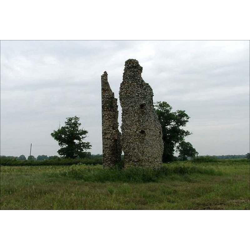
Image copyright © Simon Knott, 2005
Standing permission
Results: 3 records
view of church exterior - detail
Scene Description: the ruins of St Mary's
Copyright Statement: Image copyright © Simon Knott, 2005
Image Source: digital photograph taken June 2005 by Simon Knott [www.norfolkchurches.co.uk/thorpeparva/thorpeparva.htm] [accessed 12 February 2013]
Copyright Instructions: Standing permission
view of church exterior - detail
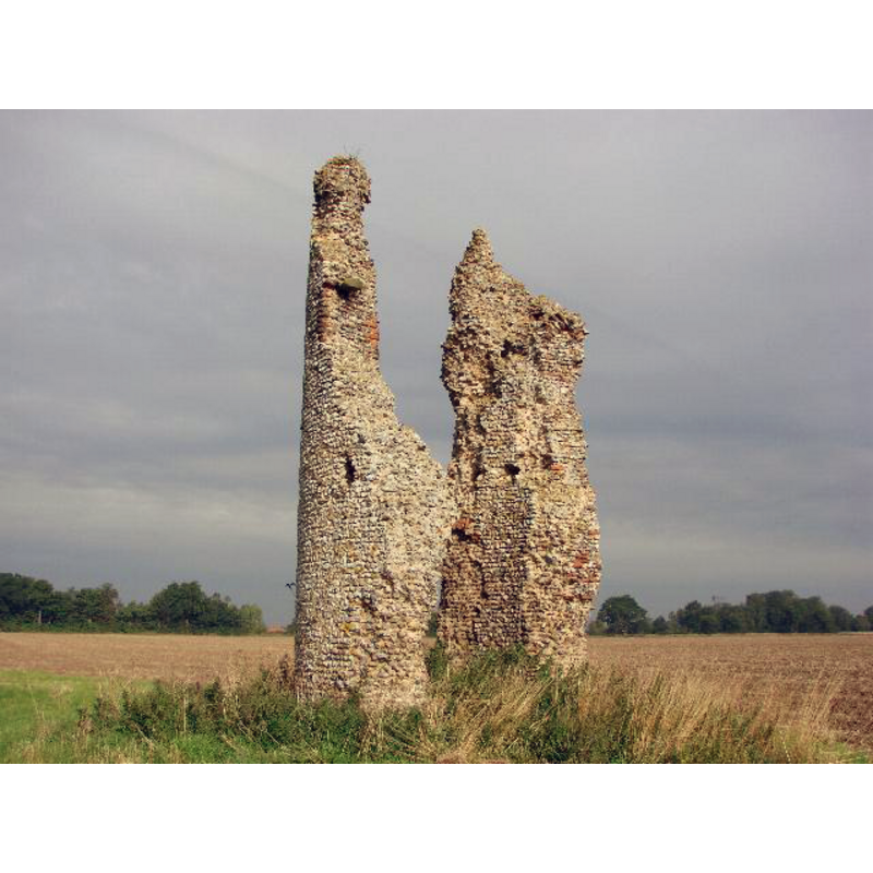
Scene Description: the ruins of St Mary's
Copyright Statement: Image copyright © Adrian S Pye, 2009
Image Source: digital photograph taken 6 August 2009 by Adrian S Pye [www.geograph.org.uk/photo/1867841] [accessed 12 February 2013]
Copyright Instructions: CC-BY-SA-3.0
view of church exterior - detail
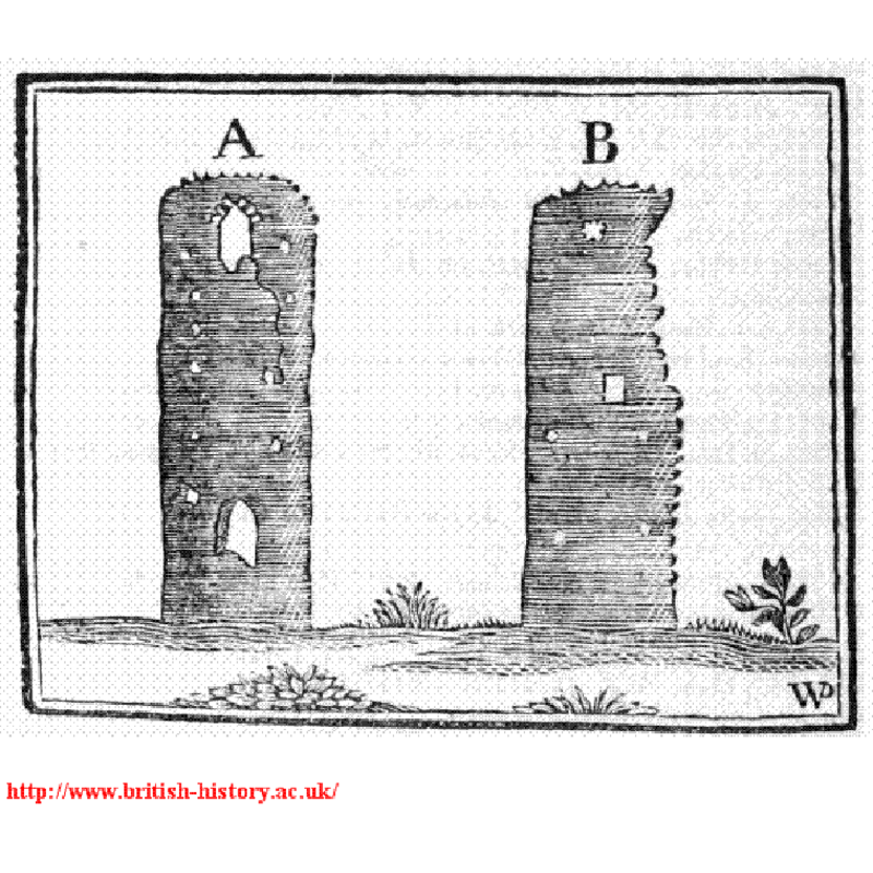
Scene Description: the ruins of St Mary's ca. 1800: showing the west end (A) and the south
Copyright Statement: Image copyright © [in the public domain]
Image Source: IllustratIion in Blomefield (1805-1810) reproduced in [www.british-history.ac.uk/image.aspx?compid=77102&filename=fig36.gif&pubid=428] [accessed 12 February 2013]
Copyright Instructions: PD
INFORMATION
Font ID: 15215THO
Object Type: Baptismal Font1?
Font Century and Period/Style: Medieval
Church / Chapel Name: Parish Church of St. Mary the Virgin [in ruins]
Font Location in Church: [cf. FontNotes]
Church Patron Saint(s): St. Mary the Virgin
Church Address: Dickleburgh and Rushall, Norfolk IP21 4DT
Site Location: Norfolk, East Anglia, England, United Kingdom
Directions to Site: There is no village -- the ruins are located off the A143, 1 km ENE of Scole, same distance from Billingsford, 5 km E of Diss
Ecclesiastic Region: [Diocese of Norwich]
Historical Region: [Hundred of Diss]
Additional Comments: disappeared font? (the one from the medieval church here)
Font Notes:
Click to view
By Blomefield's time (1805-1810) this church was already in ruins: "the church, which is dedicated to St. Mary the Virgin, being quite demolished, the ruins of the steeple, which was round" being the only thing standing. It is still the same today. Blomefield (ibid.) lists rectors going back as far as 1300 but we have no information on the font(s) of the original church here.
Credit and Acknowledgements: We are grateful to Simon Knott, of Norfolk Churches [www.norfolkchurches.co.uk] for his photographs of the church ruins
COORDINATES
UTM: 30U 651120 5874038
Latitude & Longitude (Decimal): 52.994565, -0.748307
Latitude & Longitude (DMS): 52° 59′ 40.43″ N, 0° 44′ 53.9″ W
REFERENCES
- Blomefield, Francis, An essay towards a topographical history of Norfolk, 1805-1810, vol. 1: 136-140 / [www.british-history.ac.uk/report.aspx?compid=77102] [accessed 1 September 2009]