Low Ham / Nether Ham
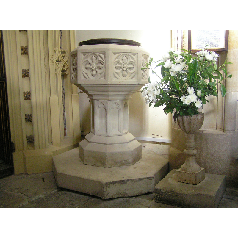
Image copyright © Tony Ethridge, 2009
Standing permission
Results: 1 records
view of font and cover
Scene Description: the modern font
Copyright Statement: Image copyright © Tony Ethridge, 2009
Image Source: digital photograph taken 21 August 2009 by Tony Ethridge
Copyright Instructions: Standing permission
INFORMATION
Font ID: 15208HAM
Object Type: Baptismal Font1?
Font Century and Period/Style: 11th - 13th century, Medieval
Church / Chapel Name: Parish Church [formerly a manor chapel]
Church Patron Saint(s): [no dedication]
Site Location: Somerset, South West, England, United Kingdom
Directions to Site: Located near High Ham, 8 km E of Somerton, 18 W of Bridgwater
Ecclesiastic Region: Diocese of Bath & Wells
Additional Comments: disappeared font?
Font Notes:
Click to view
Kelly's Directory of 1939 reports: "the font is Norman". The Victoria County History (Somerset, vol. 8, 2005) notes: "There was a chapel at Low Ham, probably in the 13th century [...] and certainly by 1316 when a chantry recently granted there for the benefit of one landowner was suppressed in favour of an earlier foundation for another [...] The chapel was served by a succession of stipendiary curates appointed by the lords of the manor, most of whom served parochial cures in the neighbourhood other than High Ham." No font mentioned in Pevsner (1958). The National Monuments Record, English Heritage [http://www.imagesofengland.org.uk/details/default.aspx?id=263114] [accessed 30 August 2009] notes "Under the tower a C19 octagonal font" [NB: there may have been earlier fonts in the original chapel, but the present font is modern, probably of the 19th century, as is the flat and round font cover on it; the present chapel dates back to the 17th century].
Credit and Acknowledgements: We are grateful to Tony Ethridge, of Somerset Villages, for the photograph of the modern font
COORDINATES
UTM: 30U 513238 5656329
Latitude & Longitude (Decimal): 51.058333, -2.811111
Latitude & Longitude (DMS): 51° 3′ 30″ N, 2° 48′ 40″ W
LID INFORMATION
Date: 19th-century?
Material: wood, oak?
Apparatus: no
Notes: [cf. FontNotes]
REFERENCES
- Victoria County History [online], University of London, 1993-. URL: https://www.british-history.ac.uk.
- Kelly, Kelly's Directory of Somerset, London: Kelly's Directories Ltd., 1939, [transcribed in http://freepages.genealogy.rootsweb.ancestry.com/~sarahhawkins/kellys_1939_high_low_or_nether_ham.htm [accessed 30 August 2009]]