Tattersett / Gatesend / Tatersete
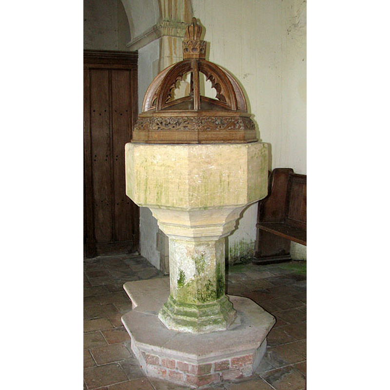
Image copyright © Evelyn Simak, 2010
CC-BY-SA-3.0
Results: 7 records
view of font and cover
Copyright Statement: Image copyright © Evelyn Simak, 2010
Image Source: digital photograph taken 27 June 2010 by Evelyn Simak [www.geograph.org.uk/photo/1938706] [accessed 1 August 2013]
Copyright Instructions: CC-BY-SA-3.0
view of font and cover in context
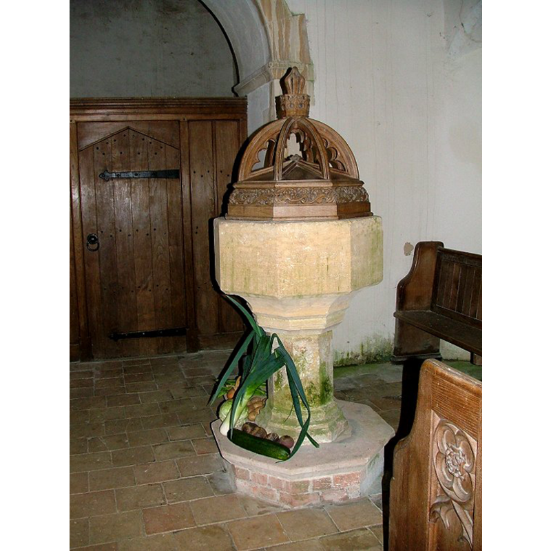
Copyright Statement: Image copyright © Simon Knott, 2005
Image Source: digital photograph taken by Simon Knott [http://www.norfolkchurches.co.uk/tattersett/tattersett.htm] [accessed 28 August 2009]
Copyright Instructions: Standing permission
design element - motifs - moulding
Copyright Statement: Image copyright © Simon Knott, 2005
Image Source: digital photograph taken by Simon Knott [http://www.norfolkchurches.co.uk/tattersett/tattersett.htm] [accessed 28 August 2009]
Copyright Instructions: Standing permission
view of church exterior - south view
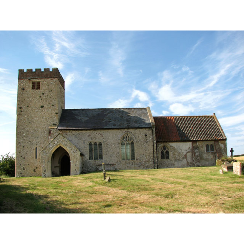
Copyright Statement: Image copyright © Evelyn Simak, 2010
Image Source: digital photograph taken 27 June 2010 by Evelyn Simak [www.geograph.org.uk/photo/1938695] [accessed 1 August 2013]
Copyright Instructions: CC-BY-SA-3.0
view of church interior - nave - looking west
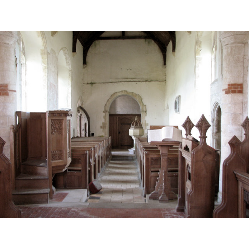
Scene Description: the font is visible at the west end, towards the north side
Copyright Statement: Image copyright © Evelyn Simak, 2010
Image Source: digital photograph taken 27 June 2010 by Evelyn Simak [www.geograph.org.uk/photo/1938705] [accessed 1 August 2013]
Copyright Instructions: CC-BY-SA-3.0
view of church interior - nave - looking east
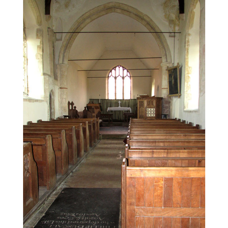
Copyright Statement: Image copyright © Evelyn Simak, 2010
Image Source: digital photograph taken 27 June 2010 by Evelyn Simak [www.geograph.org.uk/photo/1938699] [accessed 1 August 2013]
Copyright Instructions: CC-BY-SA-3.0
design element - motifs - moulding
Copyright Statement: Image copyright © Simon Knott, 2005
Image Source: digital photograph taken by Simon Knott [http://www.norfolkchurches.co.uk/tattersett/tattersett.htm] [accessed 28 August 2009]
Copyright Instructions: Standing permission
INFORMATION
Font ID: 15200TAT
Object Type: Baptismal Font1
Font Century and Period/Style: 14th - 15th century, Medieval
Church / Chapel Name: Parish Church of All Saints and St. Andrew
Font Location in Church: Inside the church, at the W end of the nave, to the N side of the centre aisle
Church Patron Saint(s): All Saints & St. Andrew
Church Address: Tattersett, Norfolk, PE31 8RS
Site Location: Norfolk, East Anglia, England, United Kingdom
Directions to Site: Located on the A148, 10 km W of Fakenham
Ecclesiastic Region: Diocese of Norwich
Historical Region: Hundreds of Gallow and Brothercross
Additional Comments: disappeared font? [cf. FontNotes]
Font Notes:
Click to view
The Domesday survey entry for "Tatersete" cited in in Blomefield (1805-1810) reports "two churches, with 40 acres", and mentions a deed of confirmation of the church of St. Andrew to the monks of Castleacre by one "Ralph of Pencheneia [...] of the family of De Pinkenye, lords of this town [...] deed, sans date, in the reign of Henry II.[i.e., 1154-1189] as it seems." Blomefield does not provide any description of the two churches, their rectors/vicars or their fate [cf. infra]. The fabric of the present church is probably 13th-century. The present font is noted in Pevsner & Wilson (1999): "Font. C15, octagonal." Noted and illustrated in Knott (2005): "The font is plain, of the early 14th century". The font consists of an octagonal basin with plain vertical sides, the underbowl chamfer slightly concave and moulded, raised on a moulded octagonal pedestal base and a narrow modern plinth. The wooden cover consists of lower octagonal box-shaped volume with carved sides, and eight ribs converging on a finial; appears modern. [NB: there may have been an earlier font contemporary with the founding of the church in the 13th century; there was another medieval church, St. Andrew's, in the area at Sengham, which is reported in Blomefield (1805), but it has long been in ruins and we have no information on its font; the chapel of ease at nearby Tatterford dates from the mid 19th century and has a neo-Norman font of that date]
Credit and Acknowledgements: We are grateful to Simon Knott, of Norfolk Churches [www.norfolkchurches.co.uk], for his photograph of this font
COORDINATES
UTM: 31U 348186 5855554
Latitude & Longitude (Decimal): 52.828334, 0.746612
Latitude & Longitude (DMS): 52° 49′ 42″ N, 0° 44′ 47.8″ E
MEDIUM AND MEASUREMENTS
Material: stone
Font Shape: octagonal, mounted
Basin Interior Shape: round
Basin Exterior Shape: octagonal
LID INFORMATION
Date: modern
Material: wood, oak
Apparatus: no
Notes: [cf. FontNotes]
REFERENCES
- Blomefield, Francis, An essay towards a topographical history of Norfolk, 1805-1810, vol. 7: 192-195 / [www.british-history.ac.uk/report.aspx?compid=78328] [accessed 28 August 2009]
- Blomefield, Francis, An essay towards a topographical history of Norfolk, 1805-1810, vol. 7: 195-197 / [www.british-history.ac.uk/report.aspx?compid=78329] [accessed 28 August 2009]
- Knott, Simon, The Norfolk Churches Site, Simon Knott, 2004. [standing permission to reproduce images received from Simon (February 2005]. URL: www.norfolkchurches.co.uk.
- Pevsner, Nikolaus, Norfolk 2: North-West and South (2nd ed.), London: Penguin, 1999, p. 693