Stoke Ferry / Stoches
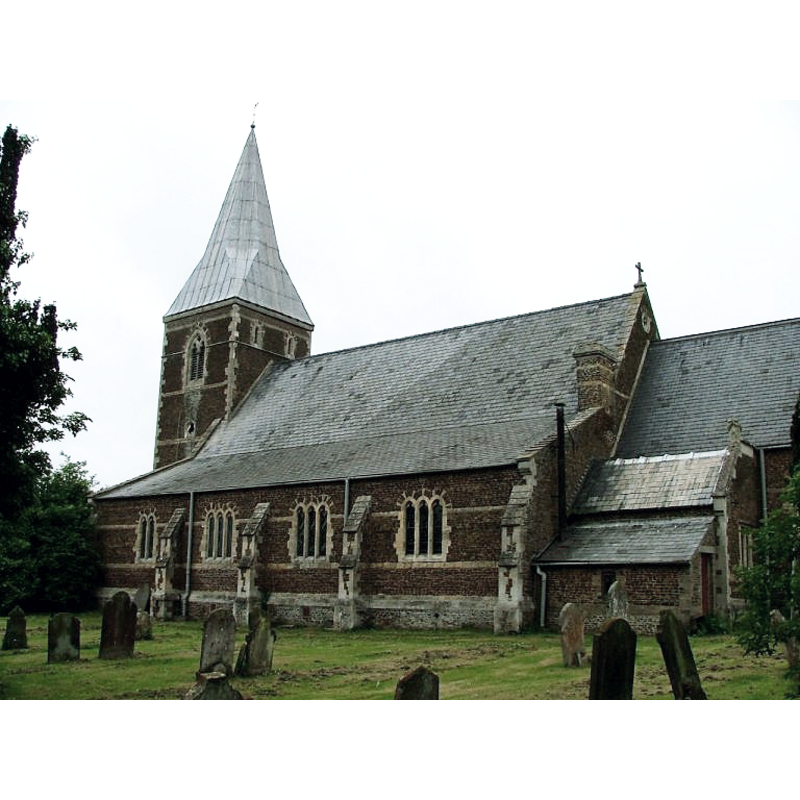
Image copyright © Simon Knott, 2006
Standing permission
Results: 2 records
view of church exterior - southeast view
Copyright Statement: Image copyright © Simon Knott, 2006
Image Source: digital photograph May 2006 taken by Simon Knott [www.norfolkchurches.co.uk/southery1/images/dscf8531.jpg] [accessed 26 August 2013]
Copyright Instructions: Standing permission
view of church exterior - northwest view
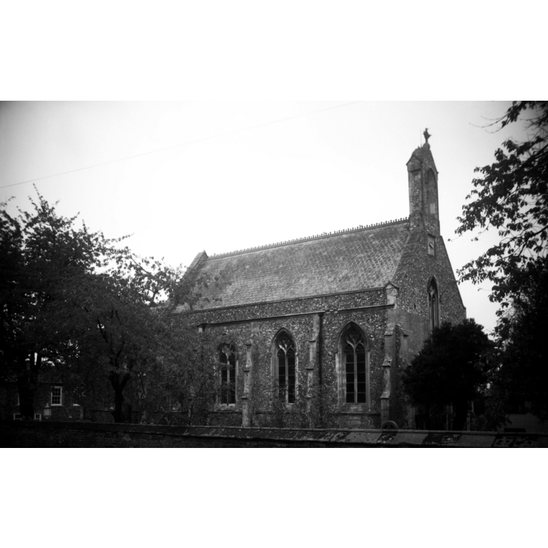
Scene Description: Photo caption: "Much renovated and rebuilt in 1848 by Donthorne. The original chancel taken down in 17c."
Copyright Statement: Image copyright © George Plunkett, 2013
Image Source: B&W photograph taken 31 October 1993 by George Plunkett [www.georgeplunkett.co.uk/Norfolk/S/Stoke Ferry All Saints church from NW [7103] 1993-10-31.jpg] [accessed 26 August 2013]
Copyright Instructions: Standing permission by Jonathan Plunkett
INFORMATION
Font ID: 15190STO
Object Type: Baptismal Font1
Font Century and Period/Style: 15th century, Perpendicular
Church / Chapel Name: Parish Church of All Saints
Font Location in Church: [cf. FontNotes]
Church Patron Saint(s): All Saints
Church Address: High Street, Stoke Ferry, Norfolk PE33 9SE
Site Location: Norfolk, East Anglia, England, United Kingdom
Directions to Site: Located 10 km ESE of Downham
Ecclesiastic Region: Diocese of Ely
Historical Region: Hundred and half of Clackclose
Additional Comments: disappeared fonts? (the one from the original 13thC(?) church and the 15thC one reported in Pevsner [cf. FontNotes])
Font Notes:
Click to view
Blomefield (1805-1810) writes: "S[toke]-F[erry] [...] in the book of Domesday, it is wrote Stoches [...] The Church is dedicated to All-Saints, and was a single pile of flint, chalk stone, &c. about 51 feet long, and 24 broad, covered with tile, with a four-square tower, embattled, and 4 pinnacles of stone, and a shaft with a weather-cock; this tower falling unexpectedly in 1758, beat down great part of the church. In this tower were 2 bells. At the west end of the steeple was a decayed little building, probably the station formerly of some hermit. There was formerly a chancel, but that has been dilapidated many years past." There is no direct indication in Blomefield (ibid.) to the date of foundation of this church, and no church is mentioned in the Domesday entries for 'Stoches', but the author refers to a plead for the right of patronage presented "In the 14th of Edward I."[ [i.e., 1286] "proving that Ulchetel, his ancestor, in the reign of King John, presented one Peter, his clerk, to this church, who died rector", dating the church thereby to at least 1199-1216, the reign of King John. Pevsner & Wilson (1999) note: "Font. Octagonal, Perp[endicular], with Flamboyant tracery patterns." In his visit to this church in July 2009, Knott reports: "today All Saints is redundant. It is in private ownership, but it is used regularly by the local community for exhibitions, concerts and other functions […] Pevsner says that these patterns [of Flamboyant tracery] were also to be found on the font, but this is now gone." [NB: we have no information on the font of the original church here].
Credit and Acknowledgements: We are grateful to to Simon Knott, of Norfolk churches [www.norfolkchurches.co.uk], for his photograph of this church; and to Jonathan Plunkett, for the photograph of this church taken by his father, George Plunkett in October 1993
COORDINATES
UTM: 30U 633225 5871228
Latitude & Longitude (Decimal): 52.974067, -1.015917
Latitude & Longitude (DMS): 52° 58′ 26.64″ N, 1° 0′ 57.3″ W
MEDIUM AND MEASUREMENTS
Material: stone
Font Shape: octagonal, mounted
Basin Interior Shape: round
Basin Exterior Shape: octagonal
REFERENCES
- Blomefield, Francis, An essay towards a topographical history of Norfolk, 1805-1810, vol. 437-439 / [www.british-history.ac.uk/report.aspx?compid=78379] [accessed 26 August 2013]
- Knott, Simon, The Norfolk Churches Site, Simon Knott, 2004. [standing permission to reproduce images received from Simon (February 2005]. URL: www.norfolkchurches.co.uk.
- Pevsner, Nikolaus, Norfolk 2: North-West and South (2nd ed.), London: Penguin, 1999, p. 672