Stanhoe / Stanho / Stanhow / Stoney Hill
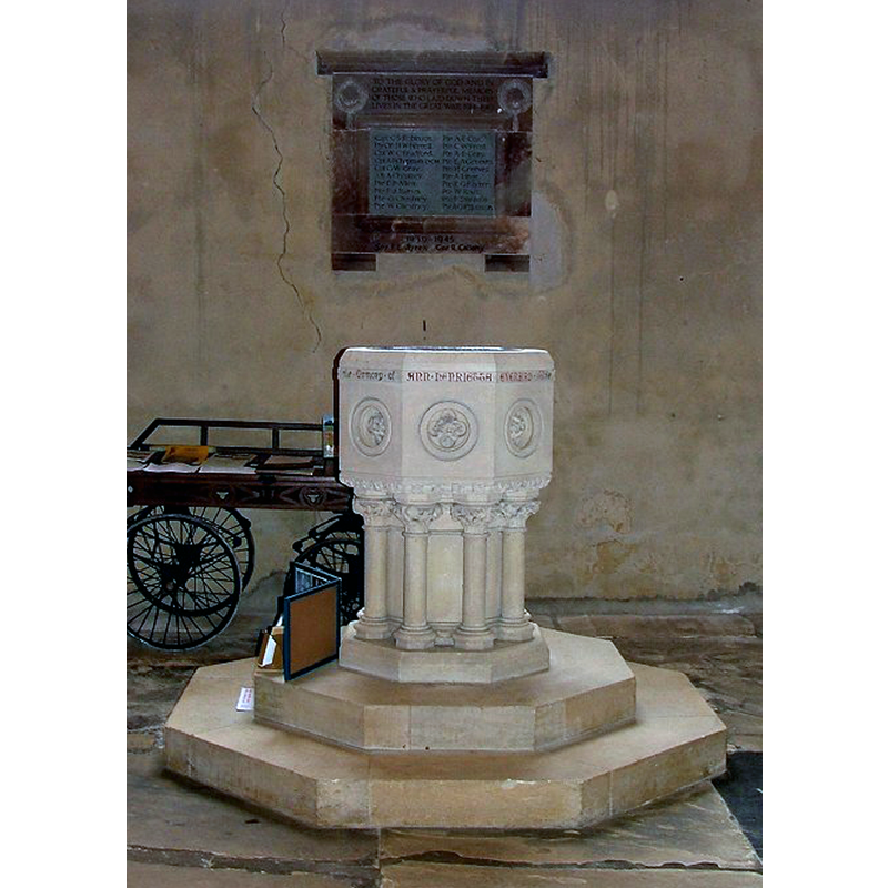
Image copyright © Simon Knott, 2006
Standing permission
Results: 5 records
view of font
Scene Description: the modern font
Copyright Statement: Image copyright © Simon Knott, 2006
Image Source: digital photograph September 2006 taken by Simon Knott [www.norfolkchurches.co.uk/stanhoe/stanhoe.htm] [accessed 8 April 2014]
Copyright Instructions: Standing permission
view of church exterior - south view
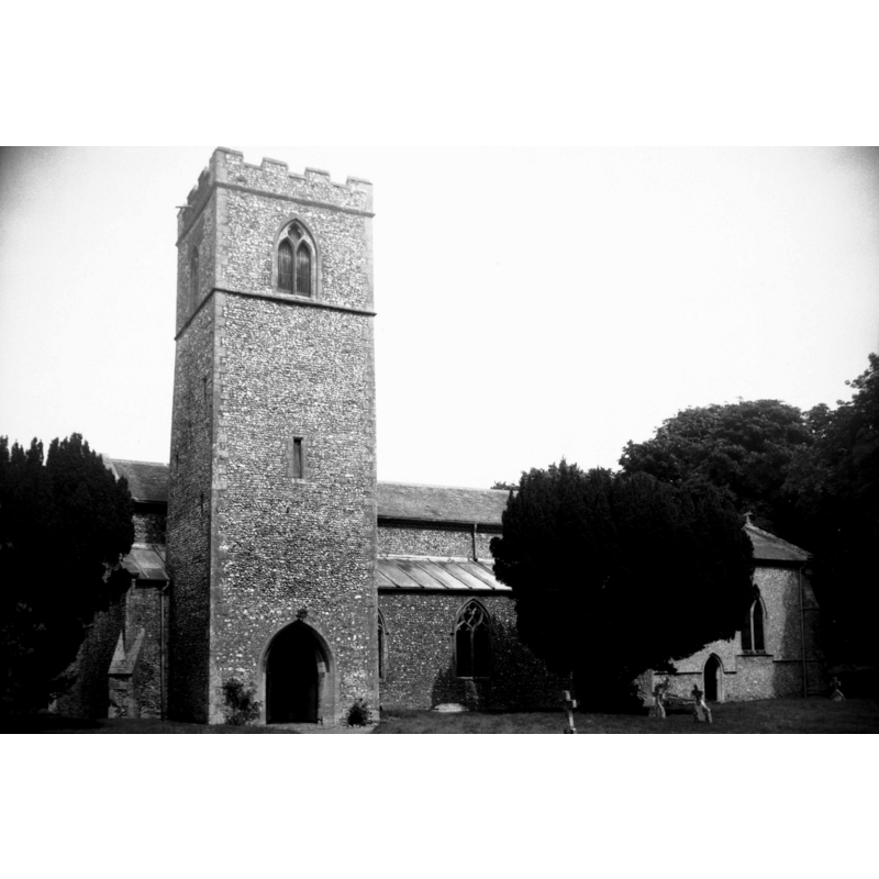
Scene Description: Photo caption: "The base of the 13c tower forms the south porch"
Copyright Statement: Image copyright © George Plunkett, 2014
Image Source: B&W photograph taken 21 August 1978 by George Plunkett [www.georgeplunkett.co.uk/Norfolk/S/Stanhoe All Saints church south side [5979] 1978-08-21.jpg] [accessed 8 April 2014]
Copyright Instructions: Standing permission by Jonathan Plunkett
view of font in context
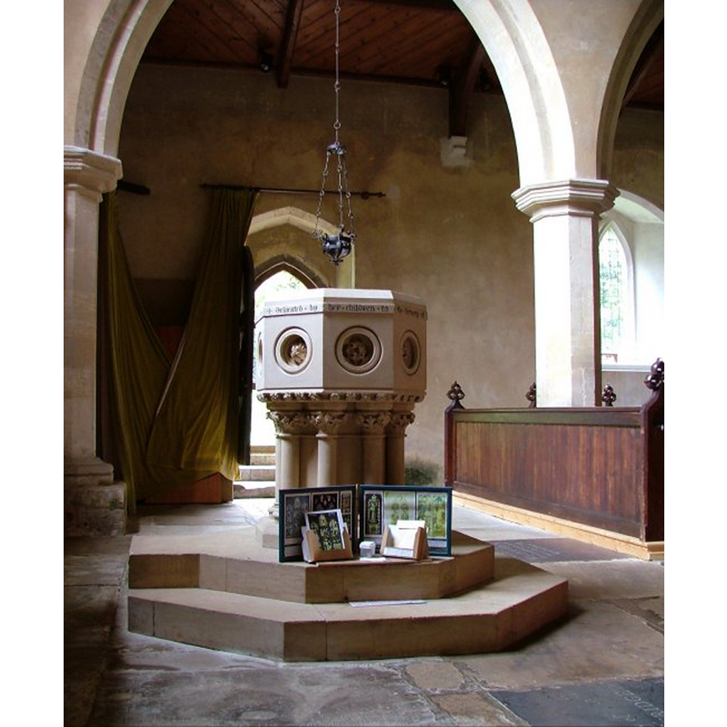
Scene Description: the modern font
Copyright Statement: Image copyright © Simon Knott, 2006
Image Source: digital photograph September 2006 taken by Simon Knott [www.norfolkchurches.co.uk/stanhoe/stanhoe.htm] [accessed 8 April 2014]
Copyright Instructions: Standing permission
view of church interior - nave - looking west
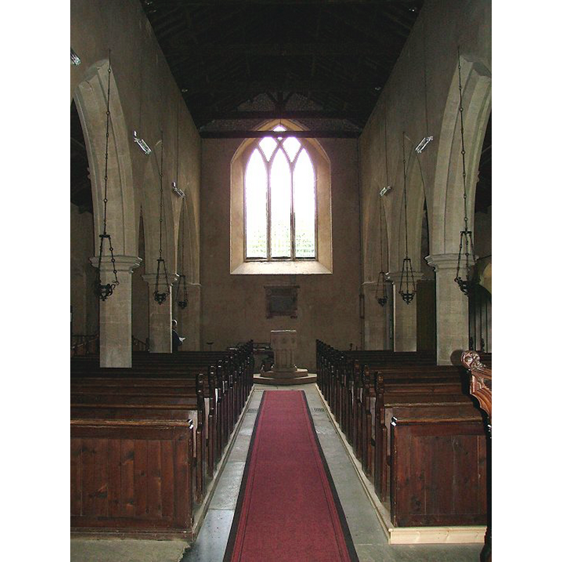
Scene Description: the modern font at the west end of the nave
Copyright Statement: Image copyright © Simon Knott, 2006
Image Source: digital photograph September 2006 taken by Simon Knott [www.norfolkchurches.co.uk/stanhoe/stanhoe.htm] [accessed 8 April 2014]
Copyright Instructions: Standing permission
view of church interior - nave - looking east
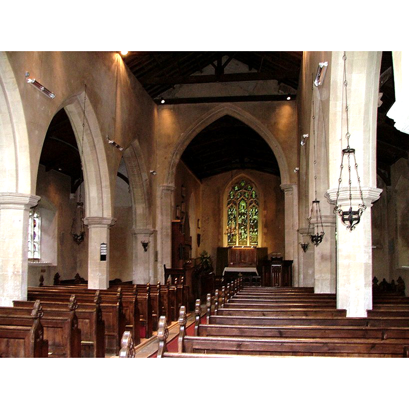
Copyright Statement: Image copyright © Simon Knott, 2006
Image Source: digital photograph September 2006 taken by Simon Knott [www.norfolkchurches.co.uk/stanhoe/stanhoe.htm] [accessed 8 April 2014]
Copyright Instructions: Standing permission
INFORMATION
Font ID: 15188STA
Object Type: Baptismal Font1?
Font Century and Period/Style: 13th century, Medieval
Church / Chapel Name: Parish Church of All Saints
Church Patron Saint(s): All Saints
Church Address: Church Lane, Stanhoe, Norfolk PE31 8QW
Site Location: Norfolk, East Anglia, England, United Kingdom
Directions to Site: Located 3 km E of Docking, 6 km SSW of Burnham Market
Ecclesiastic Region: Diocese of Norwich
Historical Region: Hundred of Smethdon [formerly in the Hundred of Docking]
Additional Comments: disappeared font? (the one from the ca.1222 church here)
Font Notes:
Click to view
There are four entries for Stanhoe [variant spelling] in the Domesday survey [http://domesdaymap.co.uk/place/TF8036/stanhoe/] [accessed 8 April 2014], one of which reports a church and church lands in it. Blomefield (1805-1810) writes: "The Church is dedicated to All-Saints; in Edward the First's time, a manor and 5 acres belonged to the rectory [...] John de Albini occurs rector in the 6th of Henry III" [i.e., 1222] [NB: there is no mention of the Domesday-period church in Blomefield; was itt in a different holding?]. The present font is a replacement introduced in 1853 according to Pevsner & Wilson (1999), at the time of the mid-19th century restoration of this church; it consists of an octagonal basin with an inscription all around, deeply-cut panels and crenellation underneath, raised on clustered columns with capitals and bases, and a two-step plinth. As Knott (2006) comments, "The 19th century font is rather magnificent in a terrifying kind of way, and you thank God that other East Anglian parishes didn't have the money that was obviously here to replace their surviving medieval ones. It would not be out of place in an Anglo-catholic church in Calcutta or Melbourne." [NB: we have no information on the fonr of the early church here].
COORDINATES
UTM: 31U 343753 5862999
Latitude & Longitude (Decimal): 52.893942, 0.67731
Latitude & Longitude (DMS): 52° 53′ 38.19″ N, 0° 40′ 38.32″ E
REFERENCES
- Blomefield, Francis, An essay towards a topographical history of Norfolk, 1805-1810, vol. 10: 381-385 / [www.british-history.ac.uk/report.aspx?compid=78695] [accessed 8 April 2014]
- Knott, Simon, The Norfolk Churches Site, Simon Knott, 2004. [standing permission to reproduce images received from Simon (February 2005]. URL: www.norfolkchurches.co.uk.
- Pevsner, Nikolaus, Norfolk 2: North-West and South (2nd ed.), London: Penguin, 1999, p. 669