Sedgeford / Secheford / Segeford / Setesford / Setesforda
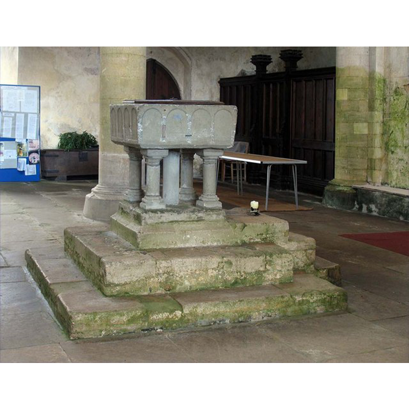
Image copyright © John Salmon, 2007
CC-BY-SA-3.0
Results: 9 records
view of font and cover - northeast side
Copyright Statement: Image copyright © John Salmon, 2007
Image Source: digital photograph taken 14 November 2007 by John Salmon [www.geograph.org.uk/photo/1701324] [accessed 8 April 2014]
Copyright Instructions: CC-BY-SA-3.0
view of font and cover - southeast side
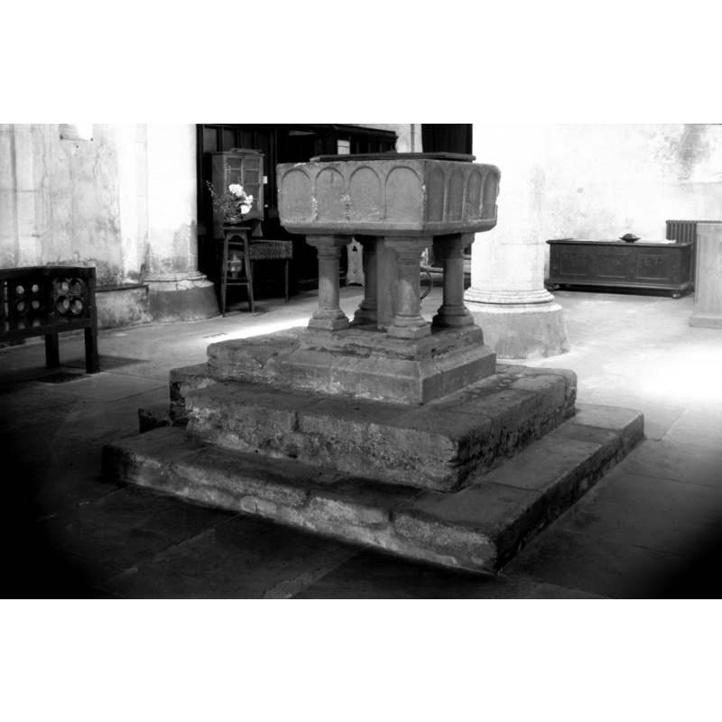
Scene Description: Photo caption: "13c square font of Purbeck marble"
Copyright Statement: Image copyright © George Plunkett, 2014
Image Source: B&W photograph taken 21 August 1978 by George Plunkett [www.georgeplunkett.co.uk/Norfolk/S/Sedgeford St Mary's church font SE [5980] 1978-08-21.jpg] [accessed 8 April 2014]
Copyright Instructions: Standing permission by Jonathan Plunkett
view of font and cover in context
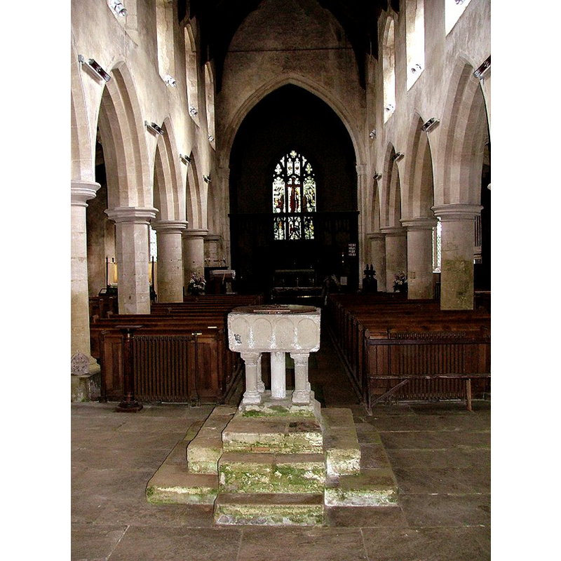
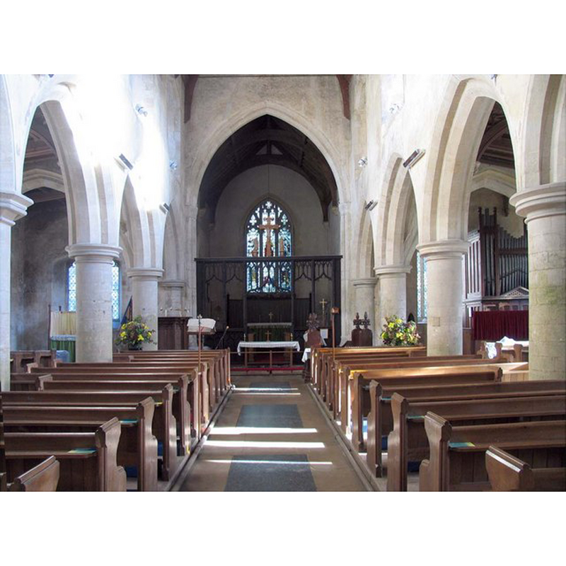
Scene Description: the nave, looking east
Copyright Statement: Image copyright © Simon Knott, 2006
Image Source: digital photograph September 2006 taken by Simon Knott [www.norfolkchurches.co.uk/sedgeford/sedgeford.htm] [accessed 21 August 2009]
Copyright Instructions: Standing permission
design element - architectural - arcade - blind - round arches - 16
Copyright Statement: Image copyright © Simon Knott, 2006
Image Source: digital photograph September 2006 taken by Simon Knott [www.norfolkchurches.co.uk/sedgeford/sedgeford.htm] [accessed 21 August 2009]
Copyright Instructions: Standing permission
view of church exterior - northeast view
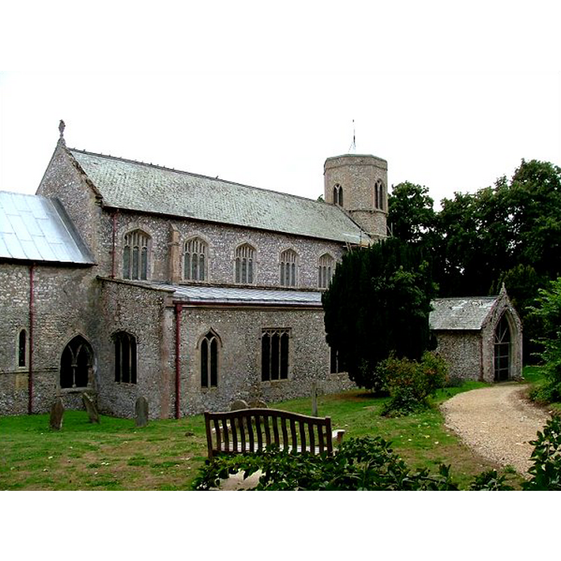
Copyright Statement: Image copyright © Simon Knott, 2006
Image Source: digital photograph September 2006 taken by Simon Knott [www.norfolkchurches.co.uk/sedgeford/sedgeford.htm] [accessed 8 April 2014]
Copyright Instructions: Standing permission
view of church exterior - northeast view
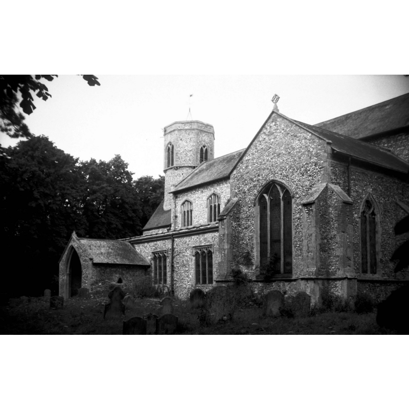
Scene Description: Photo caption: "The round tower is probably Norman, the remainder mostly 13c and 14c"
Copyright Statement: Image copyright © George Plunkett, 2014
Image Source: B&W photograph taken 21 August 1978 by George Plunkett [www.georgeplunkett.co.uk/Norfolk/S/Sedgeford St Mary's church from SE [5982] 1978-08-21.jpg] [accessed 8 April 2014]
Copyright Instructions: Standing permission by Jonathan Plunkett
view of church interior - nave - looking west
![the font at the far [west] end of the nave](/static-50478a99ec6f36a15d6234548c59f63da52304e5/compressed/1140408009_compressed.png)
Scene Description: the font at the far [west] end of the nave
Copyright Statement: Image copyright © John Salmon, 2007
Image Source: digital photograph taken 14 November 2007 by John Salmon [www.geograph.org.uk/photo/1701346] [accessed 8 April 2014]
Copyright Instructions: CC-BY-SA-3.0
view of church interior - nave - looking east
Copyright Statement: Image copyright © John Salmon, 2007
Image Source: digital photograph taken 14 November 2007 by John Salmon [www.geograph.org.uk/photo/1701353] [accessed 8 April 2014]
Copyright Instructions: CC-BY-SA-3.0
design element - architectural - column - columns with capitals and bases - 4
Scene Description: the centre one is plain, a modern replacement
Copyright Statement: Image copyright © Simon Knott, 2006
Image Source: digital photograph September 2006 taken by Simon Knott [www.norfolkchurches.co.uk/sedgeford/sedgeford.htm] [accessed 21 August 2009]
Copyright Instructions: Standing permission
INFORMATION
Font ID: 15171SED
Object Type: Baptismal Font1
Font Century and Period/Style: 12th - 13th century, Transitional / Early English
Church / Chapel Name: Parish Church of St. Mary
Font Location in Church: Inside the church, in the nave
Church Patron Saint(s): St. Mary the Virgin
Church Notes: round-tower church: the original tower base is round, the upper is re-built
Church Address: Church Lane, Sedgeford, Norfolk, PE36 5NA
Site Location: Norfolk, East Anglia, England, United Kingdom
Directions to Site: Located 16 km SW of Burnham Market, 21 km NNE of King's Lynn
Ecclesiastic Region: Diocese of Norwich
Historical Region: Hundred of Smethdon
Additional Comments: altered font [cf. FontNotes]
Font Notes:
Click to view
There is an entry for Sedgeford [variant spelling] in the Domesday survey [http://domesdaymap.co.uk/place/TF7036/sedgeford/] [accessed 8 April 2014], but it mentions neither church nor cleric in it. Blomefield (1805-1810) writes: "The Church is dedicated to St. Mary, and consists of a nave, a north and south isle, a south transept, and a chancel covered with lead. There has been also a north transept, now in ruins, and has a round steeple with three bells. [...] It was anciently a rectory valued at 45 marks, and appropriated to the use of the cellarer of Norwich priory, [...] by John de Grey Bishop of Norwich, on the 11th of the calends of April, in the 5th year of his pontificate." [NB: De Gray elected to the see of Norwich in 1196, therefore the appropriation took place in 1201, some time after which the rectory would have become a vicarage. The first recorded vicar named in Blomefield (ibid.) was: "Ralph de Barsham was vicar before 1274". A church here must have existed by 1200]. White's Directory of 1883 notes: " The basin of the font is solid Purbeck marble." Pevsner & Wilson (1999) write: "Font. Square, C13, of Purbeck type, with four shallow blank arches and five supporting columns (centre one C19). Raised on steps." Noted and illustrated in Knott (2006). The font is of the table-top type, and consists of a square basin with vertical sides decorated with a blind arcade of four round arches on each side; it is raised on a central shaft [round and modern -- cf. supra] and four angle colonnettes with moulded capitals and bases; it is probably the shape of these, that may bring the date of the font into the 13th century; otherwise the shape and execution of the basin would point to the Transitional period of the late-12th century; quadrangular lower base. The font is raised on a three-step plinth. The wooden cover is octagonal and flat, with metal decorations and handle; modern.
Credit and Acknowledgements: We are grateful to Simon Knott, of Norfolk Churches [www.norfolkchurches.co.uk], for his photographs of this church and font; we are also grateful to Jonathan Plunkett for the photographs of this church and font taken by his father, George Plunkett, in August 1978
COORDINATES
UTM: 31U 334184 5863766
Latitude & Longitude (Decimal): 52.897969, 0.534811
Latitude & Longitude (DMS): 52° 53′ 52.69″ N, 0° 32′ 5.32″ E
MEDIUM AND MEASUREMENTS
Material: stone, limestone (Purbeck marble)
Font Shape: square, mounted
Basin Interior Shape: round
Basin Exterior Shape: square
LID INFORMATION
Date: modern
Material: wood, oak?
Apparatus: no
Notes: [cf. FontNotes]
REFERENCES
- Blomefield, Francis, An essay towards a topographical history of Norfolk, 1805-1810, vol. 10: 385-390 / [www.british-history.ac.uk/report.aspx?compid=78696] [accessed 8 April 2014]
- Knott, Simon, The Norfolk Churches Site, Simon Knott, 2004. [standing permission to reproduce images received from Simon (February 2005]. URL: www.norfolkchurches.co.uk.
- Pevsner, Nikolaus, Norfolk 2: North-West and South (2nd ed.), London: Penguin, 1999, p. 635
- White, William, History, Gazetteer, and Directory of Norfolk, [s.l.]: [printed for the author], 1883, [transcribed in http://www.wegg.org/nfk/sedgeford/whites1883.html [accessed 21 August 2009]]