Saxlingham Thorpe / Saiselingeham / Saisselingeham / Sasilingaham
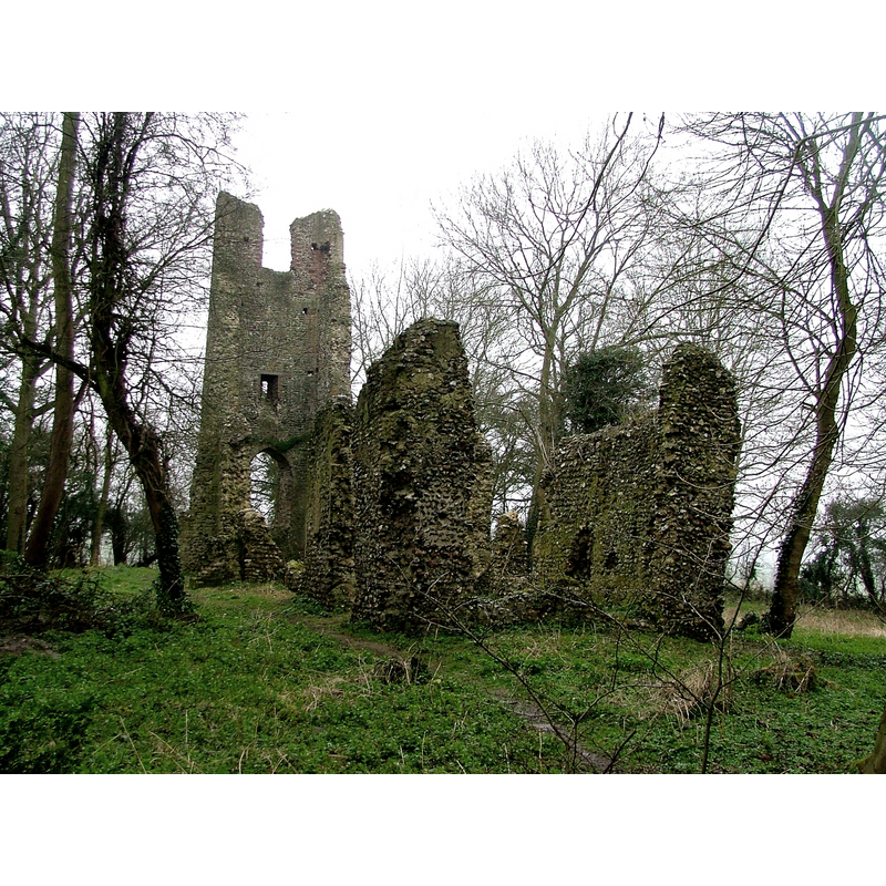
Image copyright © Simon Knott, 2007
Standing permission
Results: 5 records
view of church exterior - southeast view
Scene Description: remains of old St. Mary's ca. 2007
Copyright Statement: Image copyright © Simon Knott, 2007
Image Source: digital photograph taken 25 March 2007 by Simon Knott [www.norfolkchurches.co.uk/saxlinghamthorpe/saxlinghamthorpe.htm] [accessed 25 April 2013]
Copyright Instructions: Standing permission
view of church exterior - west tower - southwest view
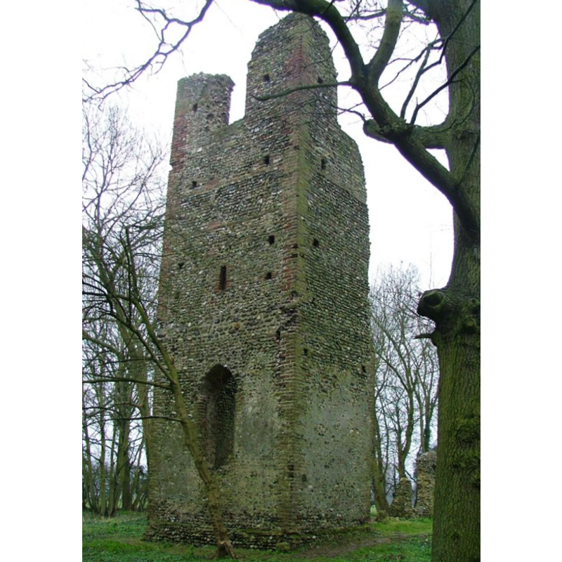
Scene Description: remains of old St. Mary's ca. 2007
Copyright Statement: Image copyright © Simon Knott, 2007
Image Source: digital photograph taken 25 March 2007 by Simon Knott [www.norfolkchurches.co.uk/saxlinghamthorpe/saxlinghamthorpe.htm] [accessed 25 April 2013]
Copyright Instructions: Standing permission
view of church interior - north doorway
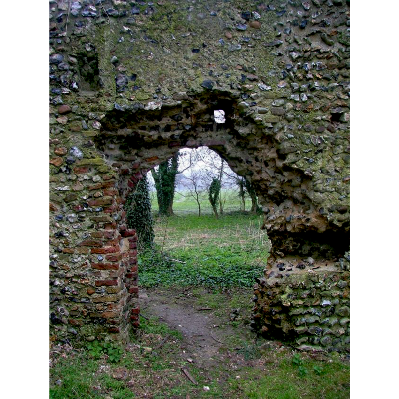
Scene Description: remains of old St. Mary's ca. 2007
Copyright Statement: Image copyright © Simon Knott, 2007
Image Source: digital photograph taken 25 March 2007 by Simon Knott [www.norfolkchurches.co.uk/saxlinghamthorpe/saxlinghamthorpe.htm] [accessed 25 April 2013]
Copyright Instructions: Standing permission
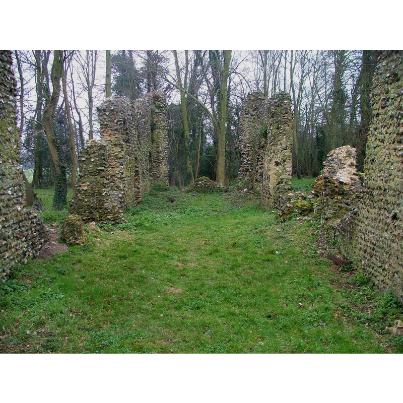
view of church interior - nave - looking west
Scene Description: remains of old St. Mary's ca. 2007
Copyright Statement: Image copyright © Simon Knott, 2007
Image Source: digital photograph taken 25 March 2007 by Simon Knott [www.norfolkchurches.co.uk/saxlinghamthorpe/saxlinghamthorpe.htm] [accessed 25 April 2013]
Copyright Instructions: Standing permission
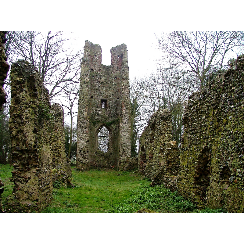
view of church interior - nave - looking east
Scene Description: remains of old St. Mary's ca. 2007
Copyright Statement: Image copyright © Simon Knott, 2007
Image Source: digital photograph taken 25 March 2007 by Simon Knott [www.norfolkchurches.co.uk/saxlinghamthorpe/saxlinghamthorpe.htm] [accessed 25 April 2013]
Copyright Instructions: Standing permission
INFORMATION
Font ID: 15168SAX
Object Type: Baptismal Font1?
Font Century and Period/Style: 11th - 12th century, Norman
Church / Chapel Name: Parish Church of St. Mary [in ruins]
Font Location in Church: [cf. FontNotes]
Church Patron Saint(s): St. Mary the Virgin
Church Notes: in ruins; nave and chancel probably 11thC-12thC, though the chancel is said to have been extendeed later; tower 16thC
Church Address: Plummer's Lane, Saxlingham Nethergate, Norfolk NR15 1TD
Site Location: Norfolk, East Anglia, England, United Kingdom
Directions to Site: Located 1 km S of Saxlingham Nethergate, 12 km S of Norwich
Ecclesiastic Region: Diocese of Norwich
Historical Region: Hundred of Henstede [aka Henstead]
Additional Comments: disappeared font? (the one from the Domesday-time church here)
Font Notes:
Click to view
Blomefield (1805-1810) writes on Saxlingham: "The town is commonly divided into two parts, called Nethergate, and Overgate, or Thorp; the manors were called Netherhall-Verdons, and Overhall or Thorphall, and have been united for some time past; to the former the advowson of Saxlingham-Nethergate belonged, and to the latter that of Saxlingham-Thorp. [...] The church of St. Mary of Saxlingham Thorp is now ruinated, the steeple and walls only standing; it stands thus in the Revision of the Archdeaconry of Norfolk, made in 1630 [...] Saxlingham-Thorp is a rectory [...] in 1740, was consolidated to Nethergate." Blomefield (ibid.) names "Richard" as first recorded rector here, in 1307. White's Directory of 1845 reports: "an ivy-clad ruin, being dilapidated long before 1740, when the rectory […] was consolidated with that of Saxlingham-Nethergate." The ruins are noted and illustrated in Knott (2007): "A small church, as most are around here, it was abandoned in the late 17th century [...] It must have been restored after this for some use, possibly agricultural, because the brick buttresses on the south side are surely 18th century". [NB: the original church here may go back to the Domesday survey, but we have no information on the font]
Credit and Acknowledgements: We are grateful to Simon Knott, of Norfolk Churches [www.norfolkchurches.co.uk] for his photographs of this church remains
COORDINATES
UTM: 31U 383762 5820412
Latitude & Longitude (Decimal): 52.521405, 1.286776
Latitude & Longitude (DMS): 52° 31′ 17.06″ N, 1° 17′ 12.4″ E
REFERENCES
- Blomefield, Francis, An essay towards a topographical history of Norfolk, 1805-1810, vol. 5: 495-502 / [www.british-history.ac.uk/report.aspx?compid=78215] [accessed 25 April 2013]
- Knott, Simon, The Norfolk Churches Site, Simon Knott, 2004. [standing permission to reproduce images received from Simon (February 2005]. URL: www.norfolkchurches.co.uk.
- White, William, History, gazetteer, and directory of Norfolk and the city and County of the city of Norwich [...], Sheffield: Robert Leader, 1845, [transcribed in http://www.origins.org.uk/genuki/NFK/places/s/saxlingham_thorpe/white1845.shtml [accessed 20 August 2009]