Rushall nr. Diss / Riveshale / Rivessalla / Rushale
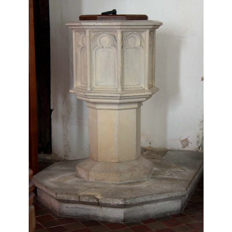
Image copyright © John Salmon, 2011
CC-BY-SA-3.0
Results: 5 records
view of font and cover
Scene Description: the modern font [cf. FontNotes]
Copyright Statement: Image copyright © John Salmon, 2011
Image Source: digital photograph taken 18 August 2011 by John Salmon [www.geograph.org.uk/photo/2570985] [accessed 16 April 2013]
Copyright Instructions: CC-BY-SA-3.0
view of church exterior - northwest end
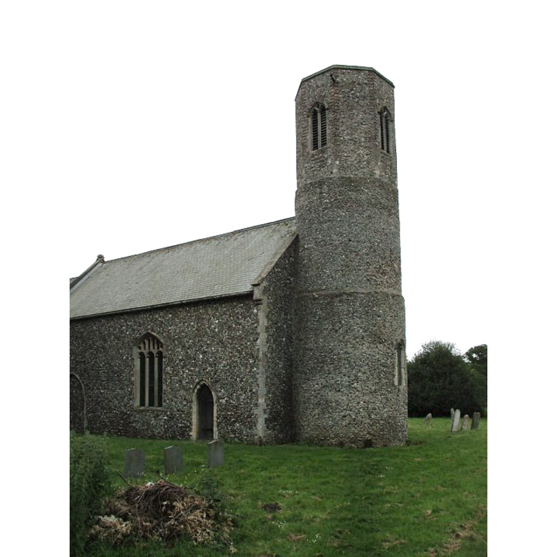
Copyright Statement: Image copyright © Simon Knott, 2010
Image Source: digital photograph taken 28 July 2010 by Simon Knott [www.norfolkchurches.co.uk/rushall/rushall.htm] [accessed 16 April 2013]
Copyright Instructions: Standing permission
view of church exterior - southeast view
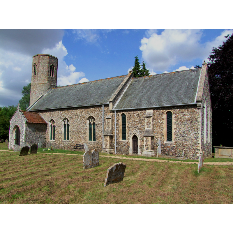
Copyright Statement: Image copyright © Simon Knott, 2010
Image Source: digital photograph taken 28 July 2010 by Simon Knott [www.norfolkchurches.co.uk/rushall/rushall.htm] [accessed 16 April 2013]
Copyright Instructions: Standing permission
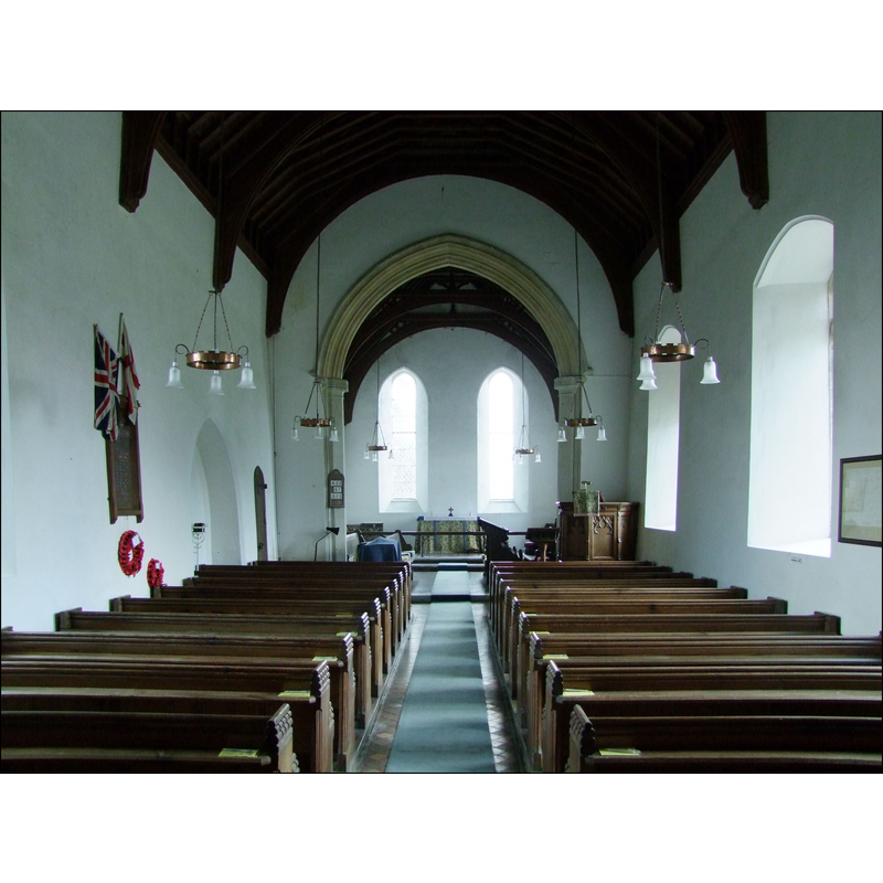
view of church interior - nave - looking west
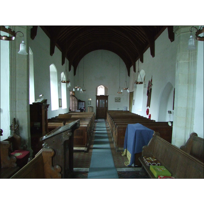
Scene Description: the top of the modern font is visible at the back (west), left (south) side
Copyright Statement: Image copyright © Simon Knott, 2010
Image Source: digital photograph taken 28 July 2010 by Simon Knott [www.norfolkchurches.co.uk/rushall/rushall.htm] [accessed 16 April 2013]
Copyright Instructions: Standing permission
view of church interior - nave - looking east
Copyright Statement: Image copyright © Simon Knott, 2010
Image Source: digital photograph taken 28 July 2010 by Simon Knott [www.norfolkchurches.co.uk/rushall/rushall.htm] [accessed 16 April 2013]
Copyright Instructions: Standing permission
INFORMATION
Font ID: 15165RUS
Object Type: Baptismal Font1?
Font Century and Period/Style: 13th century, Early English
Church / Chapel Name: Parish Church of St. Mary
Church Patron Saint(s): St. Mary the Virgin
Church Address: Harleston Road, Rushall, Norfolk, IP21 4RX
Site Location: Norfolk, East Anglia, England, United Kingdom
Directions to Site: Located 5 km W of Harleston, 10 km NE of Diss
Ecclesiastic Region: Diocese of Norwich
Historical Region: Hundred of Earsham
Additional Comments: disappeared font? (the one from the medieval church here) -- no info in Pevsner & Wilson or in Knott [checked 16 April 2013]
Font Notes:
Click to view
Blomefield (1805-1810) writes: "The church is dedicated to the Virgin Mary, hath a steeple round at bottom and octangular at top, and only one bell, two being lately sold, with the lead that covered the church, towards repairing it; so that the nave, chancel, and south porch, are tiled." Blomefield (ibid.) names "Ric. de Brom." the first recorded vicar here, in 1316. The present font, porobably from the 19th-century renovation of the church here, consists of an octagonal basin with trefoiled panels on the sides, raised on an octagonal pedestal base and a polygonal plinth. The plain octagonal cover with ring handle may also belong to the same period. [NB: the fabric of this church goes back to the 13th century, but we have no information on the original font].
Credit and Acknowledgements: We are grateful to Simon Knott, of Norfolk Churches [www.norfolkchurches.co.uk] for his photographs of this church
COORDINATES
UTM: 31U 379511 5806780
Latitude & Longitude (Decimal): 52.397983, 1.229069
Latitude & Longitude (DMS): 52° 23′ 52.74″ N, 1° 13′ 44.65″ E
REFERENCES
- Blomefield, Francis, An essay towards a topographical history of Norfolk, 1805-1810, vol. 5: 339-343 /[www.british-history.ac.uk/report.aspx?compid=78191] [accessed 16 April 2013]