Pudding Norton / Norton / Nortuna
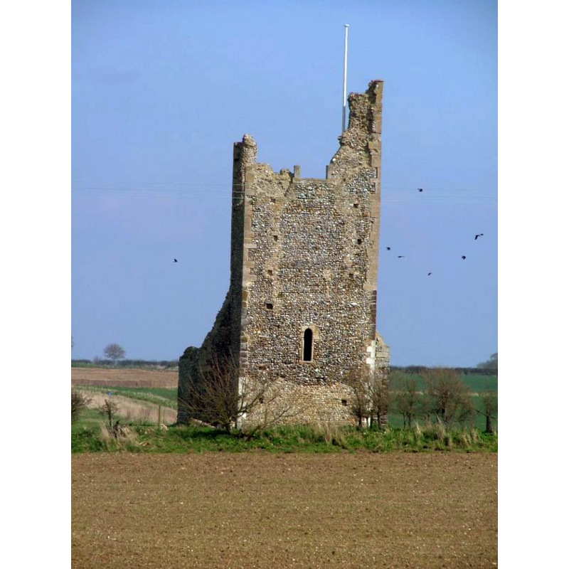
Image copyright © Simon Knott, 2008
Standing permission
Results: 1 records
view of church exterior - west view
Scene Description: the ruins of old St. Margaret
Copyright Statement: Image copyright © Simon Knott, 2008
Image Source: digital photograph taken May 2006 by Simon Knott [www.norfolkchurches.co.uk/puddingnorton/puddingnorton.htm] [accessed 29 July 2013]
Copyright Instructions: Standing permission
INFORMATION
Font ID: 15149PUD
Object Type: Baptismal Font1?
Font Century and Period/Style: 12th - 13th century, Medieval
Church / Chapel Name: Parish Church of St. Margaret [in ruins in the 18th century]
Font Location in Church: [cf. FontNotes]
Church Patron Saint(s): St. Margaret of Antioch [aka Margaret the Virgin, Marina]
Church Address: Pudding Norton, Norfolk NR21 7NB
Site Location: Norfolk, East Anglia, England, United Kingdom
Directions to Site: Located on the B1146, 2-3 km S of Fakenham
Ecclesiastic Region: Diocese of Norwich
Historical Region: Hundreds of Gallow and Brothercross
Additional Comments: disappeared font? (the one from the Domesday-period church here)
Font Notes:
Click to view
Blomefield (1805-1810) writes: "NORTON, or PUDDING-NORTON, Was an hamlet or beruite, at the survey [i.e., Domesday, 1086], belonging to the King's manor of Fakenham [...] and here was a church endowed then with 8 acres, that were valued at 6d. per ann. [=In Nortuna ecclia. viii. acr. et vi. d.']". Blomefield (ibid.) names 'Reymond', as first recorded rector, in 1296, and notes: "The Church, which is now in ruins, was dedicated to St. Margaret, and there was her guild here; nothing now remains standing but part of a small four-square tower, and is a rectory valued at 6l.—The ancient valor was 15 marks." [NB: the earlier edition of Blomefield's work had been published in 1769, by which time the church was already in ruins]. White's Directory of 1883 reports the church "was dilapidated many years ago, and a portion of the tower is all that remains". [NB: we have no information on the font of the Domesday-period church]
Credit and Acknowledgements: We are grateful to Simon Knott, of Norfolk Churches [www.norfolkchurches.co.uk], for his photographs of the ruins of this church
COORDINATES
UTM: 31U 355163 5853564
Latitude & Longitude (Decimal): 52.812383, 0.850977
Latitude & Longitude (DMS): 52° 48′ 44.58″ N, 0° 51′ 3.52″ E
REFERENCES
- Blomefield, Francis, An essay towards a topographical history of Norfolk, 1805-1810, vol. 7: 115-119 / [www.british-history.ac.uk/report.aspx?compid=78315] [accessed 29 July 2013]
- White, William, History, Gazetteer, and Directory of Norfolk, [s.l.]: [printed for the author], 1883, [transcribed in www.origins.org.uk/genuki/NFK/places/p/pudding_norton/white1883.shtml [accessed 14 August 2009]]