Pentney / Penteleia
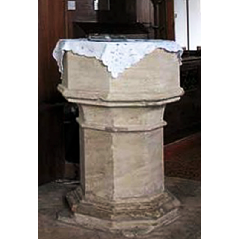
Image copyright © John Salmon, 2008
CC-BY-SA-3.0
Results: 7 records
view of font
Copyright Statement: Image copyright © John Salmon, 2008
Image Source: detail of a digital photograph taken 13 February 2008 by John Salmon [www.geograph.org.uk/photo/697338] [accessed 25 November 2013]
Copyright Instructions: CC-BY-SA-3.0
view of church exterior - southwest view
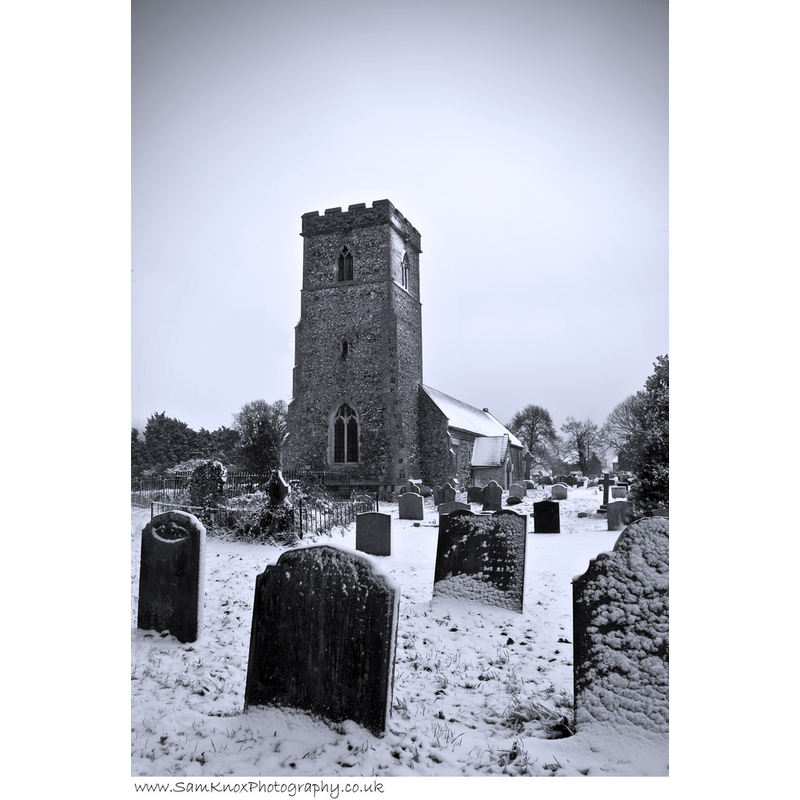
Copyright Statement: Image copyright © [in the public domain]
Image Source: digital photograph taken 23 November 2008 by PentneySam [whttp://commons.wikimedia.org/wiki/File:Pentneychurch.jpg] [accessed 25 November 2013]
Copyright Instructions: Released by its author into the public domain
view of church exterior - south view
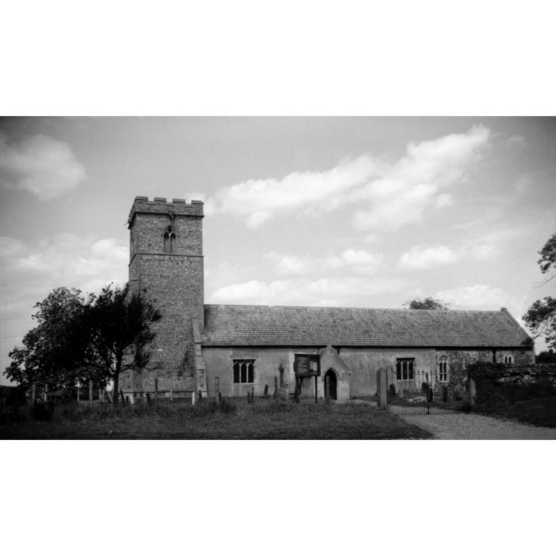
Scene Description: Photo caption: "There are Norman remains to be seen inside"
Copyright Statement: Image copyright © George Plunkett, 2013
Image Source: B&W photograph taken 31 May 1996 by George Plunkett [www.georgeplunkett.co.uk/Norfolk/P/Pentney St Mary Magdalene church south side [7326] 1996-05-31.jpg] [accessed 25 November 2013]
Copyright Instructions: Standing permission by Jonathan Plunkett
view of church exterior in context
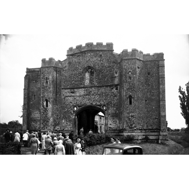
Scene Description: Photo caption: "The priory, dedicated to the Holy Trinity, the Blessed Virgin, and St Mary Magdalen, was founded during the reign of William the Conqueror by Robert de Vallibus or Vaux. Except for the late 14th century gatehouse, little more than foundations remain"
Copyright Statement: Image copyright © George Plunkett, 2013
Image Source: B&W photograph taken 3 July 1958 by George Plunkett [www.georgeplunkett.co.uk/Norfolk/P/Pentney Augustinian Priory gatehouse N side [4486] 1958-07-03.jpg] [accessed 25 November 2013]
Copyright Instructions: Standing permission by Jonathan Plunkett
view of font in context
Copyright Statement: Image copyright © John Salmon, 2008
Image Source: digital photograph taken 13 February 2008 by John Salmon [www.geograph.org.uk/photo/697338] [accessed 25 November 2013]
Copyright Instructions: CC-BY-SA-3.0
view of church interior - nave - looking west
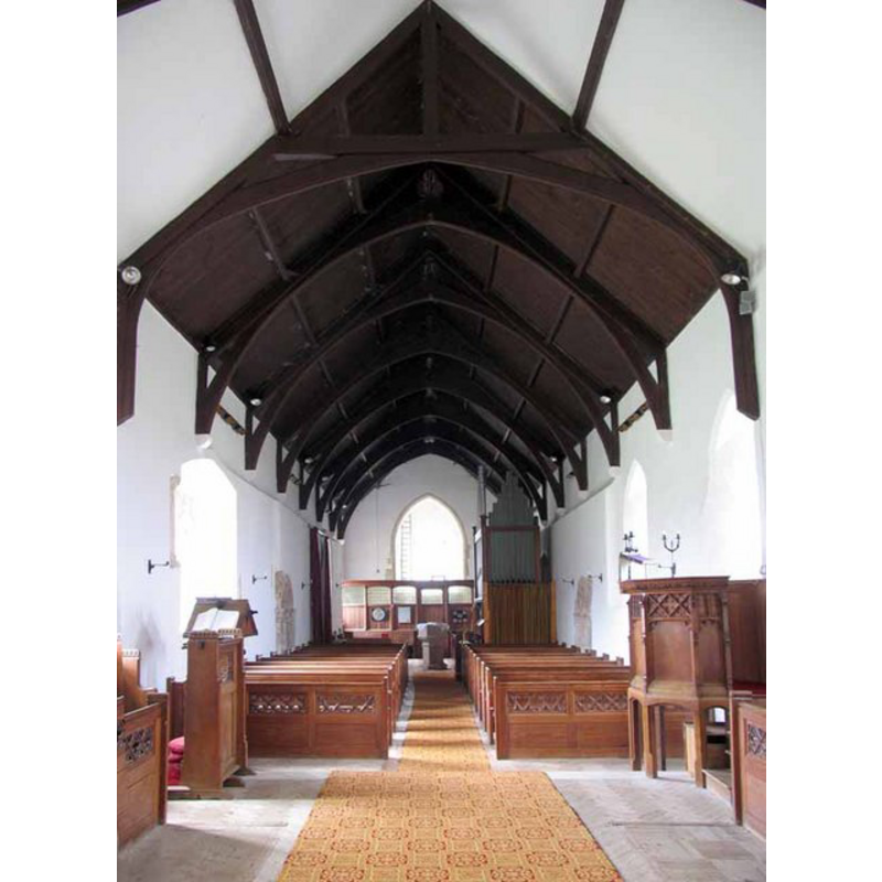
Scene Description: the font at the west end of the nave
Copyright Statement: Image copyright © John Salmon, 2008
Image Source: digital photograph taken 13 February 2008 by John Salmon [www.geograph.org.uk/photo/697350] [accessed 25 November 2013]
Copyright Instructions: CC-BY-SA-3.0
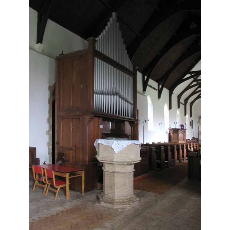
view of church interior - nave - looking east
![the font in the foreground [west end]](/static-50478a99ec6f36a15d6234548c59f63da52304e5/compressed/1131125017_compressed.png)
Scene Description: the font in the foreground [west end]
Copyright Statement: Image copyright © John Salmon, 2008
Image Source: digital photograph taken 13 February 2008 by John Salmon [www.geograph.org.uk/photo/697340] [accessed 25 November 2013]
Copyright Instructions: CC-BY-SA-3.0
INFORMATION
Font ID: 15148PEN
Object Type: Baptismal Font1
Font Century and Period/Style: 14th century, Decorated
Church / Chapel Name: Parish Church of St. Mary Magdalen
Font Location in Church: Inside the church, at the W end of the nave
Church Patron Saint(s): St. Mary Magdalene
Church Address: Narborough Road, Pentney, Norfolk, PE32 1JH
Site Location: Norfolk, East Anglia, England, United Kingdom
Directions to Site: Located off (S) the A47, between Swaffham and King's Lynn, 14 km SE of King's Lynn
Ecclesiastic Region: Diocese of Norwich
Historical Region: Hundred of Freebridge
Additional Comments: disappeard font? (the one from the 11thC(?) church here)
Font Notes:
Click to view
There is an entry for "Penteleia" in the Domesady survey [http://domesdaymap.co.uk/place/TF7213/pentney/] [accessed 25 November 2013] that reports a church in it. Blomefield (1805-1810) notes "two churches endowed with 30 acres, one here, the other (as I take it) at Walton [...] The church of Pentney was dedicated to St. Mary Magdalen'. Blomefield (ibid.) gives no date for the foundation of the church here, but it is quite likely that it existed before the Conquest, as the place fell into the "quite large" category, with 24.5 households, at the time of the survey. The present font is noted in Pevsner & Wilson (1999): "C14, like a short octagonal pier, without carving." This author also notes the existence of a priory founded by Robert de Vaux [aka de Vallibus]: "This Robert founded the priory here for the souls of Agnes his wife, and their children, dedicated to the honour of the Holy Trinity, the blessed Virgin Mary, and St. Mary Magdalen, in the Isle, Eya, for canons regular of the order of St. Augustin"
Credit and Acknowledgements: We are grateful to Jonathan Plunkett for the photographs of this church taken by his father, George Plunkett, in 1958 and 1996
COORDINATES
UTM: 31U 334114 5841168
Latitude & Longitude (Decimal): 52.69498, 0.545232
Latitude & Longitude (DMS): 52° 41′ 41.93″ N, 0° 32′ 42.83″ E
MEDIUM AND MEASUREMENTS
Material: stone
Font Shape: octagonal, mounted
Basin Interior Shape: round
Basin Exterior Shape: octagonal
REFERENCES
- Blomefield, Francis, An essay towards a topographical history of Norfolk, 1805-1810, vol. 9: 37-42 / [www.british-history.ac.uk/report.aspx?compid=78503] [accessed 25 November 2013]
- Pevsner, Nikolaus, Norfolk 2: North-West and South (2nd ed.), London: Penguin, 1999, p. 589