Norton Subcourse / Norton / Norton-sub-Course / Nortuna / Norton Soupecors
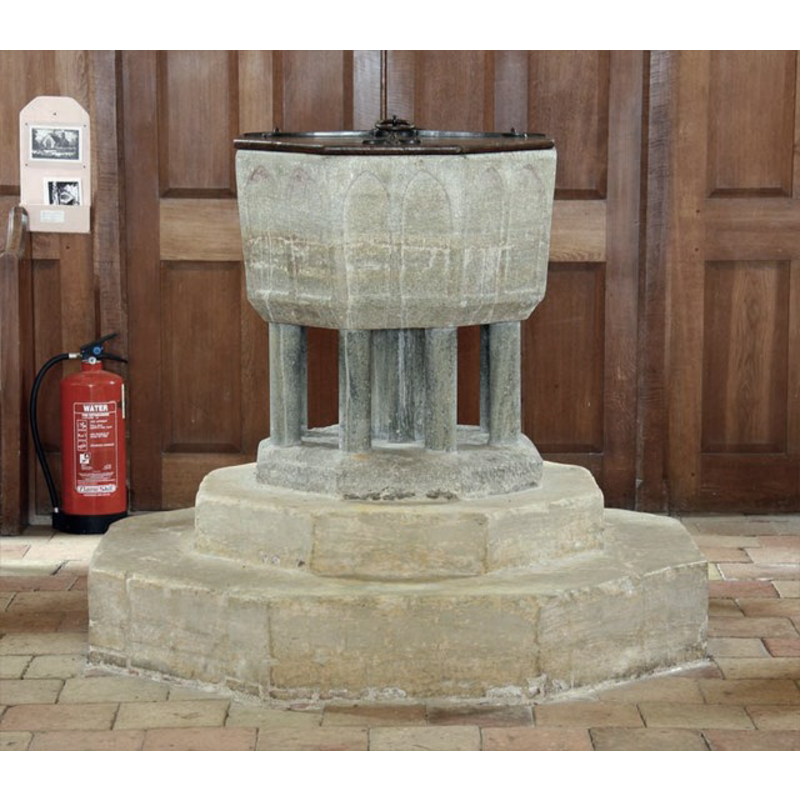
Image copyright © John Salmon, 2009
CC-BY-SA-3.0
Results: 7 records
view of font and cover
Copyright Statement: Image copyright © John Salmon, 2009
Image Source: digital photograph taken 15 July 2009 by John Salmon [www.geograph.org.uk/photo/1477850] [accessed 11 September 2013]
Copyright Instructions: CC-BY-SA-3.0
design element - architectural - arcade - blind - pointed arches - 16
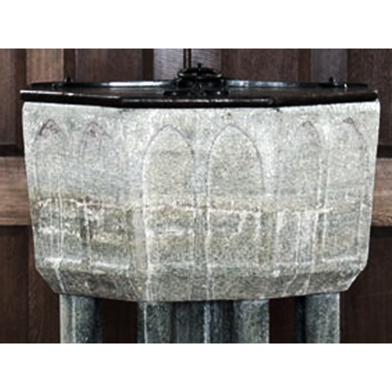
Scene Description: very shallow; two arches on each side
Copyright Statement: Image copyright © John Salmon, 2009
Image Source: detail of a digital photograph taken 15 July 2009 by John Salmon [www.geograph.org.uk/photo/1477850] [accessed 11 September 2013]
Copyright Instructions: CC-BY-SA-3.0
view of church exterior - northwest view
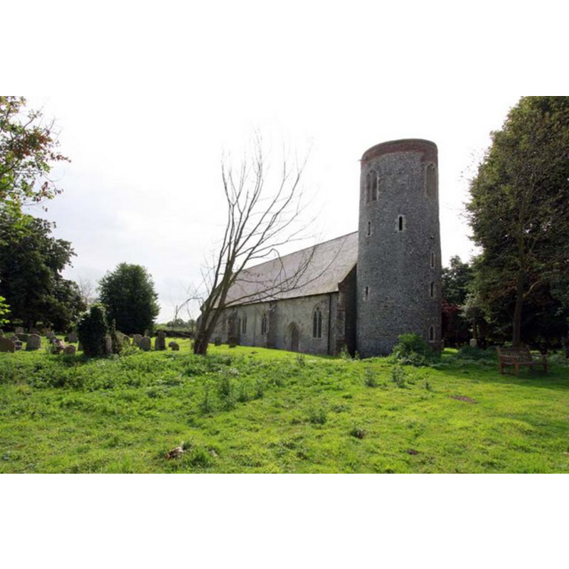
Copyright Statement: Image copyright © John Salmon, 2009
Image Source: digital photograph taken 15 July 2009 by John Salmon [www.geograph.org.uk/photo/1476318] [accessed 11 September 2013]
Copyright Instructions: CC-BY-SA-3.0
view of church exterior - southwest end
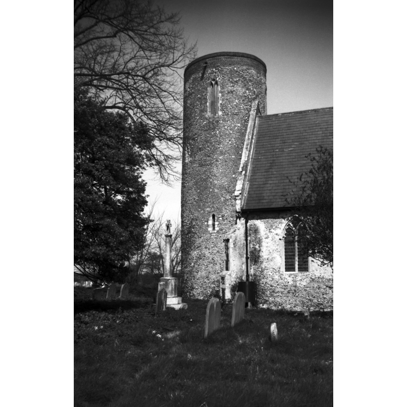
Scene Description: Photo caption: "Round tower probably pre-conquest"
Copyright Statement: Image copyright © George Plunkett, 2013
Image Source: B&W photograph taken 17 April 1976 by George Plunkett [www.georgeplunkett.co.uk/Norfolk/N/Norton Subcourse St Mary's church tower [5487] 1976-04-17.jpg] [accessed 11 September 2013]
Copyright Instructions: Standing permission by Jonathan Plunkett
view of church exterior - east end
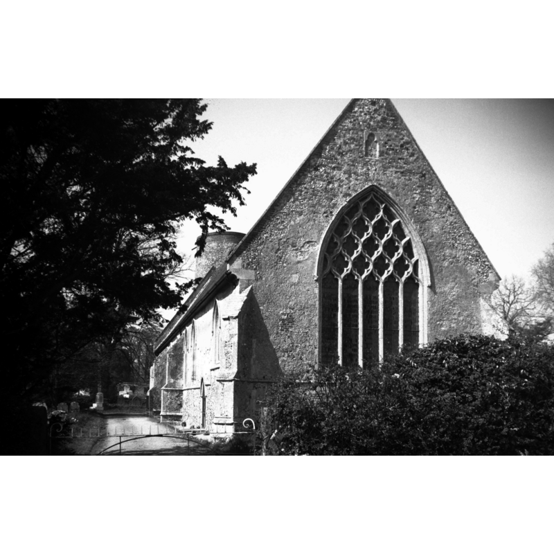
Scene Description: Photo caption: "Decorated tracery. 14c"
Copyright Statement: Image copyright © George Plunkett, 2013
Image Source: B&W photograph taken 17 April 1976 by George Plunkett [www.georgeplunkett.co.uk/Norfolk/N/Norton Subcourse St Mary's church east end [5488] 1976-04-17.jpg] [accessed 11 September 2013]
Copyright Instructions: Standing permission by Jonathan Plunkett
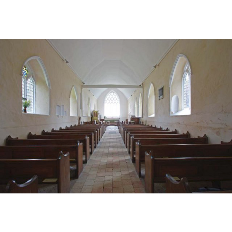
view of church interior - nave - looking west
Scene Description: the font is located at the west end, by the tower entranceway
Copyright Statement: Image copyright © John Salmon, 2009
Image Source: digital photograph taken 15 July 2009 by John Salmon [www.geograph.org.uk/photo/14778527 [accessed 11 September 2013]
Copyright Instructions: CC-BY-SA-3.0
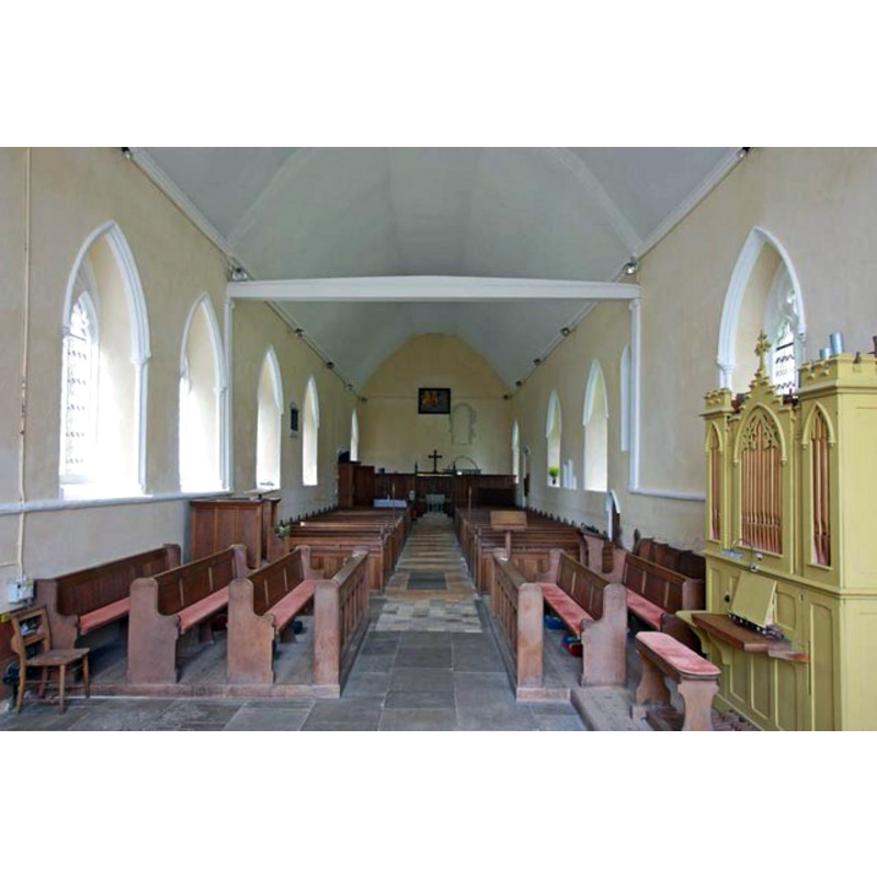
view of church interior - nave - looking east
Copyright Statement: Image copyright © John Salmon, 2009
Image Source: digital photograph taken 15 July 2009 by John Salmon [www.geograph.org.uk/photo/1476322] [accessed 11 September 2013]
Copyright Instructions: CC-BY-SA-3.0
INFORMATION
Font ID: 15147NOR
Object Type: Baptismal Font1
Font Century and Period/Style: 12th - 13th century, Transitional / Early English
Cognate Fonts: [cf. FontNotes]
Church / Chapel Name: Parish Church of St. Mary and St. Margaret
Font Location in Church: Inside the church, at the W end
Church Patron Saint(s): St. Mary the Virgin & St. Margaret
Church Address: Church Road, Norton Subcourse, Norfolk NR14 6RY
Site Location: Norfolk, East Anglia, England, United Kingdom
Directions to Site: Located 5 km E of Loddon
Ecclesiastic Region: Diocese of Norwich
Historical Region: Hundred of Clavering
Additional Comments: disappeared font (the one from the early [pre-Conquest?] church here)
Font Notes:
Click to view
The Domesday entry for "Nortuna", transcribed and translated in Blomefield (1805-1810) notes; "here was a church endowed with 20 acres of free land"; the later description in Blomefield (ibid.) reads: "The church is a single pile, and thatched, with a round tower and 3 bells [...] The Church is dedicated to St. Margaret, and was a rectory. [...] William de la Corone occurs rector in 1277 [...] In 1350, John de Lound, instituted vicar. Listed in Leach (1975) as a font made of Purbeck marble. The font in this church is described in Pevsner & Wilson (1999): "C13, of Purbeck marble, octagonal, with the usual two flat pointed arches on each side." It appears that the base is also original [are the colonnettes too?], as is the two-step octagonal plinth; the pointed arches of the basin suggest a late 12th-century, Transtional period, or early-13th, Early English [cf. supra]. The wooden cover is octagonal and flat, with metal decoration and handle; modern. [NB: we have no information on the font from the Norman or pre-Conquest church here].
Credit and Acknowledgements: We are grateful to Jonathan Plunkett for the photographs of this church taken by his father, George Plunkett, in April 1976
COORDINATES
UTM: 31U 401470 5821207
Latitude & Longitude (Decimal): 52.53204, 1.547436
Latitude & Longitude (DMS): 52° 31′ 55.34″ N, 1° 32′ 50.77″ E
MEDIUM AND MEASUREMENTS
Material: stone, limestone (Purbeck marble)
Font Shape: octagonal, mounted
Basin Interior Shape: round
Basin Exterior Shape: octagonal
LID INFORMATION
Date: modern
Material: wood
Apparatus: no
Notes: [cf. FontNotes]
REFERENCES
- Blomefield, Francis, An essay towards a topographical history of Norfolk, 1805-1810, vol. 8: 37-40 / [www.british-history.ac.uk/report.aspx?compid=78400] [accessed 11 September 2013]
- Knott, Simon, The Norfolk Churches Site, Simon Knott, 2004. [standing permission to reproduce images received from Simon (February 2005]. URL: www.norfolkchurches.co.uk.
- Leach, Rosemary, A Investigation into the use of Purbeck Marble in Medieval England, Hartlepool: E.W. Harrisons & Sons, 1975, p. 77
- Pevsner, Nikolaus, Norfolk 2: North-West and South (2nd ed.), London: Penguin, 1999, p. 577