Mulbarton / Great Barton / Milbarton / Molke / Molkebertestuna / Molkebertuna / Muche / Mykil,
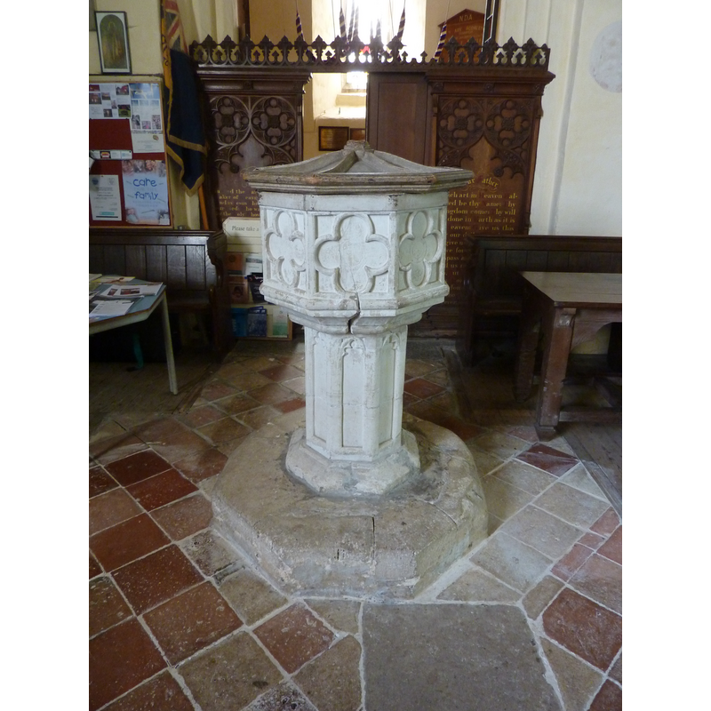
Image copyright © Janice Tostevin, 2010
Standing permission
Results: 8 records
view of font and cover
Copyright Statement: Image copyright © Janice Tostevin, 2010
Image Source: digital photograph taken 21 June 2010 by Janice Tostevin for BSI
Copyright Instructions: Standing permission
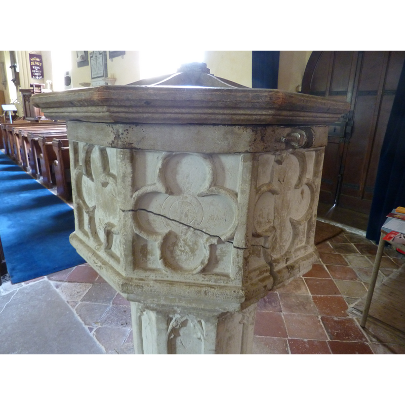
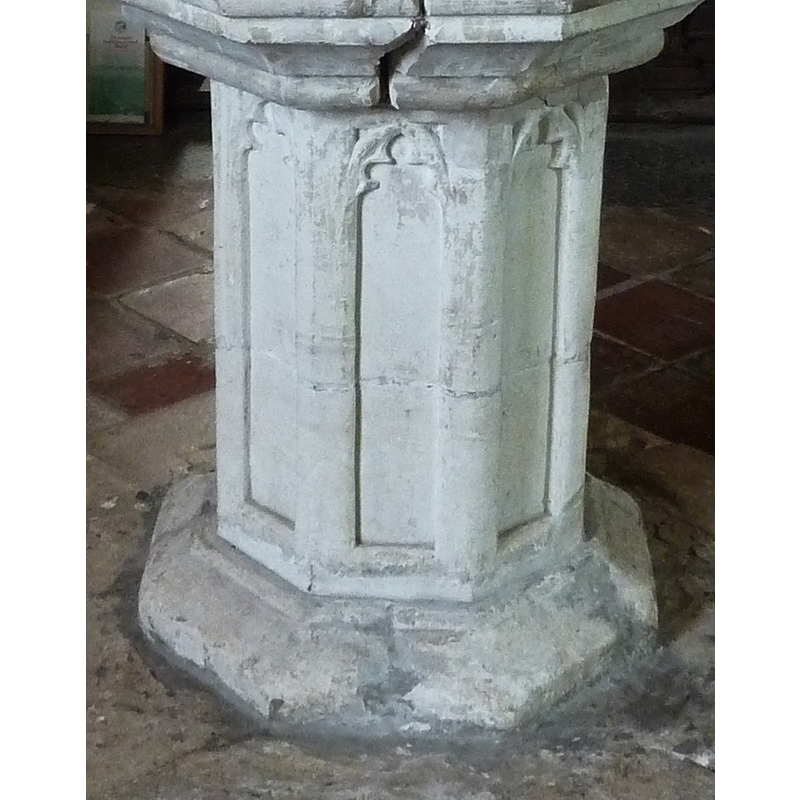
design element - motifs - quatrefoil - 8
Copyright Statement: Image copyright © Janice Tostevin, 2010
Image Source: digital photograph taken 21 June 2010 by Janice Tostevin for BSI
Copyright Instructions: Standing permission
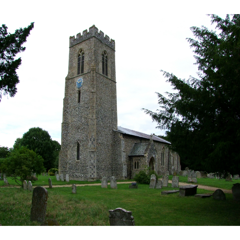
view of church exterior - southwest view
Copyright Statement: Image copyright © Simon Knott, 2010
Image Source: digital photograph taken by 5 August 2010 by Simon Knott [ww.norfolkchurches.co.uk/mulbarton/mulbarton.htm] [acessed 21 March 2013]
Copyright Instructions: Standing permission
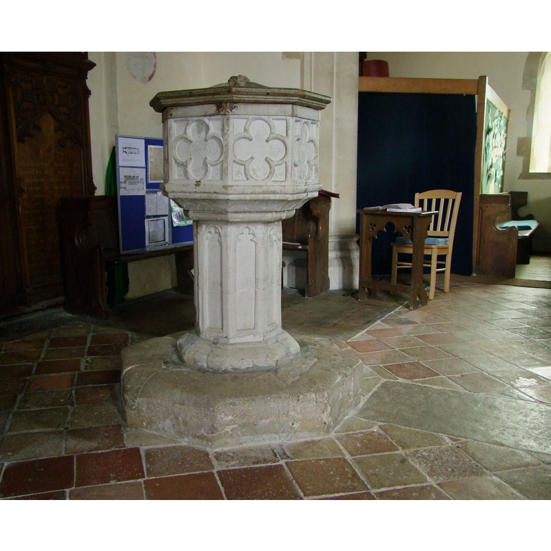
view of font and cover in context
Copyright Statement: Image copyright © Simon Knott, 2010
Image Source: digital photograph taken by 5 August 2010 by Simon Knott [ww.norfolkchurches.co.uk/mulbarton/mulbarton.htm] [acessed 21 March 2013]
Copyright Instructions: Standing permission
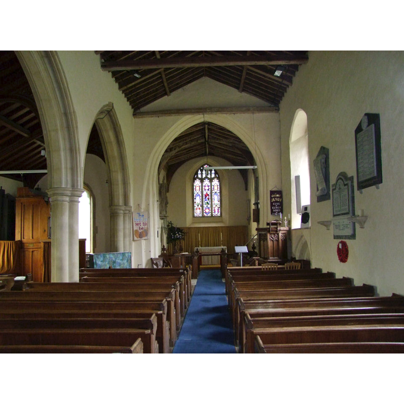
view of church interior - nave - looking west
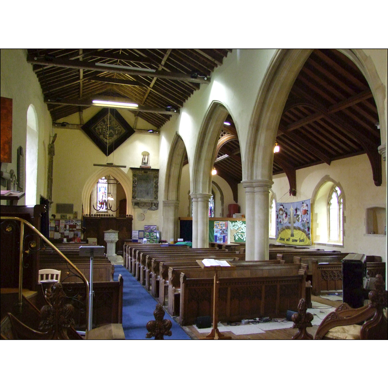
Scene Description: the font is visible at the back (west end) just east of the tower arch
Copyright Statement: Image copyright © Simon Knott, 2010
Image Source: digital photograph taken by 5 August 2010 by Simon Knott [ww.norfolkchurches.co.uk/mulbarton/mulbarton.htm] [acessed 21 March 2013]
Copyright Instructions: Standing permission
view of church interior - nave - looking east
Copyright Statement: Image copyright © Simon Knott, 2010
Image Source: digital photograph taken by 5 August 2010 by Simon Knott [ww.norfolkchurches.co.uk/mulbarton/mulbarton.htm] [acessed 21 March 2013]
Copyright Instructions: Standing permission
view of font cover
![an old cover; appears to have lost its finial [cf. Font notes]](/static-50478a99ec6f36a15d6234548c59f63da52304e5/compressed/1100704047_compressed.png)
Scene Description: an old cover; appears to have lost its finial [cf. Font notes]
Copyright Statement: Image copyright © Janice Tostevin, 2010
Image Source: detail of a digital photograph taken 21 June 2010 by Janice Tostevin for BSI
Copyright Instructions: Standing permission
design element - architectural - arch or window - cinquefoiled - 8
Copyright Statement: Image copyright © Janice Tostevin, 2010
Image Source: detail of a digital photograph taken 21 June 2010 by Janice Tostevin for BSI
Copyright Instructions: Standing permission
INFORMATION
Font ID: 15133MUL
Object Type: Baptismal Font1
Font Century and Period/Style: 17th century[basin only] -- 15th century [base only] [composite font?], Baroque [composite]
Church / Chapel Name: Parish Church of St. Mary Magdalen
Font Location in Church: Inside the church, at the W end of the nave
Church Patron Saint(s): St. Mary Magdalene
Church Address: The Common, Mulbarton, Norfolk, NR14 8JS
Site Location: Norfolk, East Anglia, England, United Kingdom
Directions to Site: Located on the B1113, 9 km SSW of Norwich
Ecclesiastic Region: Diocese of Norwich
Historical Region: Hundred of Humble-Yard
Additional Comments: composite font? / disappeared font? (the one from the 11thC church here)
Font Notes:
Click to view
Blomefield (1805-1810) writes: "M[ulbarton, Molke, Mykil, Muche, or Great-Barton, was owned by Ordinc, a thane of the Confessor's, and by Roger Bigot and Ralf de Beaufoe in the Conqueror's time, when it was six furlongs long, and five broad, and paid 6d. geld, and had a church and 15 acres of glebe, then worth two shillings" [a.p. Domesday, fol. 218: "i. ecclia. xv. et val. ii. sol. In Molkebertuna tenet"]. Blomefield (ibid.) further notes: "The church hath no isles, the nave is 26 yards and an half long, and 7 broad, and is leaded, as is the chancel also; the south porch is tiled, the tower is square and hath five bells. [...] Sir William de Hoo first presented here in 1367. He it was that built the present church and tower, in the chancel of which he and his lady were interred", and names "Ralf de St. Omer" as first recorded rector here, in 1329. Pevsner & Wilson (1999) note: "Font. Octagonal, simple, with quatrefoils, seems C17." The church guide in the Mulbarton Church Group site [www.mulbchurch.org.uk/Resources/Guide/2.html] [accessed 12 August 2009], however, has: "The stone Font is medieval in age, and octagonal (8-sided) in shape. The base is probably much older than the font itself. It may have come from a much older church which stood here […] (there was a church here in the time of the Domesday Book, in 1086)." The two parts of the font, basin and pedestal base, may be of different dates, as Pevsner & Wilson suggest [cf. supra]. The wooden cover, octagonal and with a slightly raised carved centre appears to be quite old, perhaps contemporary with the basin. The basin is badly cracked, and has been reinforced with a metal belt all around; the inner well is lead-lined. [cf. Index entry for Keningham for the disppeared font there].
Credit and Acknowledgements: We are grateful to Simon Knott [wwwnorfolkchurches.co.uk] and to Janice Tostevin for their photographs of this church and font
COORDINATES
UTM: 31U 380469 5825230
Latitude & Longitude (Decimal): 52.563981, 1.236535
Latitude & Longitude (DMS): 52° 33′ 50.33″ N, 1° 14′ 11.53″ E
MEDIUM AND MEASUREMENTS
Material: stone
Font Shape: octagonal, mounted
Basin Interior Shape: round
Basin Exterior Shape: octagonal
Drainage Notes: lead-lined
LID INFORMATION
Date: 17th - 18th century?
Material: wood, oak
Apparatus: no
Notes: [cf. FontNotes]
REFERENCES
- Blomefield, Francis, An essay towards a topographical history of Norfolk, 1805-1810, vol. 5: 75-83 / [www.british-history.ac.uk/report.aspx?compid=78158] [accessed 21 March 2013]
- Pevsner, Nikolaus, Norfolk 2: North-West and South (2nd ed.), London: Penguin, 1999, p. 547