Morley St. Botolph / Morlea
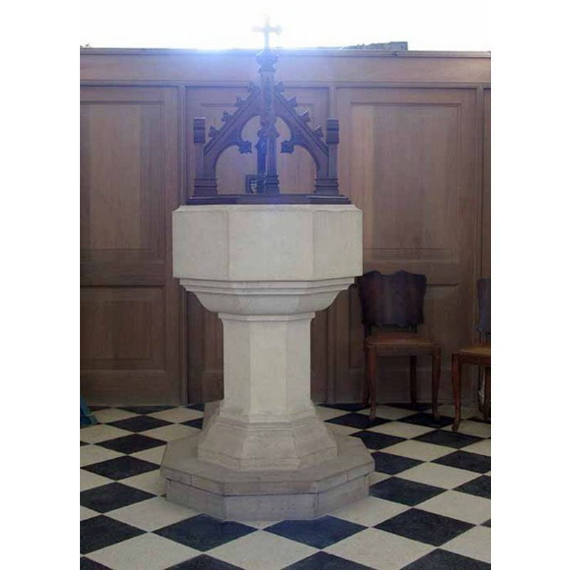
Image copyright © John Salmon, 2008
CC-BY-SA-3.0
Results: 5 records
view of font and cover
Scene Description: the old cover and the replacement font [cf. Font notes]
Copyright Statement: Image copyright © John Salmon, 2008
Image Source: digital photograph taken 7 May 2008 by John Salmon [www.geograph.org.uk/photo/805134] [accessed 11 August 2009]
Copyright Instructions: CC-BY-SA-3.0
view of church exterior - southwest view
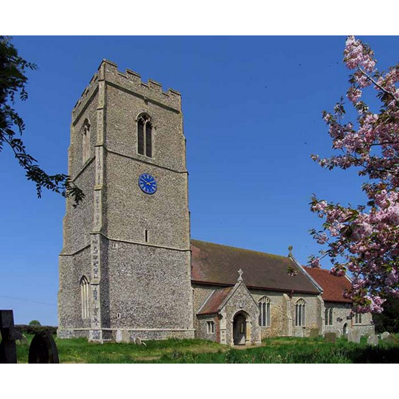
Copyright Statement: Image copyright © John Salmon, 2008
Image Source: digital photograph taken 7 May 2008 by John Salmon [www.geograph.org.uk/photo/805113] [accessed 19 March 2013]
Copyright Instructions: CC-BY-SA-3.0
view of church exterior - southeast view
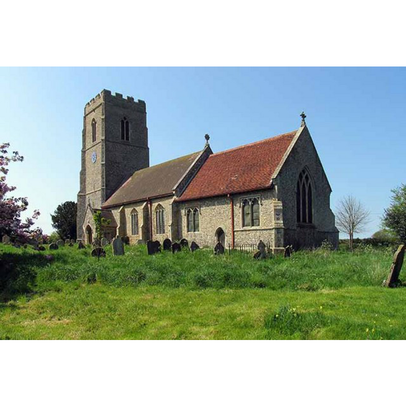
Copyright Statement: Image copyright © John Salmon, 2008
Image Source: digital photograph taken 7 May 2008 by John Salmon [www.geograph.org.uk/photo/805124] [accessed 19 March 2013]
Copyright Instructions: CC-BY-SA-3.0
view of church interior - nave - looking east
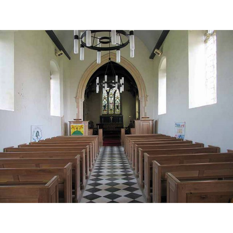
Copyright Statement: Image copyright © John Salmon, 2008
Image Source: digital photograph taken 7 May 2008 by John Salmon [www.geograph.org.uk/photo/805132] [accessed 19 March 2013]
Copyright Instructions: CC-BY-SA-3.0
view of stoup
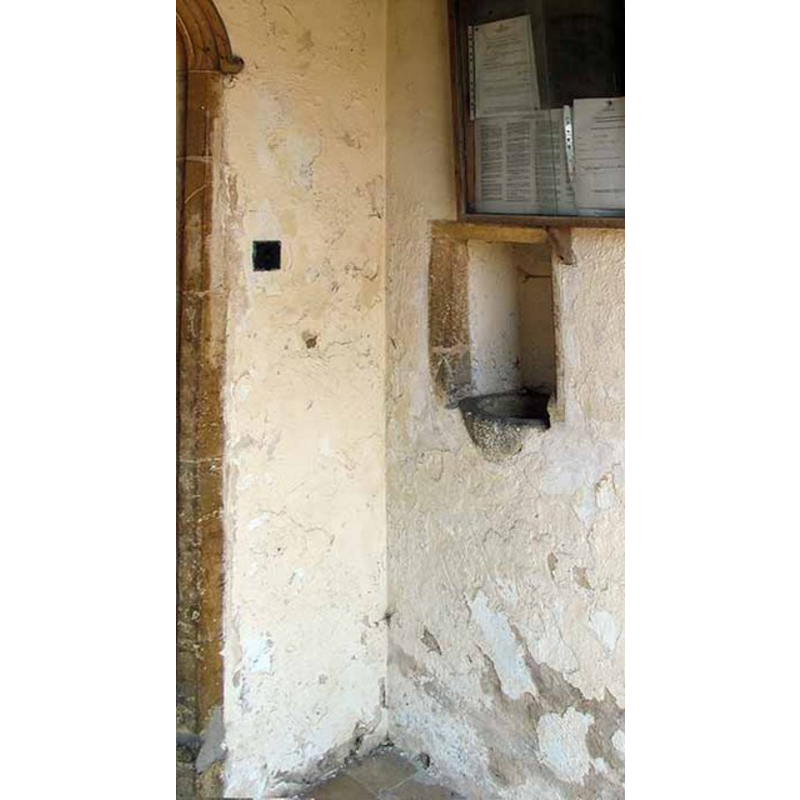
Copyright Statement: Image copyright © John Salmon, 2008
Image Source: digital photograph taken 7 May 2008 by John Salmon [www.geograph.org.uk/photo/805127] [accessed 19 March 2013]
Copyright Instructions: CC-BY-SA-3.0
INFORMATION
Font ID: 15130MOR
Object Type: Baptismal Font1
Font Century and Period/Style: 15th century, Perpendicular
Church / Chapel Name: Parish Church of St. Botolph
Font Location in Church: [cf. FontNotes]
Church Patron Saint(s): St. Botulph [aka St. Botolph, Botolph of Thorney, Botulf]
Church Address: Stone Brigg, Morley St Botolph, Norfolk, NR18 9TR
Site Location: Norfolk, East Anglia, England, United Kingdom
Directions to Site: Located just N of Morley St. Peter, 5 km WSW of Wymondham
Ecclesiastic Region: Diocese of Norwich
Historical Region: Hundred of Forehoe [aka Forehou]
Additional Comments: disappeared font? (the one from the ca.1086 church here)
Font Notes:
Click to view
Blomefield (1805-1810) writes; "The church of St. Butolph is the mother church, St. Peter's being only a chapel of ease, belonging to it, and had no separate rector, but was served by a curate, nominated by the rector [...] The Church of St. Butolph hath a nave, chancel, and south porch, which are tiled, a large square tower and three bells". Blomefield (ibid.) names "John, son of Elen de Thomston," as the first recorded rector here, in 1244, and cites two Domesday entries for 'Morlea', one of which reads: "In Morlea, ii. car. terre. unam tenuit i. presbyter, et aliam v. liberi homines. et presbyter habebat xix. bord." but it is not clear whether this church had existed at the time of Edward the Confessor's previous survey. Pevsner & Wilson (1999) describe a font at St. Botolph's: "Octagonal, with tracery on the stem and close panel tracery on the bowl. Top battlemented." The Church of England's 'A church neat you' site [www.achurchnearyou.com/morley-st-botolph/] [accessed 11 August 2009], however, informs that "The font was also renewed but the font cover (wooden) was saved" in the 1959 fire that destroyed the nave. The new font is octagonal and chiefly plain. The cover, if it is the old one, consists of a flat octagonal platform with four pinnacled and crocketed vertical ribs on it, and a cross finial; probably Victorian.
COORDINATES
UTM: 31U 367871 5825042
Latitude & Longitude (Decimal): 52.559383, 1.050855
Latitude & Longitude (DMS): 52° 33′ 33.78″ N, 1° 3′ 3.08″ E
REFERENCES
- Blomefield, Francis, An essay towards a topographical history of Norfolk, 1805-1810, vol. 2: 476-482 / [www.british-history.ac.uk/report.aspx?compid=78100] [accessed 19 March 2013]
- Pevsner, Nikolaus, Norfolk 2: North-West and South (2nd ed.), London: Penguin, 1999, p. 545