Methwold nr. Brandon / Matelwalde / Melewde / Methelwalde / Methewolde / Midlewolde
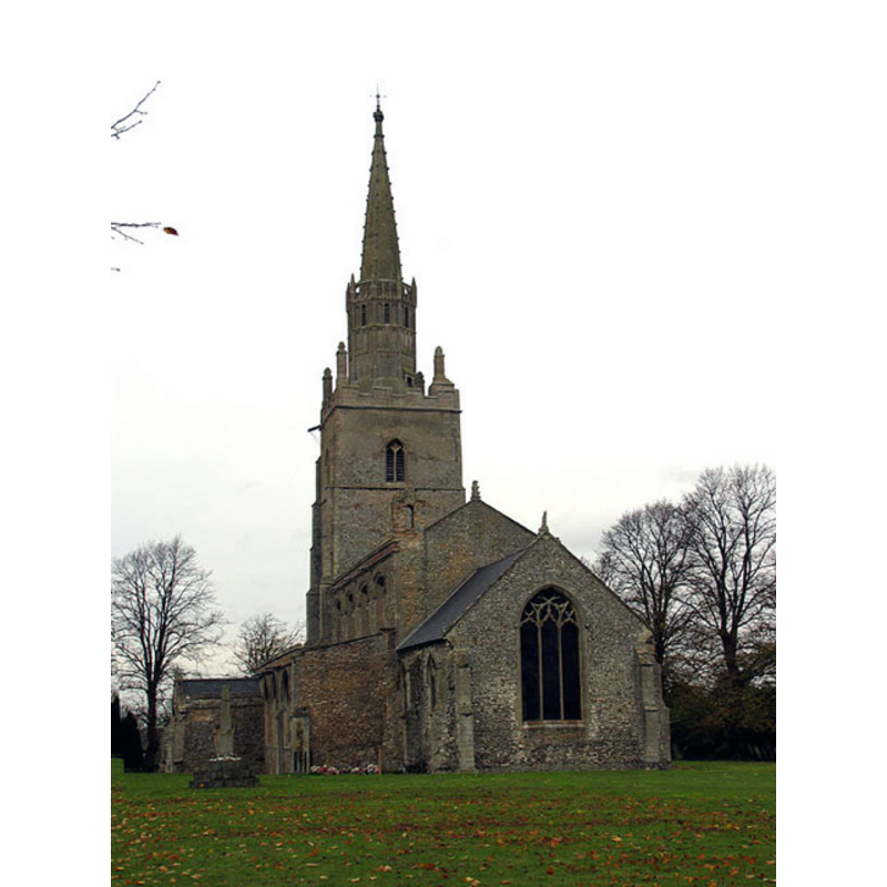
Image copyright © John Salmon, 2004
CC-BY-SA-3.0
Results: 3 records
view of church exterior - southeast view
Copyright Statement: Image copyright © John Salmon, 2004
Image Source: digital photograph taken 27 October 2004 by John Salmon [www.geograph.org.uk/photo/312475] [accessed 12 March 2013]
Copyright Instructions: CC-BY-SA-3.0
view of church interior - nave - looking east
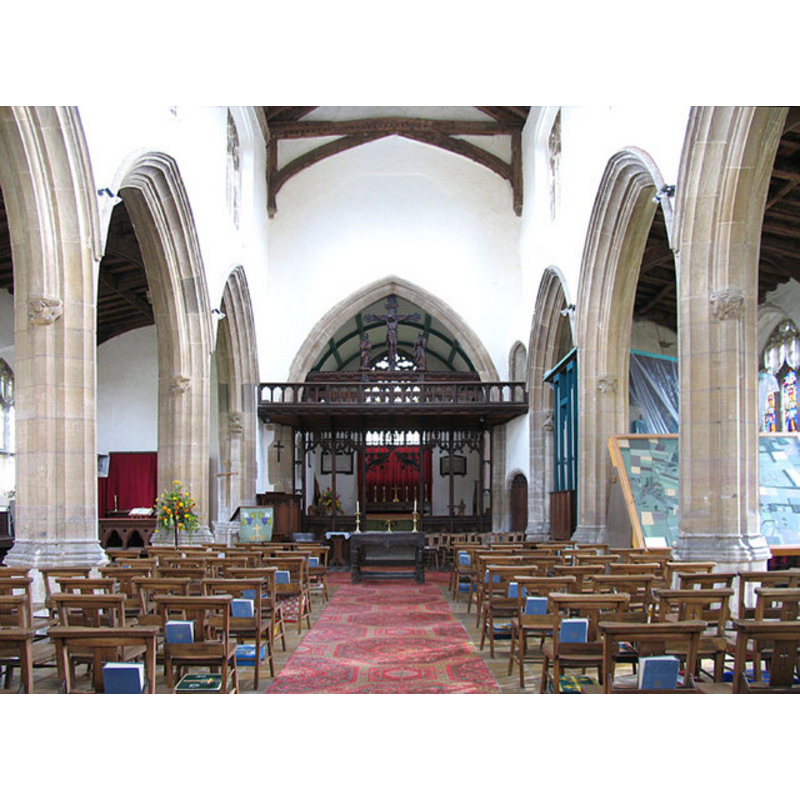
Copyright Statement: Image copyright © John Salmon, 2004
Image Source: digital photograph taken 27 October 2004 by John Salmon [www.geograph.org.uk/photo/312480] [accessed 12 March 2013]
Copyright Instructions: CC-BY-SA-3.0
view of stoup in context
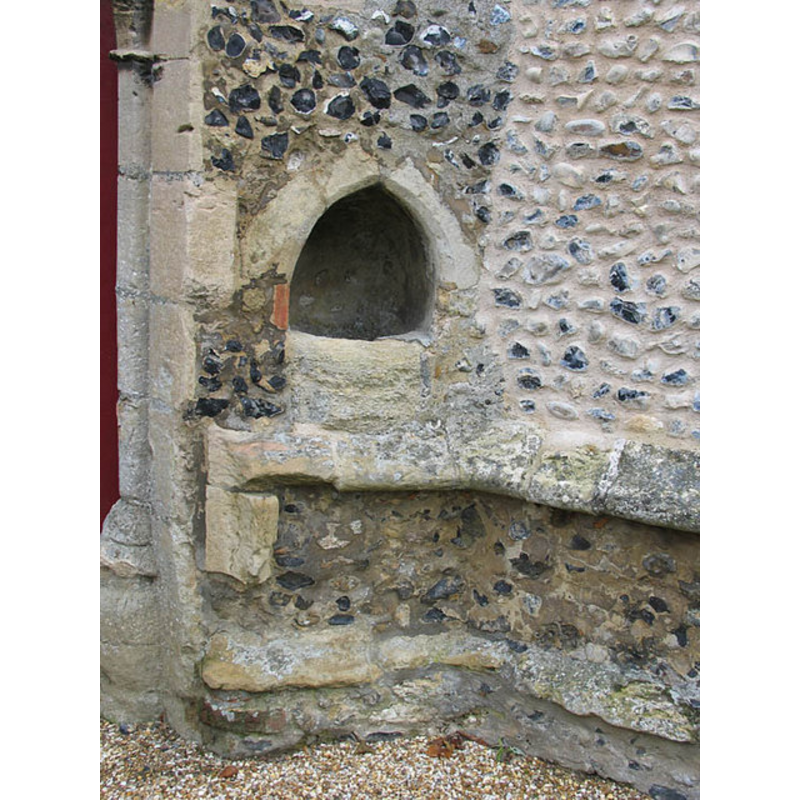
Copyright Statement: Image copyright © John Salmon, 2004
Image Source: digital photograph taken 27 October 2004 by John Salmon [www.geograph.org.uk/photo/312479] [accessed 12 March 2013]
Copyright Instructions: CC-BY-SA-3.0
INFORMATION
Font ID: 15126MET
Object Type: Baptismal Font1?
Font Century and Period/Style: 12th - 14th century, Medieval
Church / Chapel Name: Parish Church of St. George
Font Location in Church: [cf. FontNotes]
Church Patron Saint(s): St. George
Church Address: Crown Street, Methwold, Norfolk IP26 4NR
Site Location: Norfolk, East Anglia, England, United Kingdom
Directions to Site: Located N of Feltwell, 10 km NNW of Brandon, 24 km NW of Thetford
Ecclesiastic Region: Diocese of Ely
Historical Region: Hundred of Grimeshoe [aka Gimeshou]
Additional Comments: disappeared font? (the one from the earlier church here) -- [not yet in Knott -- checked 11 Aug 2009 -- present font probably a 19th-cent replacement?]
Font Notes:
Click to view
Blomefield (1805-1810) writes: "The Church of Methwold is dedicated to St. George, and was built, as I take it, in the reign of Edward II. [i.e., 1307-1327]", but adds, "1148, Alfric the priest was rector", which would put the existence of a church here to a much earlier period, though none is mentioned in Blomefield. Kelly's directory for Norfolk (1925: 273-275) [transcribed in http://apling.freeservers.com/Villages/Methwold1925.htm [accessed 12 March 2013], however, may provide a clue to an earlier church here: "There was once an older church situated at the edge of the close on which still stands the tithe barn of the Augustinian Priory of Brumwell ( later Broomhill ), founded by Sir H. de Plaiz in the reign of King John, and dedicated to SS. Mary and Thomas, of which various remains have been disinterred; it was probably the church of the original Saxon settlement of the Buntings, by which last name the lower part of the village is still known." Although the date in King John's reign is later -John reigned 1199-1216- the latter church existed much earlier than the present one. [NB: we have no information on the original font(s) of the12th-century or 14th-century church here].
COORDINATES
UTM: 31U 333934 5822125
Latitude & Longitude (Decimal): 52.52389, 0.55213
Latitude & Longitude (DMS): 52° 31′ 26″ N, 0° 33′ 7.67″ E
REFERENCES
- Blomefield, Francis, An essay towards a topographical history of Norfolk, 1805-1810, vol. 2: 201-210 / [www.british-history.ac.uk/report.aspx?compid=78052] [accessed 12 Mach 2013]