Marlingford / Marthingefordam
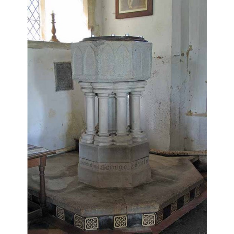
Image copyright © John Salmon, 2008
CC-BY-SA-3.0
Results: 7 records
view of font and cover
Copyright Statement: Image copyright © John Salmon, 2008
Image Source: digital photograph taken 9 May 2008 by John Salmon [www.geograph.org.uk/photo/807435] [accessed 18 March 2013]
Copyright Instructions: CC-BY-SA-3.0
view of font and cover
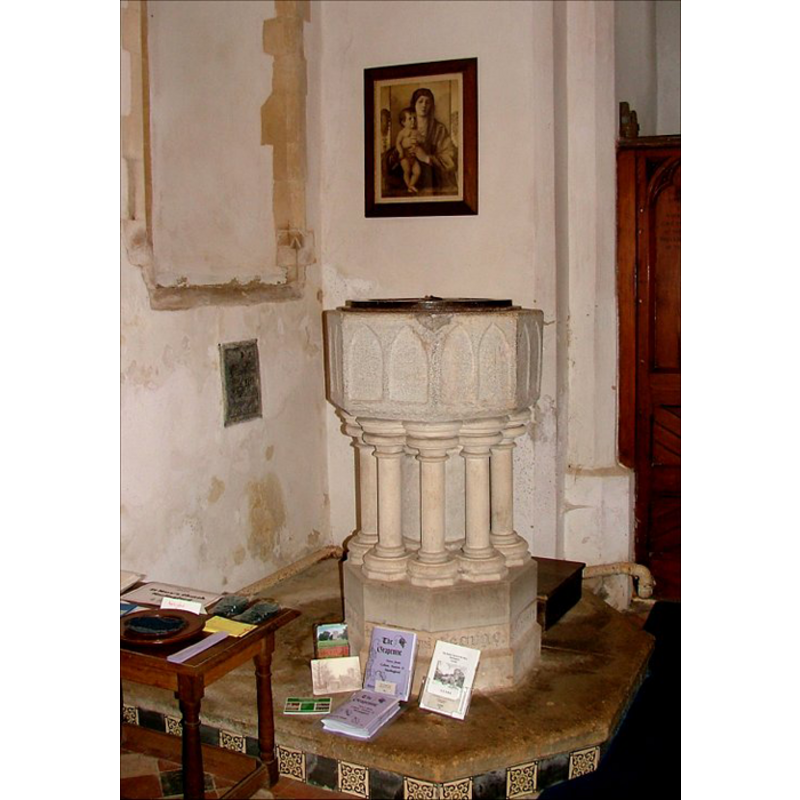
Scene Description: only the basin is medieval
Copyright Statement: Image copyright © Simon Knott, 2006
Image Source: digital photograph taken March 2006 by Simon Knott [www.norfolkchurches.co.uk/marlingford/marlingford.htm] [accessed 11 August 2009]
Copyright Instructions: Standing permssion
design element - architectural - arcade - blind - pointed arches - 16
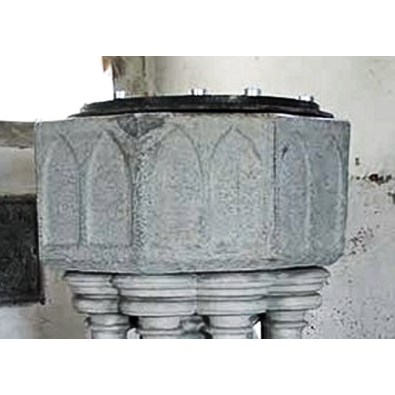
Copyright Statement: Image copyright © John Salmon, 2008
Image Source: digital photograph taken 9 May 2008 by John Salmon [www.geograph.org.uk/photo/807435] [accessed 18 March 2013]
Copyright Instructions: CC-BY-SA-3.0
view of church exterior - northeast view
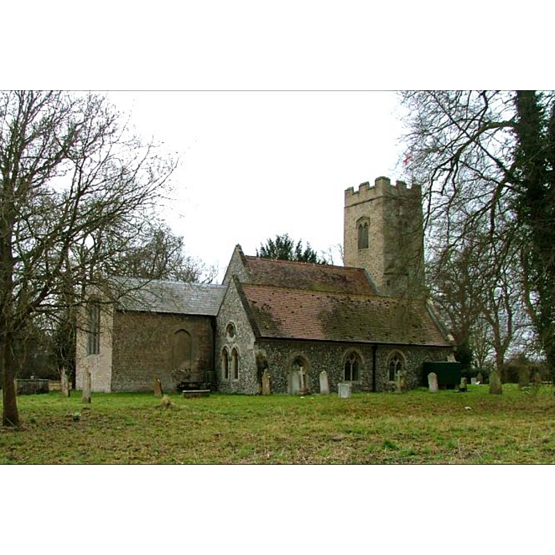
Copyright Statement: Image copyright © Simon Knott, 2006
Image Source: digital photograph taken March 2006 by Simon Knott [www.norfolkchurches.co.uk/marlingford/marlingford.htm] [accessed 18 March 2013]
Copyright Instructions: Standing permssion
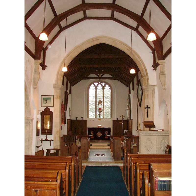
view of church interior - nave - looking west
Copyright Statement: Image copyright © Simon Knott, 2006
Image Source: digital photograph taken March 2006 by Simon Knott [www.norfolkchurches.co.uk/marlingford/marlingford.htm] [accessed 18 March 2013]
Copyright Instructions: Standing permssion
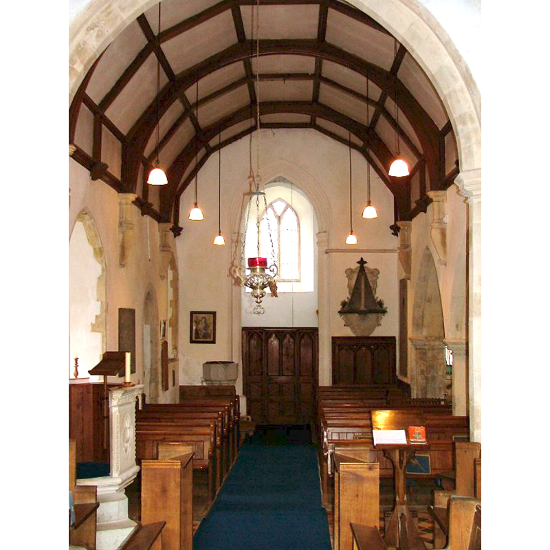
view of church interior - nave - looking east
Copyright Statement: Image copyright © Simon Knott, 2006
Image Source: digital photograph taken March 2006 by Simon Knott [www.norfolkchurches.co.uk/marlingford/marlingford.htm] [accessed 18 March 2013]
Copyright Instructions: Standing permssion
view of font base
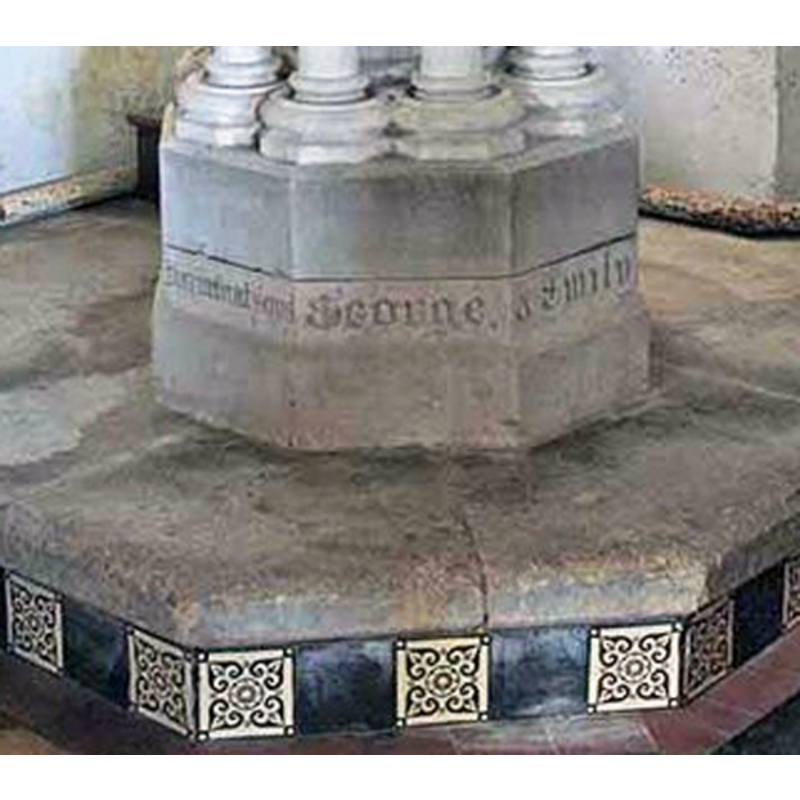
Scene Description: notice the inscription; probably of the 19th century, as the columnar base above
Copyright Statement: Image copyright © John Salmon, 2008
Image Source: digital photograph taken 9 May 2008 by John Salmon [www.geograph.org.uk/photo/807435] [accessed 18 March 2013]
Copyright Instructions: CC-BY-SA-3.0
INFORMATION
Font ID: 15125MAR
Object Type: Baptismal Font1
Font Century and Period/Style: 13th century [basin only] [composite font], Medieval [composite]
Cognate Fonts: [cf. FontNotes]
Church / Chapel Name: Parish Church of The Assumption of the Blessed Virgin Mary
Font Location in Church: Inside the church, at the W end
Church Patron Saint(s): The Assumption of St. Mary
Church Address: Church Road, Marlingford, Norfolk NR9 5HP
Site Location: Norfolk, East Anglia, England, United Kingdom
Directions to Site: Located 10 km W of Norwich
Ecclesiastic Region: Diocese of Norwich
Historical Region: Hundred of Forehoe [aka Forehou]
Additional Comments: altered font / on a new base
Font Notes:
Click to view
Blomefield (1805-1810) writes: "The Church is dedicated to the Assumption of the Virgin Mary [...] The church is 35 feet long, and 15 broad, the chancel 28 feet long, and 14 broad, the north isle 22 feet long, and 10 broad; the tower is square, there are three bells, and the nave and chancel are thatched." Blomefield (ibid.) names "Walter de Hiltone" as first recorded rector, in 1303, and the Domesday entry for 'Marthingefordam' (fol. 178) he cites mentions neither church nor priest in it. The font here is noted in Pevsner & Wilson (1999): "Octagonal, of Purbeck marble, with two shallow blank arches on each side; C13." Noted and illustrated in Knott (2006): "As is common in this part of Norfolk, the font is a Purbeck Marble bowl, reset on Victorian legs as at Easton and Swannington. It looks rather curious here, because these 'off-the-shelf' bowls were mass-produced, and were generally considered a cheap 14th century option. Here it looks out of place on such a grand setting." The columnar base is modern, as is the lower base with its inscription.
Credit and Acknowledgements: We are grateful to Simon Knott, of www.norfolkchurches.co.uk, for his photographs of this church and font
COORDINATES
UTM: 31U 374267 5832875
Latitude & Longitude (Decimal): 52.631277, 1.142176
Latitude & Longitude (DMS): 52° 37′ 52.6″ N, 1° 8′ 31.84″ E
MEDIUM AND MEASUREMENTS
Material: stone, limestone (Purbeck marble) [basin only]
Font Shape: octagonal, mounted
Basin Interior Shape: round
Basin Exterior Shape: octagonal
LID INFORMATION
Date: modern?
Material: wood
Apparatus: no
Notes: flat and round; modern
REFERENCES
- Blomefield, Francis, An essay towards a topographical history of Norfolk, 1805-1810, vol. 2: 455-460 / [www.british-history.ac.uk/report.aspx?compid=78095] [accessed 18 March 2013]
- Knott, Simon, The Norfolk Churches Site, Simon Knott, 2004. [standing permission to reproduce images received from Simon (February 2005]. URL: www.norfolkchurches.co.uk.
- Pevsner, Nikolaus, Norfolk 2: North-West and South (2nd ed.), London: Penguin, 1999, p. 534