Marham No. 1 / Mareham / Marsam
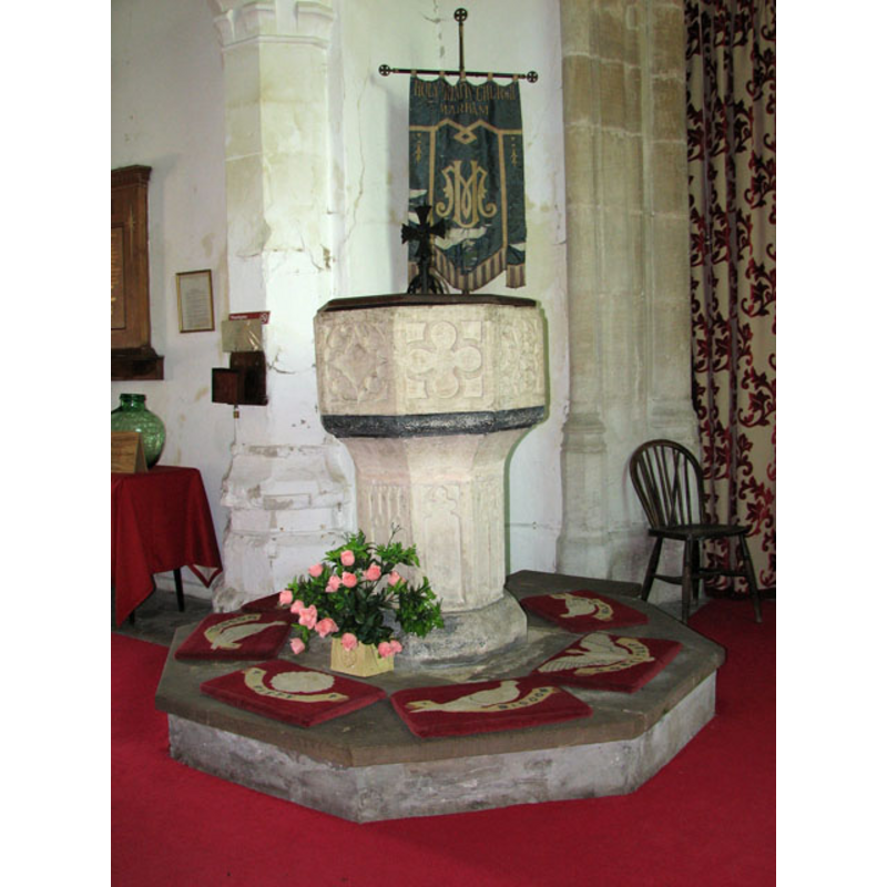
Image copyright © Evelyn Simak, 2010
CC-BY-SA-3.0
Results: 9 records
view of font and cover
Copyright Statement: Image copyright © Evelyn Simak, 2010
Image Source: digital photograph taken 6 May 2010 by Evelyn Simak [www.geograph.org.uk/photo/1846794] [accessed 21 August 2013]
Copyright Instructions: CC-BY-SA-3.0
design element - motifs - tracery
Copyright Statement: Image copyright © Evelyn Simak, 2010
Image Source: digital photograph taken 6 May 2010 by Evelyn Simak [www.geograph.org.uk/photo/1846794] [accessed 21 August 2013]
Copyright Instructions: CC-BY-SA-3.0
view of church exterior - southeast view
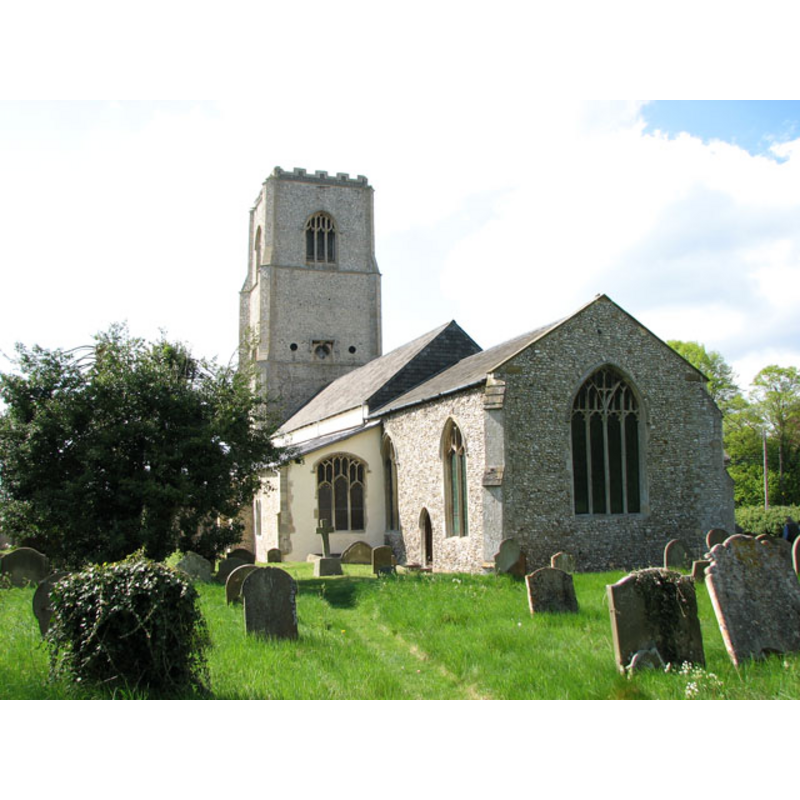
Copyright Statement: Image copyright © Evelyn Simak, 2010
Image Source: digital photograph taken 6 May 2010 by Evelyn Simak [www.geograph.org.uk/photo/1846729] [accessed 21 August 2013]
Copyright Instructions: CC-BY-SA-3.0
view of church exterior - north portal
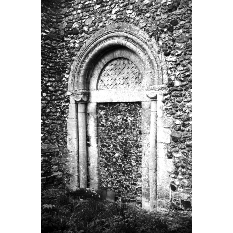
Copyright Statement: Image copyright © George Plunkett, 2013
Image Source: B&W photograph taken 14 April 1977 by George Plunkett [www.georgeplunkett.co.uk/Norfolk/M/Marham Holy Trinity church Norman N door [5742] 1977-04-14.jpg] [accessed 21 August 2013]
Copyright Instructions: Standing permission by Jonathan Plunkett
view of church exterior - southwest view
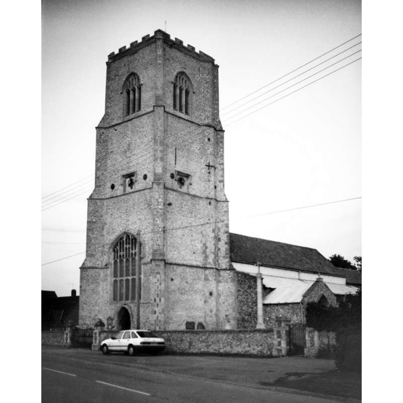
Scene Description: photograph caption: "A fine 15c west tower with quatrefoil sound-holes."
Copyright Statement: Image copyright © George Plunkett, 2013
Image Source: B&W photograph taken 28 October 1995 by George Plunkett [www.georgeplunkett.co.uk/Norfolk/M/Marham Holy Trinity church from SW [7290] 1995-10-28.jpg] [accessed 21 August 2013]
Copyright Instructions: Standing permission by Jonathan Plunkett
view of church interior - nave - looking west
Scene Description: the font is visible on the right (north) side
Copyright Statement: Image copyright © Evelyn Simak, 2010
Image Source: digital photograph taken 6 May 2010 by Evelyn Simak [www.geograph.org.uk/photo/1846793] [accessed 21 August 2013]
Copyright Instructions: CC-BY-SA-3.0
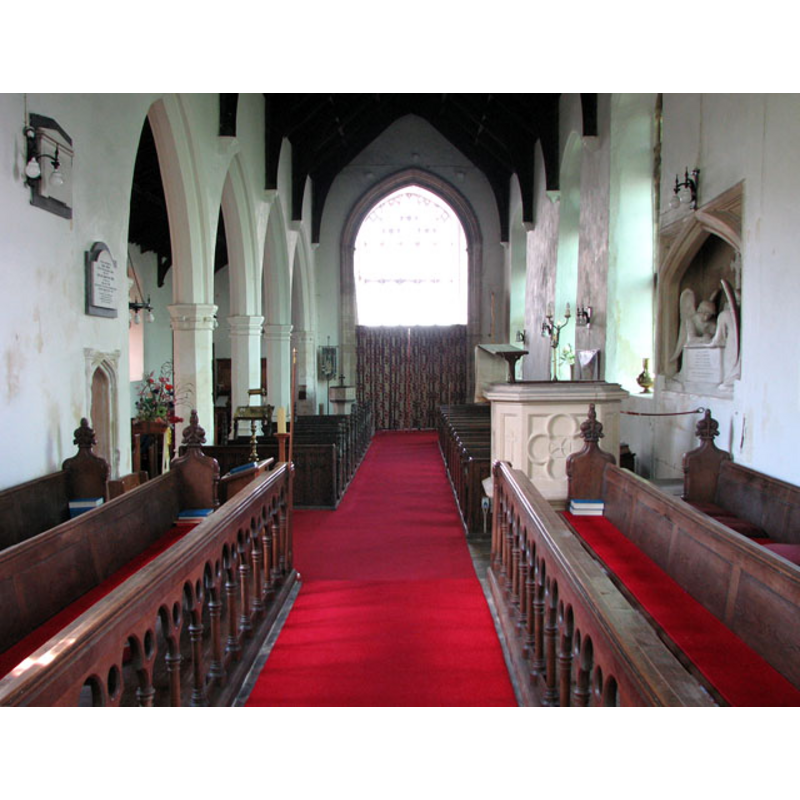
view of church interior - nave - looking east
Scene Description: the font is visible on the left (north) side
Copyright Statement: Image copyright © Evelyn Simak, 2010
Image Source: digital photograph taken 6 May 2010 by Evelyn Simak [www.geograph.org.uk/photo/1846771] [accessed 21 August 2013]
Copyright Instructions: CC-BY-SA-3.0
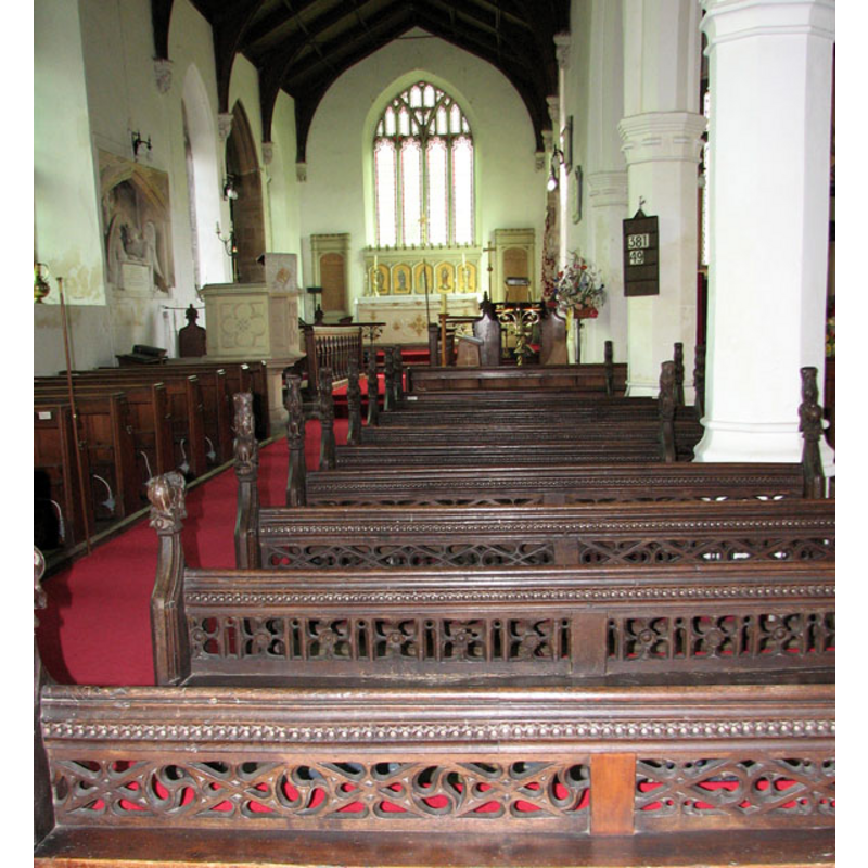
view of church interior - nave - looking southwest
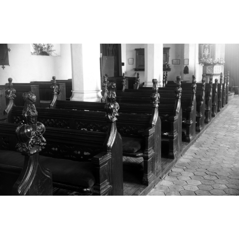
Scene Description: the font is visible at the far back (west end) -- photograph caption: "15c benches"
Copyright Statement: Image copyright © George Plunkett, 2013
Image Source: B&W photograph taken 14 April 1977 by George Plunkett [www.georgeplunkett.co.uk/Norfolk/M/Marham Holy Trinity church nave S benches [5743] 1977-04-14.jpg] [accessed 21 August 2013]
Copyright Instructions: Standing permission by Jonathan Plunkett
design element - motifs - tracery
Copyright Statement: Image copyright © Evelyn Simak, 2010
Image Source: digital photograph taken 6 May 2010 by Evelyn Simak [www.geograph.org.uk/photo/1846794] [accessed 21 August 2013]
Copyright Instructions: CC-BY-SA-3.0
INFORMATION
Font ID: 15124MAR
Object Type: Baptismal Font1
Font Century and Period/Style: 14th century, Decorated
Church / Chapel Name: Parish Church of the Holy Trinity
Font Location in Church: Inside the church, at the W end of the nave
Church Patron Saint(s): The Holy Trinity
Church Notes: Also in Marham was "The Abbey", or "Nunnery" of Marham.
The nunnery of Marham was founded by Isabell, (fn. 19) widow of Hugh de Albany Earl of Arundel, for Cistertian or White nuns, dedicated to the Virgin Mary, St. Barbara, and St. Edmund the King and Confessor, by Richard de la Wiche Bishop of Chichester, on the 27th of January, in the year 1249 [...] This house was dissolved in the 27th of Henry VIII" [i.e., 1536]
Church Address: The Street, Marham, Norfolk, PE33 9HP
Site Location: Norfolk, East Anglia, England, United Kingdom
Directions to Site: Located 12 km WNW of Swaffham
Ecclesiastic Region: Diocese of Ely
Historical Region: Hundred and hald of Clackclose
Font Notes:
Click to view
Blomefield (1805-1810) writes: "Here were formerly two churches in this town, one dedicated to St. Andrew, the other to the Holy Trinity; this last is still standing: they were rectories united and valued together [...] The patronage of the vicarages, which were consolidated, was in the priory of Westacre, [...] The Church now standing, of the Holy Trinity, has a nave, with a south isle and a chancel built of rag-stone, clunch or chalk, and covered with lead; at the west end of the nave stands a lofty four-square tower of flint stones, &c. with quoins, embattlements, &c. of freestone, with 4 bells; on the top of this tower is a wooden shaft or spire covered with lead; the length of the nave is about 63 feet, and with the south isle about 30 in breadth [...] Nicholas occurs vicar of the churches of the Holy Trinity, and St. Andrew in Marham about 1250, and John in 1294 [...] The church of St. Andrew stood in the close, near to the vicar's house, the site is still to be seen, by the wall of flint in some places; Mr. Frost, vicar, making a ditch here, found several human bones and a stone coffin. This church was standing, as appears by a will, in 1428." The font here is described in Pevsner & Wilson (1999): "Octagonal, Perp[endicular], with a variety of blank tracery motifs on stem and bowl. On the stem it is instructive to see that they include tracery motifs of c. 1300 and of c. 1330." In Knott (2009): "the font is a fairly spectacular example of the early 14th Century, its panels depicting a variety of Decorated tracery." [NB: there was a second parish church, St. Andrew's, of which "only a few carved architectural fragments remain -- Holy Trinity goes back to Norman times, St. Andrew's may have been medieval, and there had been a 13th-century nunnery here, but we have no information on the early fonts of these buildings]
COORDINATES
UTM: 31U 332526 5837209
Latitude & Longitude (Decimal): 52.658931, 0.523764
Latitude & Longitude (DMS): 52° 39′ 32.15″ N, 0° 31′ 25.55″ E
MEDIUM AND MEASUREMENTS
Material: stone
Font Shape: octagonal, mounted
Basin Interior Shape: round
Basin Exterior Shape: octagonal
LID INFORMATION
Date: modern?
Material: wood, oak?
Apparatus: no
Notes: octagonal, flat and plain; metal cross finial
REFERENCES
- Blomefield, Francis, An essay towards a topographical history of Norfolk, 1805-1810, vol. 7: 374-393 / [www.british-history.ac.uk/report.aspx?compid=78367] [accessed 21 August 2013]
- Pevsner, Nikolaus, Norfolk 2: North-West and South (2nd ed.), London: Penguin, 1999, p. 533