Little Massingham / Marsingham / Masincham / Massingham Parva
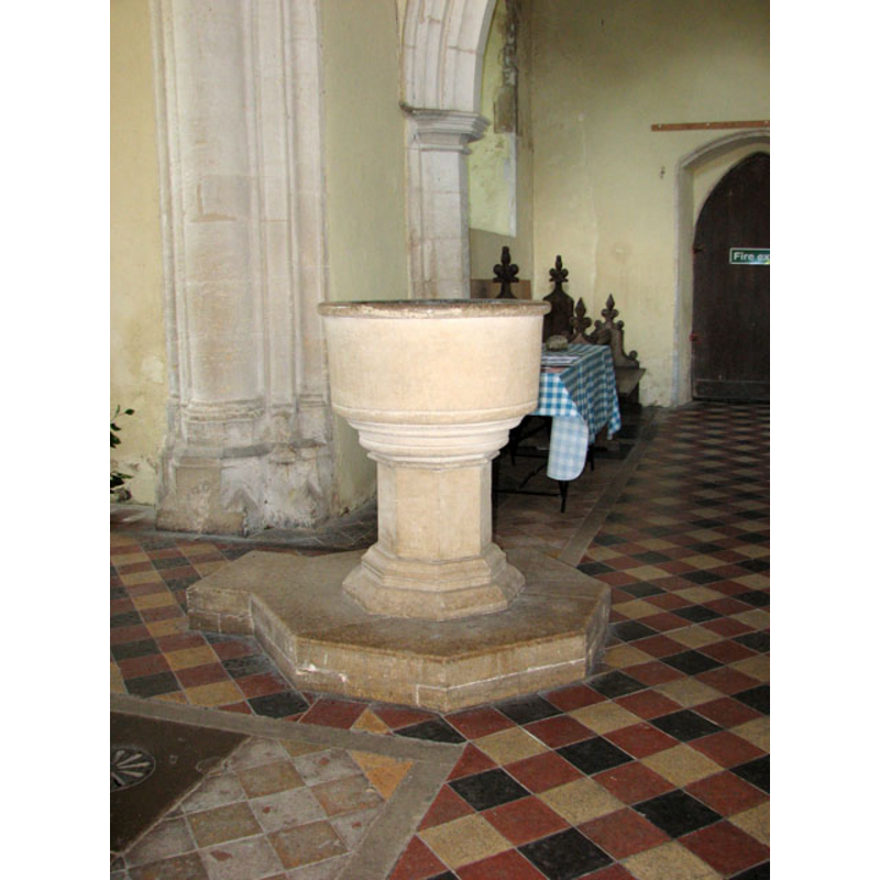
Image copyright © Evelyn Simak, 2010
CC-BY-SA-3.0
Results: 5 records
view of font in context
Scene Description: the modern font [cf. FontNotes]
Copyright Statement: Image copyright © Evelyn Simak, 2010
Image Source: digital photograph taken 17 June 2010 by Evelyn Simak [www.geograph.org.uk/photo/1921294] [accessed 21 November 2013]
Copyright Instructions: CC-BY-SA-3.0
view of church exterior - southwest view
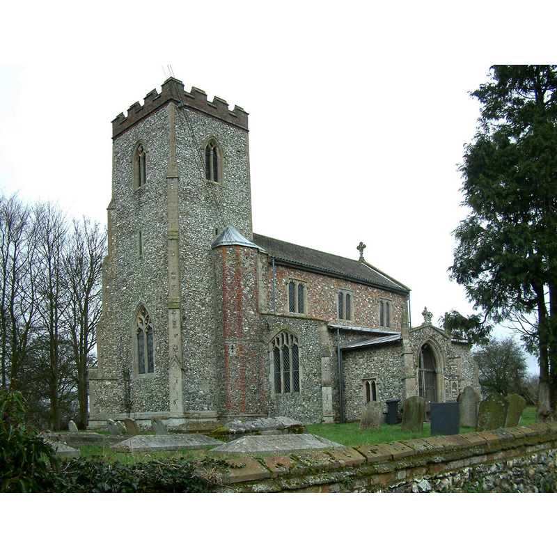
Copyright Statement: Image copyright © [in the public domain]
Image Source: digital photograph taken 15 February 2004 by Op. Deo [http://en.wikipedia.org/wiki/File:StAndrewsLittleMassingham.jpg] [accessed 21 November 2013]
Copyright Instructions: Released by its author into the public domain
view of church exterior - southeast view
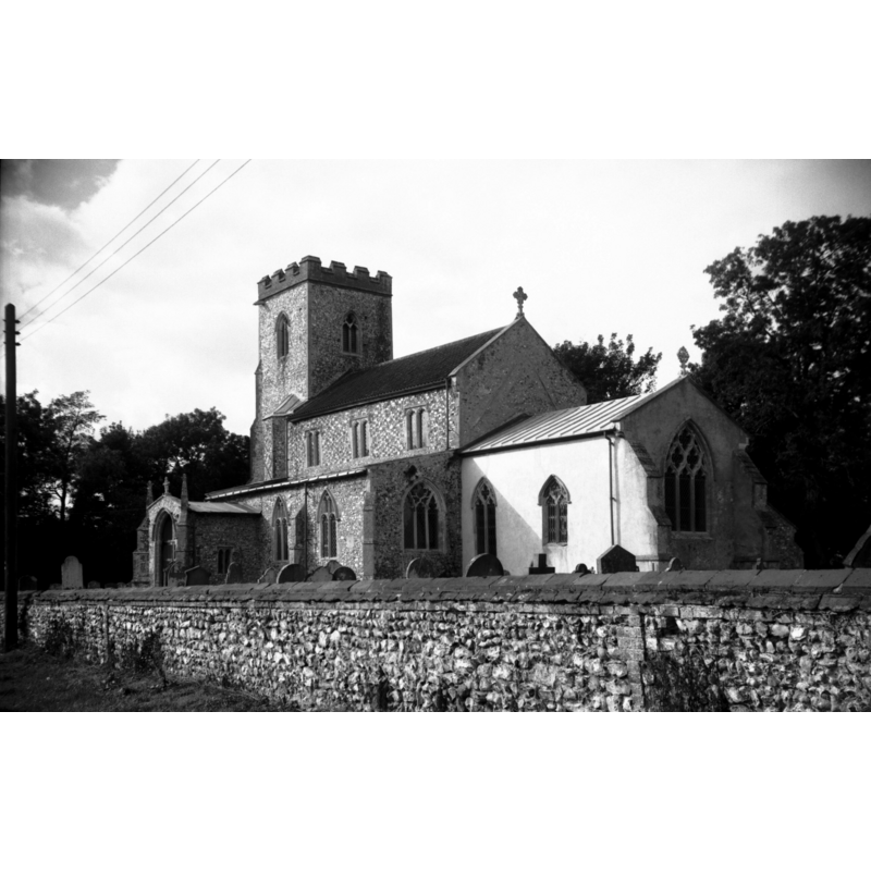
Scene Description: Photo caption: "14c tower and 15c porch"
Copyright Statement: Image copyright © George Plunkett, 2013
Image Source: B&W photograph taken 30 September 1995 by George Plunkett [www.georgeplunkett.co.uk/Norfolk/L/Lt Massingham St Andrew's church from SE [7260] 1995-09-30.jpg] [accessed 21 November 2013]
Copyright Instructions: Standing permission by Jonathan Plunkett
view of church interior - nave - looking west
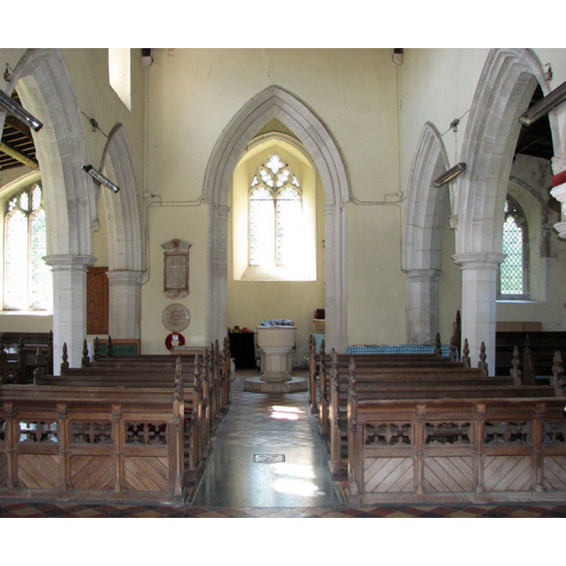
Copyright Statement: Image copyright © Evelyn Simak, 2010
Image Source: digital photograph taken 17 June 2010 by Evelyn Simak [www.geograph.org.uk/photo/1921289] [accessed 21 November 2013]
Copyright Instructions: CC-BY-SA-3.0
view of church interior - nave - looking east
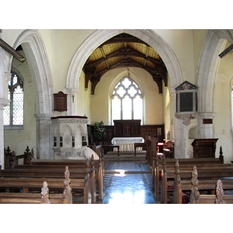
Copyright Statement: Image copyright © Evelyn Simak, 2010
Image Source: digital photograph taken 17 June 2010 by Evelyn Simak [www.geograph.org.uk/photo/1921256] [accessed 21 November 2013]
Copyright Instructions: CC-BY-SA-3.0
INFORMATION
Font ID: 15120MAS
Object Type: Baptismal Font1?
Font Century and Period/Style: 13th century (late?), Medieval
Church / Chapel Name: Parish Church of St. Andrew
Church Patron Saint(s): St. Andrew
Church Address: Church Lane, Little Massingham, Norfolk PE32 2JT
Site Location: Norfolk, East Anglia, England, United Kingdom
Directions to Site: Located just N of Great Massingham, 20 km ENE of King's Lynn
Ecclesiastic Region: Diocese of Norwich
Historical Region: Hundred of Freebridge
Additional Comments: disappeared font? (the one from the late-13thC church here)
Font Notes:
Click to view
Massingham has seven entries in the Domesday survey [under variant spellings] [http://domesdaymap.co.uk/place/XX0000/great-and-little-massingham/] [accessed 21 November 2013], but mentions neither church nor cleric in it. Blomefield (1805-1810) writes: "At the survey no distinction is made of the townships of Great and Little Massingham, so that it seems at that time to be undivided [...] The Church is dedicated to St. Andrew [...] Reginald occurs rector in the 22d of Edward I" [i.e., 1294]. The present font is illustrated in Knott (2006). It consists of a roughly cylindrical basin with a prominent rim moulding, the lower side with another moulding, and the underbowl also moulded; plain octagonal stem; moulded octagonal lower base; on an octagonal plinth. The font appears modern, probably of the mid-19th century renovation. [NB: the church goes back to at least the late 13th century, but we have no information on the earlier font(s)]
COORDINATES
UTM: 31U 341971 5850935
Latitude & Longitude (Decimal): 52.785062, 0.656677
Latitude & Longitude (DMS): 52° 47′ 6.22″ N, 0° 39′ 24.04″ E
REFERENCES
- Blomefield, Francis, An essay towards a topographical history of Norfolk, 1805-1810, vol. 9: 13-20 / [www.british-history.ac.uk/report.aspx?compid=78500] [accessed 21 November 2013]
- Knott, Simon, The Norfolk Churches Site, Simon Knott, 2004. [standing permission to reproduce images received from Simon (February 2005]. URL: www.norfolkchurches.co.uk.