Larling / Larlingford / Lerling / Lerlingford / Lirling / Lurling / Lurlinga
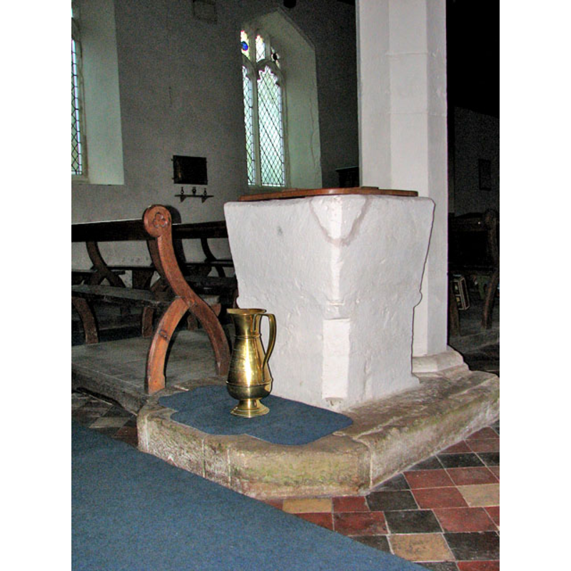
Image copyright © Evelyn Simak, 2010
CC-BY-SA-3.0
Results: 7 records
view of font and cover - southwest side
Copyright Statement: Image copyright © Evelyn Simak, 2010
Image Source: digital photograph taken 13 February 2010 by Evelyn Simak [www.geograph.org.uk/photo/1709788] [accessed 27 February 2013]
Copyright Instructions: CC-BY-SA-3.0
view of font and cover in context
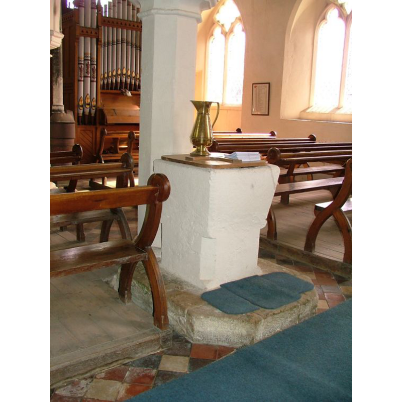
Copyright Statement: Image copyright © Simon Knott, 2006
Image Source: digital photograph taken 9 September 2006 by Simon Knott [www.norfolkchurches.co.uk/larling/larling.htm] [accessed 10 August 2009]
Copyright Instructions: Standing permission
view of church exterior - south portal
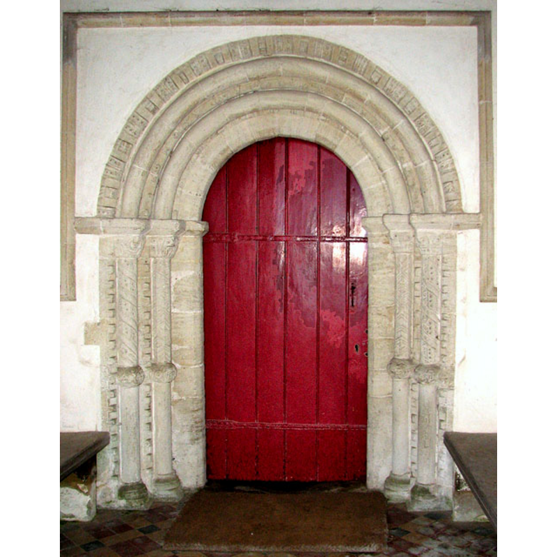
Copyright Statement: Image copyright © Evelyn Simak, 2010
Image Source: digital photograph taken 13 February 2010 by Evelyn Simak [www.geograph.org.uk/photo/1709779] [accessed 27 February 2013]
Copyright Instructions: CC-BY-SA-3.0
view of church exterior - south view
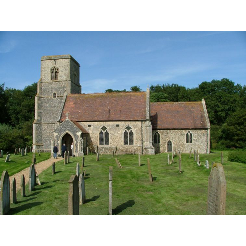
Copyright Statement: Image copyright © Simon Knott, 2006
Image Source: digital photograph taken 9 September 2006 by Simon Knott [www.norfolkchurches.co.uk/larling/larling.htm] [accessed 27 February 2013]
Copyright Instructions: Standing permission
view of church interior - nave - looking west
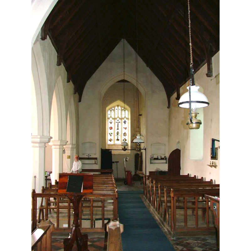
Copyright Statement: Image copyright © Simon Knott, 2006
Image Source: digital photograph taken 9 September 2006 by Simon Knott [www.norfolkchurches.co.uk/larling/larling.htm] [accessed 27 February 2013]
Copyright Instructions: Standing permission
view of church interior - nave - looking east
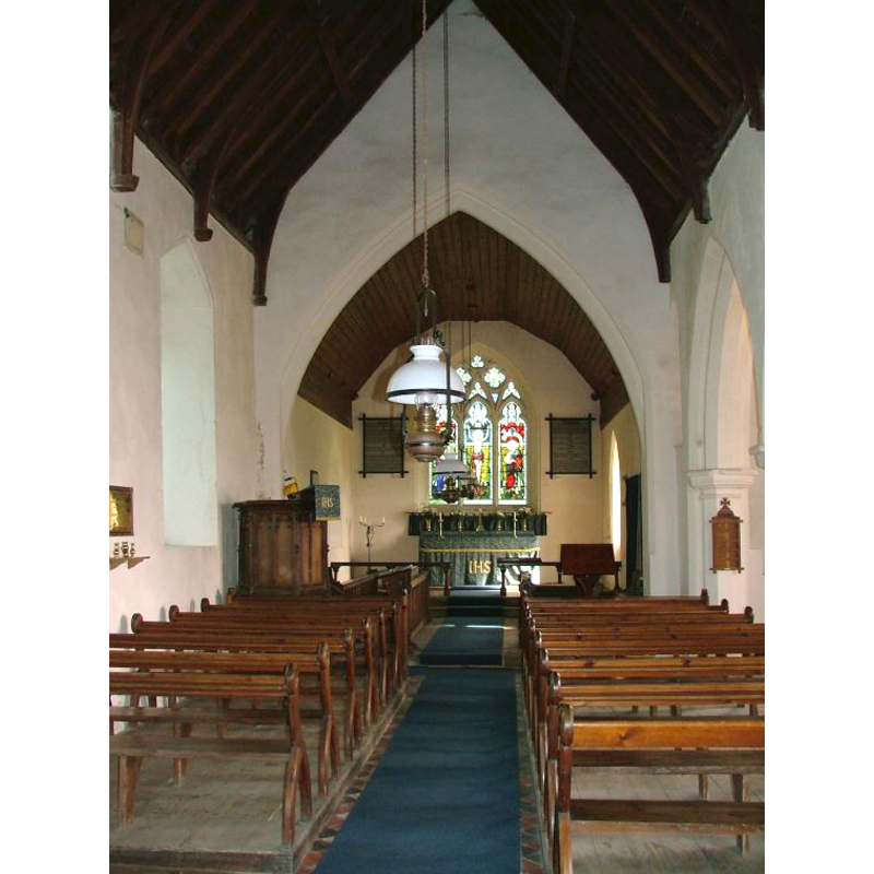
Copyright Statement: Image copyright © Simon Knott, 2006
Image Source: digital photograph taken 9 September 2006 by Simon Knott [www.norfolkchurches.co.uk/larling/larling.htm] [accessed 27 February 2013]
Copyright Instructions: Standing permission
view of font - west side

Copyright Statement: Image copyright © CRSBI, 2008
Image Source: B&W photograph in the CRSBI (2008) [www.crsbi.ac.uk/search/county/site/ed-nf-larli.html] [accessed 27 February 2013]
Copyright Instructions: PERMISSION NOT AVAILABLE -- IMAGE NOT FOR PUBLIC USE
INFORMATION
Font ID: 15114LAR
Object Type: Baptismal Font1
Font Century and Period/Style: 12th - 13th century, Medieval
Church / Chapel Name: Parish Church of St. Ethelbert
Font Location in Church: Inside the church, against a pillar at the W end of the arcade between the nave and the S aisle
Church Patron Saint(s): St. Ethelbert [aka Æthelberht]
Church Address: Larling and Roudham, Norfolk NR16 2QT
Site Location: Norfolk, East Anglia, England, United Kingdom
Directions to Site: Located 14 km ENE of Thetford
Ecclesiastic Region: Diocese of Norwich
Historical Region: Hundred of Shropham
Additional Comments: painted / whitewashed font
Font Notes:
Click to view
Blomefield (1805-1810) writes: "The Church is dedicated to St. Ethelbert, and is a rectory valued at 10l. 2d. ob. in the King's Books, and pays 1l. 1q. yearly tenths, and 12d. synodals; it hath a rectory-house and glebe belonging to it. [...] The church and chancel are thatched, the tower is square, and hath three bells". Blomfield (ibid.) further notes the first reported rector of this church, "Will. de Lerling, rector, and lord of Lerling and Elveden", in 1280. He further notes that there were two manors here at the time of the Confessor [d. 1066], and the corresponding entries in the Domesday survey, both cited in Blomefield (ibid.), mention neither church nor priest in them. A font here is described in Pevsner & Wilson (1999): "A square early C13 block with chamfered corners." Described in Knott 2006) as a "primitive font." The CRSBI (200*) writes: "The font is described in Pevsner as 'early 13th-century'. Chamfered angles with simple stop-chamfers can be found elsewhere in the county in a 12thc.context, for example on the internal jambs of the W portal of Norwich Cathedral." The Parish site [www.eastharling.com/larling.html] [accessed 10 August 2009] describes the suare basin as "a simple 12th century Norman example". The font appears monolithic, now totally covered in whitewash; the upper volume is square but irregular, one of the sides [not the one against the pillar, as might be expected] vertical and flush with the square base, the others tapering to a mould on the lower basin; the lower volume has chamfered angles; stands on a square plinth agaisnt one of the pillars at the west end of the nave. The wooden cover is square, flat and modern, with a flat cross ornament.
Credit and Acknowledgements: We are grateful to Simon Knott, of www.norfolkchurches.co.uk, for his photographs of this church and font
COORDINATES
UTM: 31U 358538 5815308
Latitude & Longitude (Decimal): 52.469582, 0.917406
Latitude & Longitude (DMS): 52° 28′ 10.49″ N, 0° 55′ 2.66″ E
MEDIUM AND MEASUREMENTS
Material: stone
Font Shape: square, mounted
Basin Exterior Shape: square
Basin Total Height: 41 cm*
Height of Base: 41 cm*
Font Height (less Plinth): 82 cm*
Square Base Dimensions: 56 x 56 cm*
Trapezoidal Basin: 68 x 68 cm*
Notes on Measurements: * [CRSBI (2008)]
LID INFORMATION
Date: modern
Material: wood
Apparatus: no
Notes: [cf. FontNotes]
REFERENCES
- Blomefield, Francis, An essay towards a topographical history of Norfolk, 1805-1810, vol. 1: 428-432 / [www.british-history.ac.uk/report.aspx?compid=77129] [accessed 27 February 2013]
- Corpus of Romanesque Sculpture in Britain and Ireland, The Corpus of Romanesque Sculpture in Britain and Ireland, The Corpus of Romanesque Sculpture in Britain and Ireland. URL: http://www.crsbi.ac.uk.
- Knott, Simon, The Norfolk Churches Site, Simon Knott, 2004. [standing permission to reproduce images received from Simon (February 2005]. URL: www.norfolkchurches.co.uk.
- Pevsner, Nikolaus, Norfolk 2: North-West and South (2nd ed.), London: Penguin, 1999, p. 515