Langford nr. Brandon / Langafordham
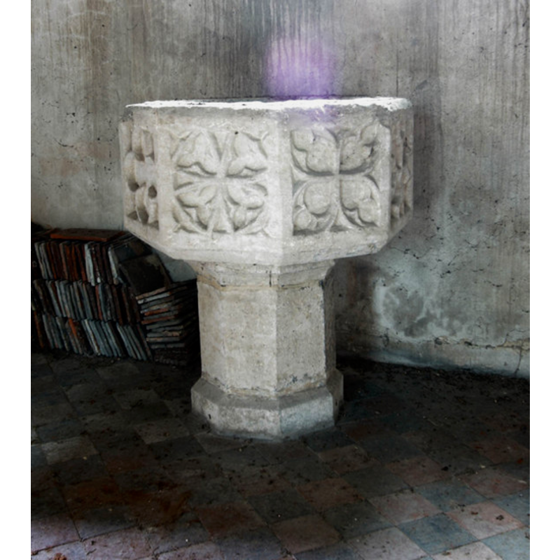
Image copyright © John Salmon, 2010
CC-BY-SA-3.0
Results: 4 records
design element - motifs - tracery - varied
Copyright Statement: Image copyright © John Salmon, 2010
Image Source: digital photograph taken 24 August 2010 by John Salmon [www.geograph.org.uk/photo/2038428] [accessed 2 May 2012]
Copyright Instructions: CC-BY-SA-3.0
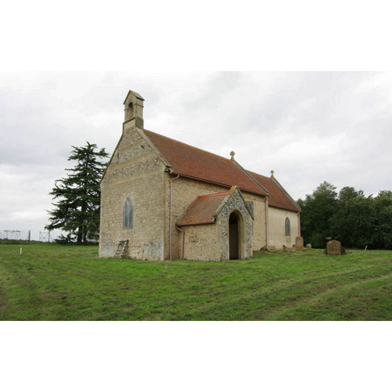
view of church exterior - southwest view
Copyright Statement: Image copyright © John Salmon, 2010
Image Source: digital photograph taken 24 August 2010 by John Salmon [www.geograph.org.uk/photo/2038423] [accessed 2 May 2012]
Copyright Instructions: CC-BY-SA-3.0
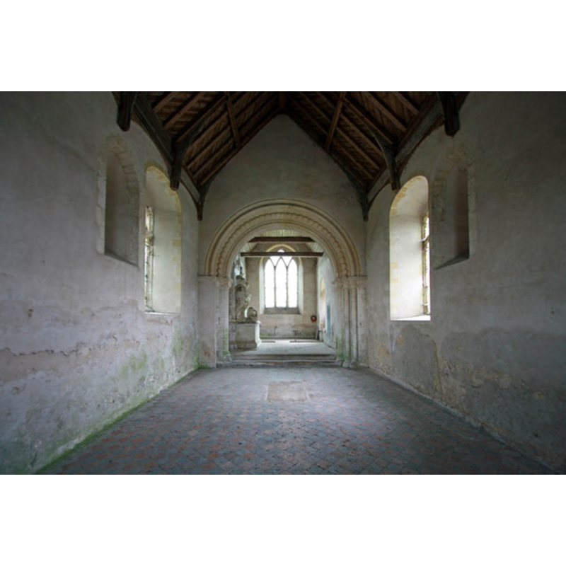
view of church interior - nave - looking east
Copyright Statement: Image copyright © John Salmon, 2010
Image Source: digital photograph taken 24 August 2010 by John Salmon [www.geograph.org.uk/photo/2038406] [accessed 2 May 2012]
Copyright Instructions: CC-BY-SA-3.0
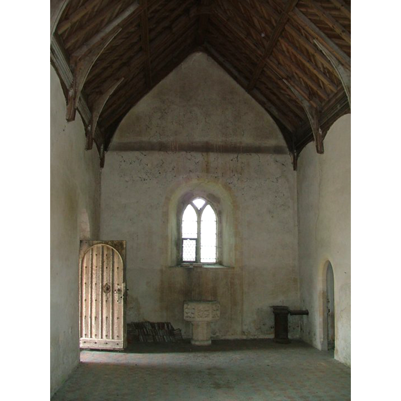
view of church interior - nave - looking west
Scene Description: the font at the west end of the nave
Copyright Statement: Image copyright © Simon Knott, 2004
Image Source: digital photograph taken by Simon Knott [http://www.norfolkchurches.co.uk/langford/langford.htm] [accessed 10 August 2009]
Copyright Instructions: Standing permission
INFORMATION
Font ID: 15112LAN
Object Type: Baptismal Font1
Font Century and Period/Style: 14th century, Decorated
Church / Chapel Name: Parish Church of St. Andrew [disused]
Font Location in Church: Inside the church, at the W end of the nave
Church Patron Saint(s): St. Andrew
Church Notes: NB: the church is inside a military training area evacuated in 1942 and still used by the military; special permission from the MoD may be required to visit the site
Church Address: [cf. Directions to site]
Site Location: Norfolk, East Anglia, England, United Kingdom
Directions to Site: Located 12 km NNE of Brandon, 13 km S of Swaffham [NB: the church is inside the STANTA military battle training area, with restricted access requiring permission from the Ministry of Defence]
Ecclesiastic Region: Diocese of Norwich
Additional Comments: disused font
Font Notes:
Click to view
Blomefield (1805-1810) writes: "The church of Langford is dedicated to St. Andrew, and stands near to the manor-house, on the west side of it, and is an ancient fabrick of flint, as appears from the old Gothick arch over the south door, and from the arch that divides the church from the chancel; it is a single building, covered with tiles, as the chancel is, which is camerated and plaistered; at the west end is a square tower embattled, in which hangs one bell." Blomfield (ibid.) names "John de Boyton" first recorded rector, in 1311. The present font is noted in Pevsner & Wilson (1999): "Font. Octagonal, big, with good C14 tracery motifs." The font is noted and illustrated in the context of the disused church in Knott (2004). It consists of an octagonal basin with vertical sides decorated with varied quatrefoil tracery motifs, raised on an octagonal pedestal base.
Credit and Acknowledgements: We are grateful to Simon Knott, of www.norfolkchurches.co.uk, for his photograph of this church
COORDINATES
UTM: 31U 344567 5823112
Latitude & Longitude (Decimal): 52.535887, 0.70826
Latitude & Longitude (DMS): 52° 32′ 9.19″ N, 0° 42′ 29.74″ E
MEDIUM AND MEASUREMENTS
Material: stone
Font Shape: octagonal, mounted
Basin Interior Shape: round
Basin Exterior Shape: octagonal
REFERENCES
- Blomefield, Francis, An essay towards a topographical history of Norfolk, 1805-1810, vol. 6: 20-26 / [www.british-history.ac.uk/report.aspx?compid=78224] [accessed 7 May 2013]
- Knott, Simon, The Norfolk Churches Site, Simon Knott, 2004. [standing permission to reproduce images received from Simon (February 2005]. URL: www.norfolkchurches.co.uk.
- Pevsner, Nikolaus, Norfolk 2: North-West and South (2nd ed.), London: Penguin, 1999, p. 509