Kirstead
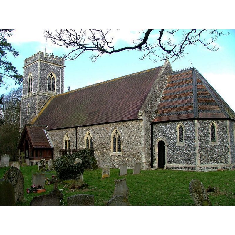
Image copyright © Simon Knott, 2006
Standing permission
Results: 5 records
view of church exterior - southeast view
Copyright Statement: Image copyright © Simon Knott, 2006
Image Source: digital photograph March 2006 taken by Simon Knott [www.norfolkchurches.co.uk/kirstead/kirstead.htm] [accessed 4 March 2014]
Copyright Instructions: Standing permission
view of church exterior - south portal
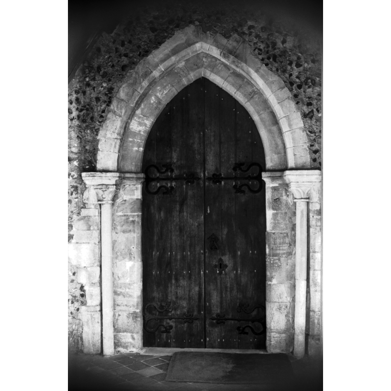
Copyright Statement: Image copyright © George Plunkett, 2014
Image Source: B&W photograph taken 21 May 1977 taken by George Plunkett [www.georgeplunkett.co.uk/Norfolk/K/Kirstead St Margaret's church 12c south door [5804] 1977-05-28.jpg] [accessed 4 March 2014]
Copyright Instructions: Standing permission by Jonathan Plunkett
view of church exterior - southeast view
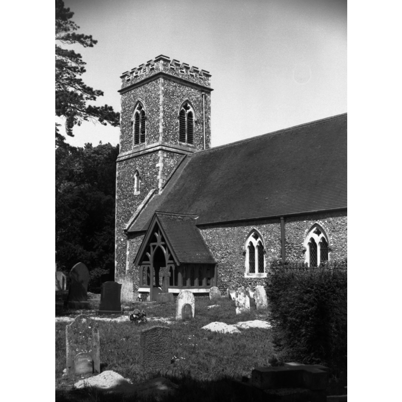
Copyright Statement: Image copyright © George Plunkett, 2014
Image Source: B&W photograph taken 21 May 1977 taken by George Plunkett [www.georgeplunkett.co.uk/Norfolk/K/Kirstead St Margaret's church from SE [5806] 1977-05-28.jpg] [accessed 4 March 2014]
Copyright Instructions: Standing permission by Jonathan Plunkett
view of church interior - nave - looking west
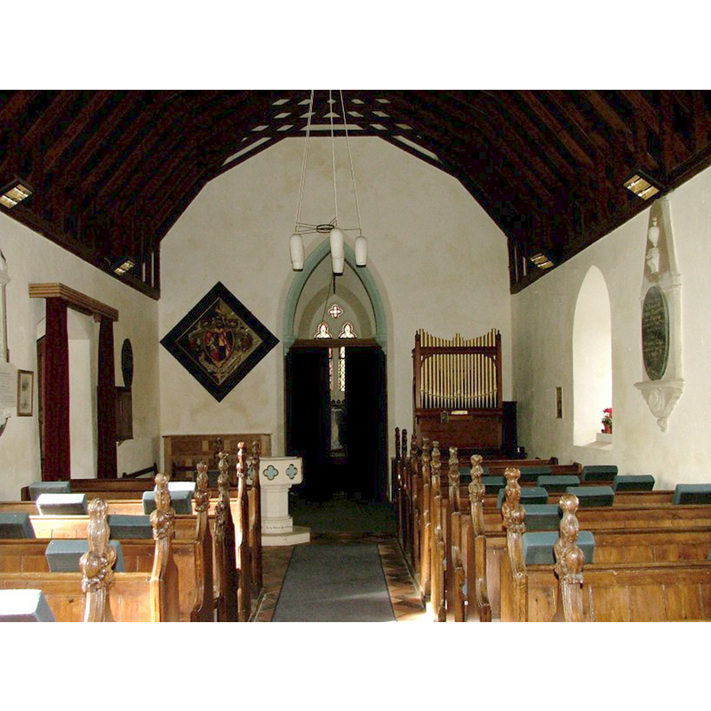
Copyright Statement: Image copyright © Simon Knott, 2006
Image Source: digital photograph March 2006 taken by Simon Knott [www.norfolkchurches.co.uk/kirstead/kirstead.htm] [accessed 4 March 2014]
Copyright Instructions: Standing permission
view of church interior - nave - looking east
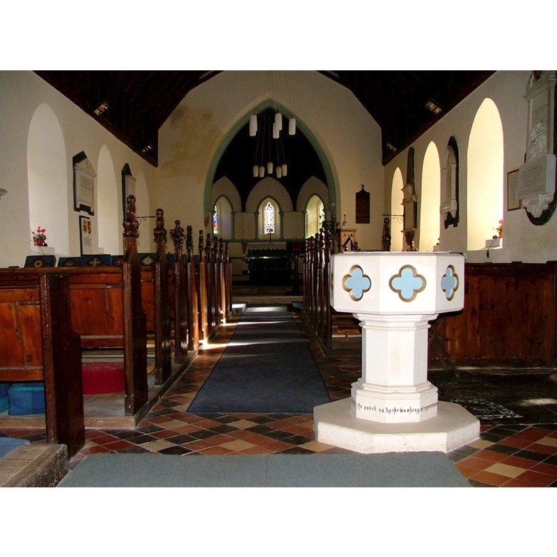
Scene Description: the modern font in the foreground
Copyright Statement: Image copyright © Simon Knott, 2006
Image Source: digital photograph March 2006 taken by Simon Knott [www.norfolkchurches.co.uk/kirstead/kirstead.htm] [accessed 4 March 2014]
Copyright Instructions: Standing permission
INFORMATION
Font ID: 15111KIR
Object Type: Baptismal Font1?
Font Century and Period/Style: 11th century, Norman
Church / Chapel Name: Parish Church of St. Margaret
Church Patron Saint(s): St. Margaret of Antioch [aka Margaret the Virgin, Marina]
Church Address: Church Road, Kirstead, Norfolk NR15 1ER
Site Location: Norfolk, East Anglia, England, United Kingdom
Directions to Site: Located 13 km SSE of Norwich
Ecclesiastic Region: Diocese of Norwich
Historical Region: Hundred of Loddon
Additional Comments: disappeared font? (the one from the Domesday-time church here)
Font Notes:
Click to view
There is an entry for Kirstead in the Domesday survey [http://domesdaymap.co.uk/place/TM2798/kirstead/] [accessed 4 March 2014], with a church and church lands mentioned in it. Blomefield (1805-1810) writes: "The church of Kirsted is a rectory, dedicated to St. Margaret [...] In the reign of Edward I [i.e., 1272-1307] the rector of Kirsted had a grange and 20 acres of land". The present font is illustrated in Knott (2006): an overall octagonal font in the late-medieval style but made by the Victorians; the quatrefoils on the basin sides are painted blue; the whole font is white and has a painted inscription around the lower base. [NB: Domesday mentions a church, and Pevsner & Wilson (1999) note that the south doorway is late-12th century, but we have no information on the font of the early church here].
Credit and Acknowledgements: We are grateful to Simon Knott, of Norfolk Churches [www.norfolkchurches.co.uk], for his photographs of this church and modern font; we are also grateful to Jonathan Plunkett for the photographs of this church, taken by his father, George Plunkett, in May 1977
COORDINATES
UTM: 31U 390396 5821876
Latitude & Longitude (Decimal): 52.53593, 1.384027
Latitude & Longitude (DMS): 52° 32′ 9.35" N, 1° 23′ 2.5″ E
REFERENCES
- Blomefield, Francis, An essay towards a topographical history of Norfolk, 1805-1810, vol. 10: 162-165 / [www.british-history.ac.uk/report.aspx?compid=78650] [accessed 4 March 2014]
- Knott, Simon, The Norfolk Churches Site, Simon Knott, 2004. [standing permission to reproduce images received from Simon (February 2005]. URL: www.norfolkchurches.co.uk.
- Pevsner, Nikolaus, Norfolk 2: North-West and South (2nd ed.), London: Penguin, 1999, p. 509