Intwood / Intewida / Intweda
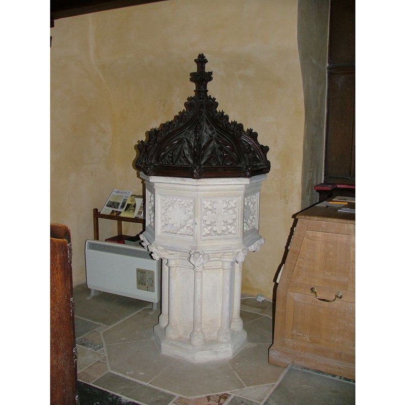
Image copyright © Simon Knott, 2007
Standing permission
Results: 4 records
view of font and cover
Scene Description: the modern font and cover
Copyright Statement: Image copyright © Simon Knott, 2007
Image Source: digital photograph taken 25 March 2007 by Simon Knott [www.norfolkchurches.co.uk/intwood/intwood.htm] [accessed 20 March 2013]
Copyright Instructions: Standing permission
view of church exterior - west view
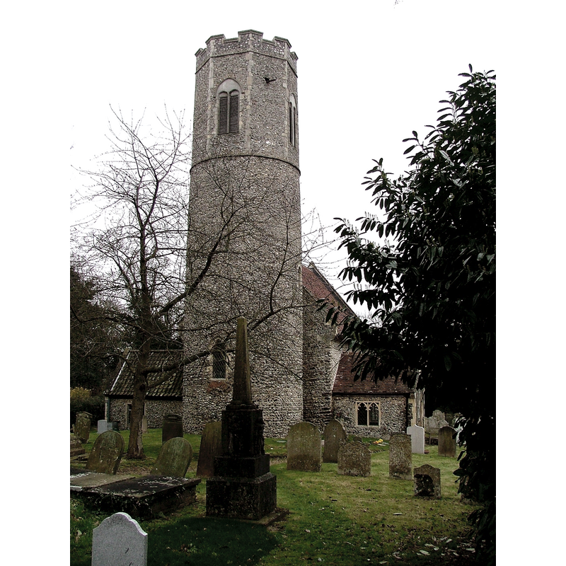
Copyright Statement: Image copyright © Simon Knott, 2007
Image Source: digital photograph taken 25 March 2007 by Simon Knott [www.norfolkchurches.co.uk/intwood/intwood.htm] [accessed 20 March 2013]
Copyright Instructions: Standing permission
view of church interior - nave - looking west
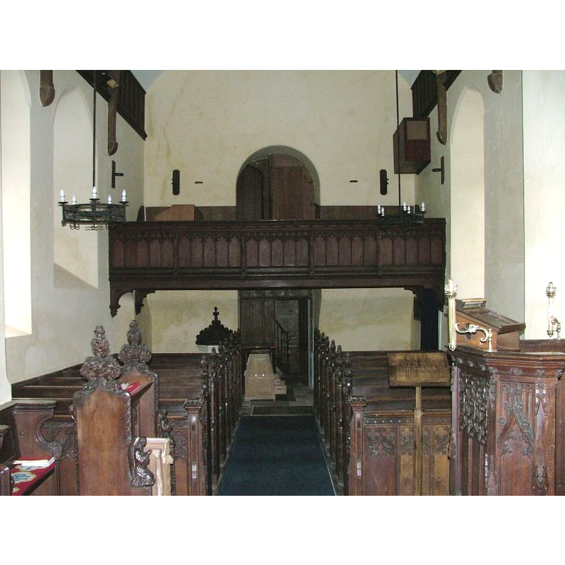
Scene Description: the top of the modern font and cover are visible at the back (west end), behind the left (south) bank of benches
Copyright Statement: Image copyright © Simon Knott, 2007
Image Source: digital photograph taken 25 March 2007 by Simon Knott [www.norfolkchurches.co.uk/intwood/intwood.htm] [accessed 20 March 2013]
Copyright Instructions: Standing permission
view of church interior - nave - looking east
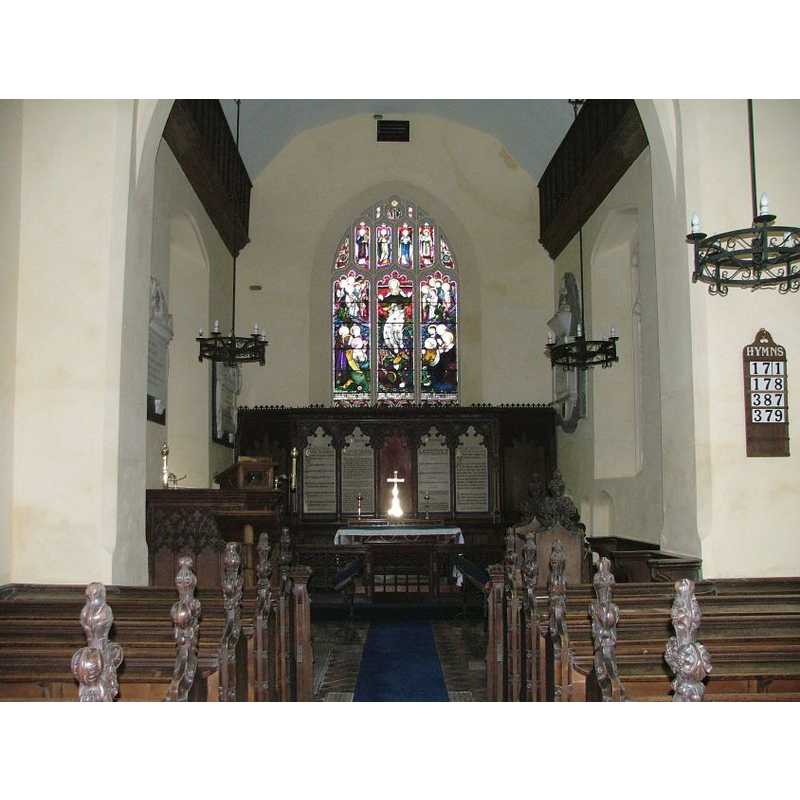
Copyright Statement: Image copyright © Simon Knott, 2007
Image Source: digital photograph taken 25 March 2007 by Simon Knott [www.norfolkchurches.co.uk/intwood/intwood.htm] [accessed 20 March 2013]
Copyright Instructions: Standing permission
INFORMATION
Font ID: 15101INT
Object Type: Baptismal Font1
Font Century and Period/Style: 11th century, Norman
Church / Chapel Name: Parish Church of All Saints
Church Patron Saint(s): All Saints
Church Notes: round-tower church -- church here noted in Domesday [cf. FontNotes]
Church Address: Intwood, Norfolk NR4 6TG
Site Location: Norfolk, East Anglia, England, United Kingdom
Directions to Site: Located 6 km SWS of Norwich
Ecclesiastic Region: Diocese of Norwich
Historical Region: Hundred of Humble-Yard
Additional Comments: disappeared font? (the font from the Domesday-time church here)
Font Notes:
Click to view
Blomefield (1805-1810) writes: "The church, which is dedicated to all the Sain's, and hath a nave 11 yards long and 6 yards wide, with a chancel and south porch, all tiled; a steeple, round at bottom and octangular at top, in which are two bells. [...] By the font there are two stones for, Robert Hammond Gent. 15 Aug. 1678", and names "Robert de Tivile, rector", i.e., first recorded rector, in 1275. The Domesday entry (fol. 237) cited in Blomefield (ibid.) reports a church with some land ["i. ecclesia de xiii.acr. terre"] in 'Intweda'/ 'Intewida. The present baptismal font, illustrated in Knott (2007), consists of an octagonal basin with cusped panels and heavily moulded and an octagonal pedestal base with attached colonnettes; the underbowl has angel demi-figures at the angles. The low-dome wooden cover constrasts in its darkness with the light stone of the font itself. Both are modern, perhaps from the mid-19th century restoration of the church which, originally, may date from the 12th century [NB: we have no information on the font from the Domesday-time church here].
COORDINATES
UTM: 31U 380813 5828152
Latitude & Longitude (Decimal): 52.590313, 1.240544
Latitude & Longitude (DMS): 52° 35′ 25.13″ N, 1° 14′ 25.96″ E
LID INFORMATION
Date: modern?
Material: wood
Apparatus: no
Notes: a mid-dome profusely carved and crocketed; appears modern
REFERENCES
- Blomefield, Francis, An essay towards a topographical history of Norfolk, 1805-1810, vol. 5: 39-43 / [www.british-history.ac.uk/report.aspx?compid=78149] [accessed 20 March 2013]
- Knott, Simon, The Norfolk Churches Site, Simon Knott, 2004. [standing permission to reproduce images received from Simon (February 2005]. URL: www.norfolkchurches.co.uk.