Howe / Hou
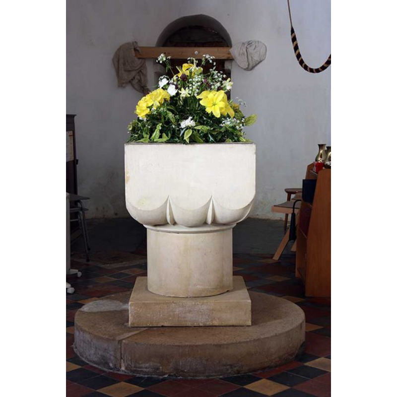
Image copyright © John Salmon, 2009
CC-BY-SA-3.0
Results: 6 records
view of font
Scene Description: the modern font [cf. FontNotes]
Copyright Statement: Image copyright © John Salmon, 2009
Image Source: digital photograph taken 24 April 2009 by John Salmon [www.geograph.org.uk/photo/1278824] [accessed 11 September 2013]
Copyright Instructions: CC-BY-SA-3.0
view of church exterior - south view
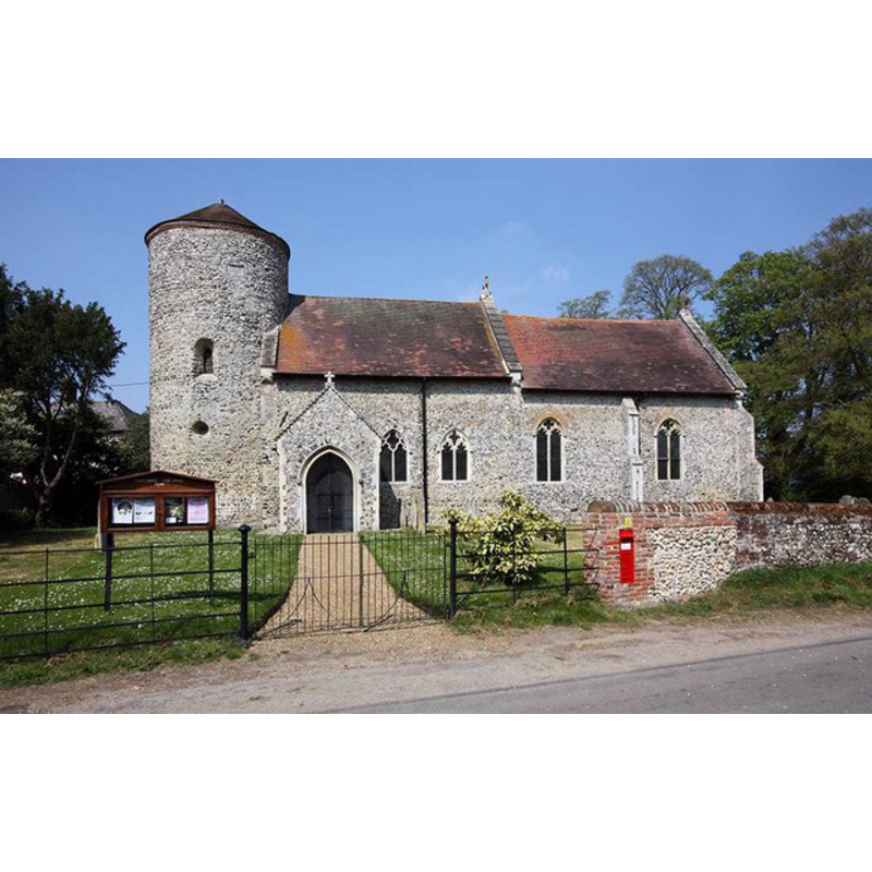
Copyright Statement: Image copyright © John Salmon, 2009
Image Source: digital photograph taken 24 April 2009 by John Salmon [www.geograph.org.uk/photo/1278801] [accessed 11 September 2013]
Copyright Instructions: CC-BY-SA-3.0
view of church exterior - southwest end
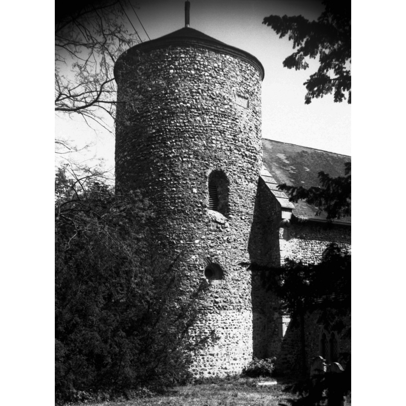
Scene Description: Photo caption: "Saxon round tower. Showing small circular window with deep concentric splay"
Copyright Statement: Image copyright © George Plunkett, 2013
Image Source: B&W photograph taken 28 May 1977 by George Plunkett [www.georgeplunkett.co.uk/Norfolk/H/Howe St Mary's church tower from SW [5798] 1977-05-28.jpg] [accessed 11 September 2013]
Copyright Instructions: Standing permission by Jonathan Plunkett
view of church exterior - southeast view
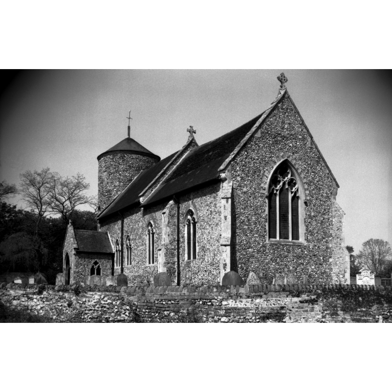
Copyright Statement: Image copyright © George Plunkett, 2013
Image Source: B&W photograph taken 28 May 1977 by George Plunkett [www.georgeplunkett.co.uk/Norfolk/H/Howe St Mary's church from SE [5799] 1977-05-28.jpg] [accessed 11 September 2013]
Copyright Instructions: Standing permission by Jonathan Plunkett
view of church interior - nave - looking west
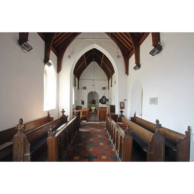
Scene Description: the modern font is visible at the west end, by the tower arch
Copyright Statement: Image copyright © John Salmon, 2009
Image Source: digital photograph taken 24 April 2009 by John Salmon [www.geograph.org.uk/photo/1278822] [accessed 11 September 2013]
Copyright Instructions: CC-BY-SA-3.0
view of church interior - nave - looking east
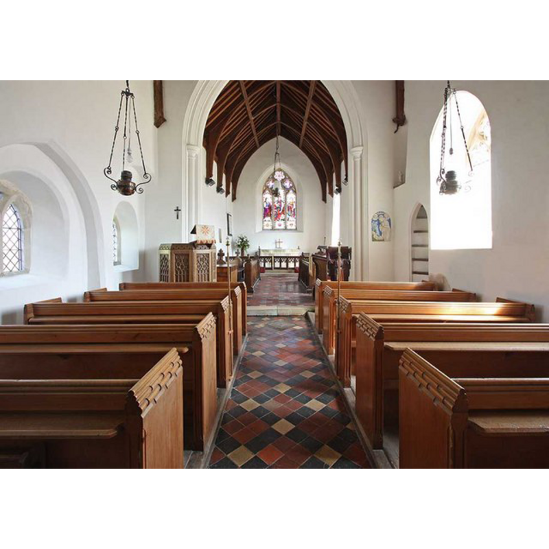
Copyright Statement: Image copyright © John Salmon, 2009
Image Source: digital photograph taken 24 April 2009 by John Salmon [www.geograph.org.uk/photo/1278810] [accessed 11 September 2013]
Copyright Instructions: CC-BY-SA-3.0
INFORMATION
Font ID: 15099HOW
Object Type: Baptismal Font1?
Font Century and Period/Style: 11th - 13th century (mid?), Medieval
Church / Chapel Name: Parish Church of St. Mary the Virgin
Church Patron Saint(s): St. Mary the Virgin
Church Notes: round-tower church [is the tower Anglo-Saxon? if so, why was this church not noted in the Domesday survey?]
Church Address: Howe Green, Howe, Norfolk, NR15 1HD
Site Location: Norfolk, East Anglia, England, United Kingdom
Directions to Site: Located 12 km SSE of Norwich
Ecclesiastic Region: Diocese of Norwich
Historical Region: Hundred of Clavering [formerly Hundred of Hensted]
Additional Comments: disappeared font? (the 11thC-13thC church here)
Font Notes:
Click to view
Blomefield (1805-1810) writes: "The church is a single pile and a chancel, both covered with tiles, and has a round tower with one bell. [...] The Church of Howe is dedicated to St. Mary, and formerly consisted of 2 medieties, or rectories; one belonged to the manor of How, of the Arundel fee, the other, to Bury abbey fee: Ralph de How was lord and patron of the Arundel fee in the 34th of Henry III. [i.e., 1250] and Miles his son in the 44th of that King" [i.e., 1260]. The present font here is noted and illustrated in Knott (2006): "The 19th century font in front of the tower arch is fashioned in a Norman style". This modern font consists of a square basin with three large scallops forming the bottom of each side, in the old design of a cushion-capital font; there are spurs in the gaps of the scallops; raised on a round pedestal base, a square lower base and a round plinth, all plain. Square wooden cover. The whole, as indicated above, a Victorian rendering of a popular Norman font design. [NB: there is no mention of a church or cleric in the Domesday entry for "Hou", but a church existed here before 1250 [is the tower pre-Conquest? [cf. supra]]; we have no information on the font of that church].
Credit and Acknowledgements: We are grateful to Jonathan Plunkett for the photographs of this church taken by his father, George Plunkett, in May 1977
COORDINATES
UTM: 31U 388375 5823499
Latitude & Longitude (Decimal): 52.550105, 1.353692
Latitude & Longitude (DMS): 52° 33′ 0.38″ N, 1° 21′ 13.29″ E
LID INFORMATION
Date: modern
Material: wood, oak?
Apparatus: no
Notes: square, flat and plain; modern
REFERENCES
- Blomefield, Francis, An essay towards a topographical history of Norfolk, 1805-1810, vol. 8: 25-27 / [www.british-history.ac.uk/report.aspx?compid=78398] [accessed 11 September 2013]
- Knott, Simon, The Norfolk Churches Site, Simon Knott, 2004. [standing permission to reproduce images received from Simon (February 2005]. URL: www.norfolkchurches.co.uk.