Islington nr. King's Lynn / Esingatuna / Ilsingetana / Ilsingetuna / Ilsinghetuna / Isingetuna / Islinghetuna / Tilney-cum-Islington
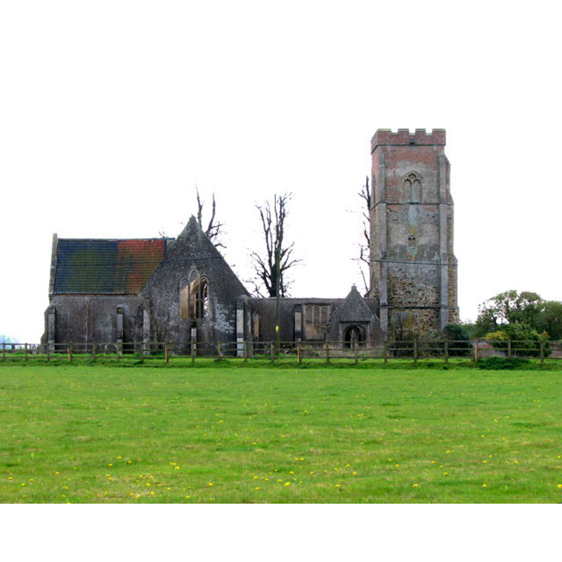
Image copyright © Evelyn Simak, 2010
CC-BY-SA-3.0
Results: 4 records
view of church exterior - north view
Copyright Statement: Image copyright © Evelyn Simak, 2010
Image Source: digital photograph taken 21 April 2010 by Evelyn Simak [www.geograph.org.uk/photo/1820254] [accessed 18 November 2013]
Copyright Instructions: CC-BY-SA-3.0
view of church exterior - southeast view
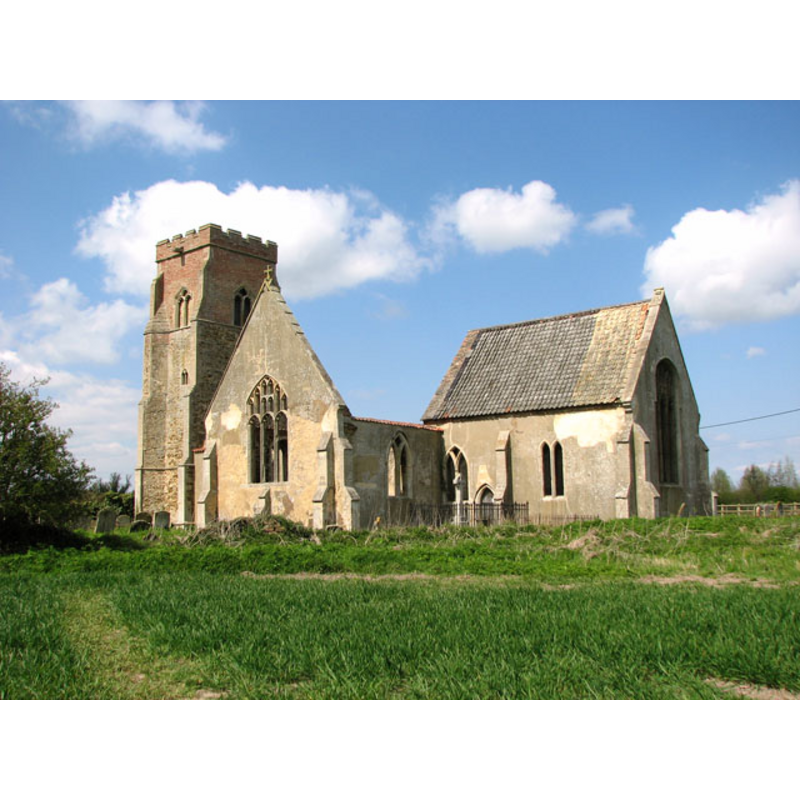
Copyright Statement: Image copyright © Evelyn Simak, 2010
Image Source: digital photograph taken 21 April 2010 by Evelyn Simak [www.geograph.org.uk/photo/1820224] [accessed 18 November 2013]
Copyright Instructions: CC-BY-SA-3.0
view of church exterior - south view
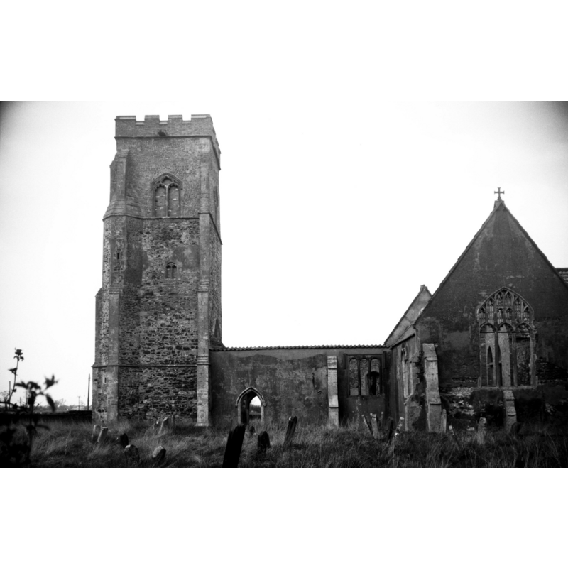
Copyright Statement: Image copyright © George Plunkett, 2013
Image Source: B&W photograph taken 14 April 1980 by George Plunkett [www.georgeplunkett.co.uk/Norfolk/T/Tilney cum Islington St Mary's church ruin [6083] 1980-04-14.jpg] [accessed 18 November 2013]
Copyright Instructions: Standing permission by Jonathan Plunkett
view of church interior - chancel
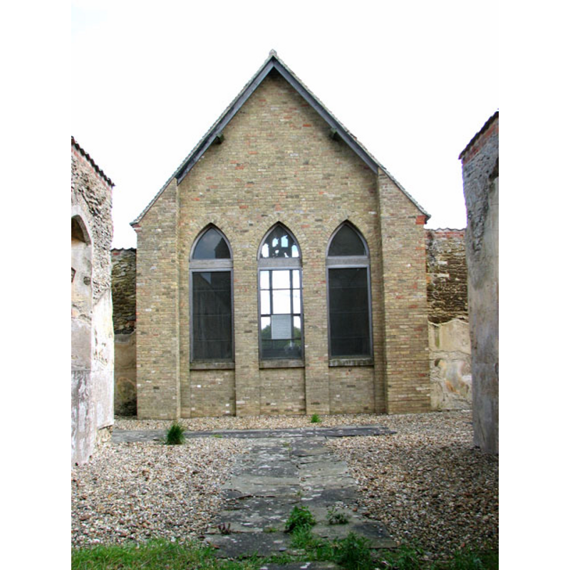
Scene Description: the renovated and maintained part of the ruins
Copyright Statement: Image copyright © Evelyn Simak, 2010
Image Source: digital photograph taken 21 April 2010 by Evelyn Simak [www.geograph.org.uk/photo/1820245] [accessed 18 November 2013]
Copyright Instructions: CC-BY-SA-3.0
INFORMATION
Font ID: 15093ISL
Object Type: Baptismal Font1
Font Century and Period/Style: 15th century, Perpendicular
Church / Chapel Name: Parish Church of St. Mary [in ruins]
Font Location in Church: Inside the church at Hillington
Church Patron Saint(s): St. Mary the Virgin
Church Address: Islington Green, Tilney, King's Lynn, Norfolk, PE34 4SB
Site Location: Norfolk, East Anglia, England, United Kingdom
Directions to Site: Islington is located S of the A47, adjacent to the Islington Hall Farm, 5 km WSW of King's Lynn -- Hillington is 13 km ENE of King's Lynn
Ecclesiastic Region: [Diocese of Norwich]
Historical Region: Hundred and half of Freebridge
Additional Comments: disappeared font? (the one from the pre-Conquest(?) church here)
Font Notes:
Click to view
There are as many as ten entries in the Domesday survey for Islington -in variant spellings-, of which only one mentions a church in it, in the part that had belonged to Archbishop Stigand before the Conquest, but was in the tenancy of Hemerus de Ferrariis [aka Hermer de Ferrers] by 1086 [http://domesdaymap.co.uk/place/TF5716/islington/] [accessed 18 November 2013]. Blomefield (1805-1810), however, argues: "This lordship of Hermerus had most probably its site in this town, and therefore is here accounted for, but the principal tenures and lands belonging to it, lay in Tilney, and the church here mentioned, was the church of Tilney, the church of Islington belonging absolutely to Montfort's fee, as appears from the presentations. [...] The Church is dedicated to St. Mary, has a nave, a cross isle and a chancel covered with reed; the tower is four-square, and stands at the south part of the church, and through it is a passage into the church, and there are two bells. [...] It was anciently a rectory [...] appropriated to the priory of Blackburgh". Pevsner & Wilson (1999) report a 15th-century octagonal font, originally from Islington St. Mary's, now in the church at Hillington [Islington St. Mary's is a redundant church now in ruins] [cf. Index entry for Hillibngton, Nrflk.]
Credit and Acknowledgements: We are grateful to Jonathan Plunkett for the photograph of this church, taken by his father, George Plunkett, 14 April 1980
COORDINATES
UTM: 31U 319346 5845237
Latitude & Longitude (Decimal): 52.7268, 0.3247
Latitude & Longitude (DMS): 52° 43′ 36.48″ N, 0° 19′ 28.92″ E
MEDIUM AND MEASUREMENTS
Material: stone
Font Shape: octagonal, mounted
Basin Interior Shape: round
Basin Exterior Shape: octagonal
REFERENCES
- Blomefield, Francis, An essay towards a topographical history of Norfolk, 1805-1810, vol. 8: 468-476 / [www.british-history.ac.uk/report.aspx?compid=78493] [accessed 18 November 2013]
- Pevsner, Nikolaus, Norfolk 2: North-West and South (2nd ed.), London: Penguin, 1999, p. 403, 449