Hethel / Hathella / Hayele / Hethell / Hethella / Hethill / Hethwold
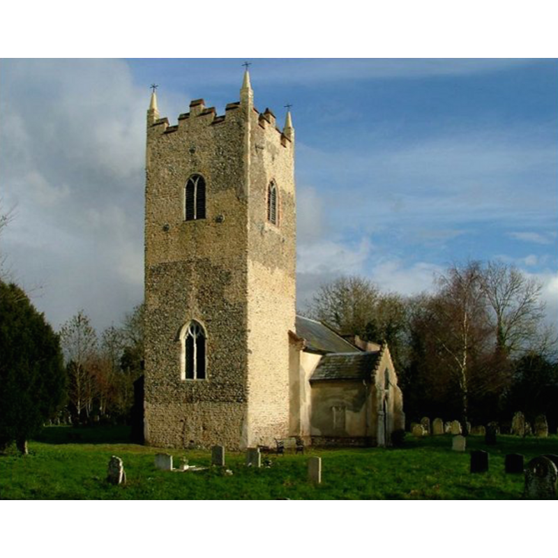
Image copyright © Simon Knott, 2006
Standing permission
Results: 3 records
view of church exterior - southwest view
Copyright Statement: Image copyright © Simon Knott, 2006
Image Source: digital photograph taken in 2006 by Simon Knott [http://www.norfolkchurches.co.uk/hethel/hethel.htm] [accessed 6 August 2009]
Copyright Instructions: Standing permission
view of font and cover in context
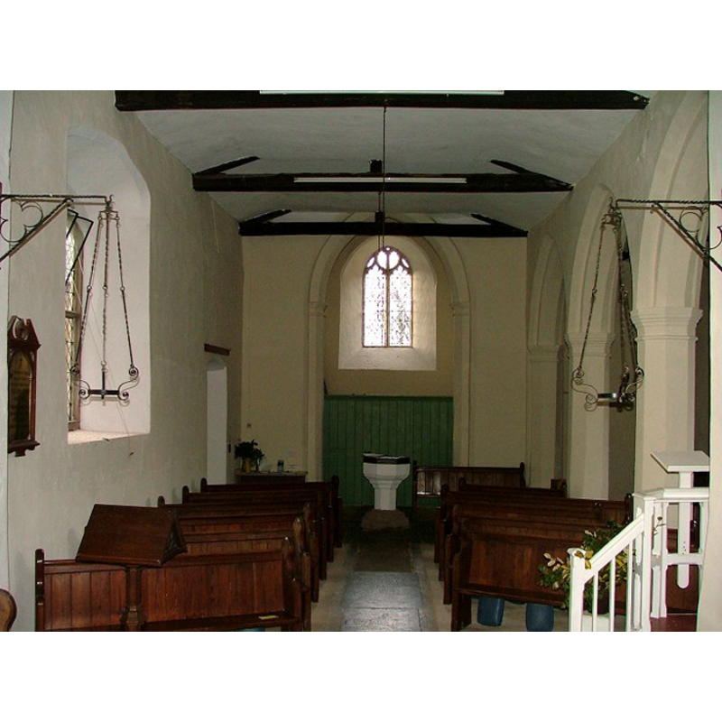
Scene Description: the font and cover at the west end of the nave
Copyright Statement: Image copyright © Simon Knott, 2006
Image Source: digital photograph taken in 2006 by Simon Knott [http://www.norfolkchurches.co.uk/hethel/hethel.htm] [accessed 6 August 2009]
Copyright Instructions: Standing permission
design element - motifs - moulding - graded


INFORMATION
Font ID: 15091HET
Object Type: Baptismal Font1
Font Century and Period/Style: 14th - 15th century / 19th century, Medieval? / Victorian?
Church / Chapel Name: Parish Church of All Saints
Font Location in Church: Inside the church, at the W end of the nave
Church Patron Saint(s): All Saints
Church Address: Church Lane, Hethel, Norfolk, NR14 8HE
Site Location: Norfolk, East Anglia, England, United Kingdom
Directions to Site: Located 7 km ESE of Wymondham, 16 km S of Norwich
Ecclesiastic Region: Diocese of Norwich
Historical Region: Hundred of Humble-Yard
Additional Comments: disappeared font? (the one from the pre-Conquest church here)
Font Notes:
Click to view
Blomfield (1805-1810) writes: Hethill "belonged to Olf, one of the Confessor's thanes [...] The church had then 30 acres of glebe, and belonged to the manor" [NB: Blomfield refers to the only survey source, the Domesday Books, especifically here to folio 121, which reads: "Hethella tenuit Olfus [...] et i. ecclesia xxx. acr."]. "The church of Hayele or Hethill, is dedicated to all the Saints, and had an image of all the saints, and a gild kept before it, of the same dedication. The rector had a house and 50 acres of glebe, when Norwich Domesday was made [...] the church is 33 feet long, and 22 broad; and the chancel 26 feet long and 13 broad; the nave and north isle are leaded, and the north porch tiled; the steeple is square, about 56 feet high, and hath only one bell." Blomefield (ibid.) names "Arnald Lupi de Tillyo, an Italian, was presented by the King", the first recorded rector here in 1312. Blomefield (ibid.) mentions the font in this church twice, but they are both indirect references related to grevestones near it, without description of the vessel itself. A font is illustrated in context in Knott (2006), octagonal and plain except for a moulded underbowl; it is whitewashed and, from its general appearance alone, could be either late-medieval or a Victorian replacement; it has a wooden octagonal cover on it. [NB: the church may date back to Anglo-Saxon times, but we have no information on the earlier font(s) of this church]
Credit and Acknowledgements: We are grateful to Simon Knott, of www.norfolkchurches.co.uk, for his photographs of this church and font
COORDINATES
UTM: 31U 378263 5824621
Latitude & Longitude (Decimal): 52.558026, 1.204223
Latitude & Longitude (DMS): 52° 33′ 28.9″ N, 1° 12′ 15.2″ E
MEDIUM AND MEASUREMENTS
Material: stone
Font Shape: octagonal, mounted
Basin Interior Shape: round
Basin Exterior Shape: octagonal
REFERENCES
- Blomefield, Francis, An essay towards a topographical history of Norfolk, 1805-1810, vol. 5: 104-114 / [www.british-history.ac.uk/report.aspx?compid=78162] [accessed 21 March 2013]
- Knott, Simon, The Norfolk Churches Site, Simon Knott, 2004. [standing permission to reproduce images received from Simon (February 2005]. URL: www.norfolkchurches.co.uk.