Heacham / Hecham / Hitcham
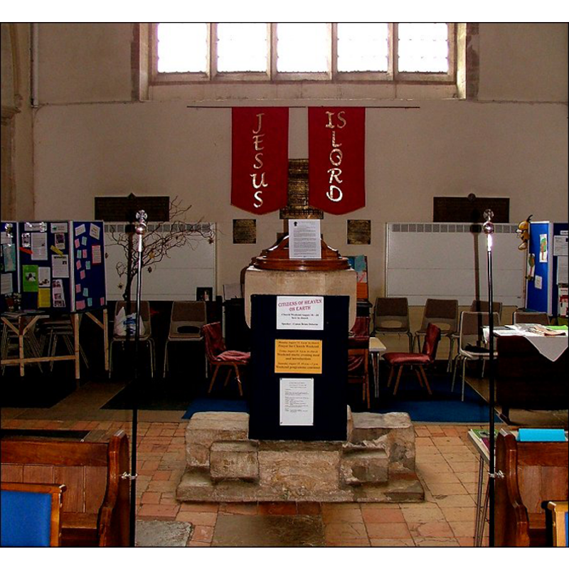
Image copyright © Simon Knott, 2009
Standing permission
Results: 6 records
view of font and cover in context
Copyright Statement: Image copyright © Simon Knott, 2009
Image Source: digital photograph taken 2006 by Simon Knott [www.norfolkchurches.co.uk/heacham/heacham.htm] [accessed 5 August 2009]
Copyright Instructions: Standing permission
view of church exterior - south view
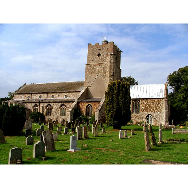
Copyright Statement: Image copyright © Simon Knott, 2009
Image Source: digital photograph September 2006 taken by Simon Knott [www.norfolkchurches.co.uk/heacham/heacham.htm] [accessed 2 April 2014]
Copyright Instructions: Standing permission
view of church exterior - southeast view
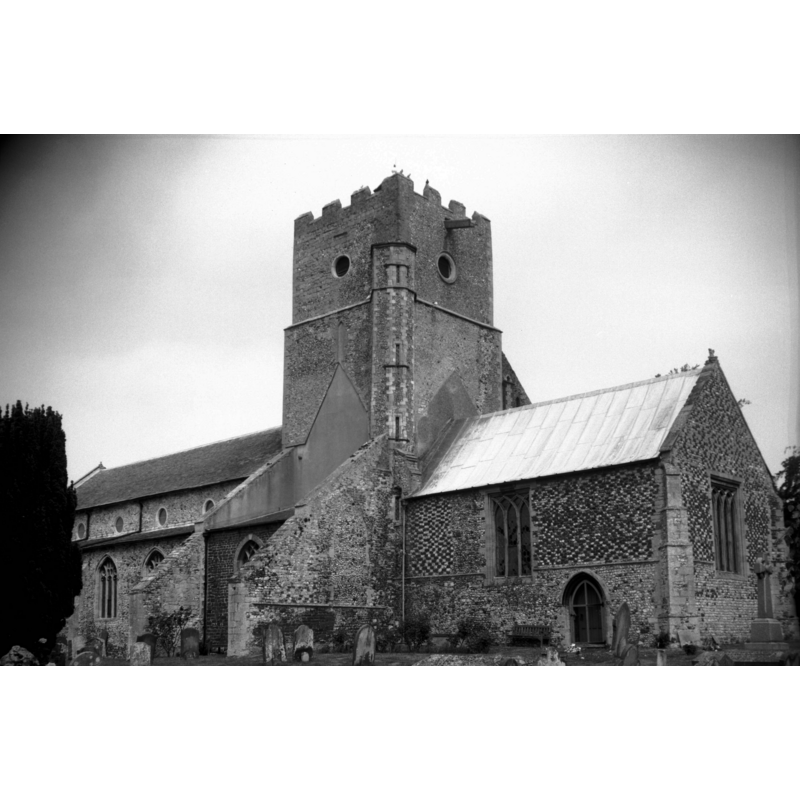
Scene Description: Photo caption: "Late 13c crossing tower and nave"
Copyright Statement: Image copyright © George Plunkett, 2014
Image Source: B&W photograph taken 16 June 1996 by George Plunkett [www.georgeplunkett.co.uk/Norfolk/H/Heacham St Mary Virgin church from SE [7332] 1996-06-16.jpg] [accessed 2 April 2014]
Copyright Instructions: Standing permission by Jonathan Plunkett
view of font and cover
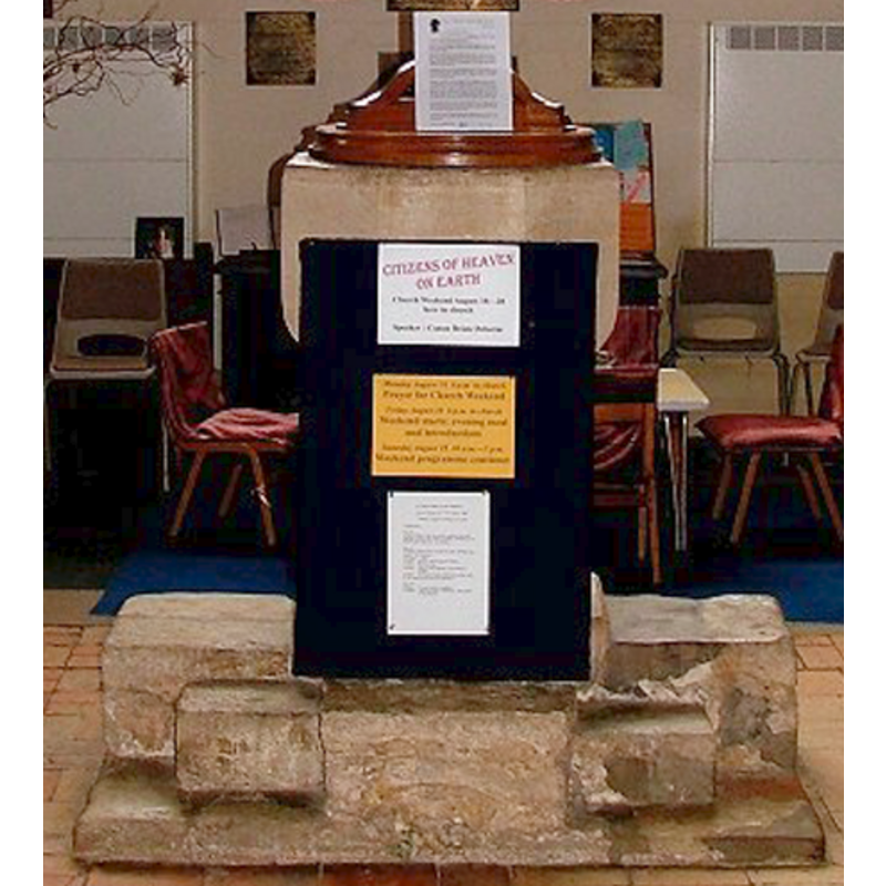
Scene Description: notice the odd plinth
Copyright Statement: Image copyright © Simon Knott, 2009
Image Source: detail of a digital photograph September 2006 taken by Simon Knott [www.norfolkchurches.co.uk/heacham/heacham.htm] [accessed 2 April 2014]
Copyright Instructions: Standing permission
view of church interior - nave - looking east
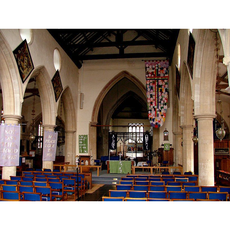
Copyright Statement: Image copyright © Simon Knott, 2009
Image Source: digital photograph September 2006 taken by Simon Knott [www.norfolkchurches.co.uk/heacham/heacham.htm] [accessed 2 April 2014]
Copyright Instructions: Standing permission
design element - motifs - quatrefoil


INFORMATION
Font ID: 15086HEA
Object Type: Baptismal Font1
Font Century and Period/Style: 14th - 15th century [composite font?], Medieval [composite]
Church / Chapel Name: Parish Church of St. Mary the Virgin
Font Location in Church: Inside the church, at the W end of the nave
Church Patron Saint(s): St. Mary the Virgin
Church Address: Church Lane, Heacham, Norfolk, PE31 7HH
Site Location: Norfolk, East Anglia, England, United Kingdom
Directions to Site: Located on the A149, 5 km S of Hunstanton, 11 km from Sandringham
Ecclesiastic Region: Diocese of Norwich
Historical Region: Hundred of Smethdon
Additional Comments: composite font? (the present one) -- disappeared font? (the one from the pre-1288 church here)
Font Notes:
Click to view
There is an entry for Heacham [variant spelling] in the Domesday survey [http://domesdaymap.co.uk/place/TF6837/heacham/] [accessed 2 April 2014] but it mentions neither church nor cleric in it. Blomefield (1805-1810) writes: "The Church is dedicated to St. Mary, and built in a cathedral or conventual manner, has a nave, a north and south isle, with a north and south transept, or cross isles, and a chancel covered with lead, a square tower, and one bell. [... ] Adam de Walsoken was vicar before 1288". [NB: the fact that it was a vicarage by 1288 may indicate that it could have been a rectory earlier, and later associated with Lewes Priory. Pevsner & Wilson (1999) mention the present font here: "On cruciform steps. Square stem with quatrefoils and plain rather rounded bowl." Partially illustrated in Knott (2006). Neither source addresses the dating of the font. [NB: it is not clear whether or not the font is a whole one or a sum of parts [i.e., a composite]. The plain octagonal basin does not seem to fit the pedestal base or the cruciform plinth. The wooden cover is probably 19th-century].
Credit and Acknowledgements: We are grateful to Simon Knott, of www.norfolkchurches.co.uk, for his photographs of this church and font; we are also grateful to Jonathan Plunkett for the photograph of this church, taken by his father, George Plunkett, in June 1996
COORDINATES
UTM: 31U 331858 5865482
Latitude & Longitude (Decimal): 52.912657, 0.499376
Latitude & Longitude (DMS): 52° 54′ 45.56″ N, 0° 29′ 57.76″ E
MEDIUM AND MEASUREMENTS
Material: stone
Font Shape: octagonal, mounted
Basin Interior Shape: round
Basin Exterior Shape: octagonal
LID INFORMATION
Date: 19th-century?
Material: wood, oak?
Apparatus: no
Notes: [cf. FontNotes]
REFERENCES
- Blomefield, Francis, An essay towards a topographical history of Norfolk, 1805-1810, vol. 10: 307-312 / [www.british-history.ac.uk/report.aspx?compid=78685] [accessed 2 April 2014]
- Knott, Simon, The Norfolk Churches Site, Simon Knott, 2004. [standing permission to reproduce images received from Simon (February 2005]. URL: www.norfolkchurches.co.uk.
- Pevsner, Nikolaus, Norfolk 2: North-West and South (2nd ed.), London: Penguin, 1999, p. 388