Great Bircham / Bircham Magna / Brecham
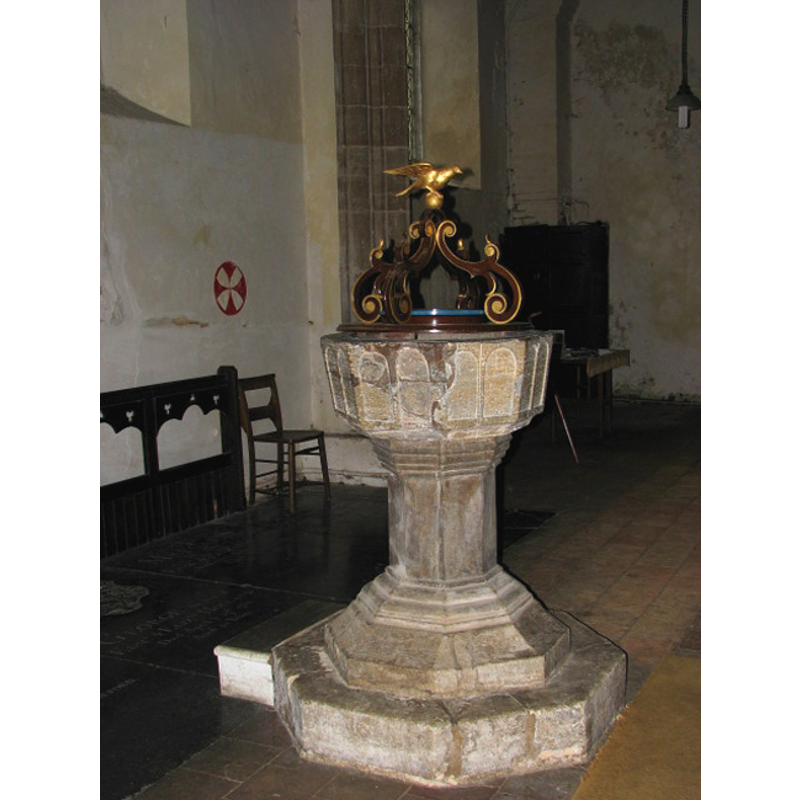
Image copyright © Evelyn Simak, 2007
CC-BY-SA-3.0
Results: 7 records
view of font and cover
Copyright Statement: Image copyright © Evelyn Simak, 2007
Image Source: digital photograph taken 15 May 2007 by Evelyn Simak [www.geograph.org.uk/photo/931929] [accessed 31 July 2009]
Copyright Instructions: CC-BY-SA-3.0
design element - architectural - arcade - blind - round arches - 16 arches
Copyright Statement: Image copyright © Evelyn Simak, 2007
Image Source: digital photograph taken 15 May 2007 by Evelyn Simak [www.geograph.org.uk/photo/931929] [accessed 31 July 2009]
Copyright Instructions: CC-BY-SA-3.0
view of church exterior - northwest end
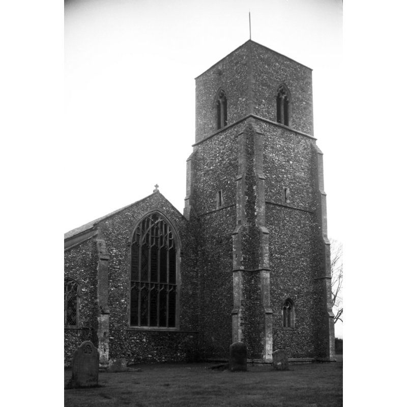
Scene Description: Photo caption: "Early 14c tower"
Copyright Statement: Image copyright © George Plunkett, 2014
Image Source: B&W photograph taken 25 November 1994 by George Plunkett [www.georgeplunkett.co.uk/Norfolk/G/Gt Bircham St Mary's church from NW [7173] 1994-11-25.jpg] [accessed 31 March 2014]
Copyright Instructions: Standing permission by Jonathan Plunkett
view of church exterior - southeast view
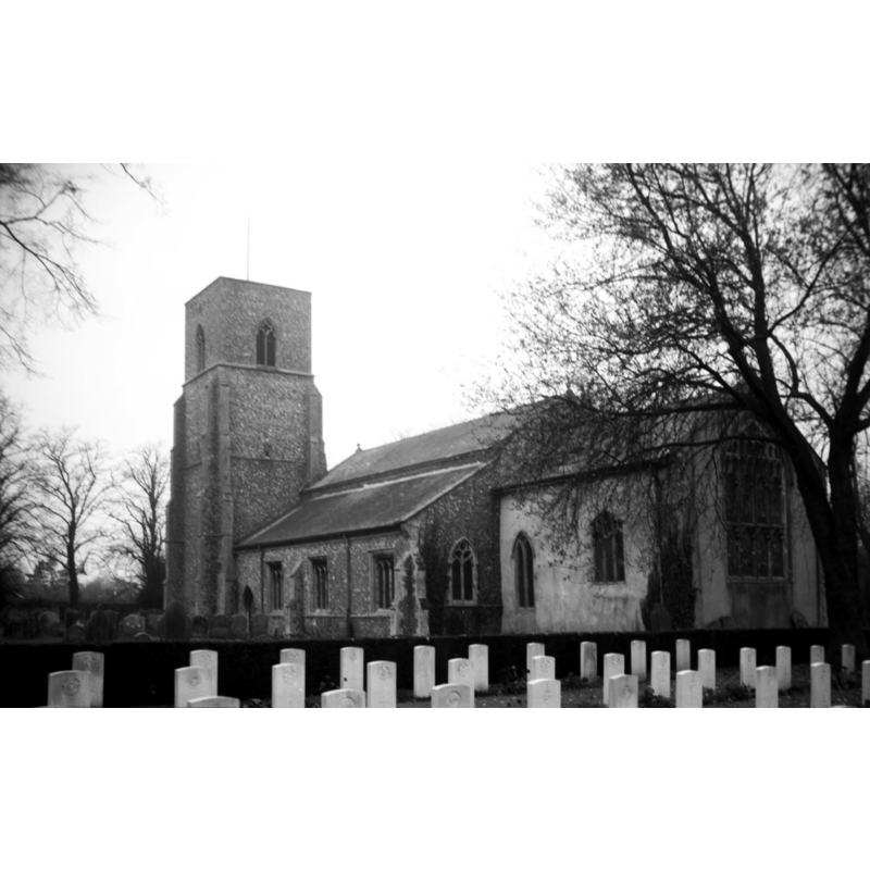
Copyright Statement: Image copyright © George Plunkett, 2014
Image Source: B&W photograph taken 25 November 1994 by George Plunkett [www.georgeplunkett.co.uk/Norfolk/G/Gt Bircham St Mary's church from SE [7172] 1994-11-25.jpg] [accessed 31 March 2014]
Copyright Instructions: Standing permission by Jonathan Plunkett
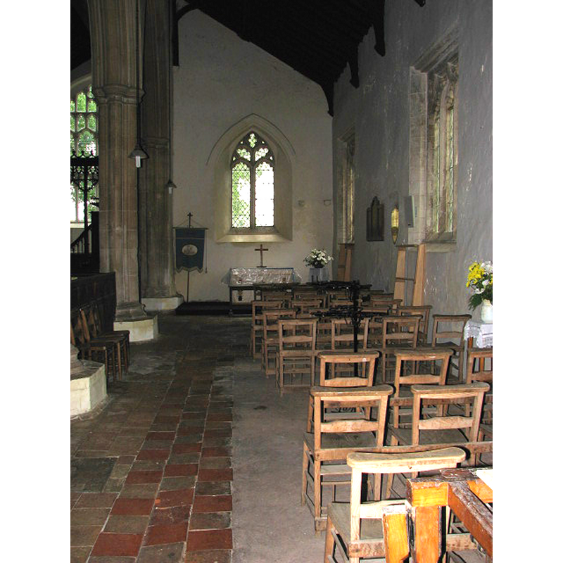
view of church interior - chancel - rood-screen, choir-screen; iconostasis
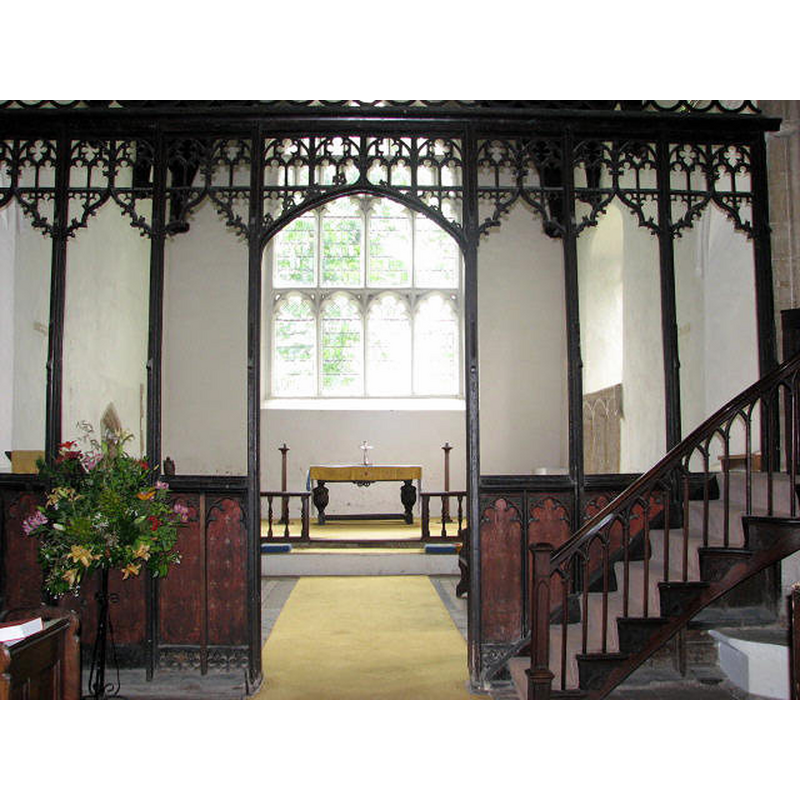
Scene Description: west side; viewed from the nave
Copyright Statement: Image copyright © Evelyn Simak, 2007
Image Source: digital photograph taken 15 May 2007 by Evelyn Simak [www.geograph.org.uk/photo/931910] [accessed 31 March 2014]
Copyright Instructions: CC-BY-SA-3.0
view of church interior - nave - looking west
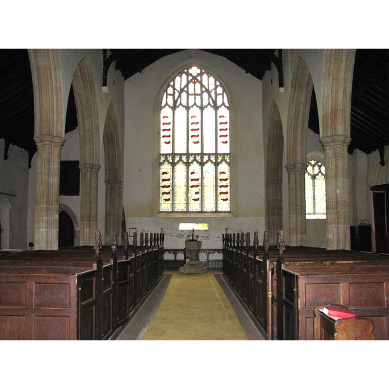
Scene Description: the font and cover at the far end
Copyright Statement: Image copyright © Evelyn Simak, 2007
Image Source: digital photograph taken 15 May 2007 by Evelyn Simak [www.geograph.org.uk/photo/931926] [accessed 31 March 2014]
Copyright Instructions: CC-BY-SA-3.0
view of church interior - north aisle - looking east
Copyright Statement: Image copyright © Evelyn Simak, 2007
Image Source: digital photograph taken 15 May 2007 by Evelyn Simak [www.geograph.org.uk/photo/931923] [accessed 31 March 2014]
Copyright Instructions: CC-BY-SA-3.0
INFORMATION
Font ID: 15061BIR
Object Type: Baptismal Font1
Font Date: ca. 1200? [basin only]
Font Century and Period/Style: 12th - 13th century [basin only] -- 15th century [base only] -- composite font, Medieval [composite]
Church / Chapel Name: Parish Church of St. Mary the Virgin
Font Location in Church: Inside the church, at the W end
Church Patron Saint(s): St. Mary the Virgin
Church Address: Church Lane, Great Bircham, Norfolk PE31 6RJ
Site Location: Norfolk, East Anglia, England, United Kingdom
Directions to Site: Located 23 km NE of King's Lynn
Ecclesiastic Region: Diocese of Norwich
Historical Region: Hundred of Smethdon
Additional Comments: altered font: later base / composite font (the present one) -- disappeared font? (the one from the Domesday-time church here)
Font Notes:
Click to view
There are two entries for [Great] Bircham [variant spellings] in the Domesday survey [http://domesdaymap.co.uk/place/TF7732/great-bircham/] [accessed 31 March 2014], one of which reports a church and church lands in it. Blomefield (1805-1810) writes; "The Church is dedicated to St. Mary. The rector had a manse with 30 acres". Pevsner & Wilson (1999) write: "Font. Of c.1200. Purbeck marble, octagonal, the familiar pattern with two shallow round arches to each side. This is quite early for an octagonal font." The font consists of an octagonal basin with tapering sides decorated as indicated above; raised on a later octagonal pedestal base with mouldings at both ends, and on an octagonal plinth, also of later date. The modern (1962) wooden cover consists of a round flat platform with raised scroll ribs painted and gilded, and a dove finial. [NB: there may be a medieval holy-water stoup in the porch, but we have not been able to confirm it yet]
Credit and Acknowledgements: We are grateful to Jonathan Plunkett for the photographs of this church taken by his father, George Plunkett, in November 1994
COORDINATES
UTM: 31U 340796 5859396
Latitude & Longitude (Decimal): 52.860716, 0.63515
Latitude & Longitude (DMS): 52° 51′ 38.58″ N, 0° 38′ 6.54″ E
MEDIUM AND MEASUREMENTS
Material: stone, limestone (Purbeck marble) [basin only]
Font Shape: octagonal, mounted
Basin Interior Shape: round
Basin Exterior Shape: octagonal
LID INFORMATION
Date: 1962
Material: wood
Apparatus: no
Notes: [cf. FontNotes]
REFERENCES
- Blomefield, Francis, An essay towards a topographical history of Norfolk, 1805-1810, vol. 10: 291-294 / [www.british-history.ac.uk/report.aspx?compid=78680] [accessed 31 March 2014]
- Pevsner, Nikolaus, Norfolk 2: North-West and South (2nd ed.), London: Penguin, 1999, p. 362