Fring / Frainges / Frenga / Frenge
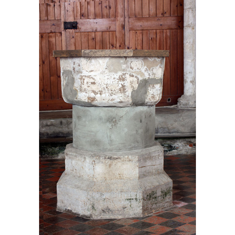
Image copyright © John Salmon, 2009
CC-BY-SA-3.0
Results: 7 records
view of font and cover
Copyright Statement: Image copyright © John Salmon, 2009
Image Source: digital photograph taken 14 February 2009 by John Salmon [www.geograph.org.uk/photo/1163028] [accessed 30 July 2009]
Copyright Instructions: CC-BY-SA-3.0
design element - architectural - arcade - blind - pointed arches - 8
Copyright Statement: Image copyright © John Salmon, 2009
Image Source: digital photograph taken 14 February 2009 by John Salmon [www.geograph.org.uk/photo/1163028] [accessed 30 July 2009]
Copyright Instructions: CC-BY-SA-3.0
view of church exterior - southwest view
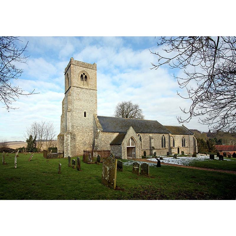
Copyright Statement: Image copyright © John Salmon, 2009
Image Source: digital photograph taken 14 February 2009 by John Salmon [www.geograph.org.uk/photo/1163005] [accessed 2 April 2014]
Copyright Instructions: CC-BY-SA-3.0
view of church exterior - southeast view
![Photo caption: "14thc"
EXT SW digital photograph taken 14 February 2009 by John Salmon [www.geograph.org.uk/photo/1163005] [accessed 2 April 2014]
INT E digital photograph taken 14 February 2009 by John Salmon [www.geograph.org.uk/photo/1163018] [accessed 2 April 2014]
INT W digital photograph taken 14 February 2009 by John Salmon [www.geograph.org.uk/photo/1163026] [accessed 2 April 2014]
FONT+COVER CNTXT digital photograph taken 2 September 2010 by Evelyn Simak [www.geograph.org.uk/photo/2048583] [accessed 2 April 2014]](/static-50478a99ec6f36a15d6234548c59f63da52304e5/compressed/1140404017_compressed.png)
Scene Description: Photo caption: "14thc"
EXT SW digital photograph taken 14 February 2009 by John Salmon [www.geograph.org.uk/photo/1163005] [accessed 2 April 2014]
INT E digital photograph taken 14 February 2009 by John Salmon [www.geograph.org.uk/photo/1163018] [accessed 2 April 2014]
INT W digital photograph taken 14 February 2009 by John Salmon [www.geograph.org.uk/photo/1163026] [accessed 2 April 2014]
FONT+COVER CNTXT digital photograph taken 2 September 2010 by Evelyn Simak [www.geograph.org.uk/photo/2048583] [accessed 2 April 2014]
Copyright Statement: Image copyright © George Plunkett, 2014
Image Source: B&W photograph taken 25 November 1994 by George Plunkett [www.georgeplunkett.co.uk/Norfolk/F/Fring All Saints church from SE [7176] 1994-11-25.jpg] [accessed 2 April 2014]
Copyright Instructions: Standing permission by Jonathan Plunkett
view of font and cover in context
![at the west end of the nave [looking east]](/static-50478a99ec6f36a15d6234548c59f63da52304e5/compressed/1140404021_compressed.png)
Scene Description: at the west end of the nave [looking east]
Copyright Statement: Image copyright © Evelyn Simak, 2010
Image Source: digital photograph taken 2 September 2010 by Evelyn Simak [www.geograph.org.uk/photo/2048583] [accessed 2 April 2014]
Copyright Instructions: CC-BY-SA-3.0
view of church interior - nave - looking west
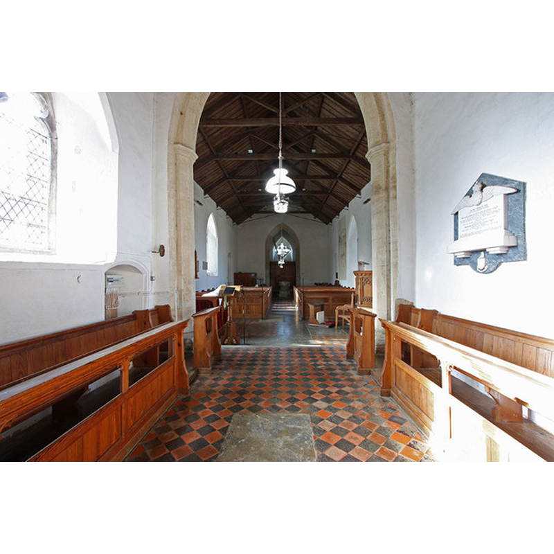
Copyright Statement: Image copyright © John Salmon, 2009
Image Source: digital photograph taken 14 February 2009 by John Salmon [www.geograph.org.uk/photo/1163026] [accessed 2 April 2014]
Copyright Instructions: CC-BY-SA-3.0
view of church interior - nave - looking east
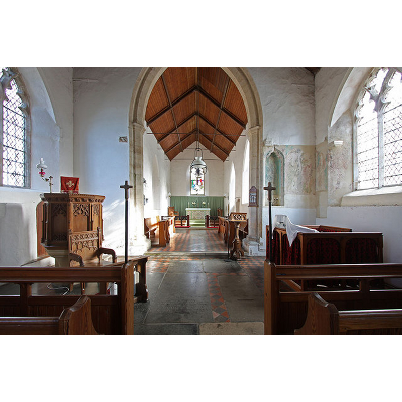
Copyright Statement: Image copyright © John Salmon, 2009
Image Source: digital photograph taken 14 February 2009 by John Salmon [www.geograph.org.uk/photo/1163018] [accessed 2 April 2014]
Copyright Instructions: CC-BY-SA-3.0
INFORMATION
Font ID: 15054FRI
Object Type: Baptismal Font1
Font Century and Period/Style: 13th century, Early English
Church / Chapel Name: Parish Church of All Saints
Font Location in Church: Inside the church
Church Patron Saint(s): All Saints
Site Location: Norfolk, East Anglia, England, United Kingdom
Directions to Site: Located 22 km NNE of King's Lynn
Ecclesiastic Region: Diocese of Norwich
Historical Region: Hundred of Smethdon [Hundred of Docking?]
Font Notes:
Click to view
There are three entries for Fring [variant spelling] in the Domesday survey [http://domesdaymap.co.uk/place/TF7334/fring/] [accessed 2 April 2014], neither or which reports a church or cleric in it. Blomefield (1805-1810) writes; "The church stands on a rising hill, a little westward of the town, and is a single pile, covered with tile, and the chancel with lead, with a small tower of flint stones, &c. at the west end of the body, with one bell. [...] The Church is dedicated to All-Saints, and was a rectory [...] In the time of Edward I. the rector had a manse, and 40 acres of glebe [...] It was appropriated by Bishop Bateman to the priory of Norwich, on May 13, 1352 [...] No vicarage was apppointed, but the church was to be served by a stipendiary curate, paid by the convent, and at present paid by the dean and chapter, who hold the impropriation." The present font is described in Pevsner & Wilson (1999): "Font. Octagonal, C13, of the Purbeck type, with two shallow pointed arches on each side." The much damaged basin and the lower base may be original, both of octagonal shape, but the cylindrical stem is either modern or has totally re-cut. The wooden cover is plain, octagonal and flat; modern.
Credit and Acknowledgements: We are also grateful to Jonathan Plunkett for the photograph of this church taken by his father, George Plunkett, in November 1994
COORDINATES
UTM: 31U 337010 5862026
Latitude & Longitude (Decimal): 52.8832, 0.57765
Latitude & Longitude (DMS): 52° 52′ 59.52″ N, 0° 34′ 39.54″ E
MEDIUM AND MEASUREMENTS
Material: stone
Font Shape: octagonal, mounted
Basin Interior Shape: round
Basin Exterior Shape: octagonal
LID INFORMATION
Date: modern
Material: wood, oak?
Apparatus: no
Notes: [cf. FontNotes]
REFERENCES
- Blomefield, Francis, An essay towards a topographical history of Norfolk, 1805-1810, vol. 10: 302-307 / [www.british-history.ac.uk/report.aspx?compid=78684] [accessed 2 April 2014]
- Pevsner, Nikolaus, Norfolk 2: North-West and South (2nd ed.), London: Penguin, 1999, p. 346