Framingham Pigot / Framingham Picot
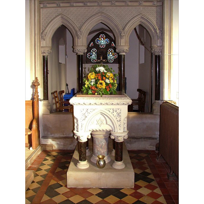
Image copyright © Simon Knott, 2006
Standing permission
Results: 4 records
view of font and cover
Scene Description: the modern font [cf. FontNotes]
Copyright Statement: Image copyright © Simon Knott, 2006
Image Source: digital photograph March 2006 taken by Simon Knott [www.norfolkchurches.co.uk/framinghampigot/framinghampigot.htm] [accessed 26 April 2013]
Copyright Instructions: Standing permission
view of church exterior - southeast view
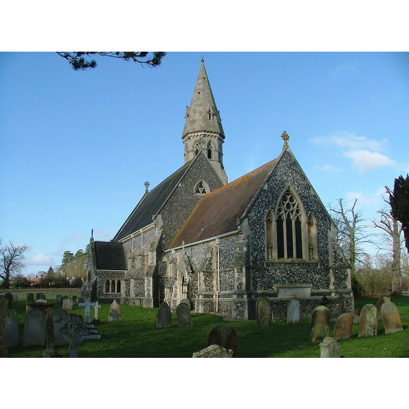
Copyright Statement: Image copyright © Simon Knott, 2006
Image Source: digital photograph March 2006 taken by Simon Knott [www.norfolkchurches.co.uk/framinghampigot/framinghampigot.htm] [accessed 26 April 2013]
Copyright Instructions: Standing permission
view of church interior - nave - looking west
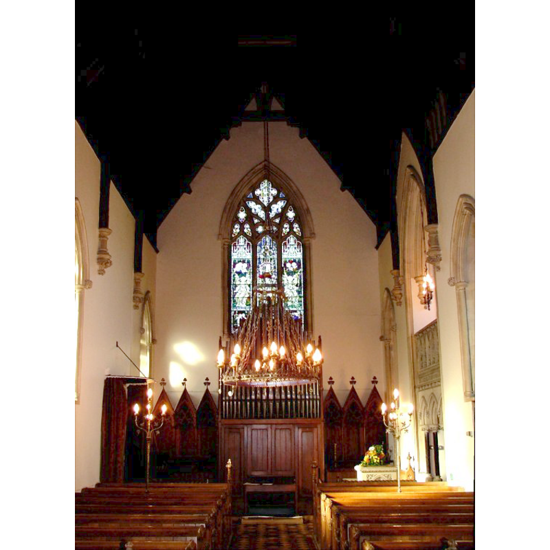
Copyright Statement: Image copyright © Simon Knott, 2006
Image Source: digital photograph March 2006 taken by Simon Knott [www.norfolkchurches.co.uk/framinghampigot/framinghampigot.htm] [accessed 26 April 2013]
Copyright Instructions: Standing permission
view of church interior - nave - looking east
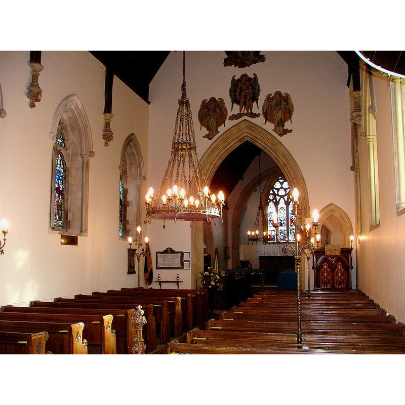
Copyright Statement: Image copyright © Simon Knott, 2006
Image Source: digital photograph March 2006 taken by Simon Knott [www.norfolkchurches.co.uk/framinghampigot/framinghampigot.htm] [accessed 26 April 2013]
Copyright Instructions: Standing permission
INFORMATION
Font ID: 15052FRA
Object Type: Baptismal Font1?
Font Century and Period/Style: 13th century, Medieval
Church / Chapel Name: Parish Church of St. Andrew
Church Patron Saint(s): St. Andrew
Church Notes: originally a round-tower church, but remodelled in the 19th century
Church Address: The Street, Framingham Pigot, Norfolk, NR14 7QH
Site Location: Norfolk, East Anglia, England, United Kingdom
Directions to Site: Located 6 km SSE of Norwich
Ecclesiastic Region: Diocese of Norwich
Historical Region: Hundred of Henstede [aka Henstead] [in Domesday]
Additional Comments: disappeared font? (there was a church here in Domesday time -- a font was present inside the church in 1501 [cf. FontNotes])
Font Notes:
Click to view
There are seven entries for Framingham [Earl and Pigot] in the Domesday survey [http://domesdaymap.co.uk/place/XX0000/framingham-earl-and-pigot/] [accesseed 7 December 2014], of which only one, the part in the lordship of Turold and tenancy of Roger Bigot, reports a church and church lands in it. Blomefield (1805-1810) writes: "The church is very small, and never had a steeple, but a bell hanging on the outside, in an arch at the west end. The nave is only eleven yards long and seven broad; the chancel six yards square; both, as the south porch, are tiled: this is also dedicated to St. Andrew"; and there is an indirect mention of a font in this church in 1501: "In 1501, Stephen Stamford was buried between the font and the church-door." Blomefield (ibid.) names "Tho. le Bygod" as first recorded rector here, in 1244. Illustrated in Knott (2006). A Victorian rendition of a 13th-century square font design, white stone with marble colonnettes, probably of the 1859 renovation by Robert Kerr noted in Pevsner & Wilson (1999). [NB: we have no information on the earlier font(s)]
Credit and Acknowledgements: We are grateful to Simon Knott, of Norfolk Churches, for his photographs of church and modern font
COORDINATES
UTM: 31U 388961 5827045
Latitude & Longitude (Decimal): 52.582091, 1.361155
Latitude & Longitude (DMS): 52° 34′ 55.53″ N, 1° 21′ 40.16″ E
REFERENCES
- Blomefield, Francis, An essay towards a topographical history of Norfolk, 1805-1810, vol. 5: 435-437 / [www.british-history.ac.uk/report.aspx?compid=78203] [accessed 21 May 2013]
- Knott, Simon, The Norfolk Churches Site, Simon Knott, 2004. [standing permission to reproduce images received from Simon (February 2005]. URL: www.norfolkchurches.co.uk.
- Pevsner, Nikolaus, Norfolk 2: North-West and South (2nd ed.), London: Penguin, 1999, p. 344