Fordham nr. Downham Market
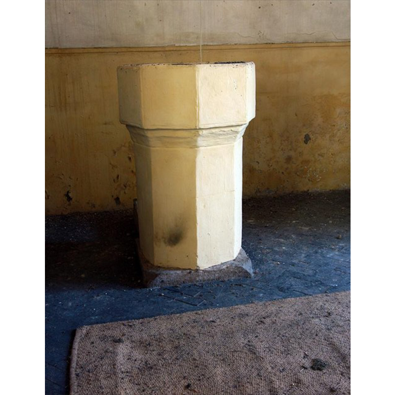
Image copyright © John Salmon, 2009
CC-BY-SA-3.0
Results: 5 records
view of font
Copyright Statement: Image copyright © John Salmon, 2009
Image Source: digital photograph taken 19 August 2009 by John Salmon [www.geograph.org.uk/photo/1449372] [accessed 15 August 2013]
Copyright Instructions: CC-BY-SA-3.0
view of church exterior - southeast view
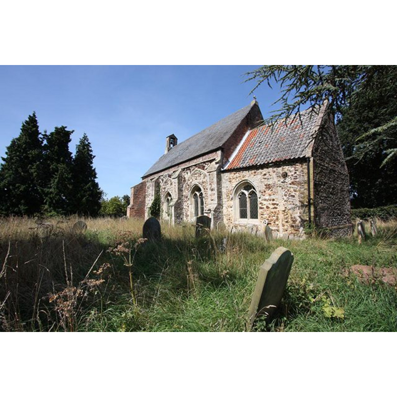
Copyright Statement: Image copyright © John Salmon, 2009
Image Source: digital photograph taken 19 August 2009 by John Salmon [www.geograph.org.uk/photo/1449353] [accessed 15 August 2013]
Copyright Instructions: CC-BY-SA-3.0
view of church exterior - southeast view
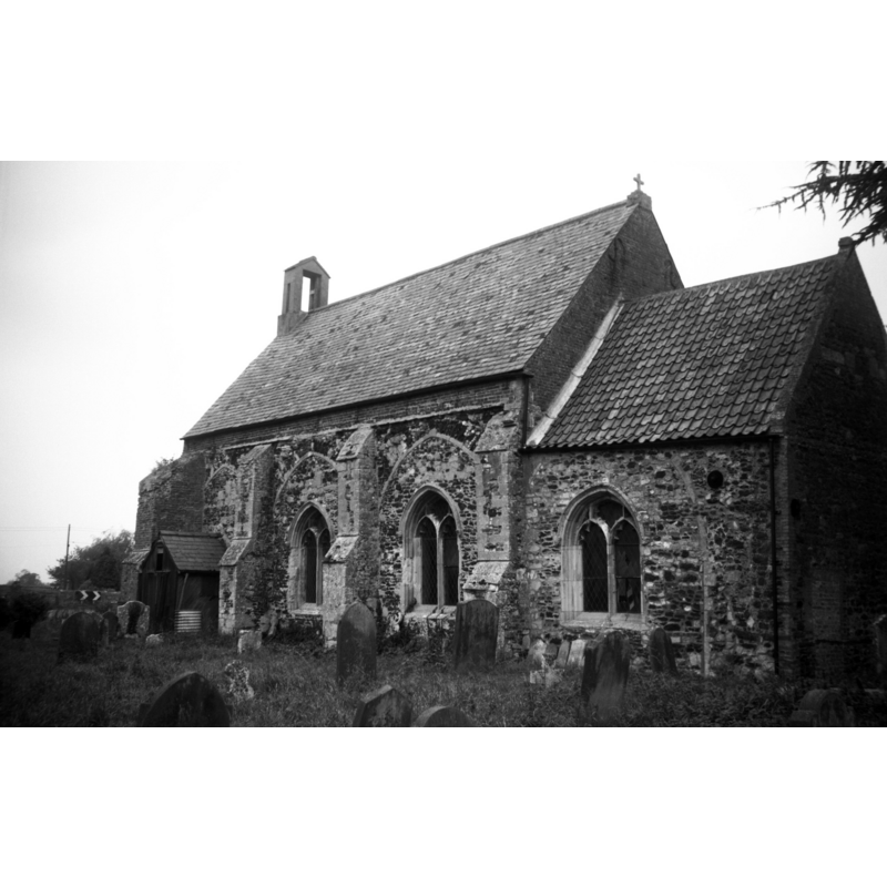
Scene Description: George Plunkett noted: "Partly rebuilt in 1730. South aisle demolished but arcade visible."
Copyright Statement: Image copyright © George Plunkett, 2013
Image Source: B&W photograph taken 31 October 1993 by George Plunkett [www.georgeplunkett.co.uk/Norfolk/F/Fordham St Mary's church from SE [7092] 1993-10-31.jpg] [accessed 15 August 2013]
Copyright Instructions: Standing permission
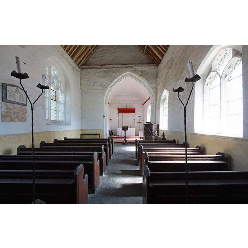
view of church interior - nave - looking west
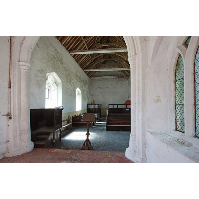
Copyright Statement: Image copyright © John Salmon, 2009
Image Source: digital photograph taken 19 August 2009 by John Salmon [www.geograph.org.uk/photo/1449365] [accessed 15 August 2013]
Copyright Instructions: CC-BY-SA-3.0
view of church interior - nave - looking east
Copyright Statement: Image copyright © John Salmon, 2009
Image Source: digital photograph taken 19 August 2009 by John Salmon [www.geograph.org.uk/photo/1449363] [accessed 15 August 2013]
Copyright Instructions: CC-BY-SA-3.0
INFORMATION
Font ID: 15048FOR
Object Type: Baptismal Font1
Font Century and Period/Style: 13th - 15th century / 19th century?, Medieval? / Victorian?
Church / Chapel Name: Parish Church of St. Mary
Font Location in Church: Inside the church, at the W end of the nave
Church Wikidata: https://en.wikipedia.org/wiki/St_Mary%27s_Church,_Fordham
Church Patron Saint(s): St. Mary the Virgin
Church Notes: church redundant since 1991; now in the care of the Friends of Friendless Churches
Church Address: Fordham, Norfolk PE38 0HJ
Site Location: Norfolk, East Anglia, England, United Kingdom
Directions to Site: Located on the Downham Market to Ely road [there is no village, just the church]
Additional Comments: painted font (whitewashed)
Font Notes:
Click to view
Blomefield (1805-1810) informs that 1286 there was a conveyance of "a moiety of the church of Fordham, belonging to him, to Robert de Benhale, and Robert to Hervey de Stanton [...] The old church was a small pile, and falling down in 1780, is rebuilt. [...] the church was dedicated to St. Mary.. Wirmegey mediety was called the portion of John, who was rector in 1278." The font here is illustrated in context in Knott (2005). The stone font at the west end of the nave is octagonal, consisting of an octagonal basin with plain vertical sides, a narrow chamfer at the underbowl; raised on a plain octagonal pedestal base, and a square lower base or plinth. The font is covered in yellow paint or wash. Not known whether medieval or a 19th-century replacement font.
Credit and Acknowledgements: We are grateful to Jonathan Plunkett for the photograph of this church, taken by his father, George Plunkett, 31 October 1993
COORDINATES
Latitude & Longitude (Decimal): 52.5706, 0.3839
Latitude & Longitude (DMS): 52° 34′ 11.16″ N, 0° 22′ 59.39″ E
MEDIUM AND MEASUREMENTS
Material: stone
Font Shape: octagonal, mounted
Basin Interior Shape: round
Basin Exterior Shape: octagonal
REFERENCES
- Blomefield, Francis, An essay towards a topographical history of Norfolk, 1805-1810, vol. 7: 366-368 / [www.british-history.ac.uk/report.aspx?compid=78365] [accessed 15 August 2013]
- Knott, Simon, The Norfolk Churches Site, Simon Knott, 2004. [standing permission to reproduce images received from Simon (February 2005]. URL: www.norfolkchurches.co.uk.