Leek Wootton
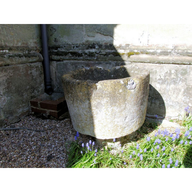
Image copyright © Churches of Britain and Ireland web site [www.churches-uk-ireland.org], 2009
No known copyright restriction – Fair Dealing
Results: 3 records
view of font
Copyright Statement: Image copyright © Churches of Britain and Ireland web site [www.churches-uk-ireland.org], 2009
Image Source: digital photograph [www.churches-uk-ireland.org/images/warks/leek_wootton_fnt.jpg] [accessed 28 July 2009]
Copyright Instructions: No known copyright restriction – Fair Dealing
view of church exterior - north view
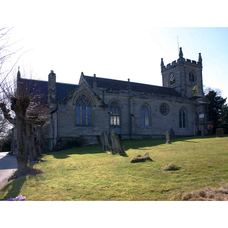
Copyright Statement: Image copyright © David P Howard, 2010
Image Source: digital photograph taken 16 March 2010 by David P Howard [www.geograph.org.uk/photo/1756608] [accessed 4 February 2015]
Copyright Instructions: CC-BY-SA-2.0
view of church exterior - south view
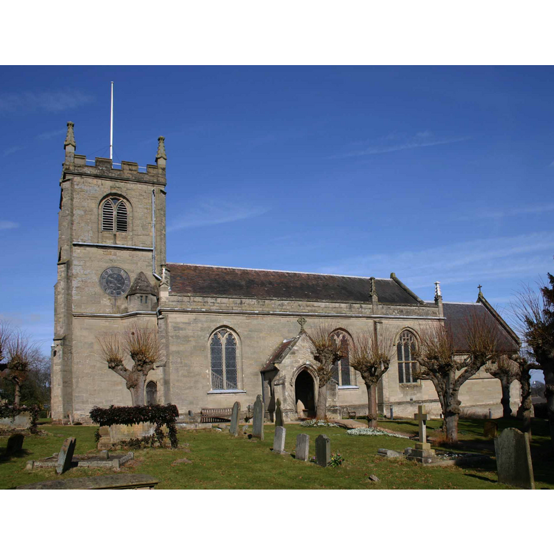
Copyright Statement: Image copyright © David P Howard, 2010
Image Source: digital photograph taken 16 March 2010 by David P Howard [www.geograph.org.uk/photo/1756532] [accessed 4 February 2015]
Copyright Instructions: CC-BY-SA-2.0
INFORMATION
Font ID: 15038LEE
Object Type: Baptismal Font1
Font Century and Period/Style: 12th century (early?), Norman
Church / Chapel Name: Parish Church of All Saints
Font Location in Church: Outside the new church, in the churchyard
Church Patron Saint(s): All Saints
Church Address: 93 Warwick Road, Leek Wootton, Warwickshire CV35 7QX
Site Location: Warwickshire, West Midlands, England, United Kingdom
Directions to Site: Located on the road between Birmingham and Southam
Ecclesiastic Region: Diocese of Coventry
Additional Comments: disused font / damaged font
Font Notes:
Click to view
We found no entry for Leek Wootton in the Domesday survey. The Victoria County History (Warwick, no. 6, 1951) notes: "The church of Leek Wootton was given by Geoffrey de Clinton to the Priory of Kenilworth, with the chapel of Leamington and pensions from the formerly dependent chapels of Ashow (20s.), Cubbington (½ mark), Lillington (½ mark), and Milverton (1 mark). [...] In 1204, when the knight's fee of Wootton was in dispute, the prior registered his claim to the church, [,,,] and this was acknowledged in the settlement of the dispute. [...] The old church was pulled down in 1789 and the present church built on the site in the gothic style near the close of the 18th century", with its own stone font. The VCH (ibid.) further reports: "No trace of the earlier church remains, but in the churchyard is a 12th-century tapered circular font". The Churches of Britain and Ireland web site [www.churches-uk-ireland.org] [accessed 28 July 2009] reports and illustrates a tub-shaped basin that fits the font in the VCH description; it is plain, damaged at the upper rim and raised on a small circular base. [NB: if the donation of this church by Geoffrey de Clinton is correct, and his death is given as 1134, the church here must have existed by that date -- is the font the original?]
COORDINATES
UTM: 30U 596866 5797098
Latitude & Longitude (Decimal): 52.315656, -1.57894
Latitude & Longitude (DMS): 52° 18′ 56.36″ N, 1° 34′ 44.18″ W
MEDIUM AND MEASUREMENTS
Material: stone
Font Shape: tub-shaped, mounted
Basin Interior Shape: round
Basin Exterior Shape: round
REFERENCES
- Victoria County History [online], University of London, 1993-. URL: https://www.british-history.ac.uk.