Coston / Corston / Coson
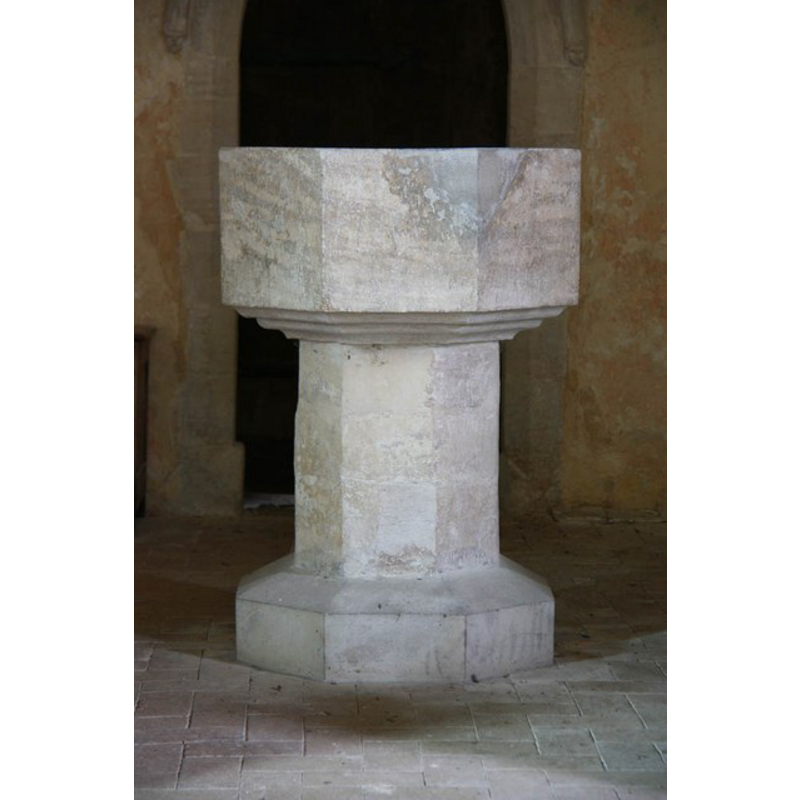
Image copyright © John Salmon, 2011
CC-BY-SA-3.0
Results: 5 records
view of font
Scene Description: the re-tooling and repairs are visible on the font
Copyright Statement: Image copyright © John Salmon, 2011
Image Source: digital photograph taken12 August 2011 by John Salmon [www.geograph.org.uk/photo/2574025] [accessed 18 March 2013]
Copyright Instructions: CC-BY-SA-3.0
view of church exterior - southeast view
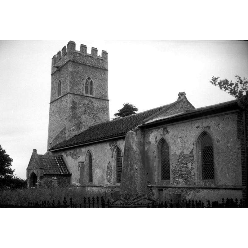
Scene Description: Photo caption: "Late 13thc'
Copyright Statement: Image copyright © George Plunkett, 2014
Image Source: B&W photograph taken 9 June 1994 by George Plunkett [www.georgeplunkett.co.uk/Norfolk/C/Coston St Michael's church from SE [7137] 1994-06-19.jpg] [accessed 11 July 2014]
Copyright Instructions: Standing permission by Jonathan Plunkett
view of church exterior - southeast view
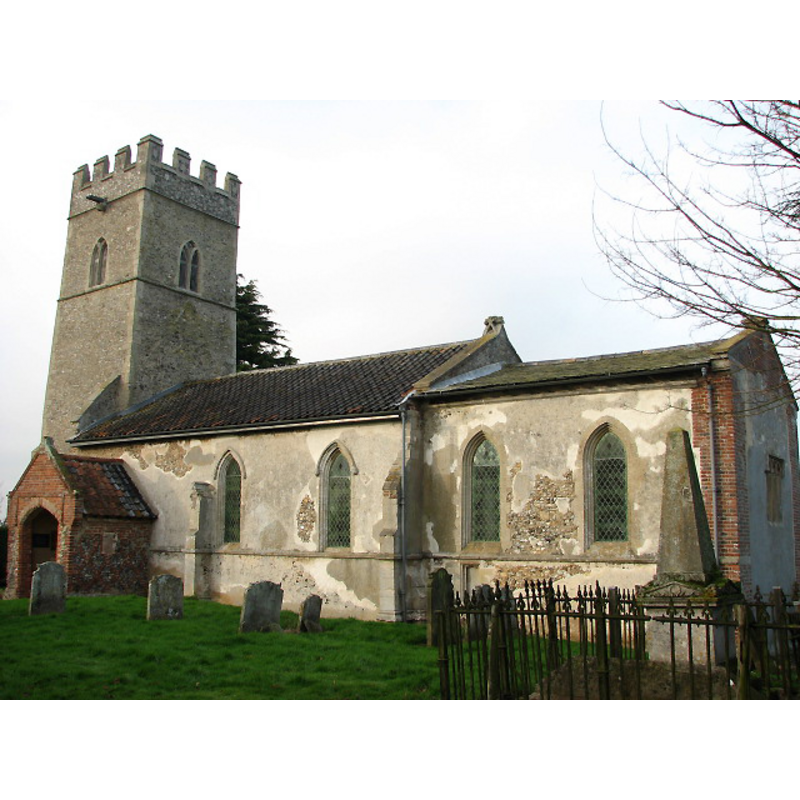
Copyright Statement: Image copyright © Evelyn Simak, 2008
Image Source: digital photograph taken 29 January 2008 by Evelyn Simak [www.geograph.org.uk/photo/671942] [accessed 18 March 2013]
Copyright Instructions: CC-BY-SA-3.0
view of church interior - nave - looking west
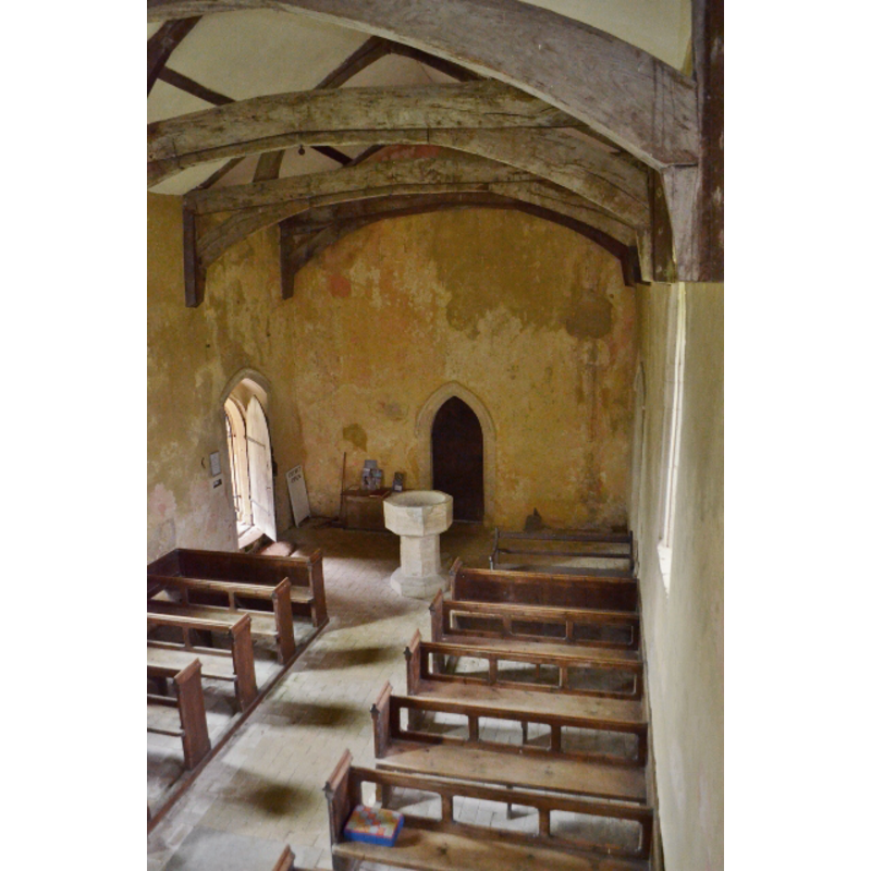
Scene Description: the font at the west end of the nave
Copyright Statement: Image copyright © Ashley Dace, 2012
Image Source: digital photograph taken 2 August 2012 by Ashley Dace [www.geograph.org.uk/photo/3064962] [accessed 18 March 2013]
Copyright Instructions: CC-BY-SA-3.0
view of church interior - nave - looking east
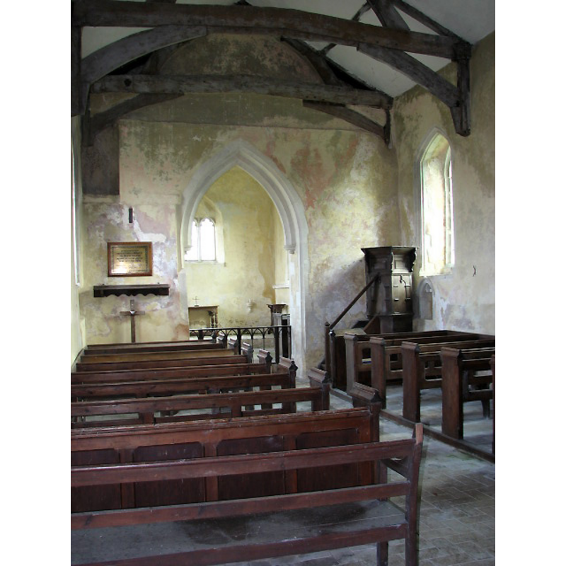
Copyright Statement: Image copyright © Evelyn Simak, 2008
Image Source: digital photograph taken 29 January 2008 by Evelyn Simak [www.geograph.org.uk/photo/671950] [accessed 18 March 2013]
Copyright Instructions: CC-BY-SA-3.0
INFORMATION
Font ID: 15018COS
Object Type: Baptismal Font1
Font Century and Period/Style: 15th century, Perpendicular
Church / Chapel Name: Parish Church of St. Michael the Archangel [redundant]
Font Location in Church: Inside the church, at the W end
Church Patron Saint(s): St. Michael
Church Notes: the church has been redundant since the 1970s, and is now in the care of the Churches Conservation Trust
Church Address: Church Lane, Coston, Norwich, Norfolk, NR9 4DT
Site Location: Norfolk, East Anglia, England, United Kingdom
Directions to Site: Located 2 km NE of Hardingham, 6-7 km NNE of Hingham, 8 W of Wymondham
Ecclesiastic Region: Diocese of Norwich
Historical Region: Hundred of Forehoe [aka Forehou]
Additional Comments: altered font [cf. FontNotes] -- disappeared font? (the one from the 13thC church here?)
Font Notes:
Click to view
Blomefield (1805-1810) writes: "The Church is dedicated to St. Michael the Archangel [...] The church and chancel are leaded, the south porch tiled; there is a square tower and one bell". A font here is noted in Pevsner & Wislon (1999) simply as "Perp[endicular], octagonal". Illustrated in Knott (2006). The font consists of a plain octagonal basin with a flat underbowl, raised on a plain octagonal stem and lower base; on a narrow plinth. Only the basin appears old, and it has been repaired and re-tooled.
Credit and Acknowledgements: We are grateful to Jonathan Plunkett for the photograph of this church taken by his father, George Plunkett, in 1994
COORDINATES
UTM: 31U 367636 5831181
Latitude & Longitude (Decimal): 52.614483, 1.044936
Latitude & Longitude (DMS): 52° 36′ 52.14″ N, 1° 2′ 41.77″ E
MEDIUM AND MEASUREMENTS
Material: stone
Font Shape: octagonal, mounted
Basin Interior Shape: round
Basin Exterior Shape: octagonal
REFERENCES
- Blomefield, Francis, An essay towards a topographical history of Norfolk, 1805-1810, vol. 2: 471-473 / [www.british-history.ac.uk/report.aspx?compid=78098] [accessed 19 March 2013]
- Knott, Simon, The Norfolk Churches Site, Simon Knott, 2004. [standing permission to reproduce images received from Simon (February 2005]. URL: www.norfolkchurches.co.uk.
- Pevsner, Nikolaus, Norfolk 2: North-West and South (2nd ed.), London: Penguin, 1999, p. 273