East Carleton No. 2 / Carleton by Norwich / Carleton Curson / Carleton Curzon / Carletuna / Karletuna / Norwich Carleton
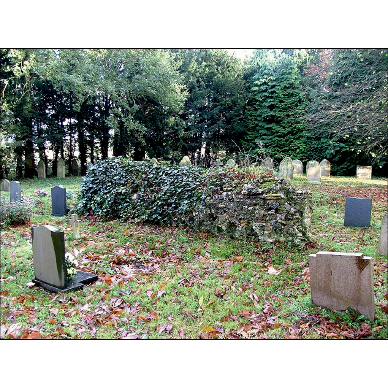
Image copyright © Simon Knott, 2006
Standing permission
Results: 1 records
view of church exterior - ruins
Scene Description: the ruins of the former church [cf. FontNotes]
Copyright Statement: Image copyright © Simon Knott, 2006
Image Source: digital photograph taken January 2006 by Simon Knott [www.norfolkchurches.co.uk/eastcarletonruin/eastcarletonruin.htm] [accessed 21 March 2013]
Copyright Instructions: Standing permission
INFORMATION
Font ID: 15013CAR
Object Type: Baptismal Font1?
Font Century and Period/Style: 11th century, Norman
Church / Chapel Name: Parish Church of St. Peter [in ruins since the 16thC]
Church Patron Saint(s): St. Peter
Church Address: Rectory Road, East Carleton, East Carleton, Norfolk, NR14 8HT
Site Location: Norfolk, East Anglia, England, United Kingdom
Directions to Site: Located side-by-side East Carleton St. Mary's [cf. Index entry] -- [NB: not to be mistaken with 'Carleton St. Peter', also with an entry in this Index]
Ecclesiastic Region: Diocese of Norfolk
Historical Region: Hundred of Humble-Yard
Additional Comments: disappeared font? (the one from the ca. 1086 church here [cf. FontNotes])
Font Notes:
Click to view
Blomefield (1805-1810) writes: "C[arleton.] Commonly called Carleton Curson, from its lords of that name, [...] for distinction it is sometimes called Norwich Carleton, or Carleton by Norwich, and very often East-Carleton: as there are two manors, so there were also two parochial churches, standing within about 50 yards of one another, with a highway only between their churchyards; that now standing, is dedicated to St. Mary" [cf. Index entry for East Carleton No.2 for the font at the second church, St. Peter's]. Blomefield (ibid.) cites the Domesday entry in fol. 136, in which two churches with thirty-eight acres of land are reported [= "ii. ecclesie xxxviii. acr. [...] In Carletuna"]. The first recorded rector for St. Peter's is named in Blomefield (ibid.) as "Ric. Cross", in 1439, and, on the church itself, he adds: "the church, which is a small one, without any tower, was turned into a parsonage-house, now uninhabited and in ruins [...] The church was suffered to be dilapidated about 1550.
Credit and Acknowledgements: We are grateful to Simon Knott [www.norfolkchurches.co.uk] for his photograph of the ruins of this church
COORDINATES
UTM: 31U 378696 5826277
REFERENCES
- Blomefield, Francis, An essay towards a topographical history of Norfolk, 1805-1810, vol. 5: 98-103 / [www.british-history.ac.uk/report.aspx?compid=78161] [accessed 21 March 2013]
- Knott, Simon, The Norfolk Churches Site, Simon Knott, 2004. [standing permission to reproduce images received from Simon (February 2005]. URL: www.norfolkchurches.co.uk.