Brettenham / Bretenham / Bretham / Brettenham nr. Thetford
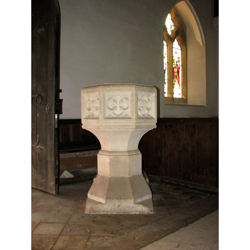
Image copyright © Evelyn Simak, 2010
CC-BY-SA-3.0
Results: 4 records
view of font
Scene Description: the modern font [cf. FontNotes]
Copyright Statement: Image copyright © Evelyn Simak, 2010
Image Source: digital photograph taken 6 February 2010 by Evelyn Simak [www.geograph.org.uk/photo/1701061] [accessed 27 February 2013]
Copyright Instructions: CC-BY-SA-3.0
view of church exterior - southeast view
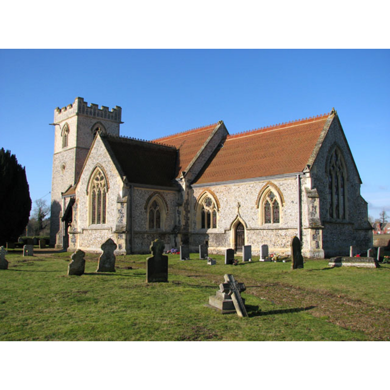
Copyright Statement: Image copyright © Evelyn Simak, 2010
Image Source: digital photograph taken 6 February 2010 by Evelyn Simak [www.geograph.org.uk/photo/1698914] [accessed 27 February 2013]
Copyright Instructions: CC-BY-SA-3.0
view of church interior - nave - looking west
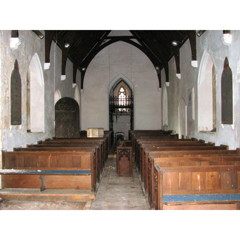
Copyright Statement: Image copyright © Evelyn Simak, 2010
Image Source: digital photograph taken 6 February 2010 by Evelyn Simak [www.geograph.org.uk/photo/1701060] [accessed 27 February 2013]
Copyright Instructions: CC-BY-SA-3.0
view of church interior - nave - looking east
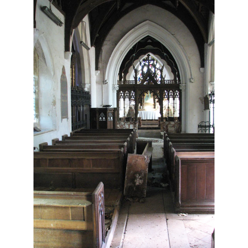
Copyright Statement: Image copyright © Evelyn Simak, 2010
Image Source: digital photograph taken 6 February 2010 by Evelyn Simak [www.geograph.org.uk/photo/1701060] [accessed 27 February 2013]
Copyright Instructions: CC-BY-SA-3.0
INFORMATION
Font ID: 15004BRE
Object Type: Baptismal Font1?
Font Century and Period/Style: 12th century, Late Norman
Church / Chapel Name: Parish Church of St. Mary
Font Location in Church: [cf. FontNotes]
Church Patron Saint(s): St. Mary the Virgin
Church Address: Kilverstone Road, Brettenham, Norfolk IP24 2RP
Site Location: Norfolk, East Anglia, England, United Kingdom
Directions to Site: Located off (N) the A1066, ENE of Thetford
Ecclesiastic Region: Diocese of Norwich
Historical Region: Hundred of Shropham
Additional Comments: Simon K did not get access to the interior [updt. 27 Feb 2013]
Font Notes:
Click to view
Blomefield (1805-1810) writes: "It is a small parish of near 100 inhabitants; in 1603, it had 48 communicants [...] The Church and parsonage-house were burnt down in 1693: the nave was rebuilt, but the chancel was not; there is a square tower and one bell; the nave and south porch are tiled. This is written on the north wall, By this Place lyeth the Body of Roger Beales, who died June 29, 1711, and was Church-Warden alone for the Town of Bretenham, and built this Church after the Fire, being the 18th Day of May, in the Year 1693, and laid out all the money, before he made his Rate, to gather in any Money, and whose Names, and what every Man paid." Blomefield (ibid.) further notes that "1303, 5 id. May, a sequestration was granted to Alfred de Brok", first recorded rector. Blomefield (ibid.) cites three entries for this place in Domesday ["Bretham"], but neither of them mention a church or a priest here. Pevsner & Wilson (1999) inform that only the south doorway and the base of the tower of the original Norman church remain; the old church was almost in ruins at the time of its renovation by Teulon in 1852 [NB: the original font of the Norman church is assumed lost -- the present font, octagonal and of a Perpendicular design, is modern].
COORDINATES
UTM: 31U 353441 5809443
Latitude & Longitude (Decimal): 52.414478, 0.838907
Latitude & Longitude (DMS): 52° 24′ 52.12″ N, 0° 50′ 20.06″ E
REFERENCES
- Blomefield, Francis, An essay towards a topographical history of Norfolk, 1805-1810, vol. 1:440-445 / [www.british-history.ac.uk/report.aspx?compid=77132] [accessed 27 February 2013]
- Pevsner, Nikolaus, Norfolk 2: North-West and South (2nd ed.), London: Penguin, 1999, p. 217