Bressingham / Brisingham / Brissingham
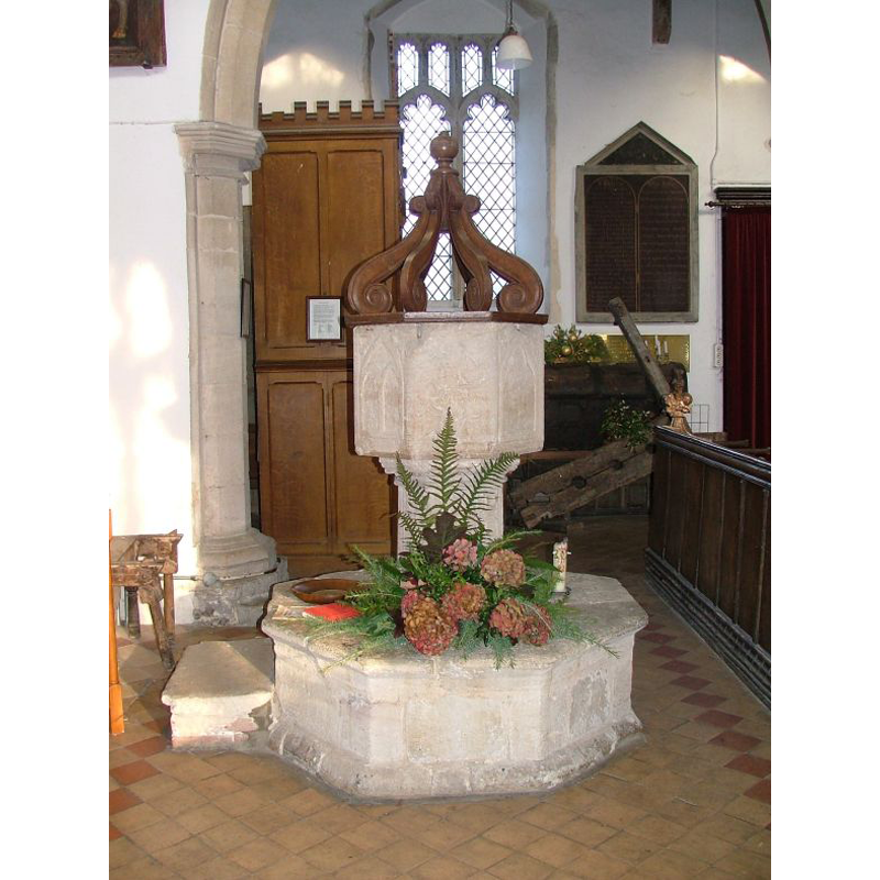
Image copyright © Simon Knott, 2013
Standing permission
Results: 6 records
view of font and cover in context
Copyright Statement: Image copyright © Simon Knott, 2013
Image Source: digital photograph taken 14 January 2006 by Simon Knott [http://www.norfolkchurches.co.uk/bressingham/bressingham.htm] [accessed 16 July 2009]
Copyright Instructions: Standing permission
design element - patterns - tracery
Copyright Statement: Image copyright © Simon Knott, 2013
Image Source: digital photograph taken 14 January 2006 by Simon Knott [http://www.norfolkchurches.co.uk/bressingham/bressingham.htm] [accessed 16 July 2009]
Copyright Instructions: Standing permission
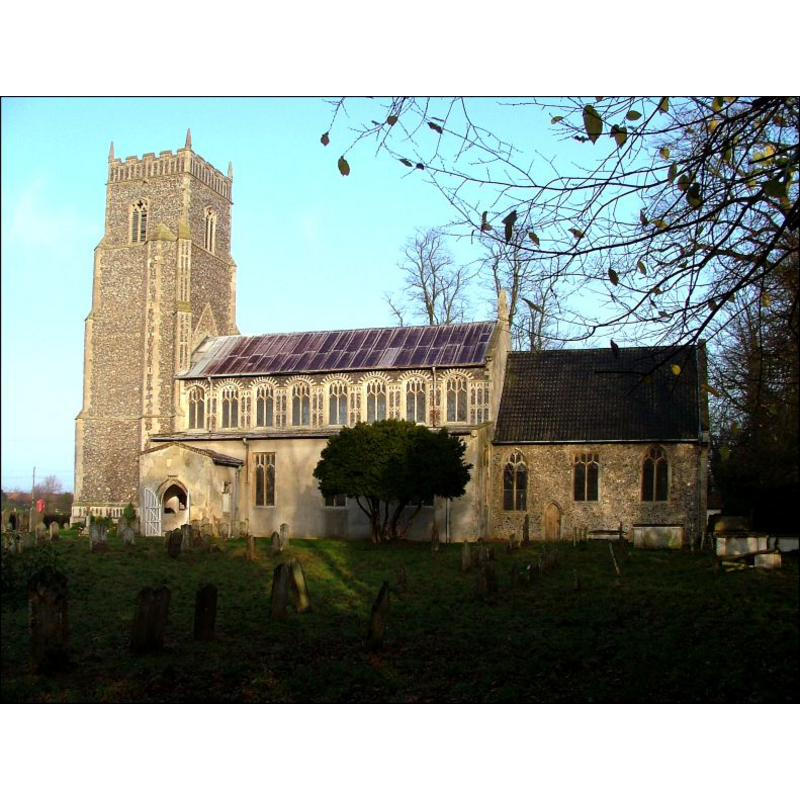
view of church exterior - south view
Copyright Statement: Image copyright © Simon Knott, 2013
Image Source: digital photograph taken January 2007 by Simon Knott [www.norfolkchurches.co.uk/bressingham/bressingham.htm] [accessed 11 February 2013]
Copyright Instructions: Standing permission
view of church interior - nave - looking west
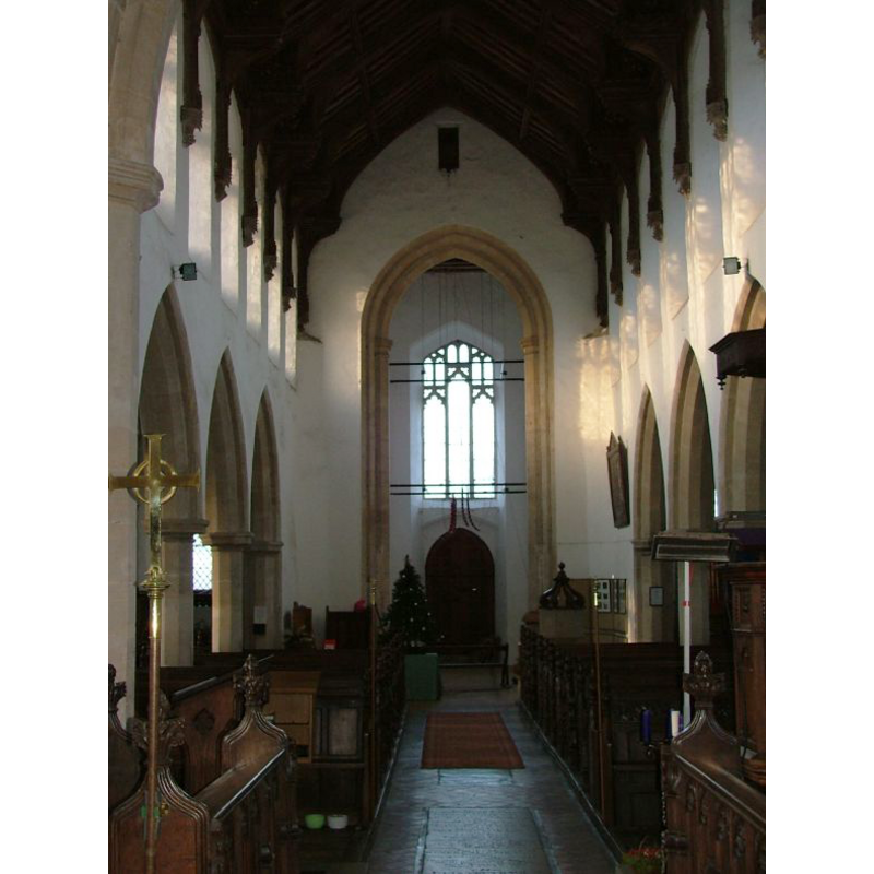
Scene Description: the top of the font and the cover are visible at the back (west), right (north) side
Copyright Statement: Image copyright © Simon Knott, 2013
Image Source: digital photograph taken January 2007 by Simon Knott [www.norfolkchurches.co.uk/bressingham/bressingham.htm] [accessed 11 February 2013]
Copyright Instructions: Standing permission
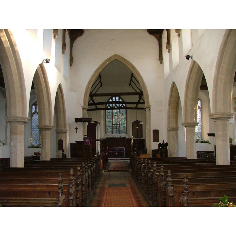
view of church interior - nave - looking east
Copyright Statement: Image copyright © Simon Knott, 2013
Image Source: digital photograph taken January 2007 by Simon Knott [www.norfolkchurches.co.uk/bressingham/bressingham.htm] [accessed 11 February 2013]
Copyright Instructions: Standing permission
design element - patterns - tracery
Copyright Statement: Image copyright © Simon Knott, 2013
Image Source: digital photograph taken 14 January 2006 by Simon Knott [http://www.norfolkchurches.co.uk/bressingham/bressingham.htm] [accessed 16 July 2009]
Copyright Instructions: Standing permission
INFORMATION
Font ID: 15003BRE
Object Type: Baptismal Font1
Font Century and Period/Style: 13th century, Early English
Church / Chapel Name: Parish Church of St. John the Baptist
Font Location in Church: Inside the church, at the W end of the nave, N side
Church Patron Saint(s): St. John the Baptist
Church Address: High street, Bressingham, Norfolk, IP22 2AT
Site Location: Norfolk, East Anglia, England, United Kingdom
Directions to Site: Located 5 km NW of Diss
Ecclesiastic Region: Diocese of Norwich
Historical Region: Hundred of Diss
Font Notes:
Click to view
Blomefield (1805-1810) reports the state of repairs of the church and notes: "the font standing in an obscure place behind one of the pillars". [NB: Blomefield uses the spelling 'Brisingham']. Described in Pevsner & Wilson (1999): "Octagonal, with a traceried stem and on the bowl a number of window patterns of the late C13, as if taken from a pattern book. Font tracery lagged behind window tracery in date usually by about thirty years." Illustrated in Knott (2007). Raised on a tall octagonal plinth. The wooden cover is of the popular Jacobean design, scroll ribs (eight in this case) on a plain octagonal platform, converging up on a finial (a ball), but it is probably 19th-century.
Credit and Acknowledgements: We are grateful to Simon Knott, of www.norfolkchurches.co.uk, for his photographs of church and font
COORDINATES
UTM: 31U 367253 5805725
Latitude & Longitude (Decimal): 52.38567, 1.049439
Latitude & Longitude (DMS): 52° 23′ 8.41″ N, 1° 2′ 57.98″ E
MEDIUM AND MEASUREMENTS
Material: stone
Font Shape: octagonal, mounted
Basin Interior Shape: round
Basin Exterior Shape: octagonal
LID INFORMATION
Date: 19th-century?
Material: wood, oak
Apparatus: no
Notes: [cf. FontNotes]
REFERENCES
- Blomefield, Francis, An essay towards a topographical history of Norfolk, 1805-1810, vol. 1: 49-73 / [www.british-history.ac.uk/report.aspx?compid=77097] [accessed 11 February 2013]
- Knott, Simon, The Norfolk Churches Site, Simon Knott, 2004. [standing permission to reproduce images received from Simon (February 2005]. URL: www.norfolkchurches.co.uk.
- Pevsner, Nikolaus, Norfolk 2: North-West and South (2nd ed.), London: Penguin, 1999, p. 216