Bawsey / Bouseda / Boweseia
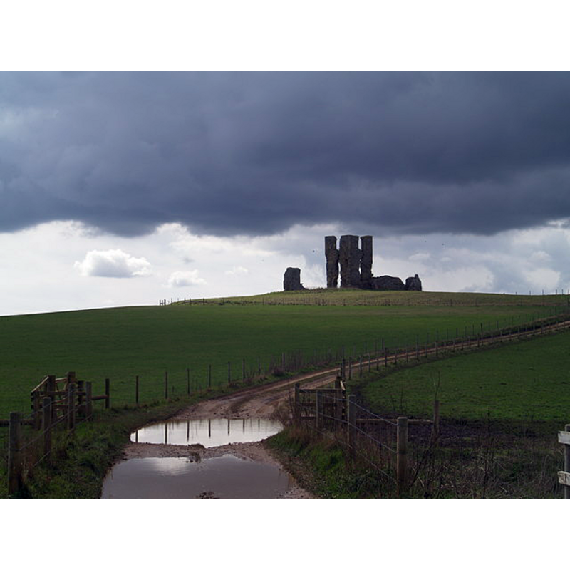
Image copyright © Chris McAuley, 2010
CC-BY-SA-3.0
Results: 6 records
view of church exterior in context
Scene Description: the ruins of St. James' in the eerie landscape of the disappeared village
Copyright Statement: Image copyright © Chris McAuley, 2010
Image Source: digital photograph taken 3 April 2010 by Chris McAuley [www.geograph.org.uk/photo/1807301] [accessed 6 November 2013]
Copyright Instructions: CC-BY-SA-3.0
view of church exterior - tower - detail
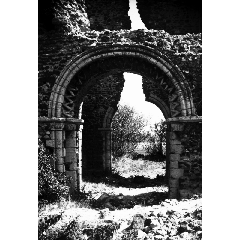
Scene Description: the ruins of St. James' -- Photo caption: "West side of central tower"
Copyright Statement: Image copyright © George Plunkett, 2013
Image Source: B&W photograph taken 19 August 1976 by George Plunkett [www.georgeplunkett.co.uk/Norfolk/B/Bawsey St James' church ruin Norman W arch [5628] 1976-08-19.jpg] [accessed 6 November 2013]
Copyright Instructions: Standing permission by Jonathan Plunkett
view of church exterior - south portal - detail
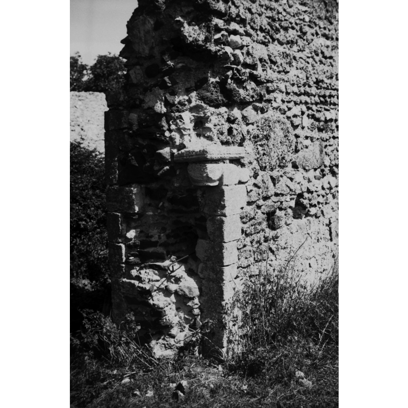
Scene Description: the ruins of St. James' -- Photo caption: "Right hand jamb with Norman capital"
Copyright Statement: Image copyright © George Plunkett, 2013
Image Source: B&W photograph taken 19 August 1976 by George Plunkett [www.georgeplunkett.co.uk/Norfolk/B/Bawsey St James' church ruin Norman S door [5630] 1976-08-19.jpg] [accessed 6 November 2013]
Copyright Instructions: Standing permission by Jonathan Plunkett
view of church exterior - southwest view
![the ruins of St. James' [NB: the tower is in a central position]](/static-50478a99ec6f36a15d6234548c59f63da52304e5/compressed/1131106012_compressed.png)
Scene Description: the ruins of St. James' [NB: the tower is in a central position]
Copyright Statement: Image copyright © George Plunkett, 2013
Image Source: B&W photograph taken 19 August 1976 by George Plunkett [www.georgeplunkett.co.uk/Norfolk/B/Bawsey St James' church ruin from SW [5627] 1976-08-19.jpg] [accessed 6 November 2013]
Copyright Instructions: Standing permission
view of church interior - tower - east doorway
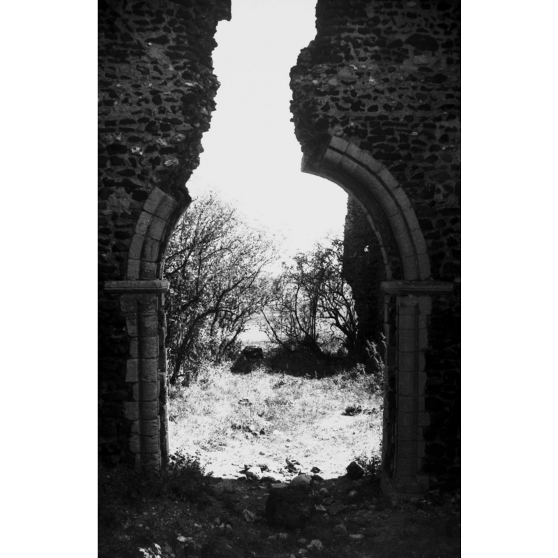
Scene Description: the ruins of St. James' -- Photo caption: "East side of central tower"
Copyright Statement: Image copyright © George Plunkett, 2013
Image Source: B&W photograph taken 19 August 1976 by George Plunkett [www.georgeplunkett.co.uk/Norfolk/B/Bawsey St James' church ruin Norman E arch [5629] 1976-08-19.jpg] [accessed 6 November 2013]
Copyright Instructions: Standing permission by Jonathan Plunkett
information
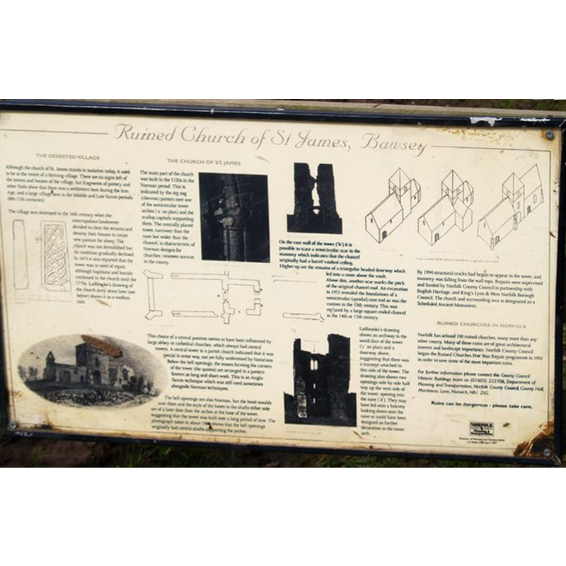
Scene Description: the ruins of St. James' -- sign of he Norfolk County Council posted at the church
Copyright Statement: Image copyright © Chris McAuley, 2010
Image Source: digital photograph taken 3 April 2010 by Chris McAuley [www.geograph.org.uk/photo/1809021] [accessed 6 November 2013]
Copyright Instructions: CC-BY-SA-3.0
INFORMATION
Font ID: 14988BAW
Object Type: Baptismal Font1?
Font Century and Period/Style: 12th century, Late Norman
Church / Chapel Name: Parish Church of St. James [in ruins]
Font Location in Church: [cf. FontNotes]
Church Patron Saint(s): St. James
Church Address: [cf. Directions to site]
Site Location: Norfolk, East Anglia, England, United Kingdom
Directions to Site: There has not been a Bawsey village for centuries -- the church is located off (N) the B1145, just E of King's Lynn; the church is just N of the Church Farm
Ecclesiastic Region: {Diocese of Norwich]
Historical Region: Hundred and half of Freebridge
Additional Comments: disappeared font? (the one from the medieval church here)
Font Notes:
Click to view
"Bouseda" and "Boweseia" are noted in the Domesday survey [http://domesdaymap.co.uk/place/TF6519/bawsey/] [accessed 6 November 2013] but there is neither church nor cleric mentioned in it, which appears as a hamlet [beruit] of Glosthorp ["Gloresthorp" in Domesday]. Blomefield (1805-1810) reports that William de Bovill sued "for the advowson of the church [...] in the 3d of Edward I." [i.e., 1275". Blomefield (ibid.) names "Oliver de Bradley" first recorded rector [sine data], and the first one with a date "John de Walpole, presented by the prior and convent of Eye", in 1330. The Norman church of St. James has been, according to Pevsner & Wilson (1999), "ruinous since before 1770" [NB: we have no information on its original font].
Credit and Acknowledgements: We are grateful to Jonathan Plunkett for the photographs of this church, taken by his father, George Plunkett, in August 1976
COORDINATES
UTM: 31U 328990 5848190
Latitude & Longitude (Decimal): 52.756454, 0.465818
Latitude & Longitude (DMS): 52° 45′ 23.23″ N, 0° 27′ 56.95″ E
REFERENCES
- Blomefield, Francis, An essay towards a topographical history of Norfolk, 1805-1810, vol. 8: 340-347 / [www.british-history.ac.uk/report.aspx?compid=78477] [accessed 6 November 2013]
- Pevsner, Nikolaus, Norfolk 2: North-West and South (2nd ed.), London: Penguin, 1999, p. 196